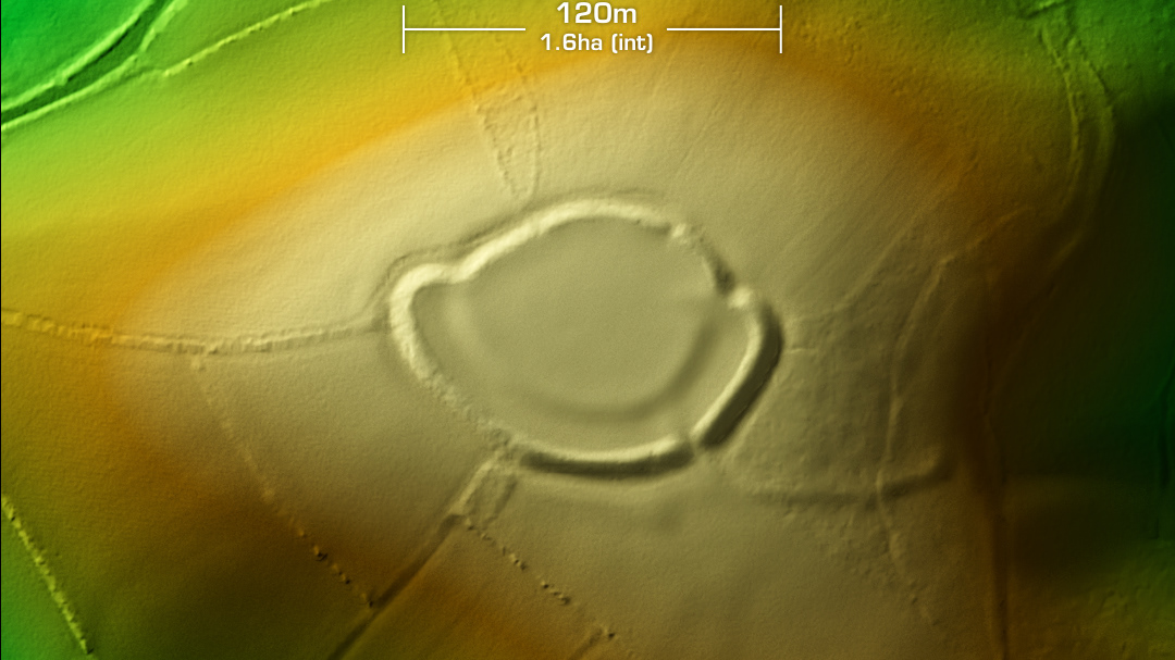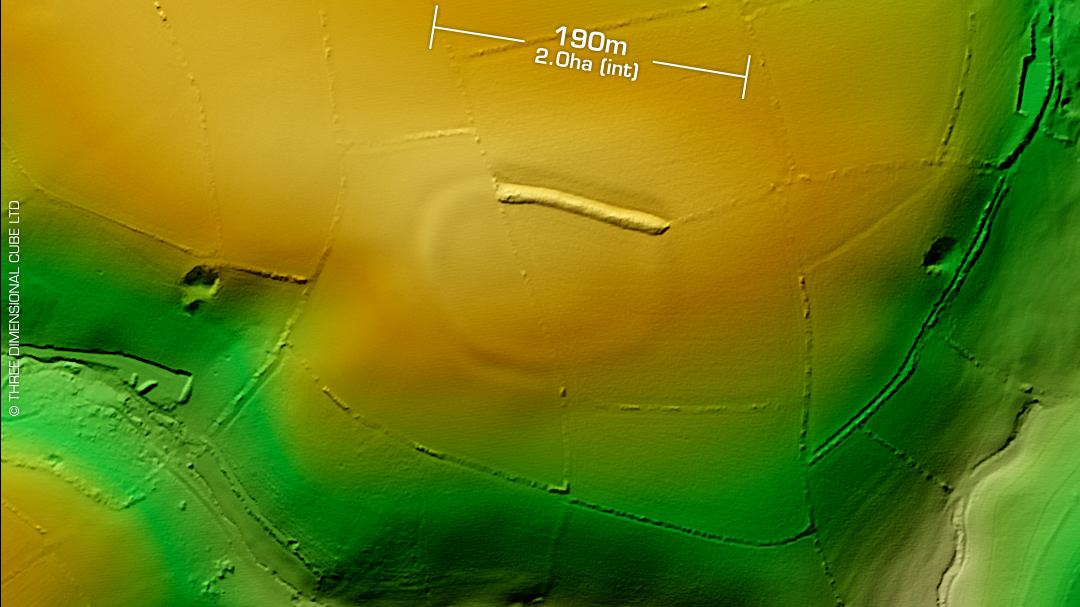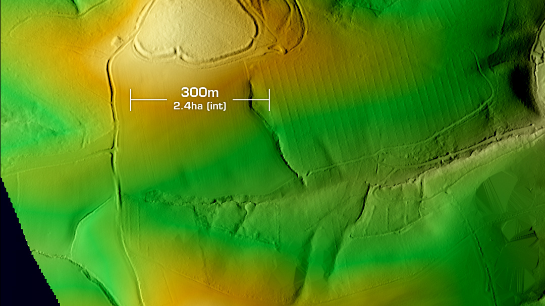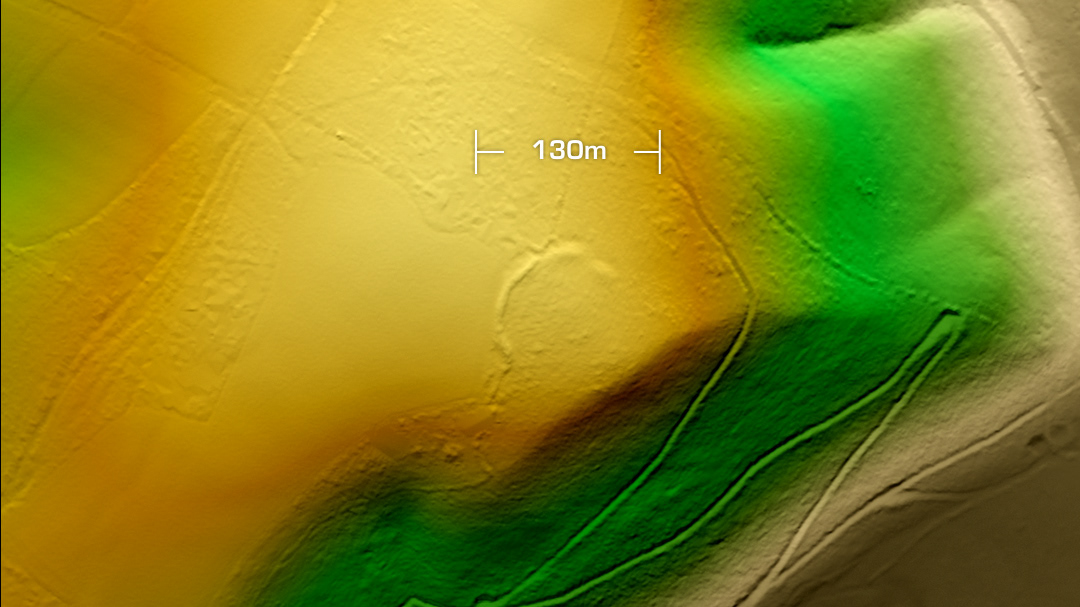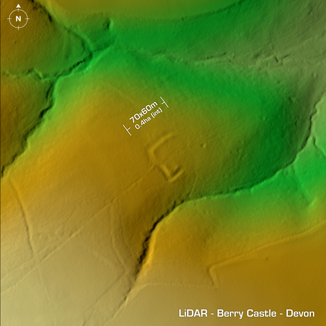
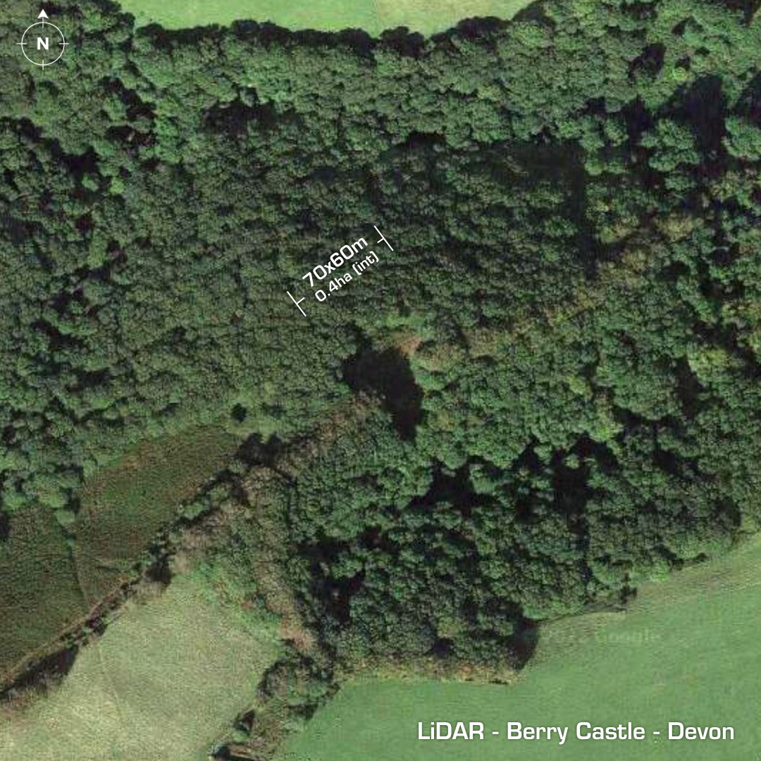
DTM- (Digital Terrain Model, i.e. No buildings or foliage) South of the A39 at Porlock Hill and at the end of the SW lower spur of Hawkcombe Woods lies the small & unusual possible hillslope fort, Berry Castle. Hidden in woodland this part-rectangular structure has massive banks, but its morphology suggests an enclosure or medieval farmstead, but the aforementioned banks preclude that definition. Stone faced boundary bank bisects the interior marking the parish boundary. First recorded in 1889, last survey 2015. Iron Age tribal association (conjecture based on location): Dumnonii (Scheduled Monument) [Any descriptive text is attributed to the Atlas of Hillforts & Wikipedia websites and any associated archaeological descriptions online which will be credited accordingly.]