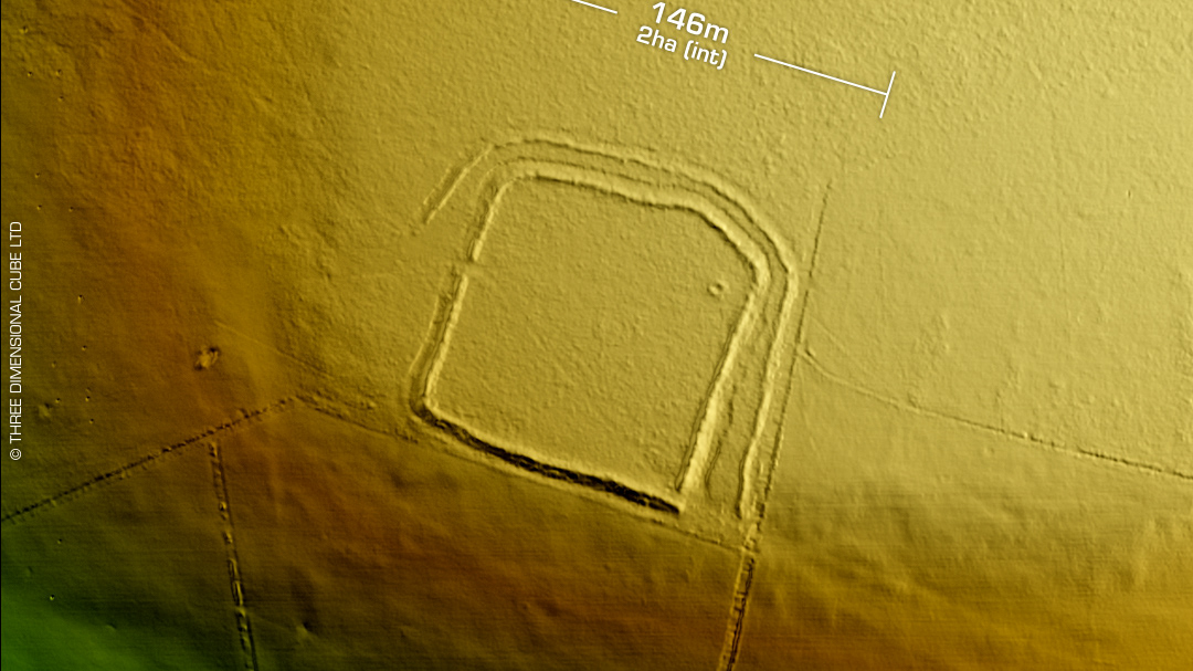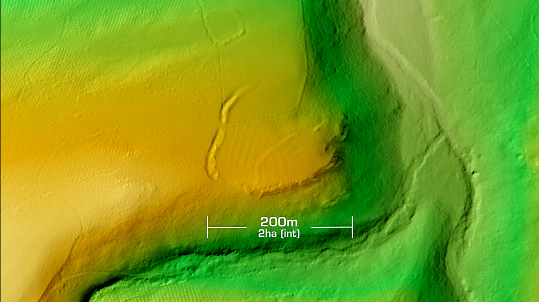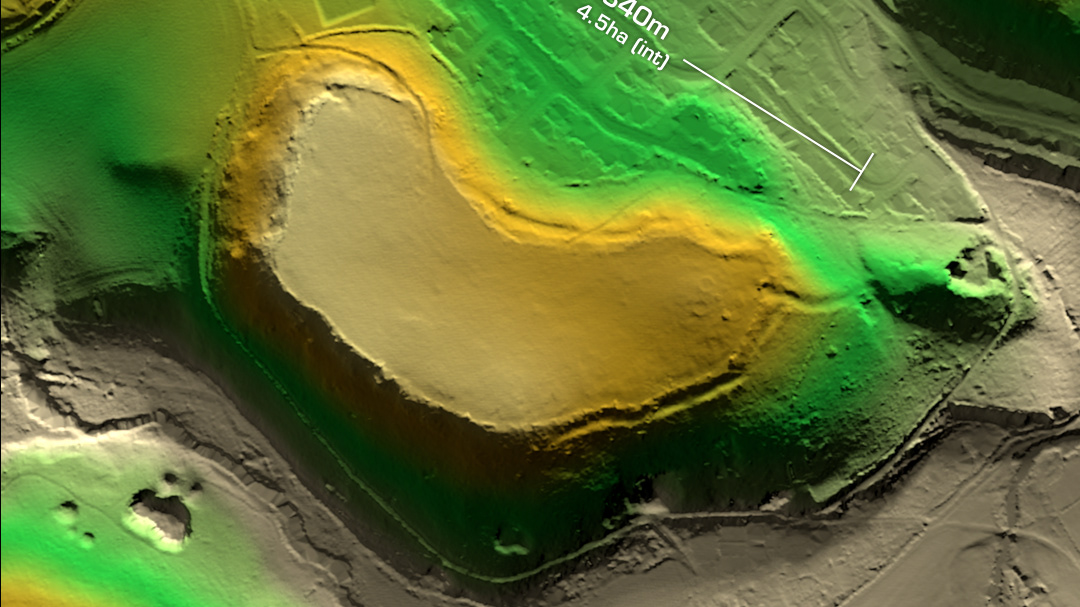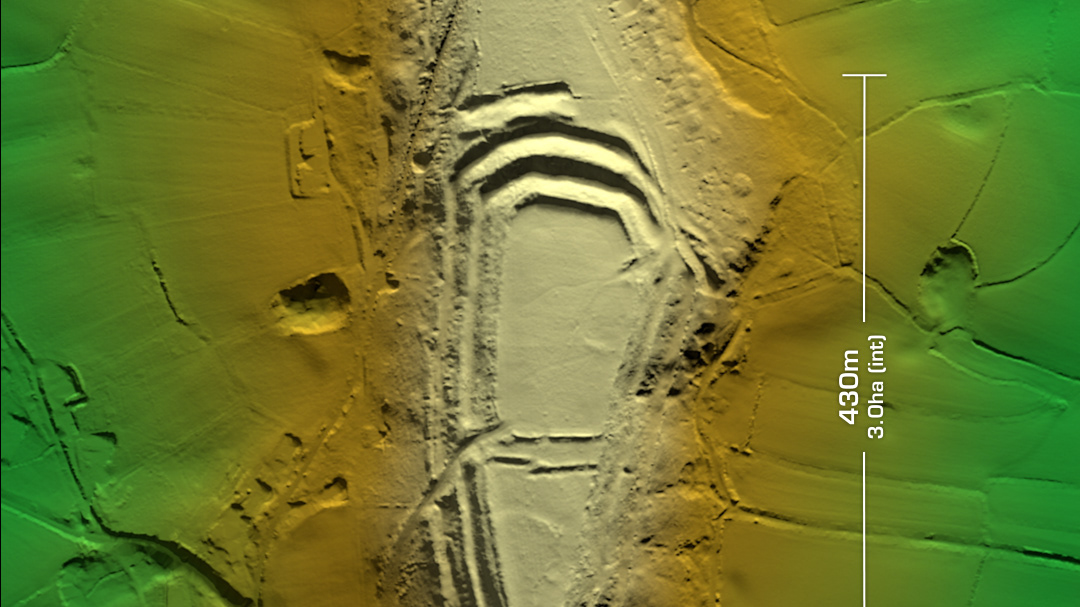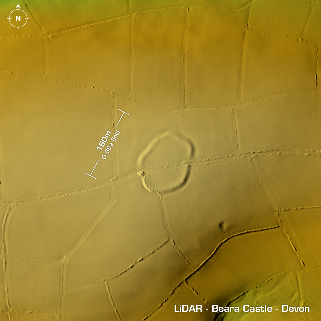
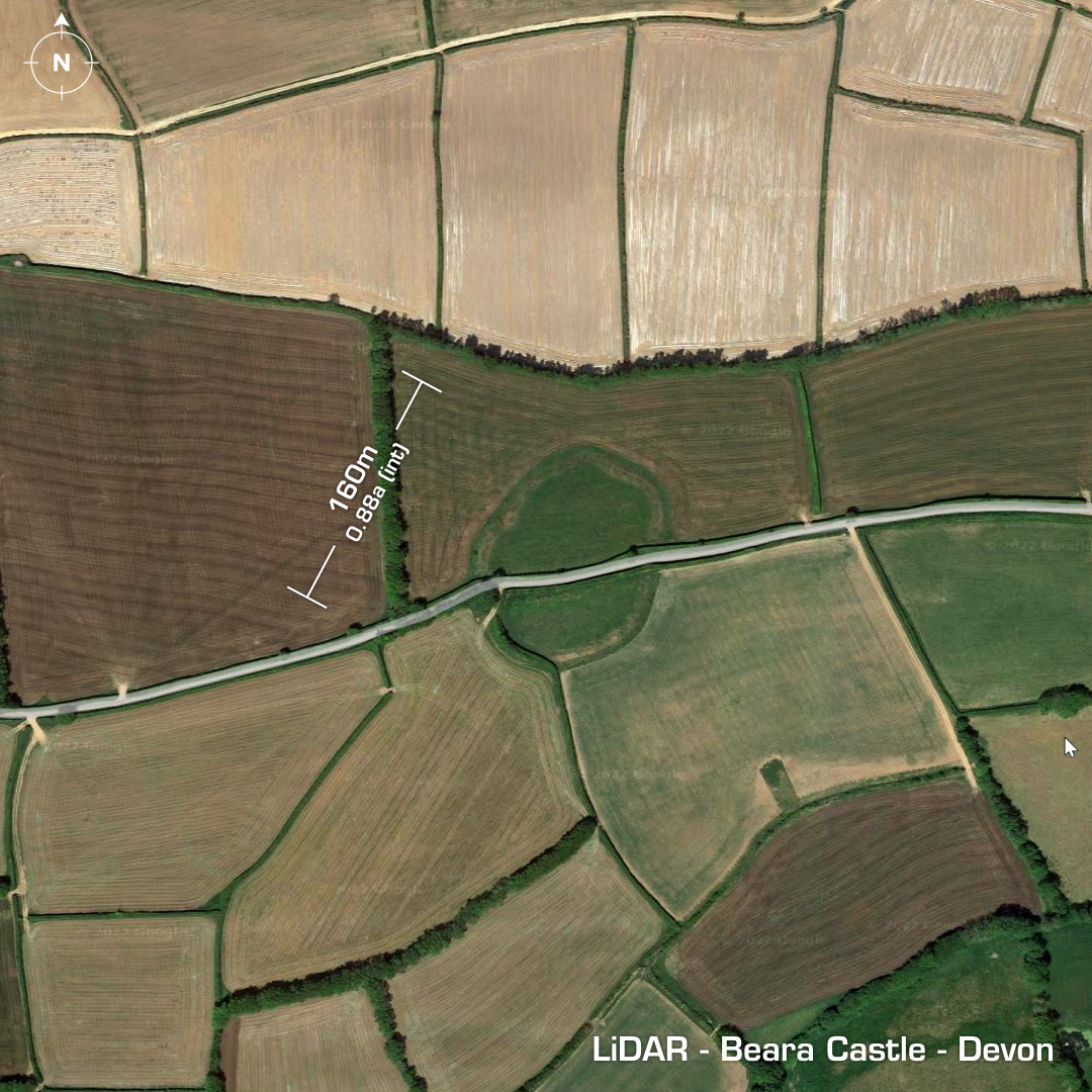
DTM- (Digital Terrain Model, i.e. No buildings or foliage) Just to the southwest of Benton and bisected by an unnamed B-Road lies the univallate contour hillfort, Beara Castle. (Also known locally as Stoke Castle). Heavily degraded by the road running through it & ploughing over the centuries. Now on Heritage at Risk Register since 2015. There was an excavation in 1962 but the details are now lost. Site undated. Iron Age tribal association (conjecture based on location): Dumnonii (Scheduled Monument) [Any descriptive text is attributed to the Atlas of Hillforts & Wikipedia websites and any associated archaeological descriptions online which will be credited accordingly.]