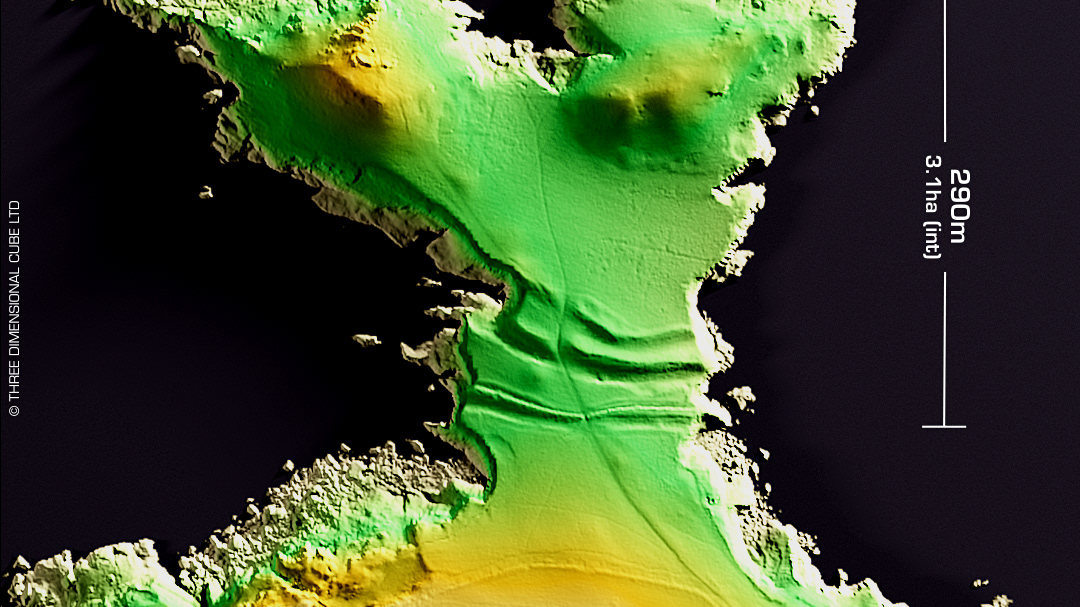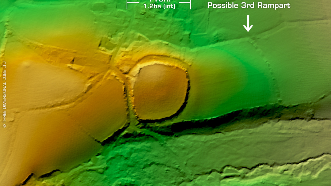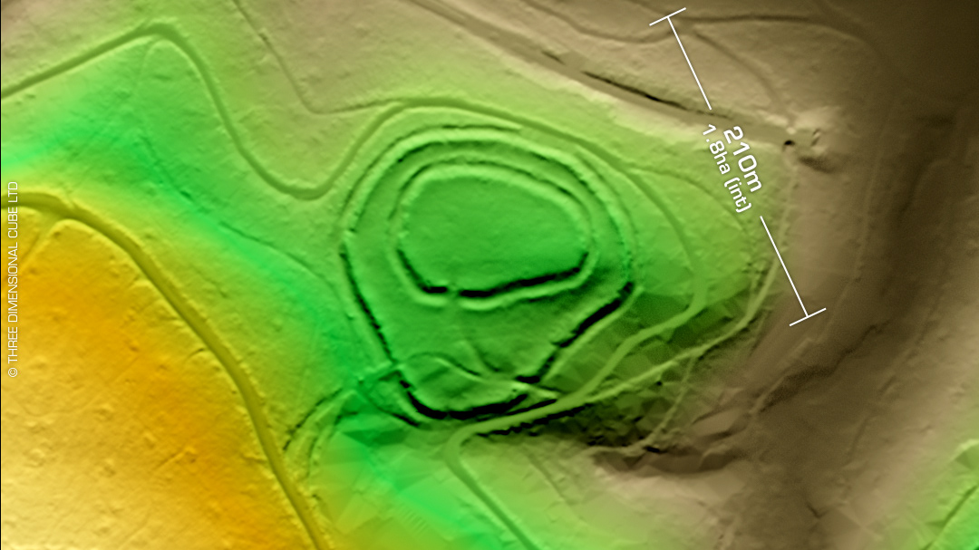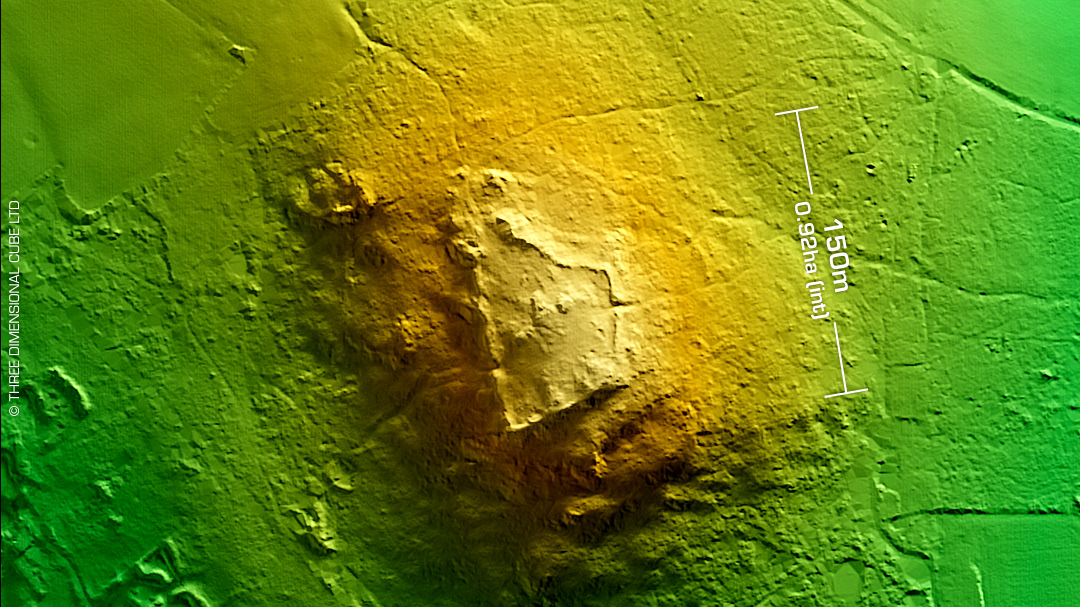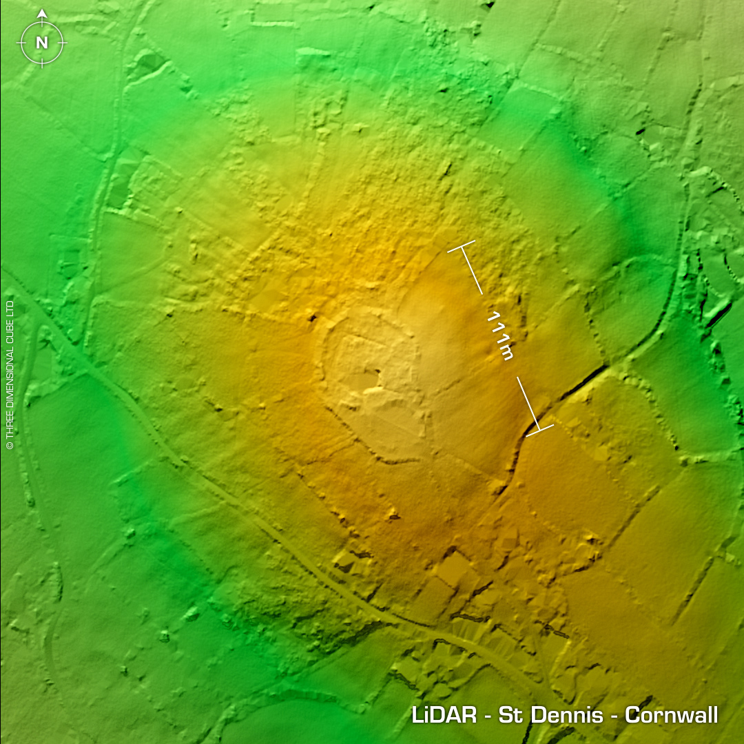
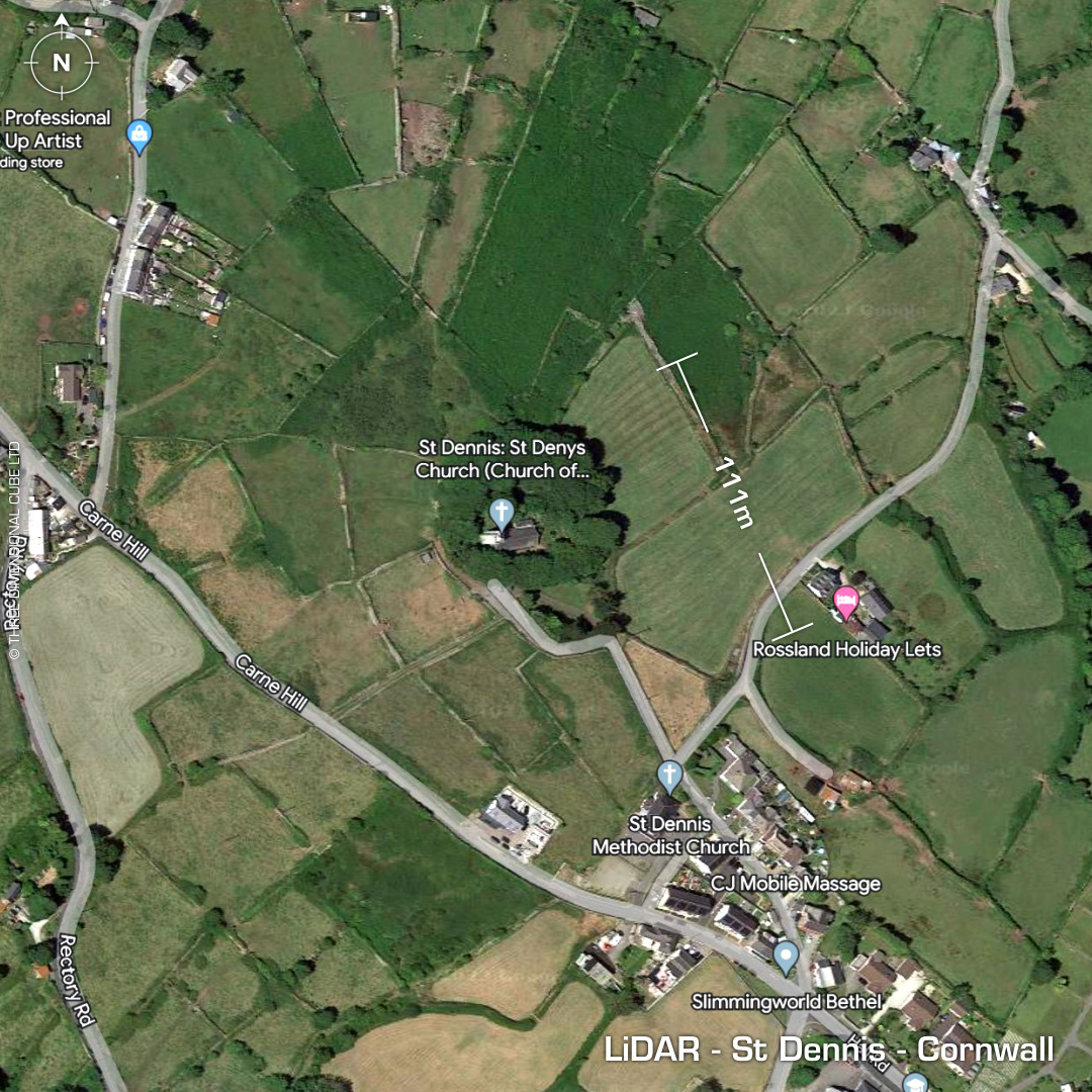
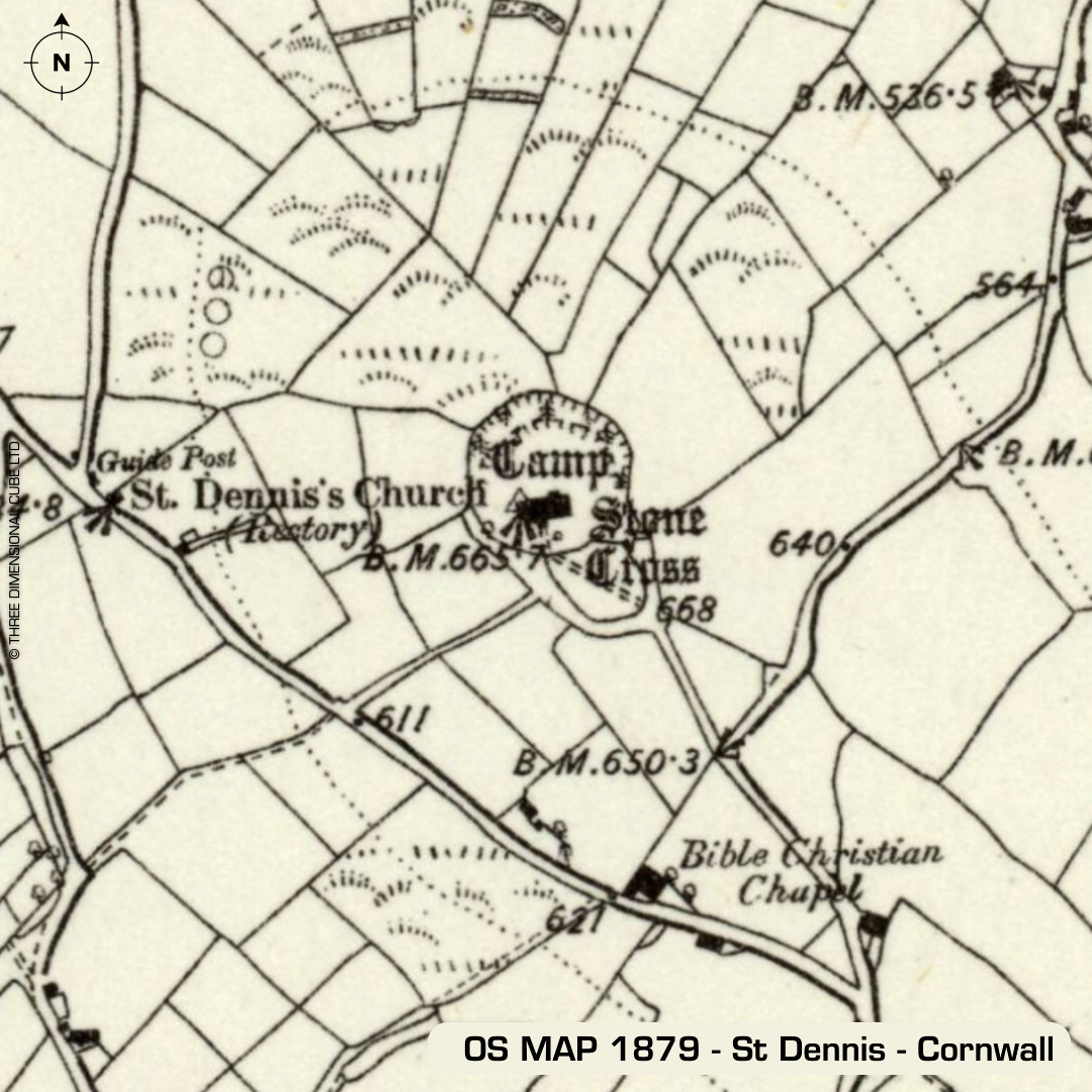
DTM- (Digital Terrain Model, i.e. No buildings or foliage) Just north of & overlooking Saint Dennis and now surrounding the Church of St Dennis (was St Denys the martyr) lies the remains of a contour hillfort. Unlisted on The Atlas of Hillforts website I stumbled across this on Cornwall's HER viewer and decided to give it a render. Two ramparts were visible in 1849. 2nd bank (outside church wall built over 1st bank) reduced by stone robbing in the 19th century. Name apparently derives from 'dynas' or 'fort' or an earlier name of Dimelihoc (1145AD) derived from 'din' or 'fort' and a personal name. Thomas in 1965 promoted the theory that the site was a hillfort. Church destroyed in 1985 by fire then rebuilt. Excavations inside church during rebuilding found rock-cut graves circa 16-17th century, which have destroyed any earlier occupation evidence. No recorded finds, hence undated. Iron Age tribal association (conjecture based on location): Dumnonii (Scheduled Monument) [Any descriptive text attributed to the Atlas of Hillforts & Historic England websites]