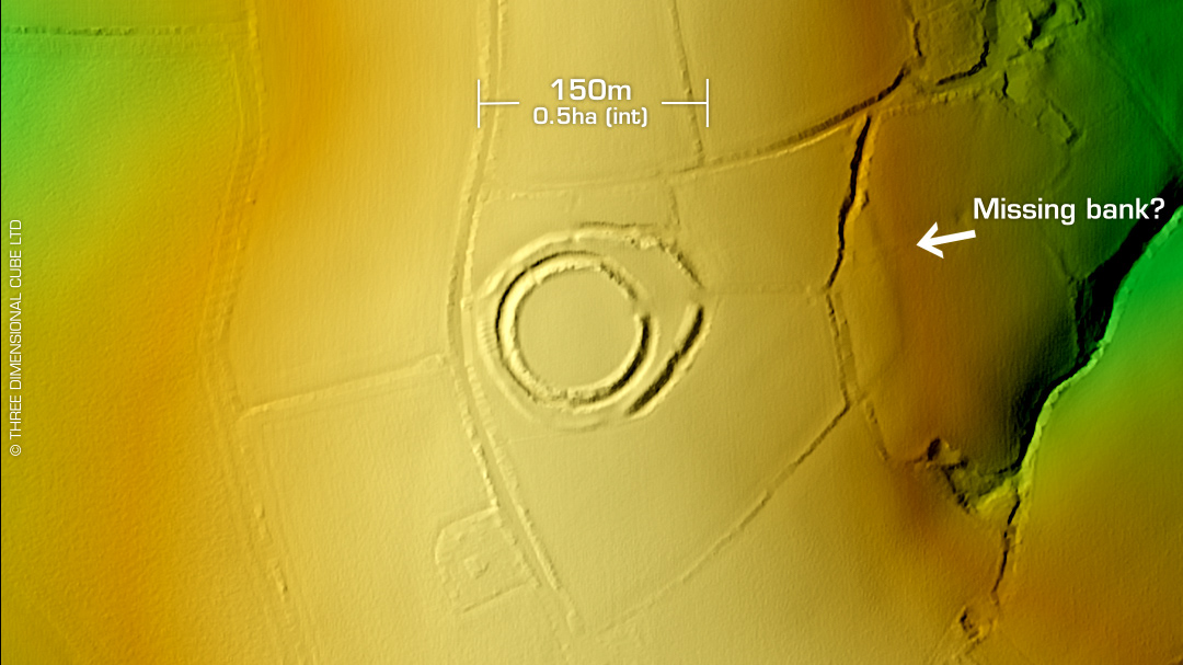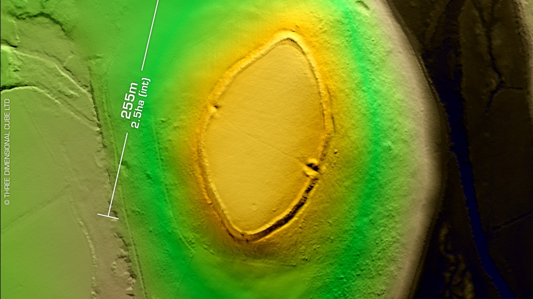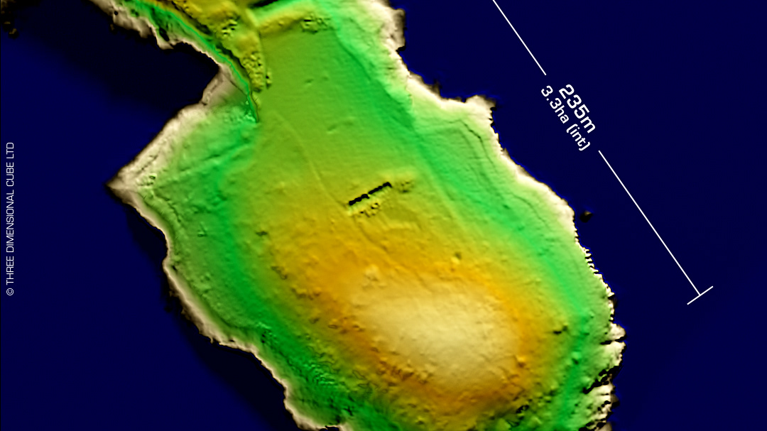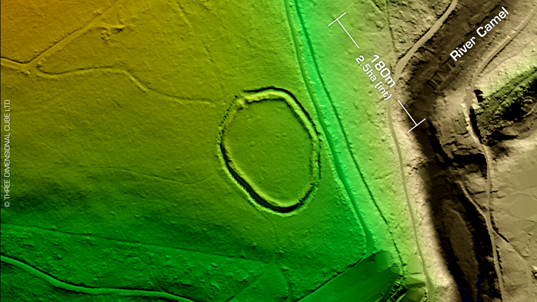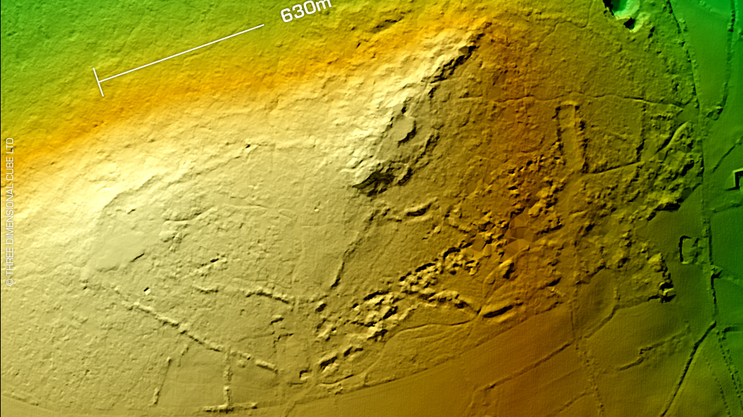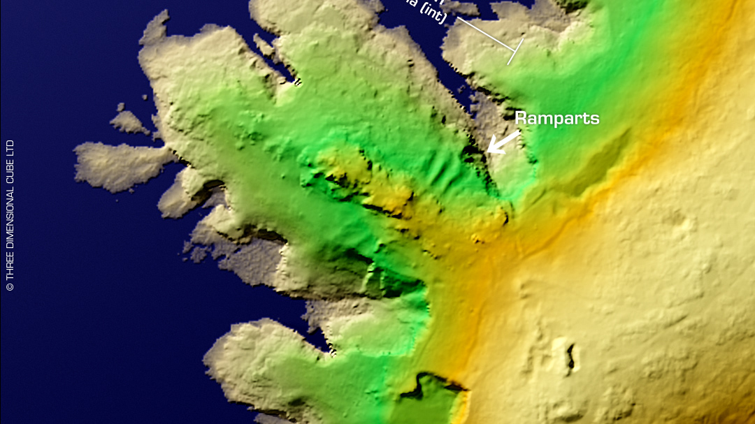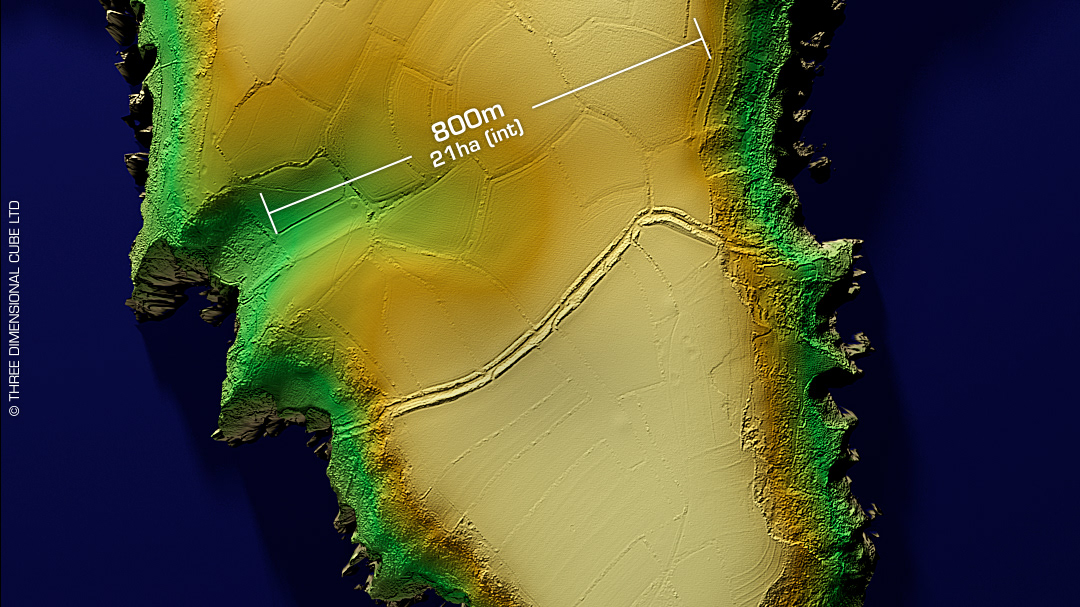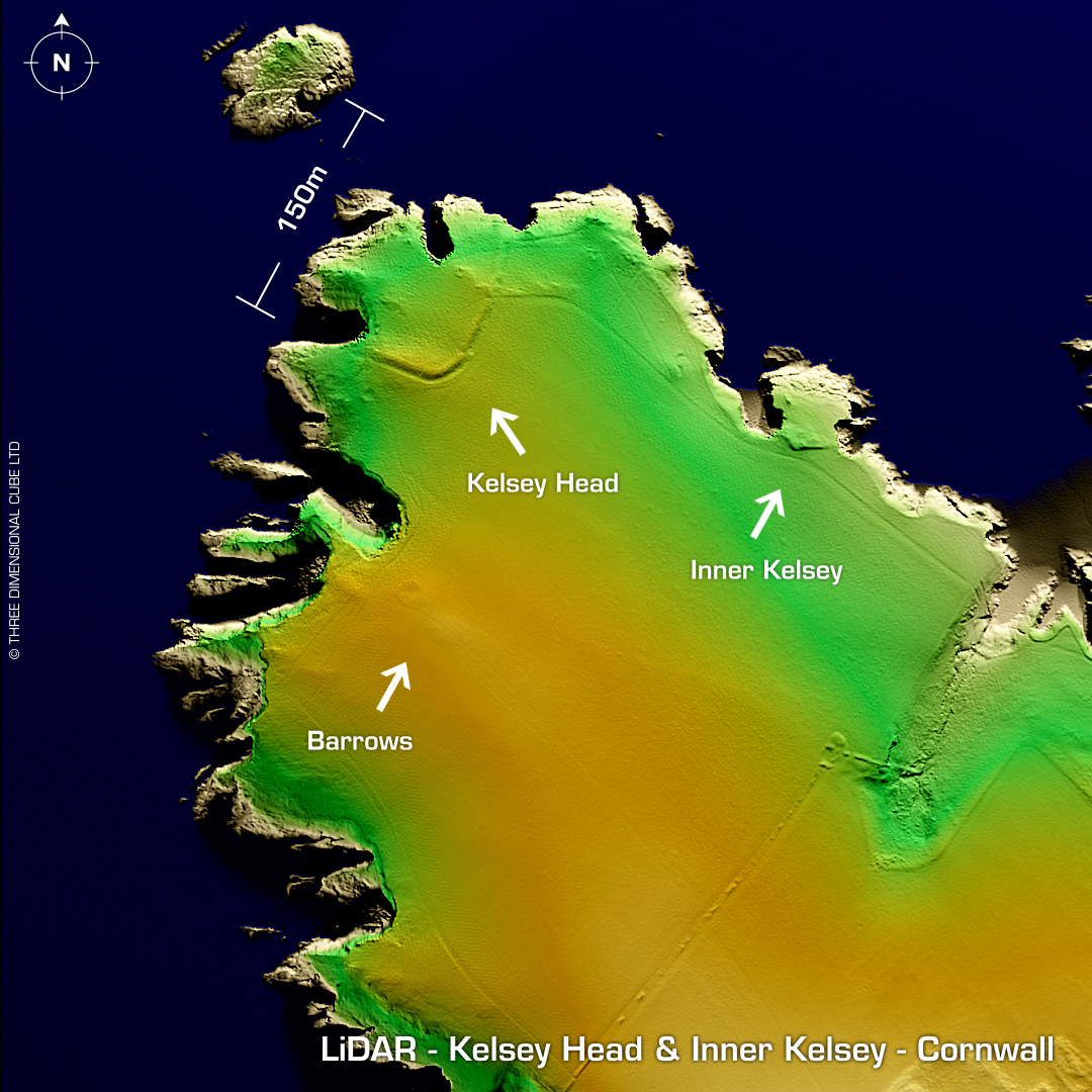
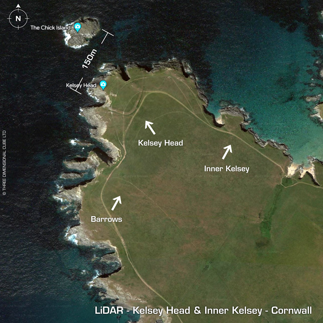
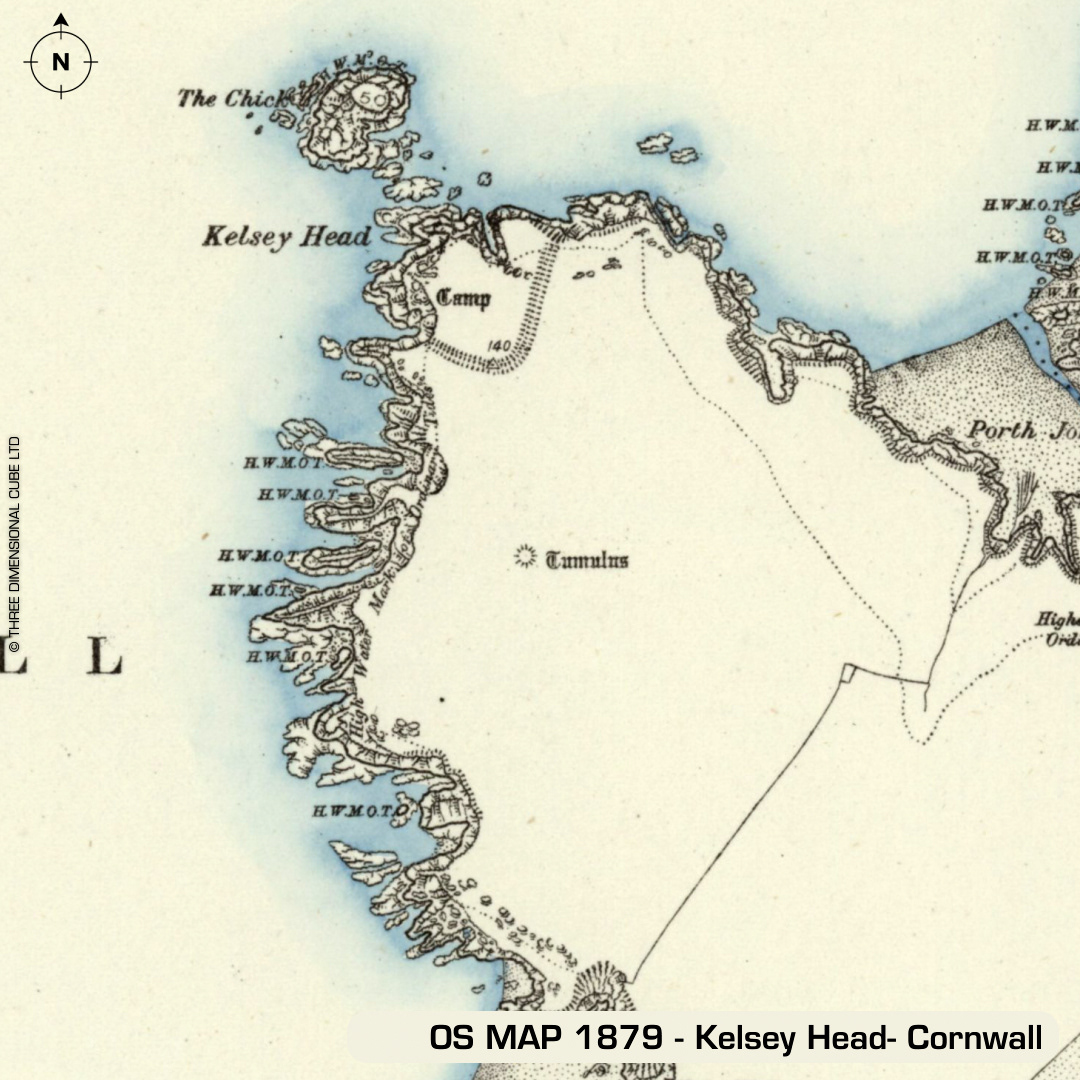
DTM- (Digital Terrain Model, i.e. No buildings or foliage) North of Penhale Point promontory fort and above Holywell lies another promontory. This time containing two sites, which were probably one & the same back in the day, Kelsey Head and Porth Joke. The attached 1879 map indicates the highest tide levels, which goes to show how much coastal erosion has occurred over the two & a half thousand years since the site's probable construction (as most of both sites have now been lost to the sea). The Chick Island just offshore was probably part of the fort complex when it joined the mainland. Porth Joke, Inner Kelsey: Indicated by rampart bisecting mini-promontory to the east of Kelsey Head. Kelsey Head: L shaped rampart & NE annex are still visible. Just south of the site lie two bronze age barrows, which you can just make out on the LiDAR. At least four hut sites in interior. There are arguments for this being a Roman site due to morphology but no excavations have been made to support this hypothesis. Random flint flakes suggest Mesolithic occupation of the area. First written reference in 1849. No recorded excavations or finds from both sites, hence undated. Iron Age tribal association (conjecture based on location): Dumnonii (Scheduled Monuments) [Any descriptive text attributed to the Atlas of Hillforts & Historic England websites]