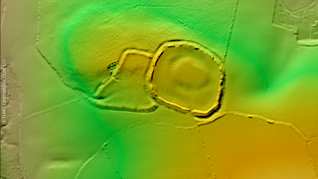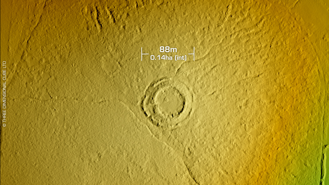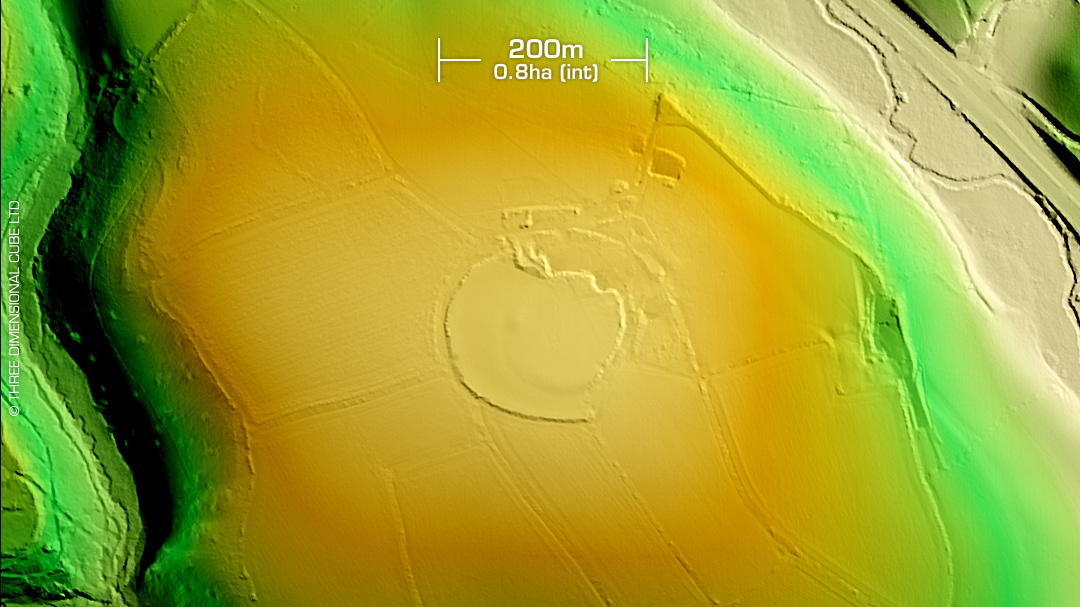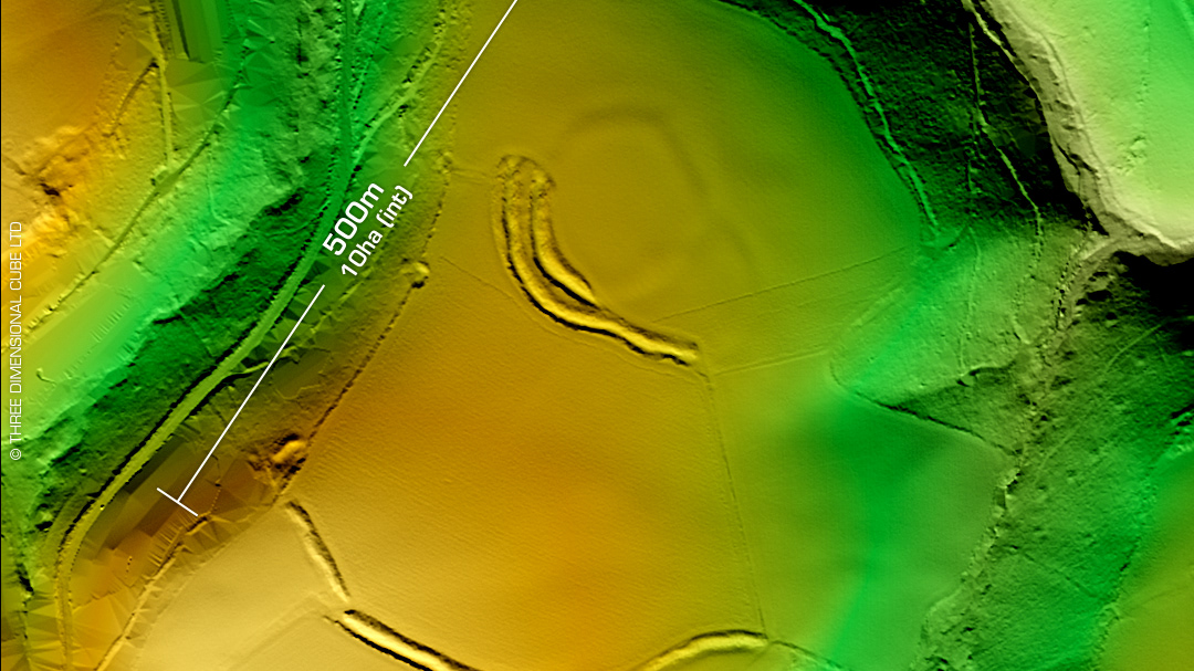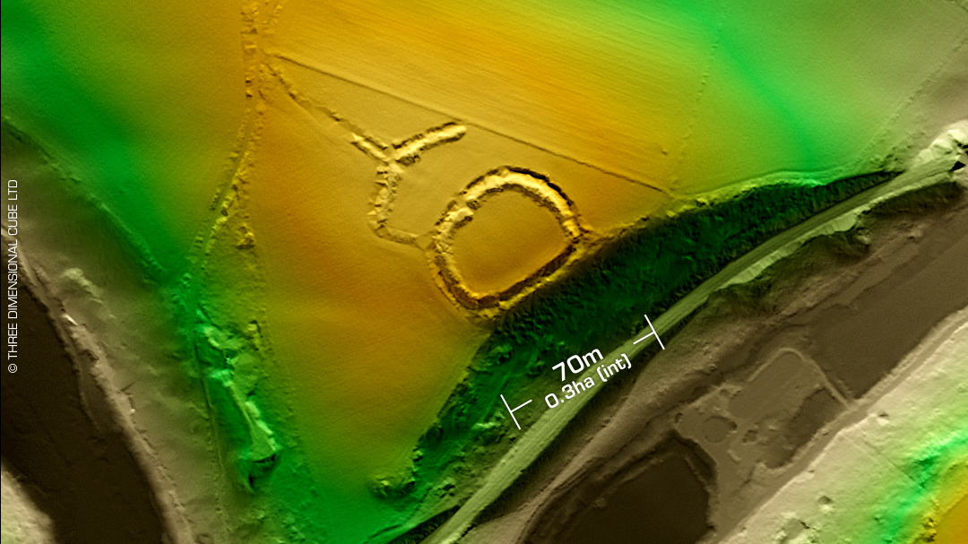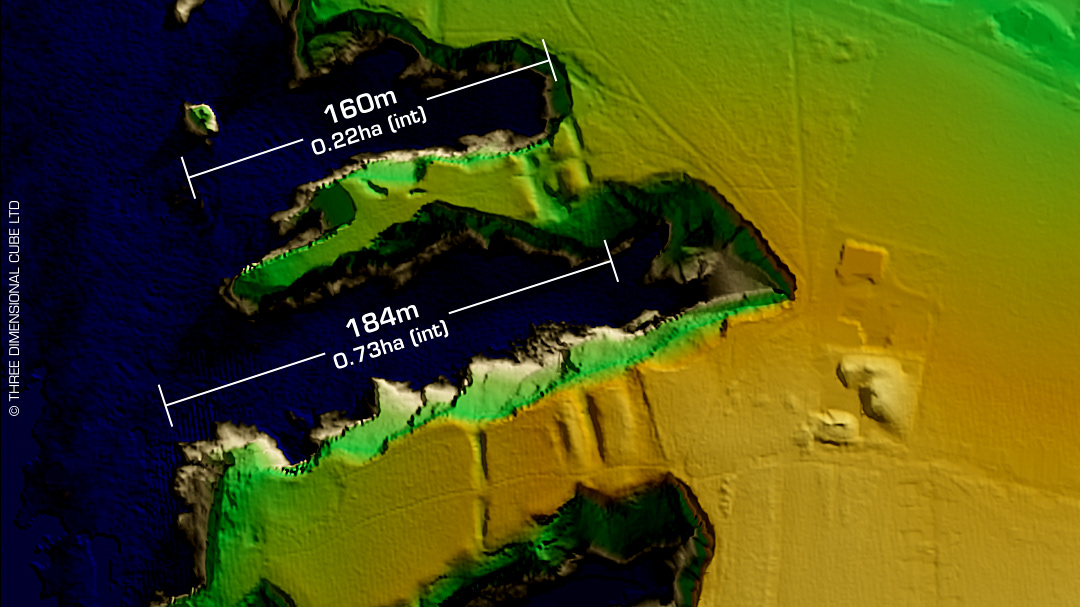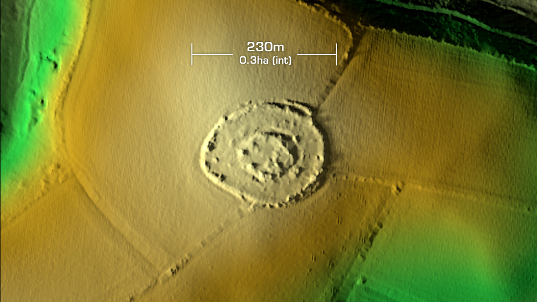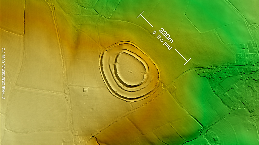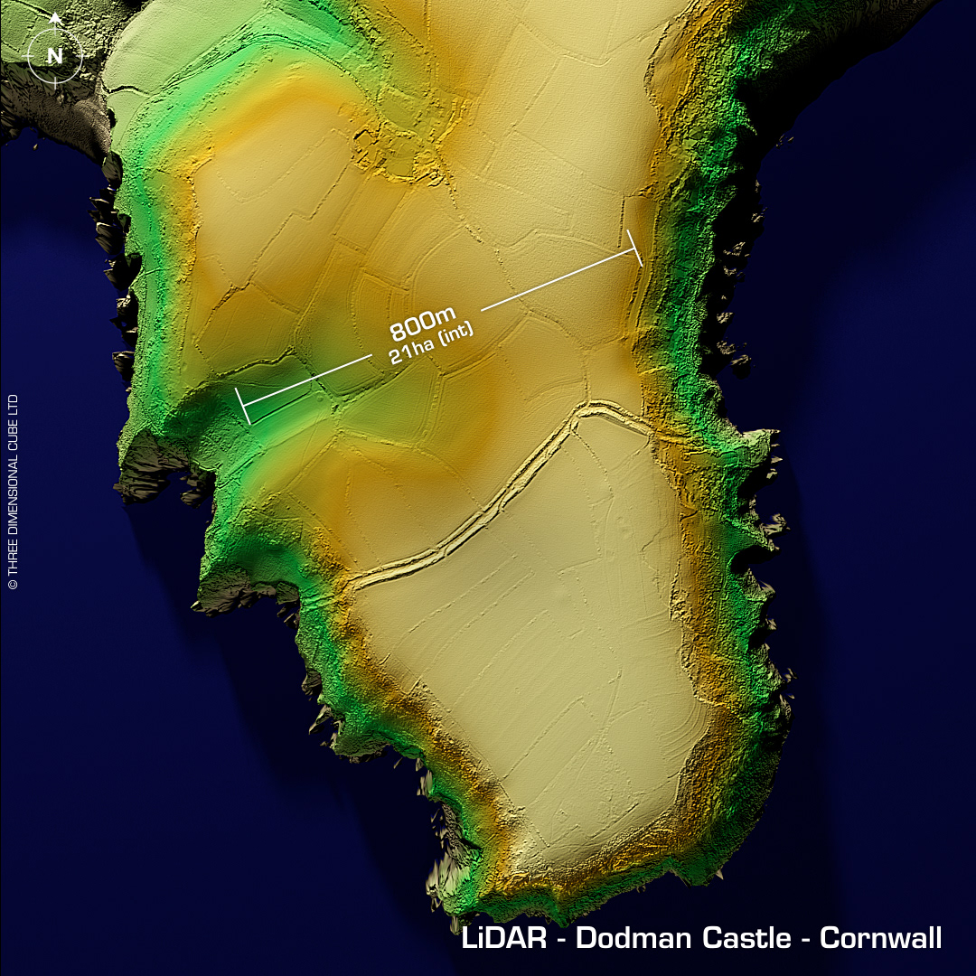

DTM- (Digital Terrain Model, i.e. No buildings or foliage) Dodman Castle lies on the promontory Dodman Point, which lies just to the SW of Gorran Haven. This 21-hectare promontory fort has been heavily degraded by ploughing over the centuries. Medieval trackway and beacon with medieval field system. Napoleonic signal station (1794). Shipping watch house. Two probable WW2 bomb craters. Two large round barrows in interior. Geyophys in 2013. First written record in 1760 on the Edgecombe Map. No recorded finds or excavations, hence undated. Iron Age tribal association (conjecture based on location): Dumnonii (Scheduled Monument) [Any descriptive text attributed to the Atlas of Hillforts & Historic England websites]