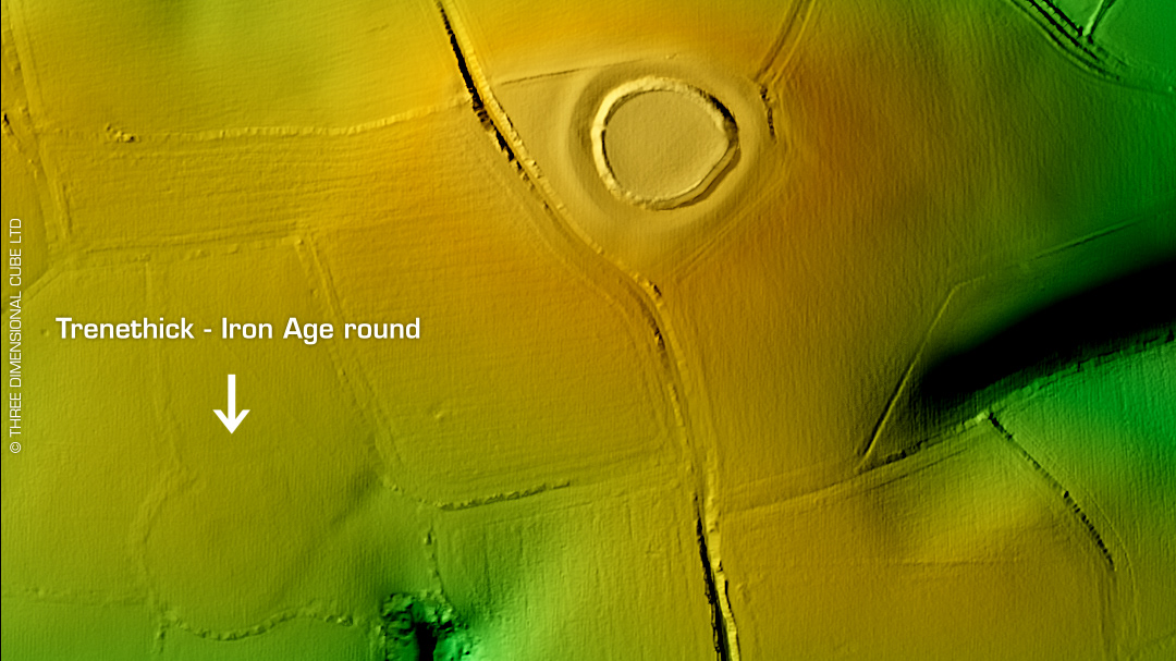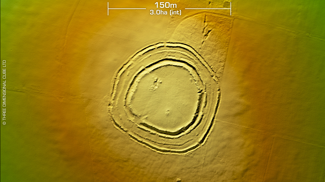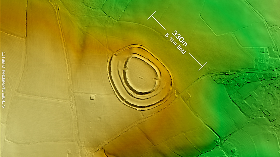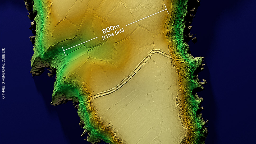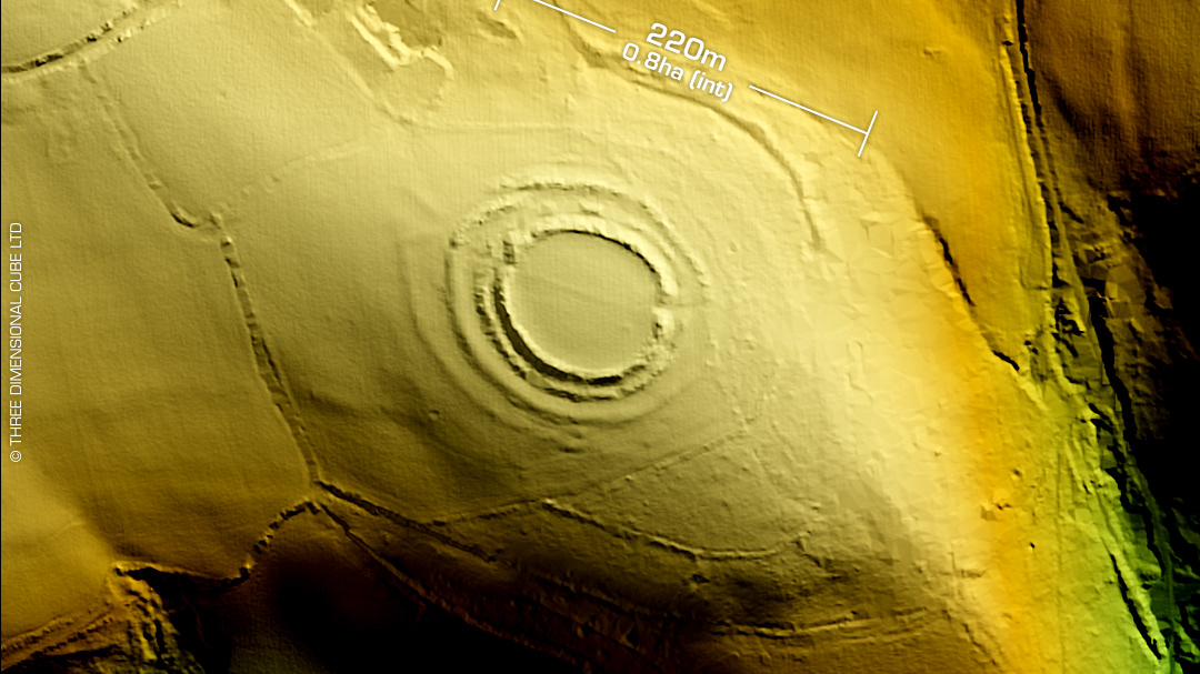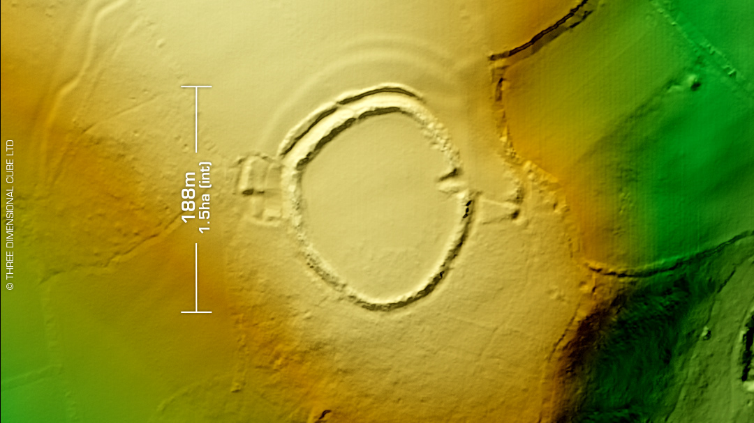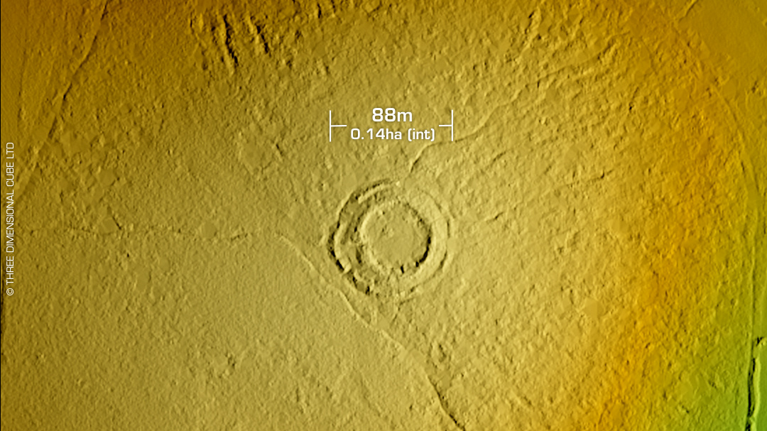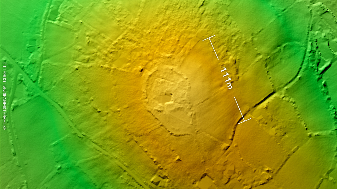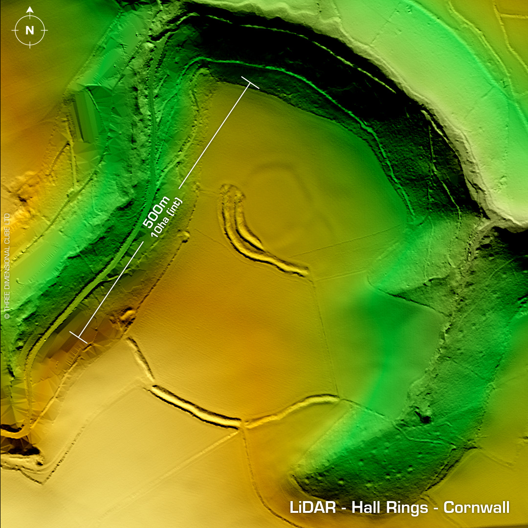
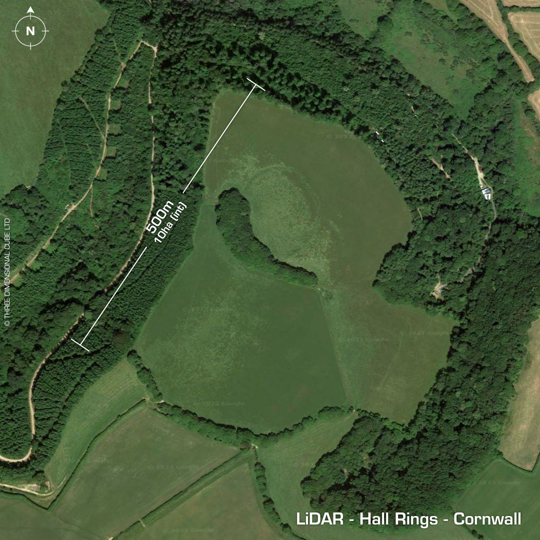
DTM- (Digital Terrain Model, i.e. No buildings or foliage) Overlooking Pelynt from the east lies the 'unusual' partial contour hillfort, Hall Rings. Possible two-phase construction. Three enclosures. Rampart 2.8m high, ditch 1.8m deep. Heavily degraded by ploughing in WW2. First written record in 1813 (OS Map). Described by T.Bond in 1823. On the oblique shot you can see St Nons Camp in the distance. No recorded finds or excavations, hence undated. Iron Age tribal association (conjecture based on location): Dumnonii (Scheduled Monument) [Any descriptive text attributed to the Atlas of Hillforts & Historic England websites]