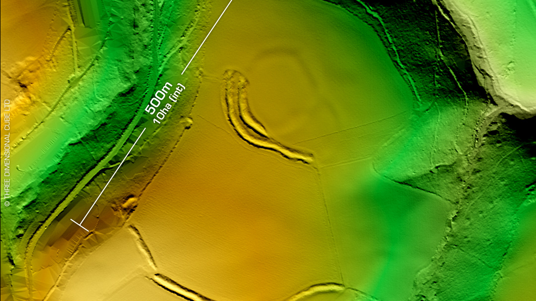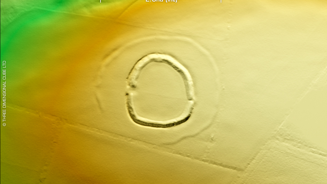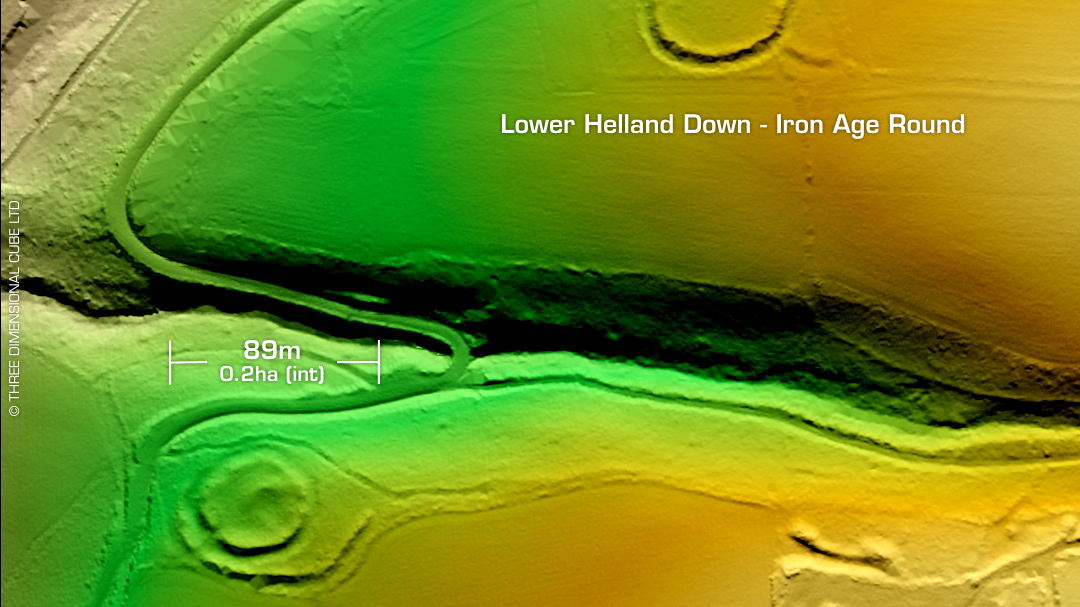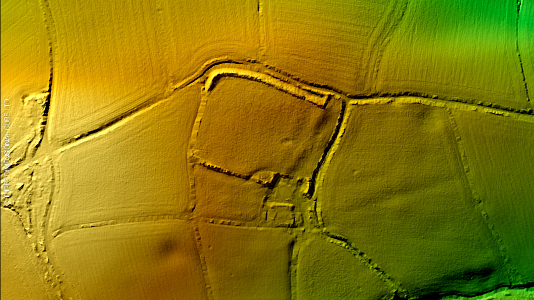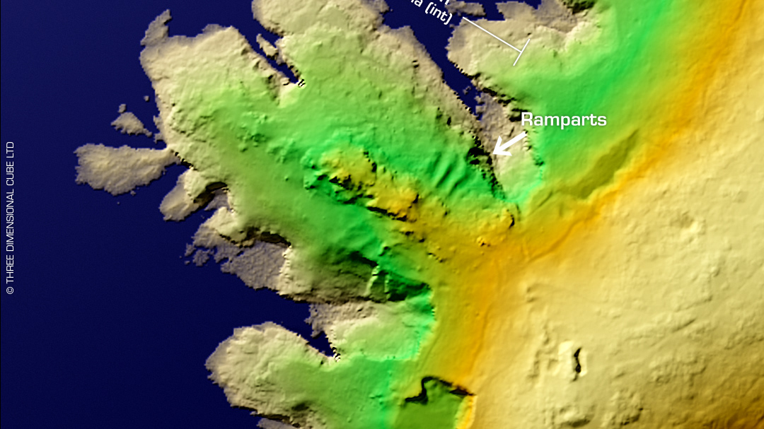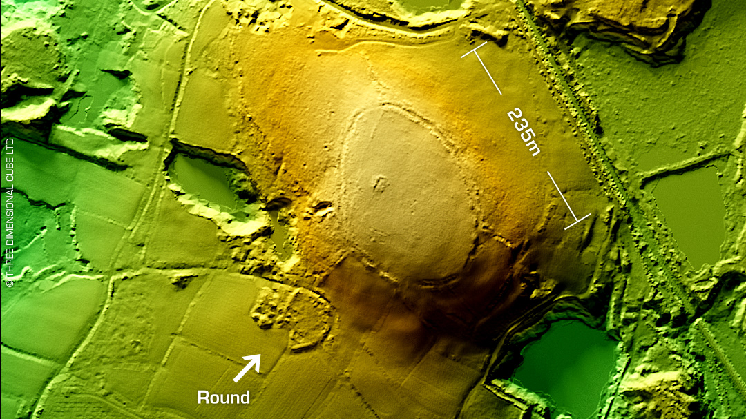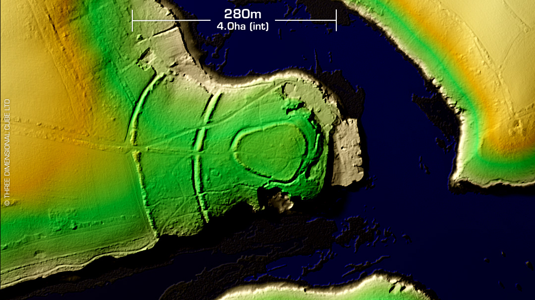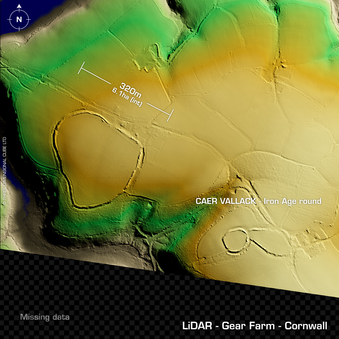
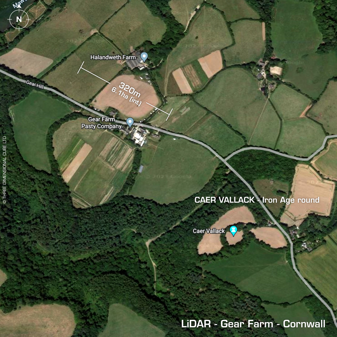
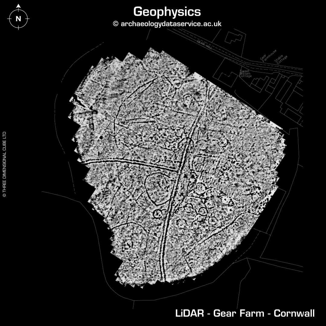
DTM- (Digital Terrain Model, i.e. No buildings or foliage) Overlooking the Helford River from the south & just to the east of Mawgan and ringed by trees lies the univallate partial contour hillfort, Gear Farm. I've included the Iron Age round, Caer Vallack as it was in-frame on the LiDAR tile. Construction of the farm destroyed the probable north and/or west entrance. Place name 'Gear' derived from Cornish 'Ker' meaning 'Fort. First written reference in 1262. Rev Richard Polwhele in 1803 first to describe the site as a fort. Time Team site visit in 2001 (S9 EP7). A Google search finds on YouTube an uploaded video by Stefanie Harrell of the whole episode. Whole interior Geophys by Time Team. (See additional images). PM me for link to site where the excavation report & geophys data can be accessed. Iron Age tribal association (conjecture based on location): Dumnonii (Scheduled Monument) [Any descriptive text attributed to the Atlas of Hillforts & Historic England websites]