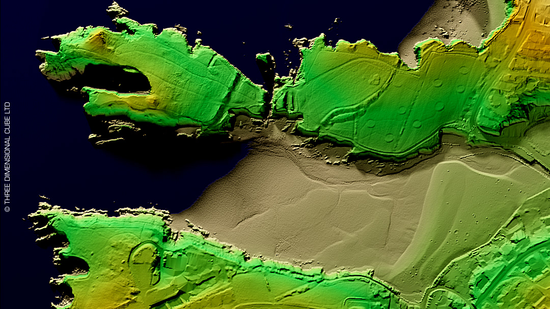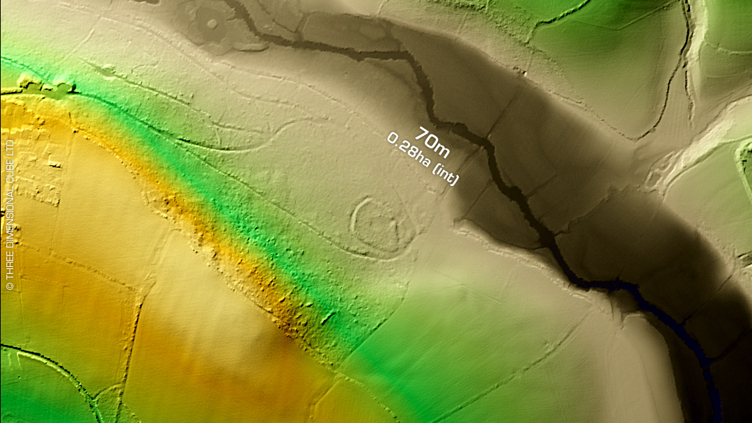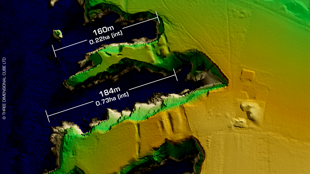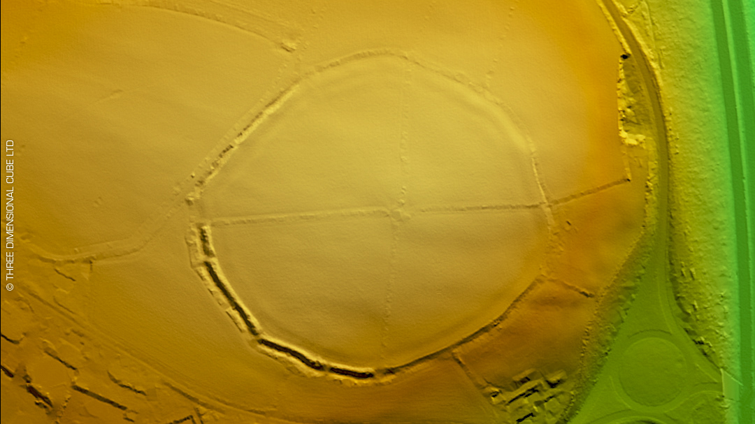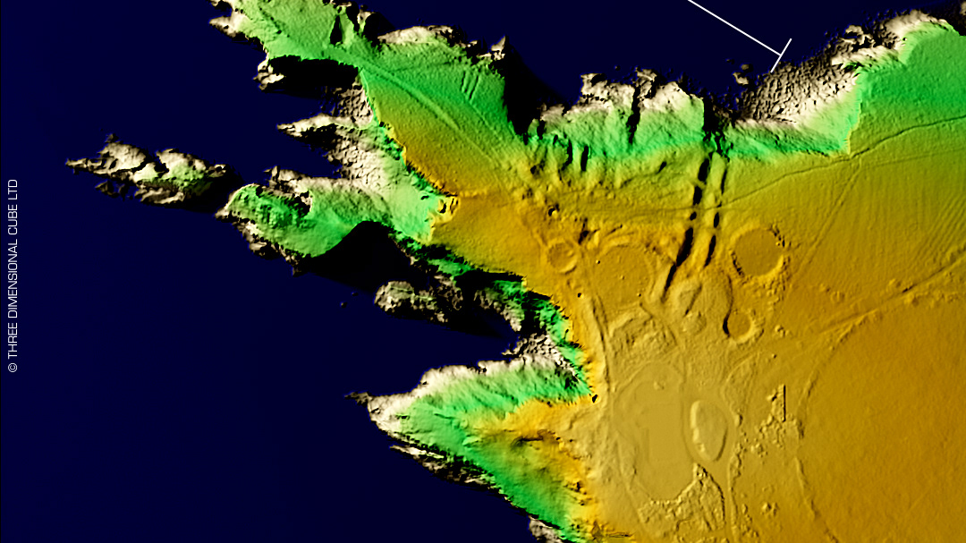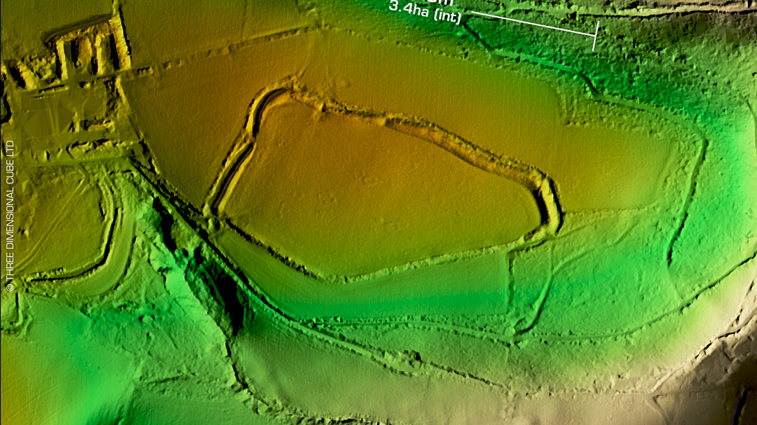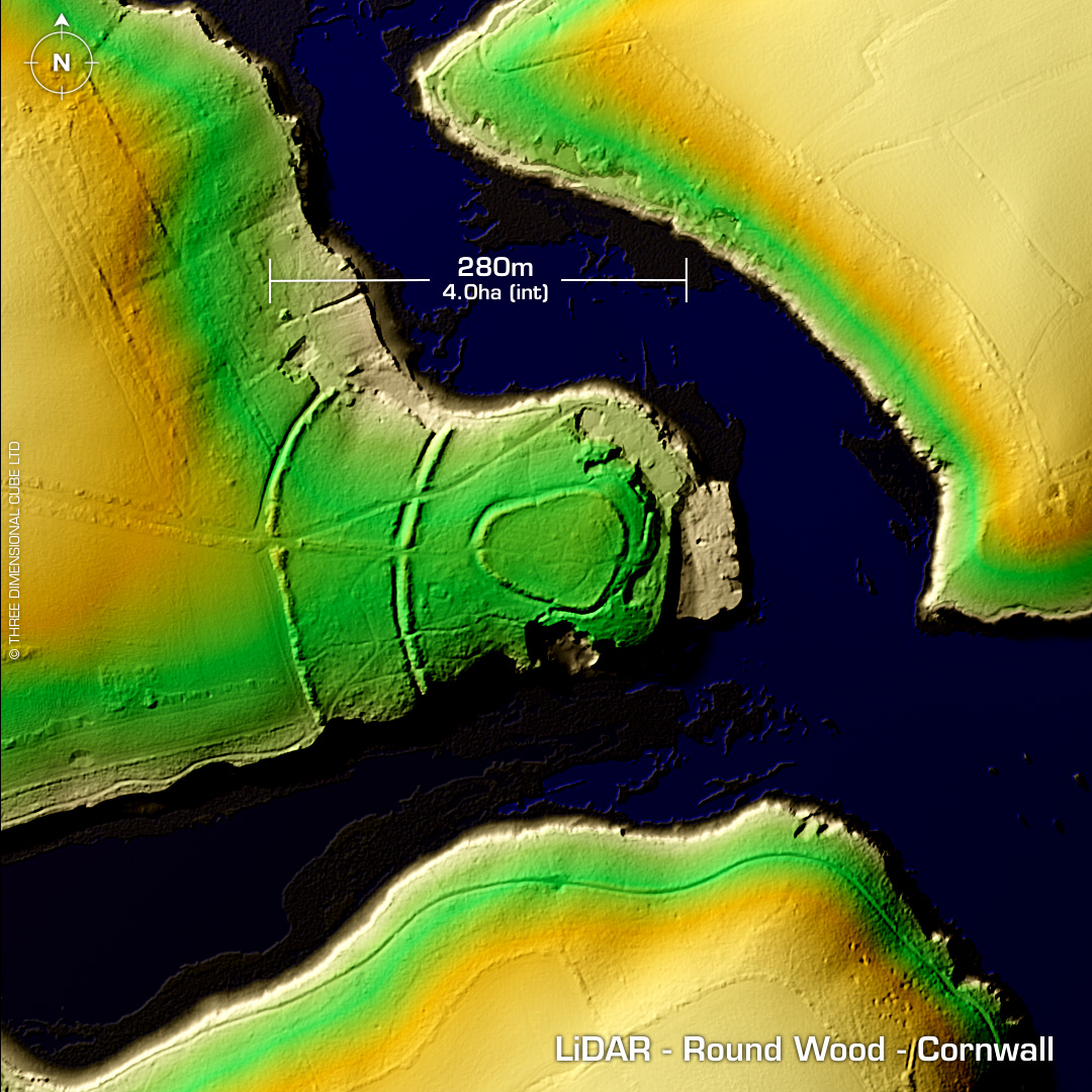
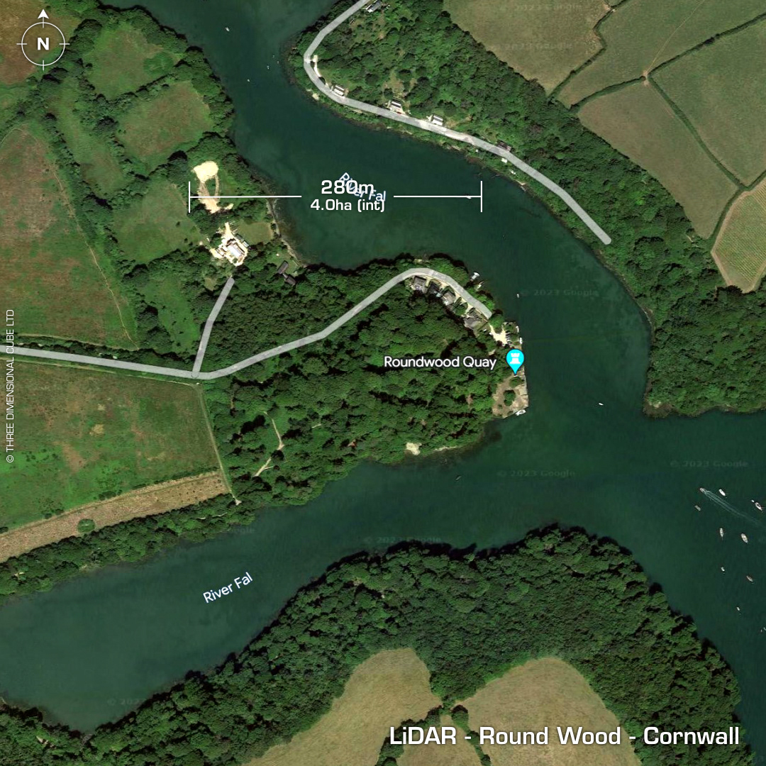
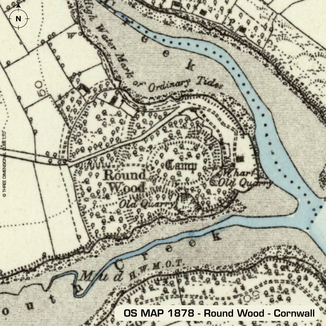
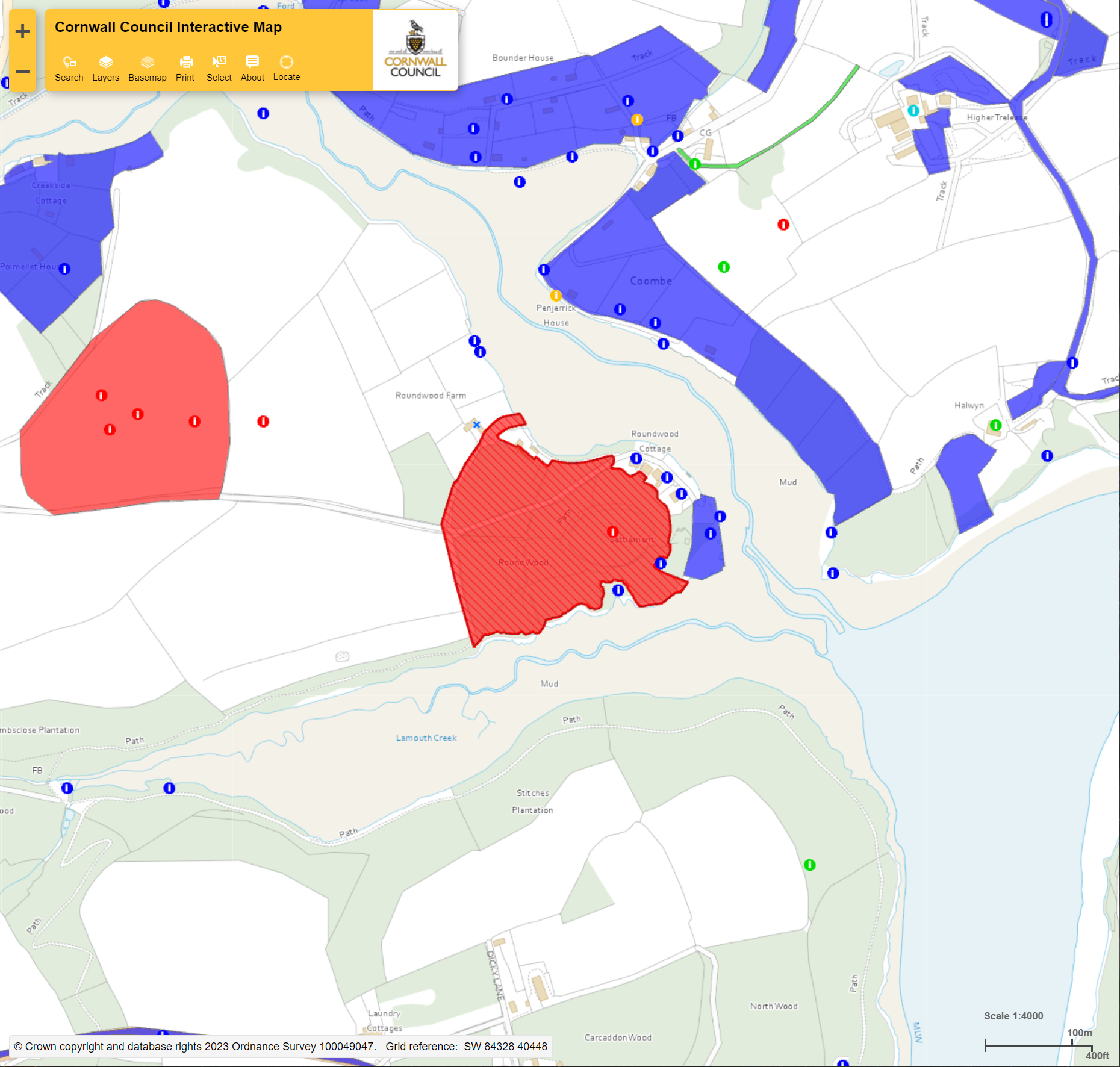
DTM- (Digital Terrain Model, i.e. No buildings or foliage) On a promontory north of the National Trust's - Trelissick Garden lies the well preserved multiple enclosure fort, Round Wood. Post medieval boundary runs along spine of promontory to the west. Many 18/19th century tracks populate the site as Roundwood Quay was an important dock for the very profitable mines in the area. Copper smelting on-site in this period. As you can see on the Cornwall HER map, west of the main site lies a curved earthwork enclosing multiple Bronze Age barrow sites moving westwards. Last site visit 2010. No recorded excavations or finds (of the fort), hence undated. Iron Age tribal association (conjecture based on location): Dumnonii (Scheduled Monument) [Any descriptive text attributed to the Atlas of Hillforts & Historic England websites]