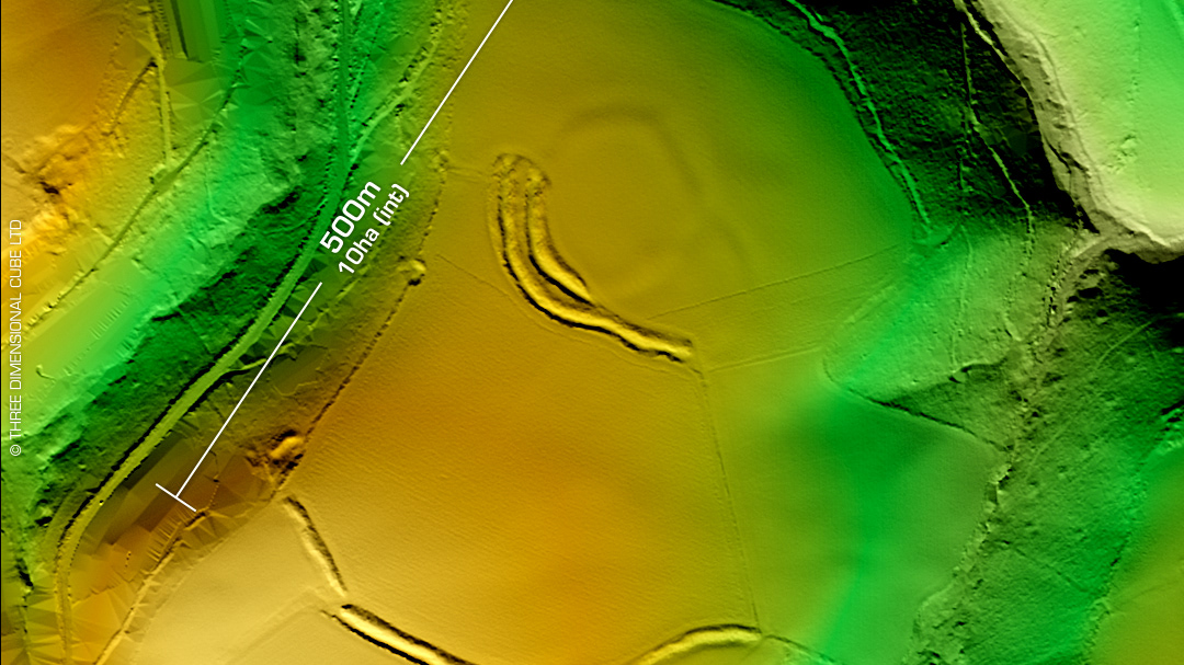
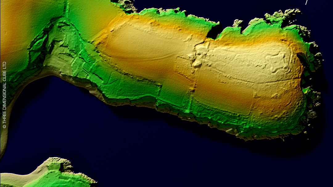
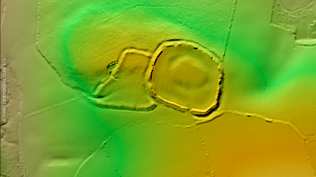
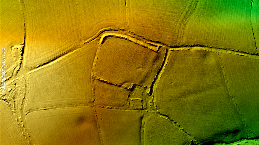
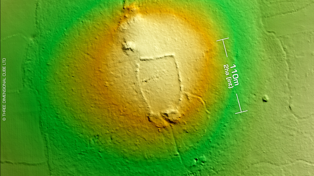
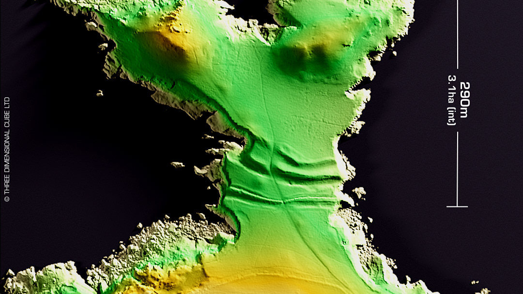
DTM- (Digital Terrain Model, i.e. No buildings or foliage) Overlooking the River Tamar, southeast of Luckett & atop Greenscoombe Hill lies a small contour hillfort, Greenscoombe Wood. Interestingly, when I zoomed-out on the LiDAR tile I noticed possible defensive trench arcs dug into the headland of the promontory. Pure supposition I know but possible. They are not listed on Cornwall HER so could just be geology. The site is surrounded by Medieval field systems. No recorded finds or excavations, hence undated. Iron Age tribal association (conjecture based on location): Dumnonii (Scheduled Monument) [Any descriptive text attributed to the Atlas of Hillforts & Historic England websites]