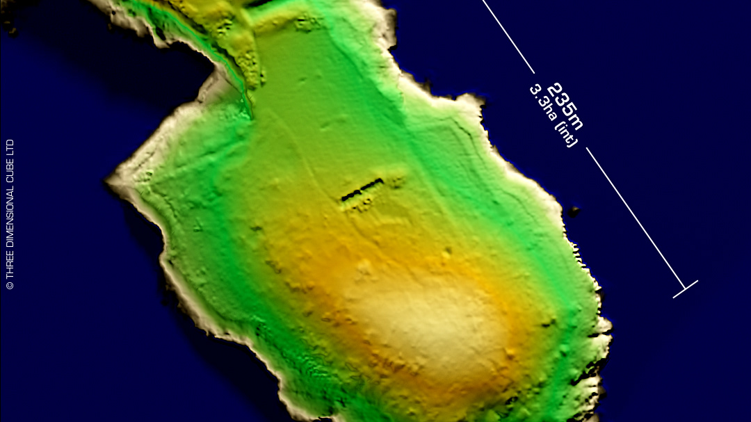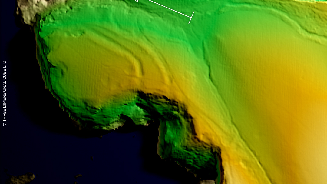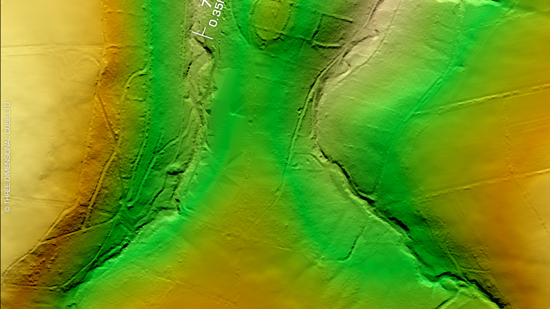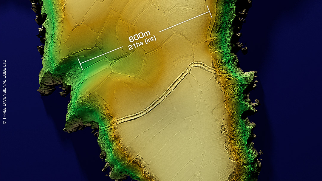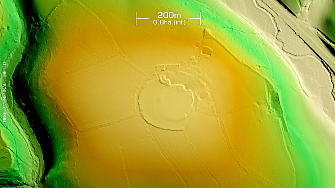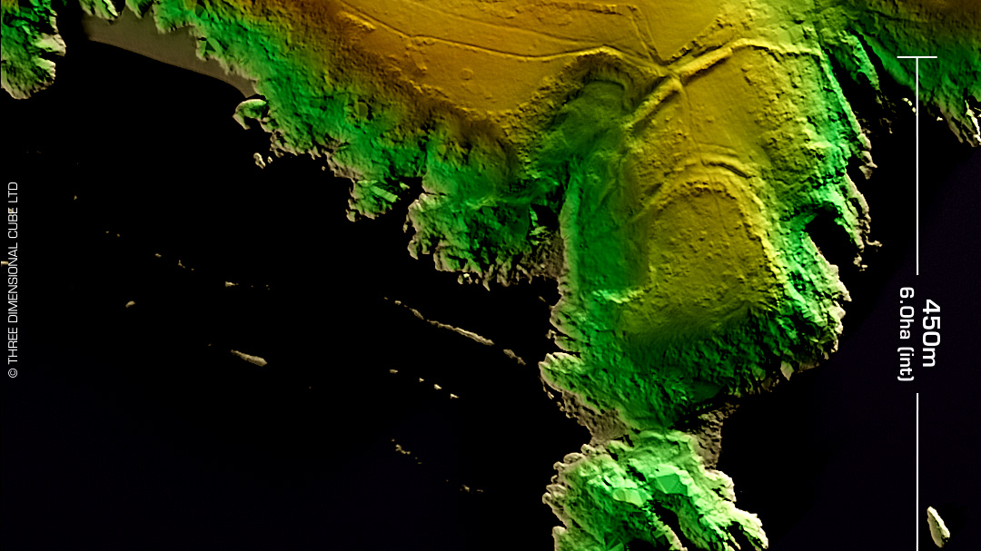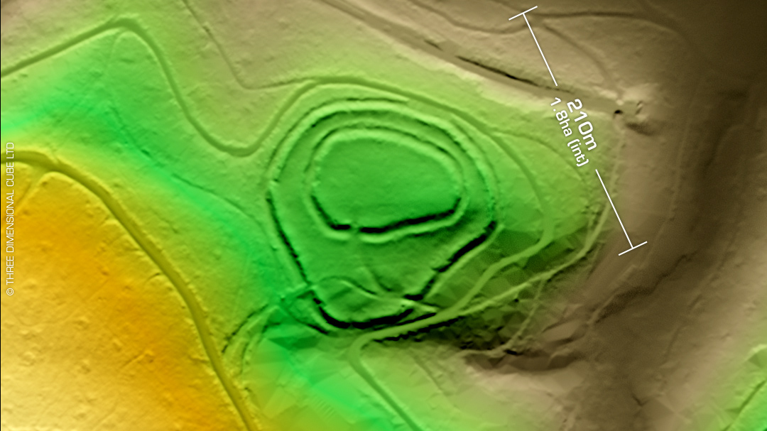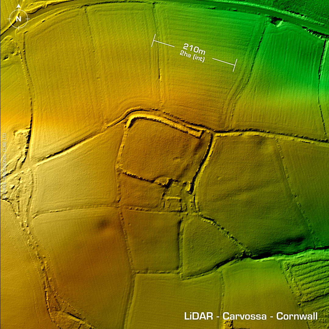
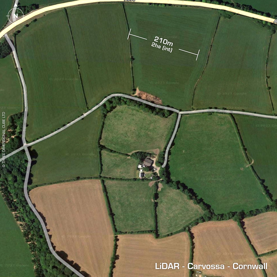
DTM- (Digital Terrain Model, i.e. No buildings or foliage) Directly between the villages of Probus and Grampound & just south of the A390 lies the univallate partial contour hillfort, Carvossa. Site still a complete rectangle with rounded corners in 1848. Degraded by cultivation and construction of farm buildings on top of the SE corner. Iron Age South Western Decorated pottery finds. Excavations found a road heading SE out of site to the River Fal over 2.5Km away, which was considered navigable in Roman times. Excavations in 1968 found roundhouse bases & sub-rectangular enclosures dated to 1st century AD. 2nd century finds include a metalworking area which later became a midden (rubbish/cess pit). Other finds inside east defences include Coins, broaches, glass and pottery. (1-3rd century) Roman occupied site. Possible external vicus or settlement. The LiDAR shows interesting features surrounding the site which may support this. Site lies only 1.3 km to the NW of Golden Camp, another Iron Age hillfort, then possible Roman Camp. First written reference in 1754. Last survey (Geophys) in 1980. Iron Age tribal association (conjecture based on location): Dumnonii (Scheduled Monument) [Any descriptive text attributed to the Atlas of Hillforts & Historic England websites]