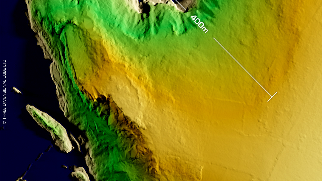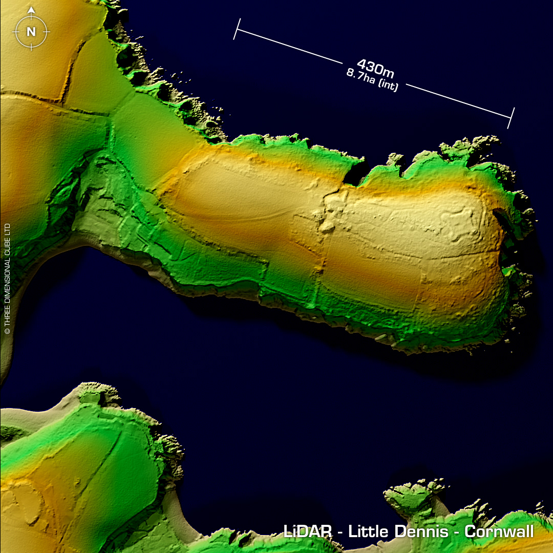
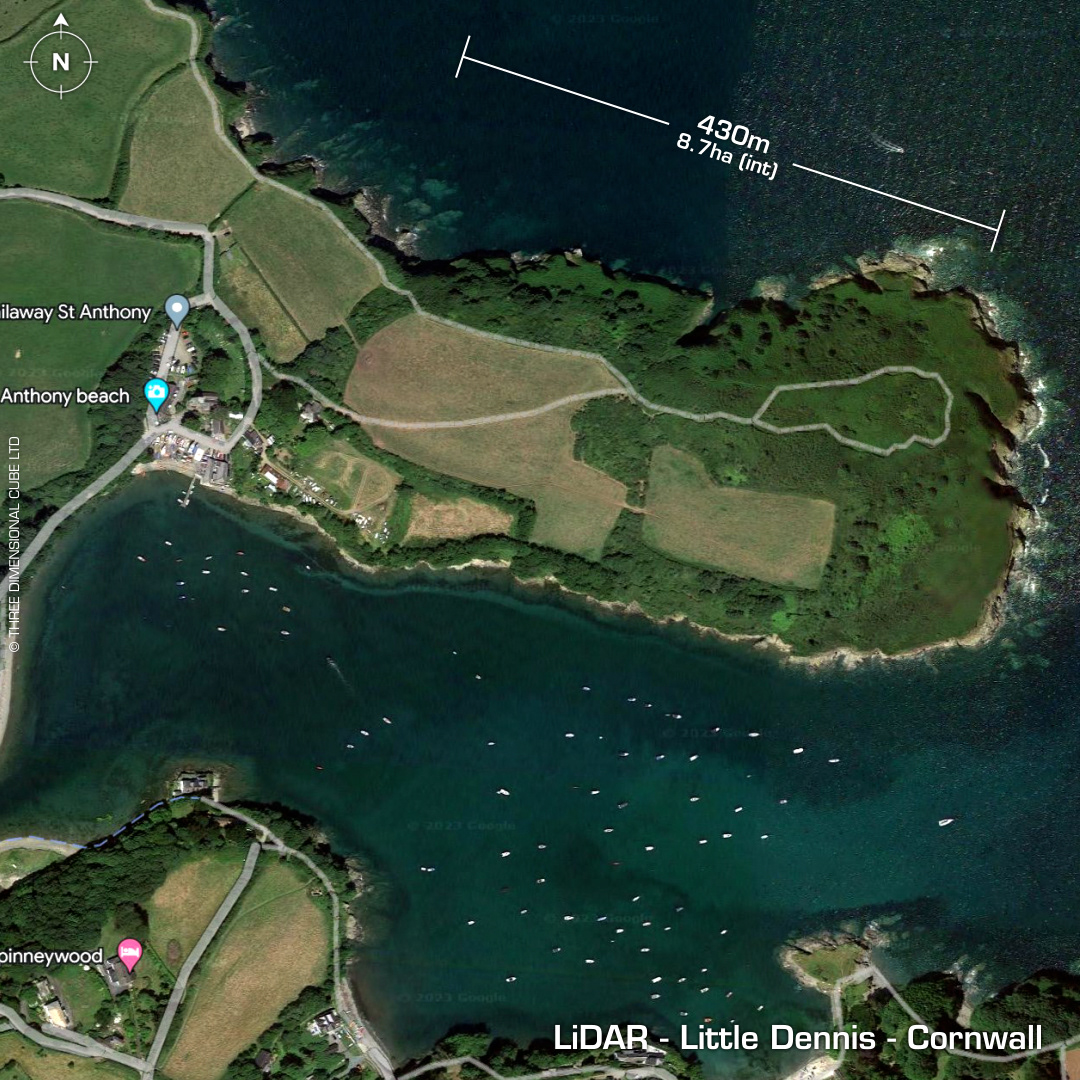
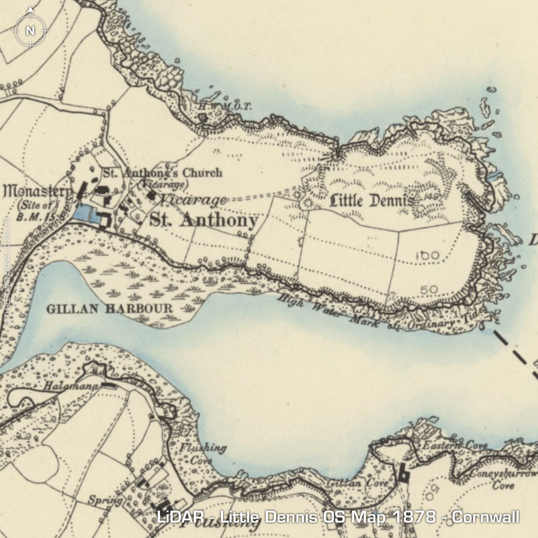
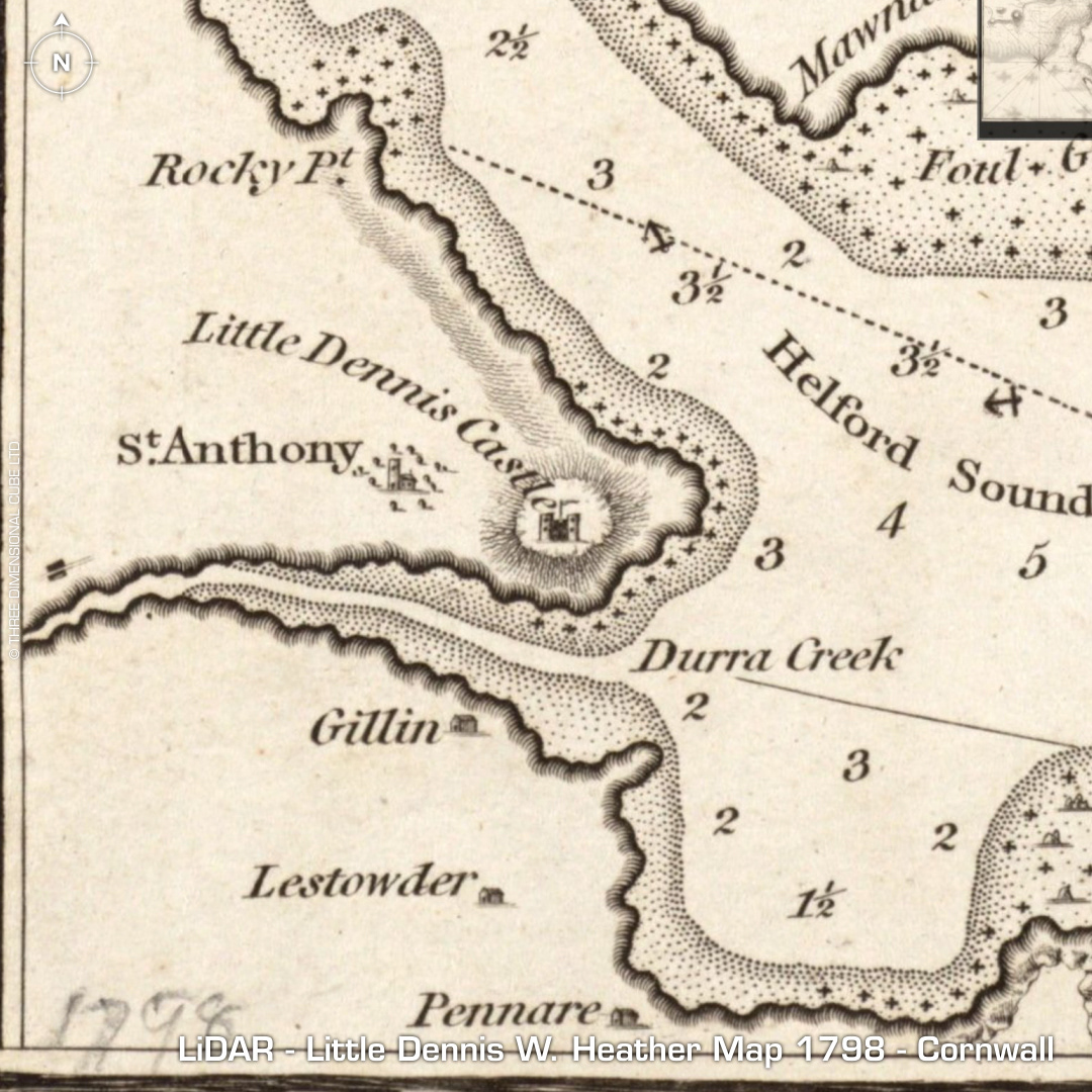
DTM- (Digital Terrain Model, i.e. No buildings or foliage) On a promontory, Dennis Head at the end of Gillian Creek at St Anthony-in-Meneage lies the mostly destroyed fort of Little Dennis. Contains civil war earthworks which is prominent on the LiDAR and it shows the position of the old destroyed bastion fort indicated on the map (Castle dated to 1643, surrendered to parliament in 1646). First recorded as 'Dinas' in 1610. Next recorded as 'Old Vallum' by W.Borlase in 1769, probably Roman cutting across the neck of the promontory. The name in Cornish contains the element 'Dynas', meaning 'fort'. Vyvyan in 1910 describing the civil war fort found no traces of earlier occupation. At the bottom-left of frame lies an Iron Age 'round' which has been bisected by a road and ploughed-out. (I only found this after looking for Little Dennis on the Historic England HER portal) First reference in 1780 as 'The Castle'. Now occupied as a private residence since the 1930s. No recorded excavations or finds, hence undated. Iron Age tribal association (conjecture based on location): Dumnonii (Scheduled Monument) [Any descriptive text attributed to the Atlas of Hillforts & Historic England websites]