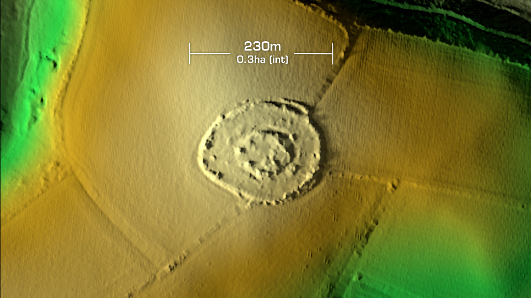
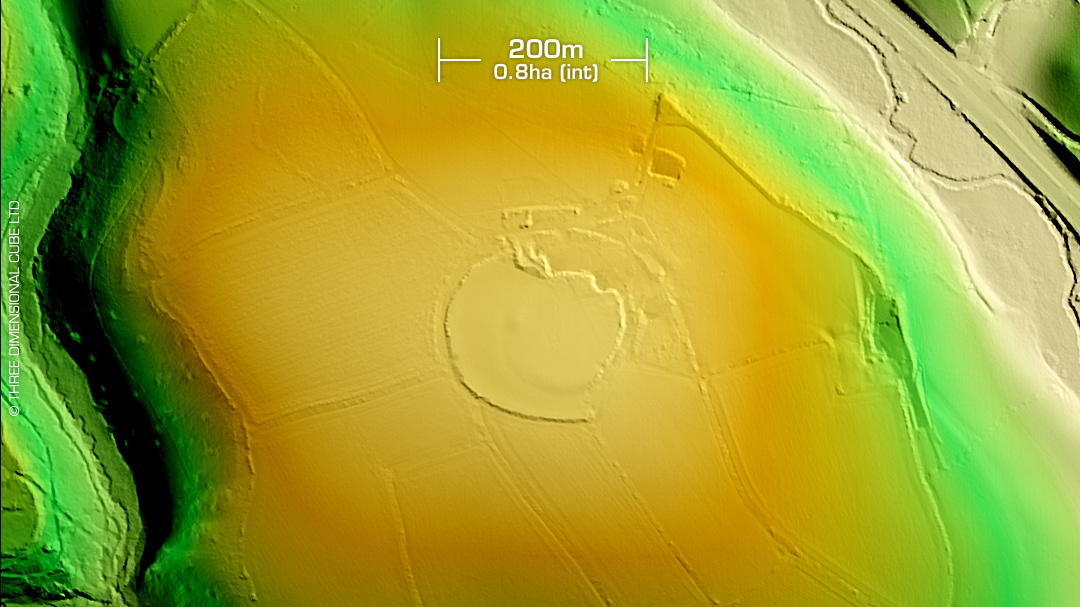
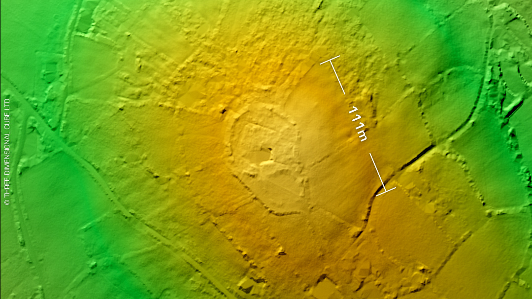
DTM- (Digital Terrain Model, i.e. No buildings or foliage) As you leave Trewithian to the northeast along the A3078 on the right before you pass the water tower lies the hidden heavily degraded bivallate partial contour hillfort, Dingerein Castle on Curgurrell Farm. Possible east annex (not visible on LiDAR) Medial ditch visible as crop feature on ariel photos. A 'Fogou' or underground chamber reported. (Details lost in antiquity) Possible first written reference in 1711 by Thomas Hearne of John Leland visit. In about 1540, Leland mentions a 'vault', "within but a shot of the north side" of the earthwork at Cargurrel. This is also referred to by Whitaker, Hencken, and the Bousfields. All consider it likely that this was a reference to a now lost Fogou. Last site visit in 1983. No recorded finds or excavations, hence undated. Iron Age tribal association (conjecture based on location): Dumnonii (Scheduled Monument) [Any descriptive text attributed to the Atlas of Hillforts & Historic England websites]