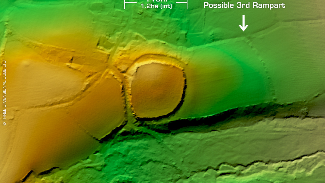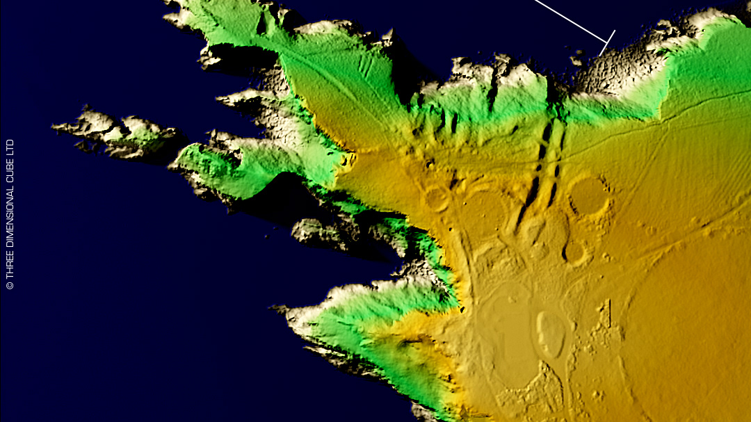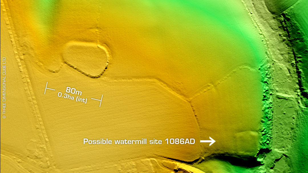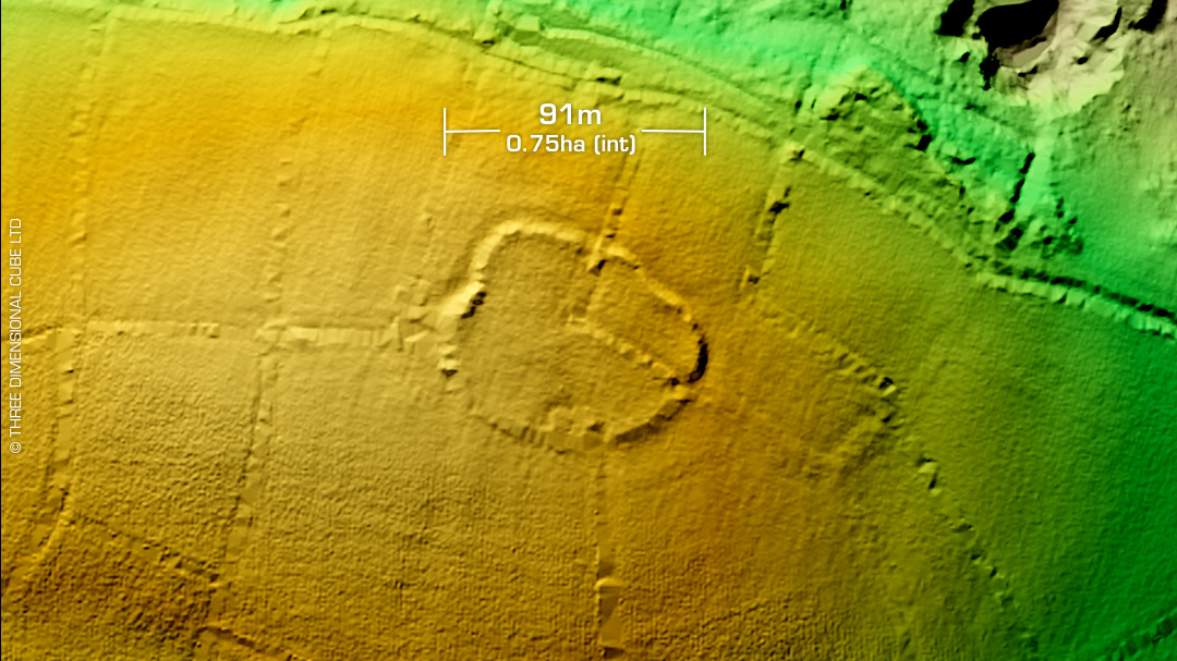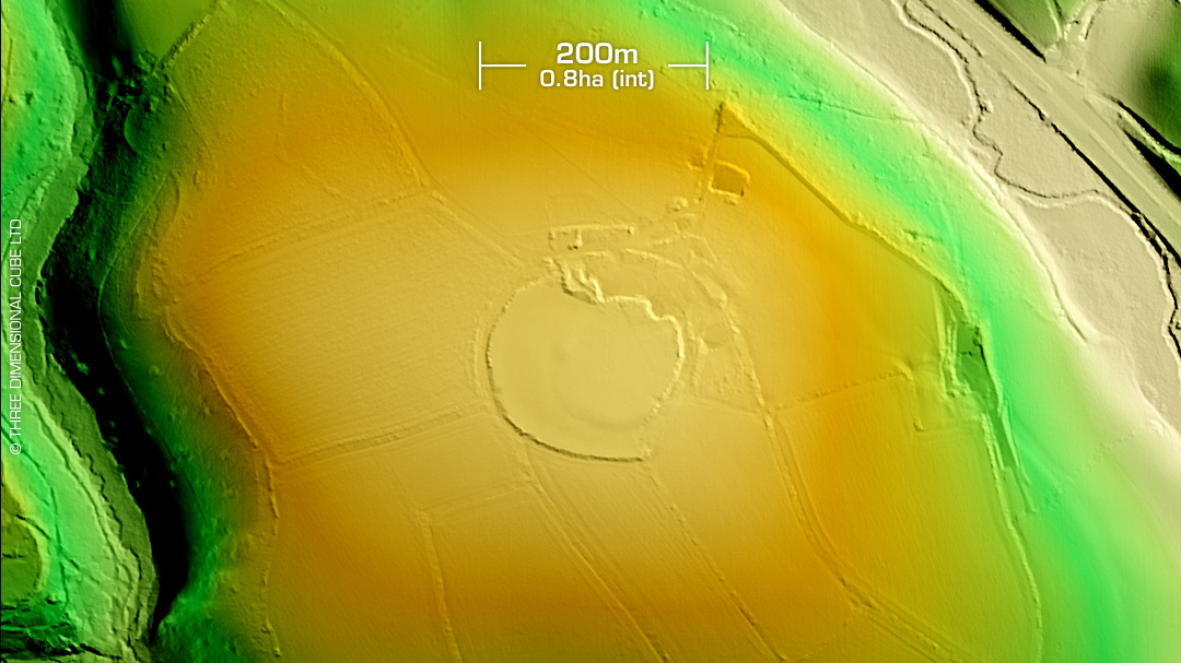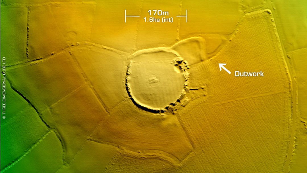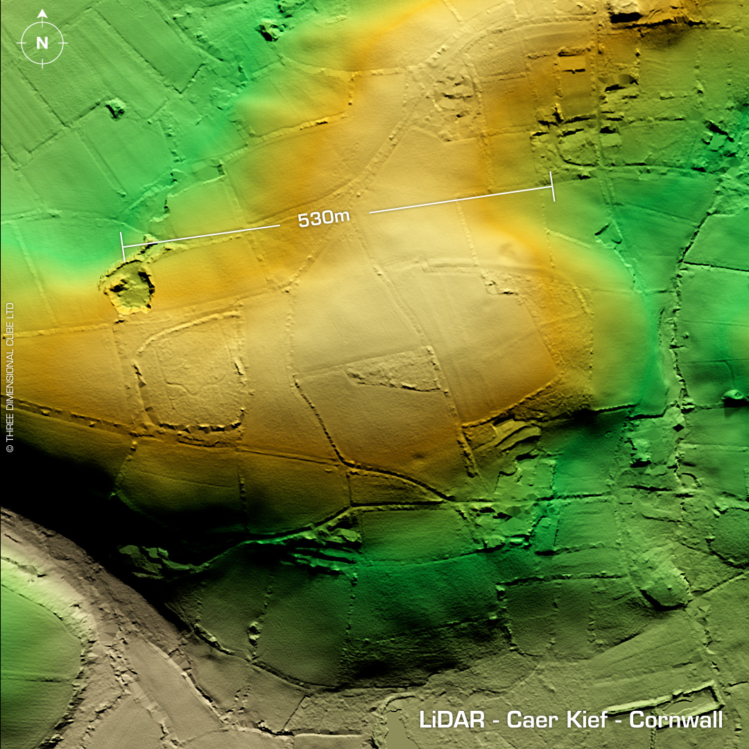
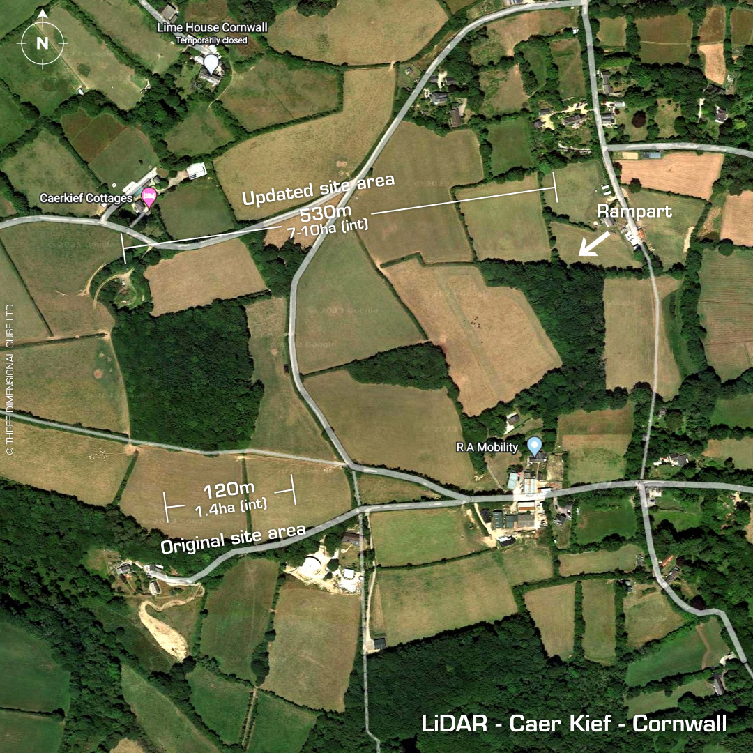
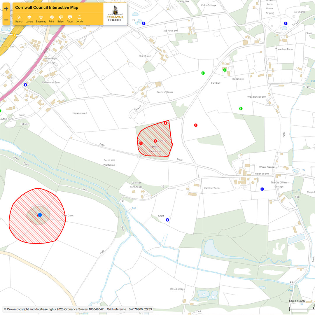
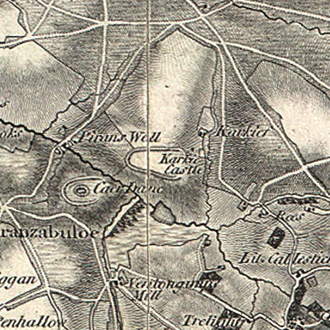
NEW DISCOVERY! When I was looking at the hillfort site, Engelly, which lies not far to the east of Caer Dane hillfort near Perranwell, I was researching old maps of the area as Engelly was supposed to be a complete circuit on these old maps but I couldn't find it. Now then, I did notice a much bigger hillfort illustrated north of Caer Dane on an 1865 OS Map of the area named as Karkief Castle. Nowadays this is called Caer Kief and was originally classified as a small ‘round' or (defended) enclosure but my newly found map indicated a much larger hillfort structure. So, I re-rendered a wide view and the northeast embankments stood right out so now you can almost visualise the complete circuit. I sent my findings to HER Cornwall, and it looks like I've been given the official nod by Hannah Curnow, who is the Historic Environment Record Officer for Cornwall. She also said that Historic England have been contacted to amend the scheduled area in light of these new findings. The HER map shows the current Caer Kief site area. This will now change to cover the entire east end of the hilltop. Winner! Mind you, the land owner might get a bit upset… (Re-Scheduled Monument)