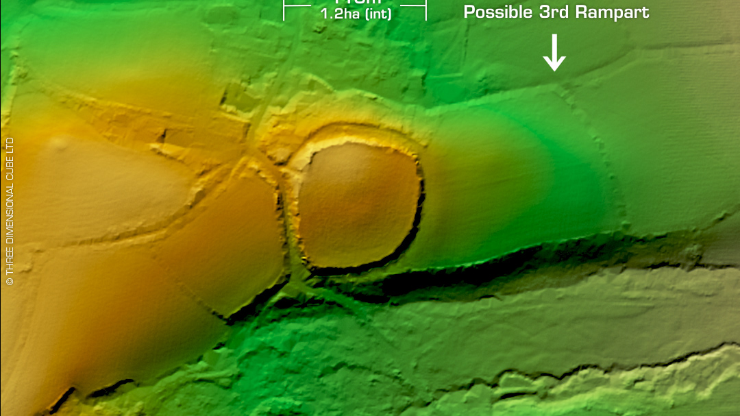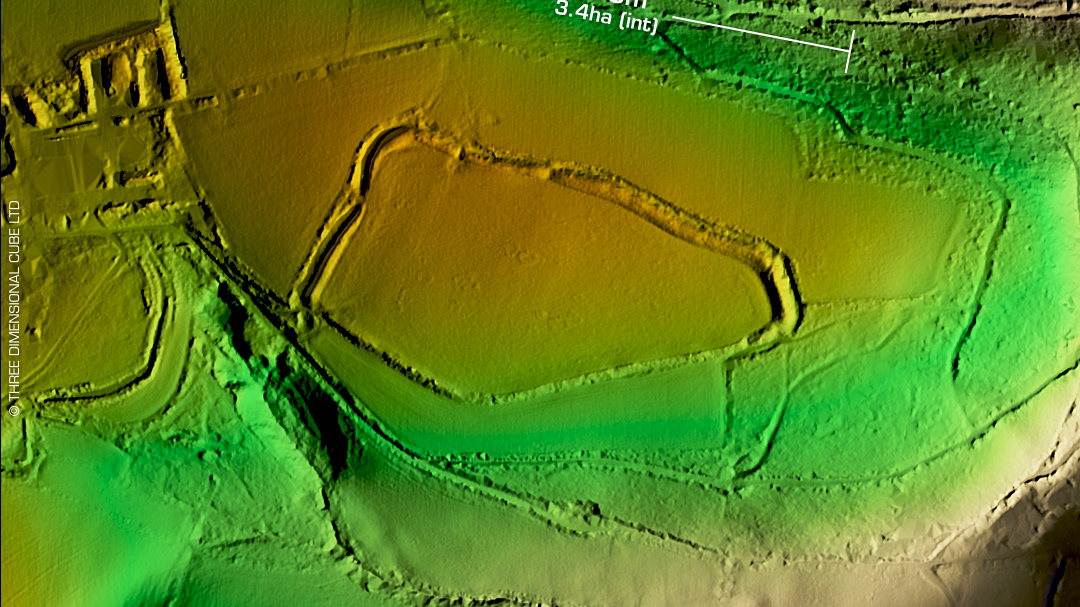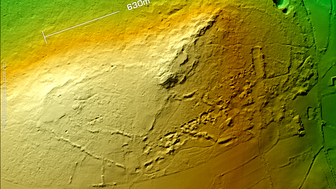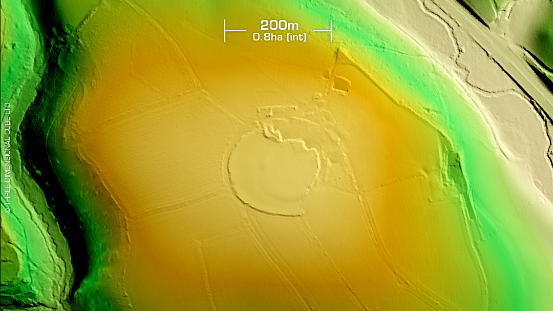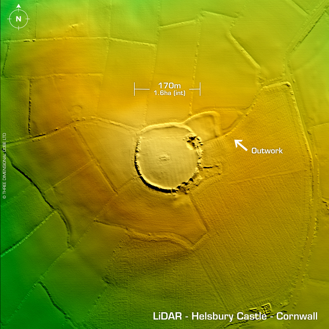
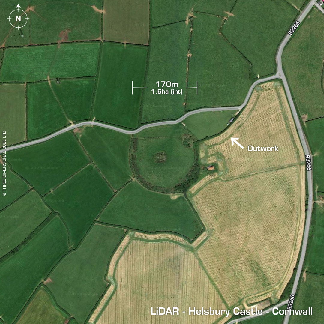
DTM- (Digital Terrain Model, i.e. No buildings or foliage) Overlooking Treveighan from the east from the summit of Michaelstow Beacon lies the univallate contour hillfort, Helsbury Castle. First recorded in 1284 when it was spelt 'Hellesbury', meaning 'hen-lys': ancient court/ruins & 'bury': fortification. Tithe map documents a windmill on north side of site but no remains visible. North rampart destroyed by road. Outwork or annex to the NE reported in 1850, visible on LiDAR. St Syth's Chapel (attributed) within rectangular enclosure at site centre. (Excavated in 19th century by Rev. Gibbons with no reported finds). WWII Home Guard site. (Underground observation post in SW side of hillfort connected by field telephone to Michaelstow House to the SW. Stone quarried from site in antiquity. Last site visit in 2012 where a geophysical survey was made of the interior as well as the surrounding area for the possible placement of a wind turbine to the SE of the hill. (Available at archaeologydataservice.ac.uk) Iron age sherd recovered from Badger den spoil. No recorded excavations, hence undated. Iron Age tribal association (conjecture based on location): Dumnonii (Scheduled Monument) [Any descriptive text attributed to the Atlas of Hillforts & Historic England websites]