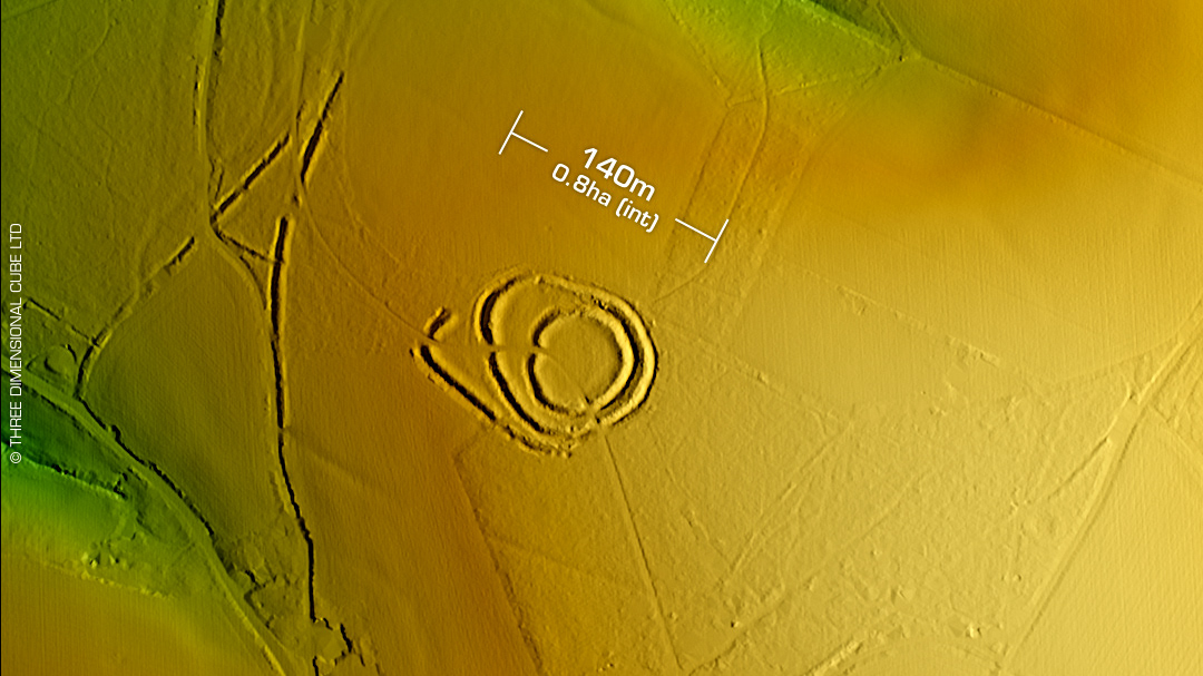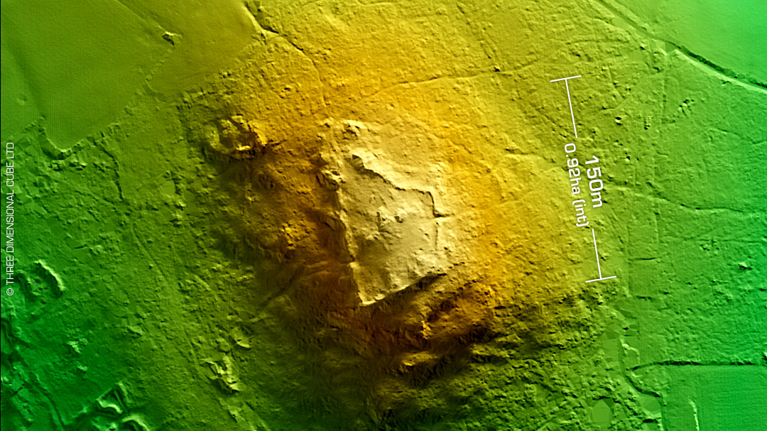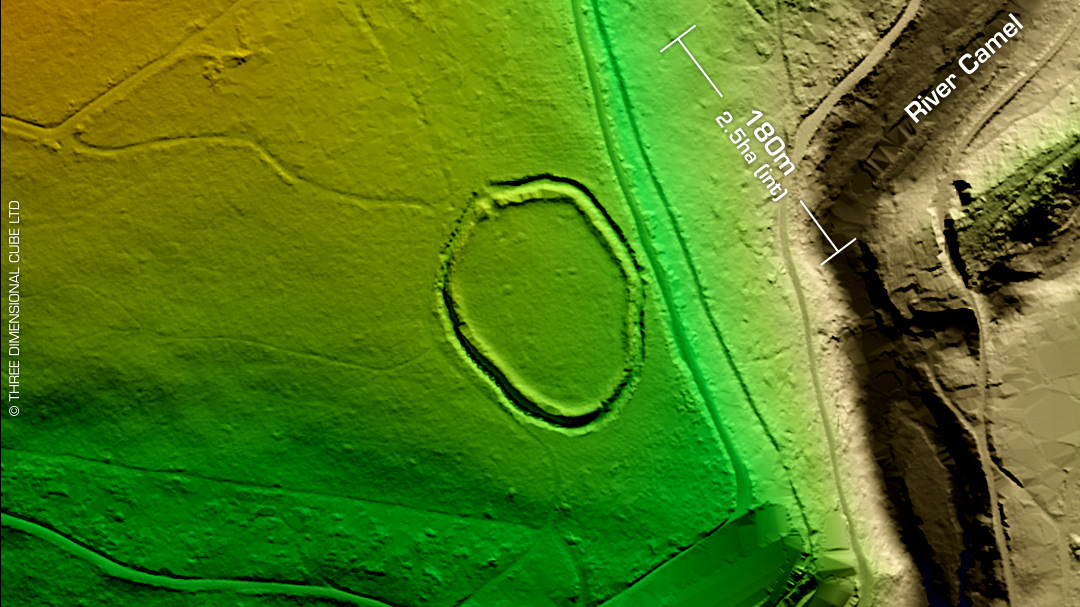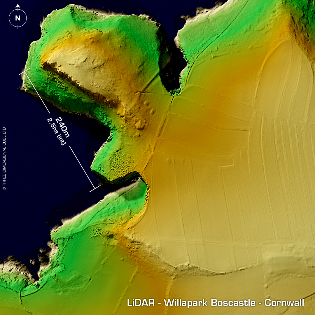
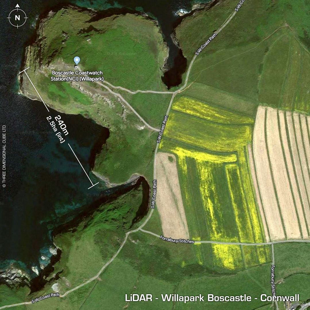
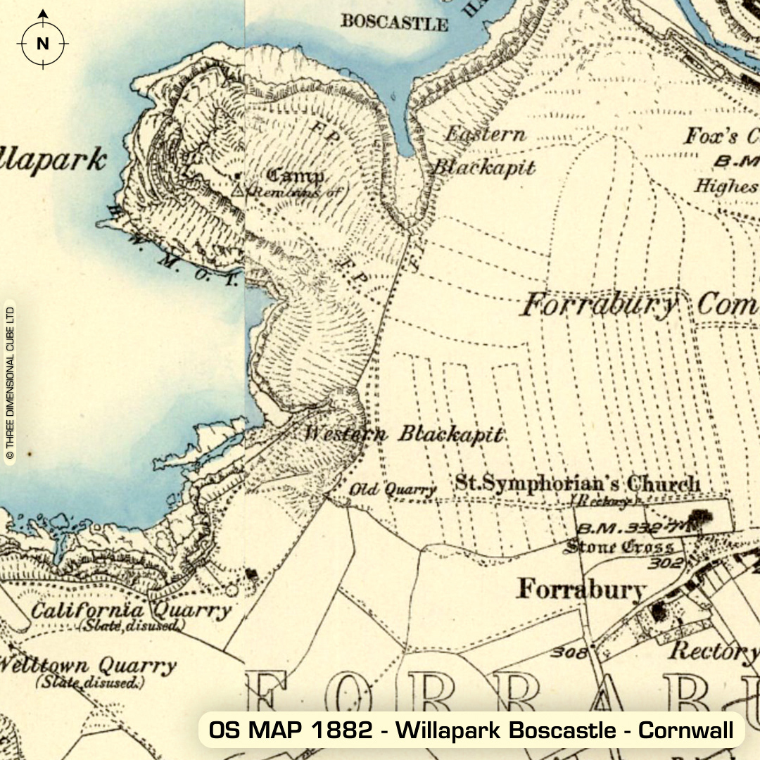
DTM- (Digital Terrain Model, i.e. No buildings or foliage) To the northwest of Boscastle lies the large promontory fort, Willapark Boscastle. 110m long main bank & ditch bisects the promontory with possible 200m long additional bank & ditch east of this (visible on LiDAR but guesswork), currently classed as a medieval boundary. Old footpath through bank may be original entrance. Twin mounds are Bronze Age barrows. Many features lost to coastal erosion & heavy quarrying during the medieval period. First written reference in 1876 (J. Maclean), who classed the site as 'unfinished'. Last site visit (OS) 1976. No recorded excavations or finds, hence undated. Iron Age tribal association (conjecture based on location): Dumnonii (Scheduled Monument) [Any descriptive text attributed to the Atlas of Hillforts & Historic England websites]