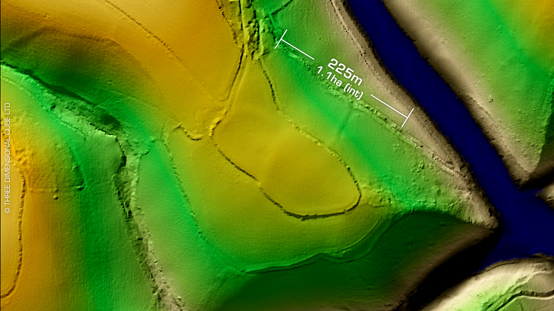
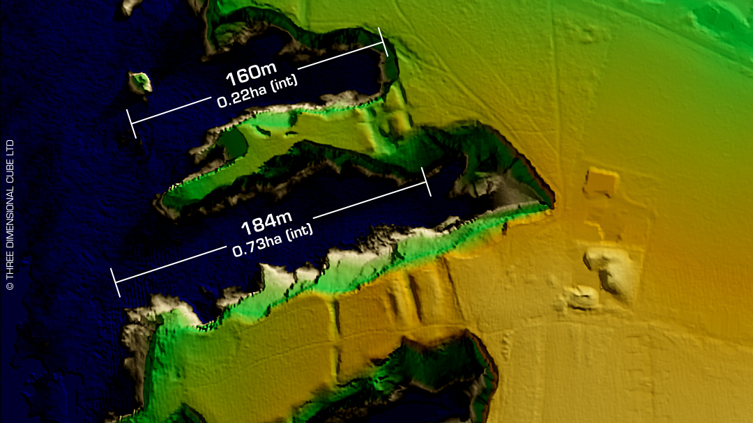
DTM- (Digital Terrain Model, i.e. No buildings or foliage) On the opposite side of Bodmin town to Castle Canyke and overlooking the River Camel lies the univallate partial contour hillfort, Dunmere Wood, where it resides hidden within. Rock cut outer ditch. First written record in 1220 as 'Dunmere' which means, 'Great Fort'. On 1st OS Map of 1813. First recorded as a hillfort in 1849. Belonged to the Priory of Bodmin in the medieval period. Last field investigation in 1974. No recorded excavations or finds, hence undated. Iron Age tribal association (conjecture based on location): Dumnonii (Scheduled Monument) [Any descriptive text attributed to the Atlas of Hillforts & Historic England websites]