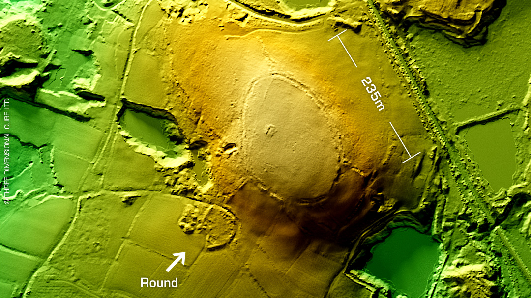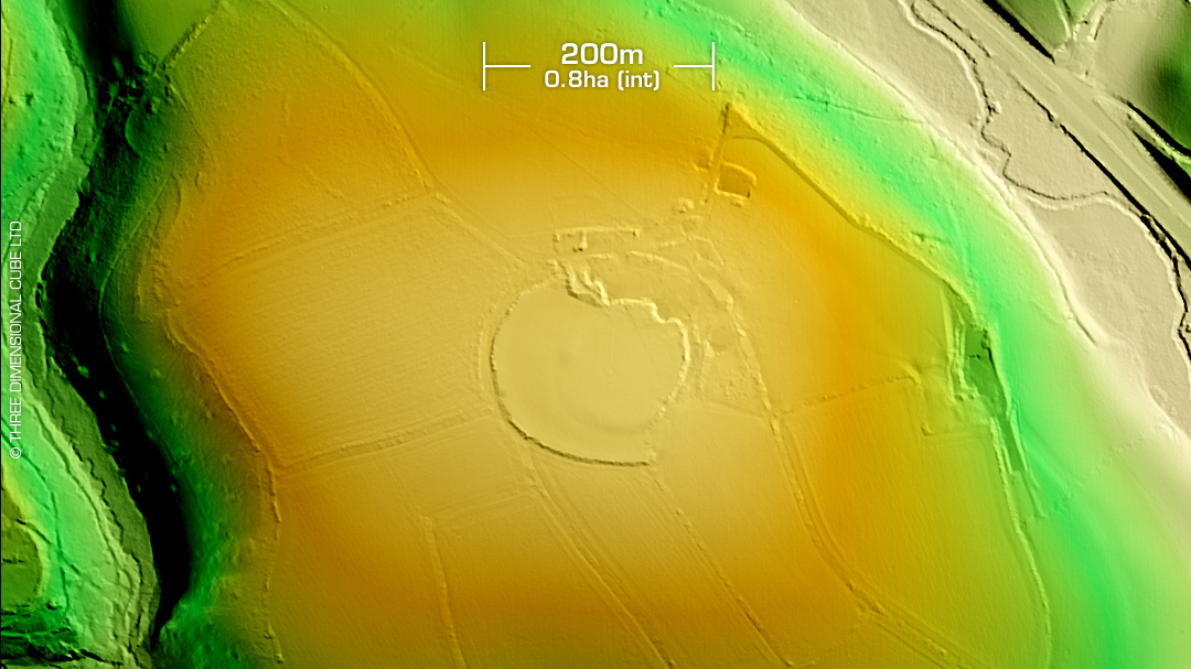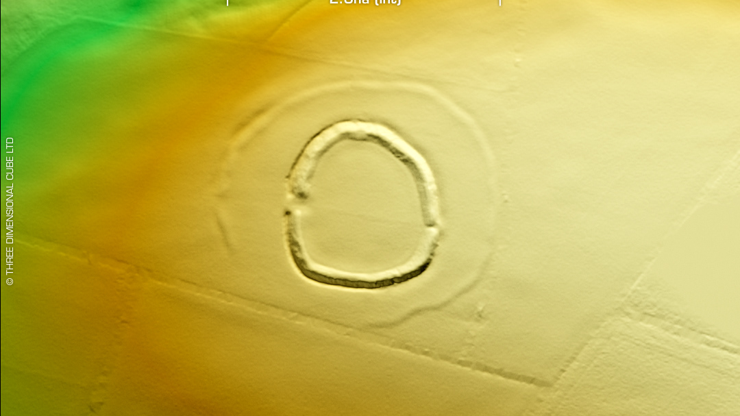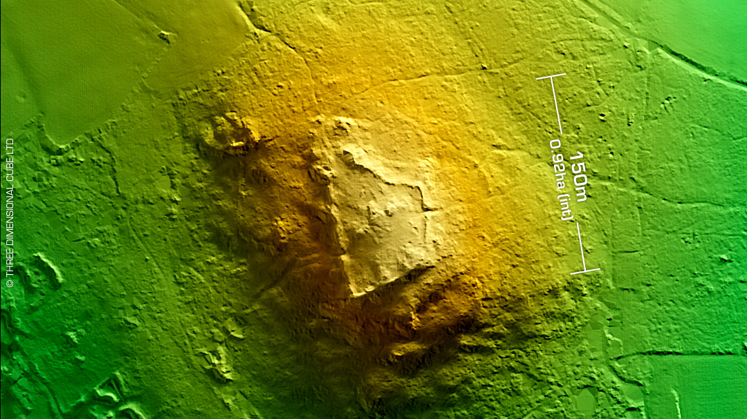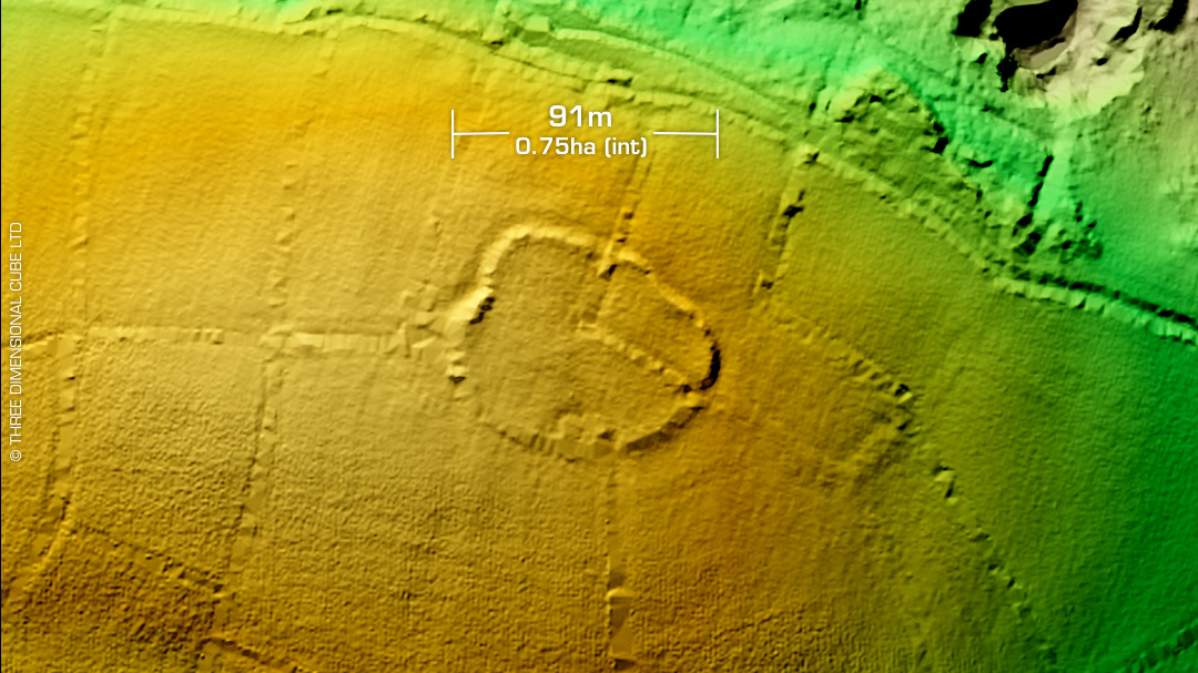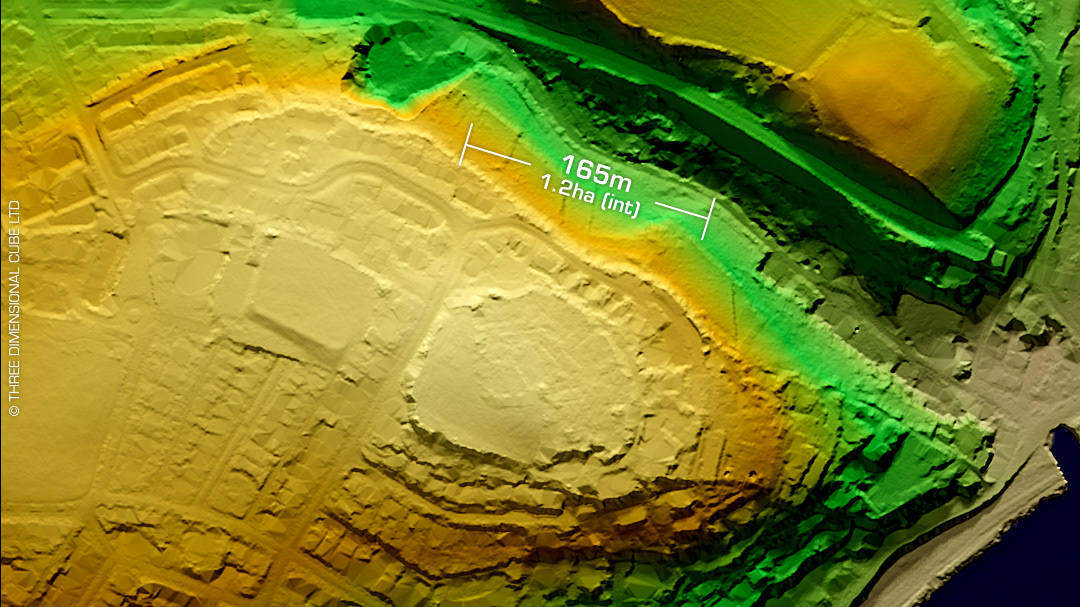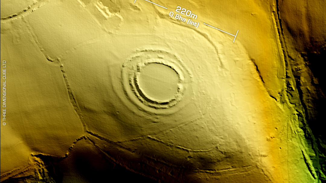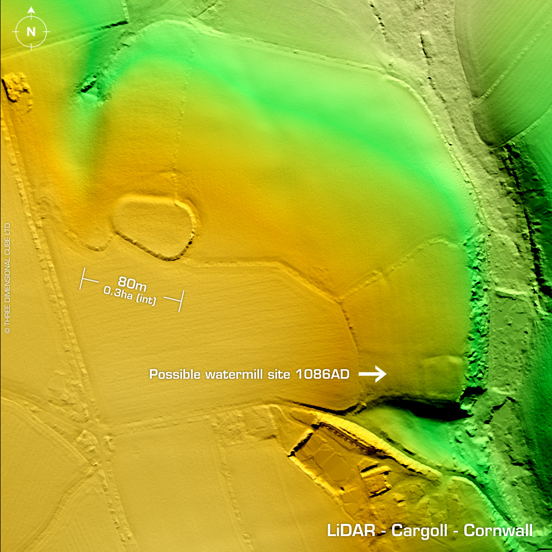
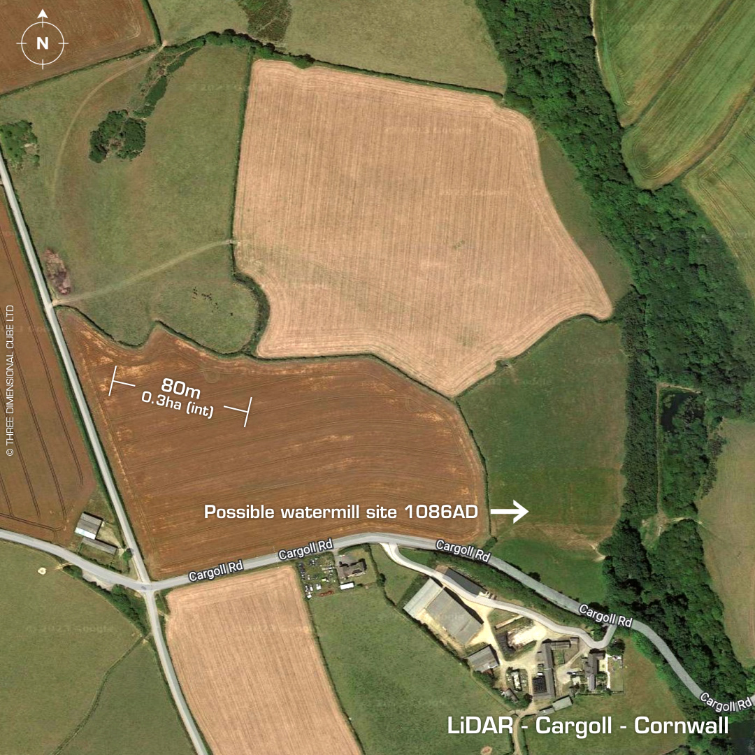
DTM- (Digital Terrain Model, i.e. No buildings or foliage) Just to the west of St Newlyn East and above Cargoll road lies the sub-oval univallate hillslope fort, Cargoll. Earth & stone bank. NW side degraded by ploughing. First written reference on tithe map of 1840. On 1st Ed. OS Map 1880. Last field survey 1970. Square enclosure site to the SE is possibly part of a medieval settlement & Mill recorded in the Domesday book of 1086. (Listed on Cornwall HER). This settlement is recorded just below the enclosure on the other side of the dip and included a prison but the enclosure is not recorded so could be contemporary. No recorded finds or excavations, hence undated. Iron Age tribal association (conjecture based on location): Dumnonii (Scheduled Monument) [Any descriptive text attributed to the Atlas of Hillforts & Historic England websites]