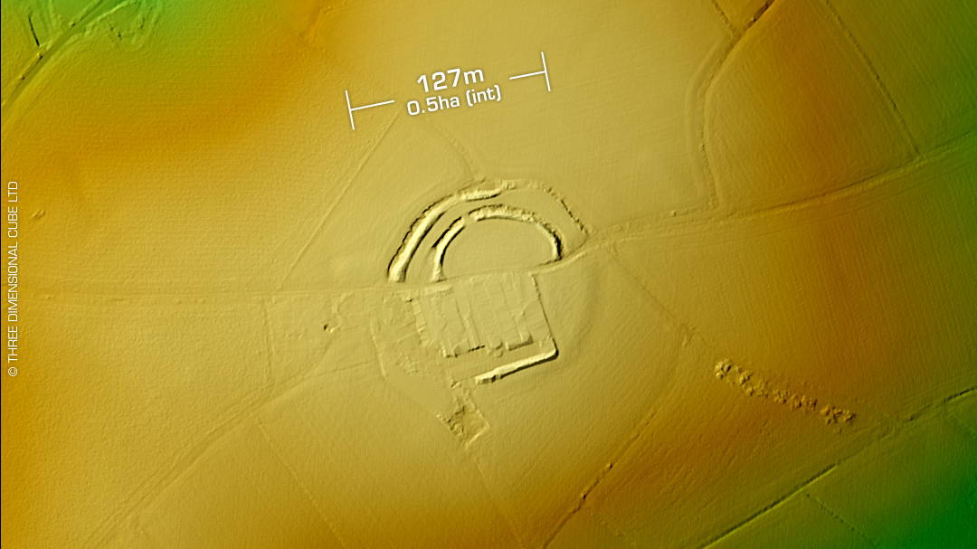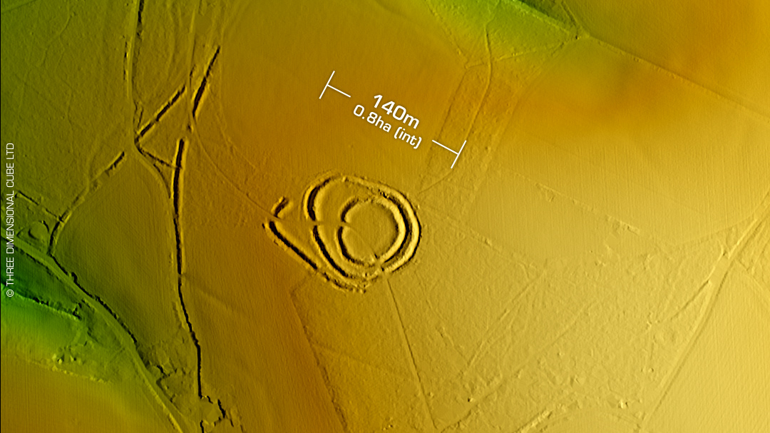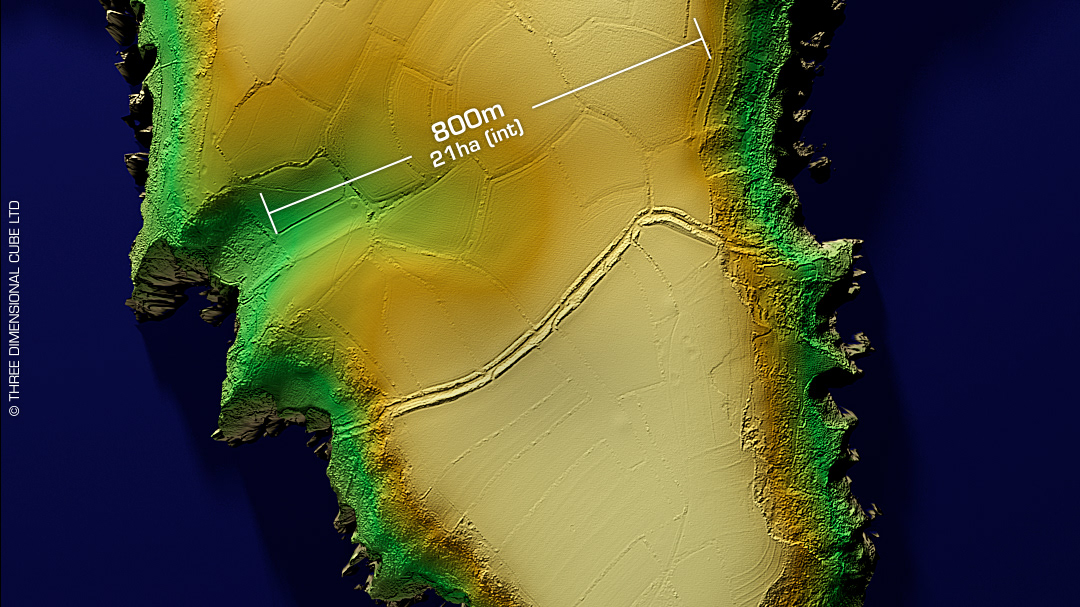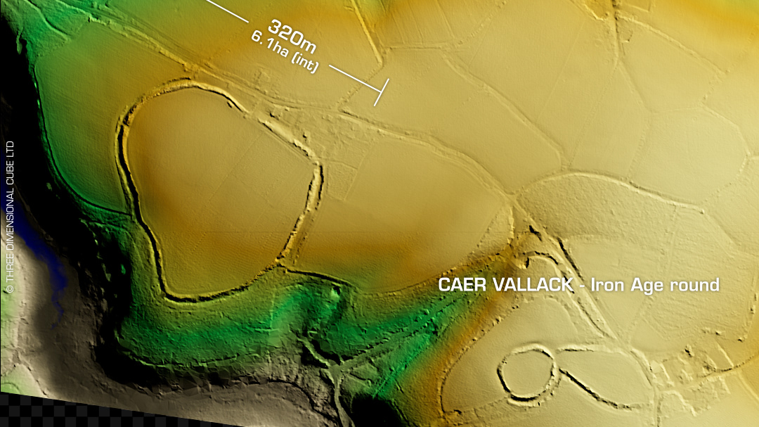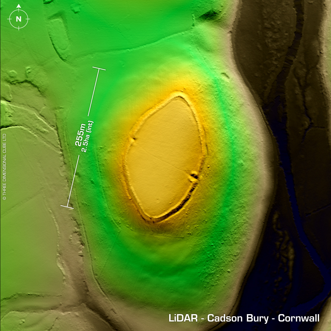
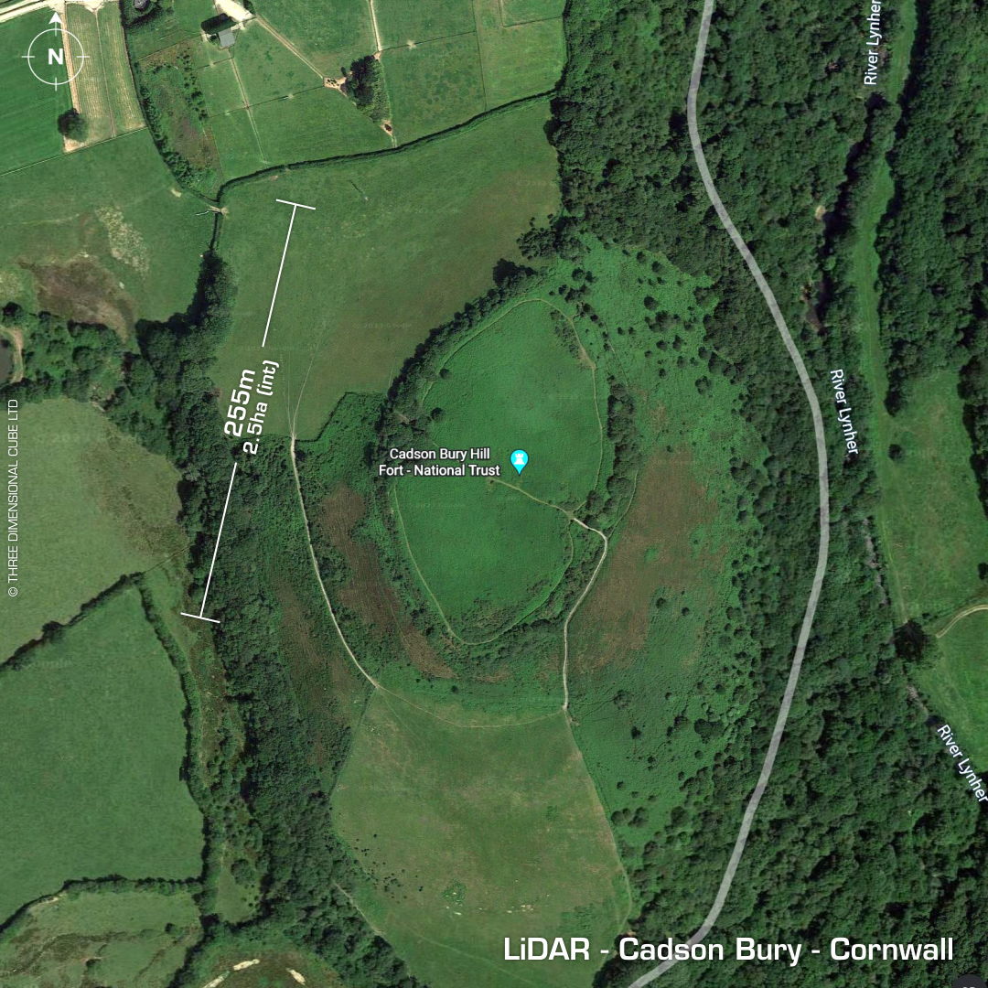
DTM- (Digital Terrain Model, i.e. No buildings or foliage) Overlooking the River Lynher to the east and Callington from the SW lies the National Trust site, the univallate contour hillfort, Cadson Bury. Chance find of a spindle whorl on SE slope. First written reference in 1262 AD. Included on Martyn's Map of 1748 AD. No recorded excavations, hence undated. Iron Age tribal association (conjecture based on location): Dumnonii (Scheduled Monument) [Any descriptive text attributed to the Atlas of Hillforts & Historic England websites]