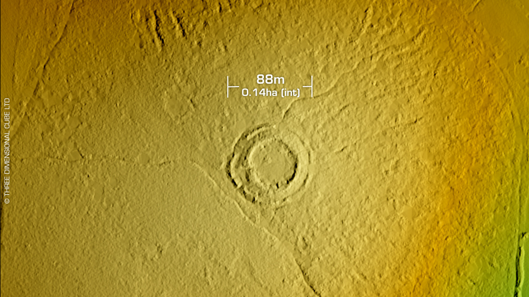
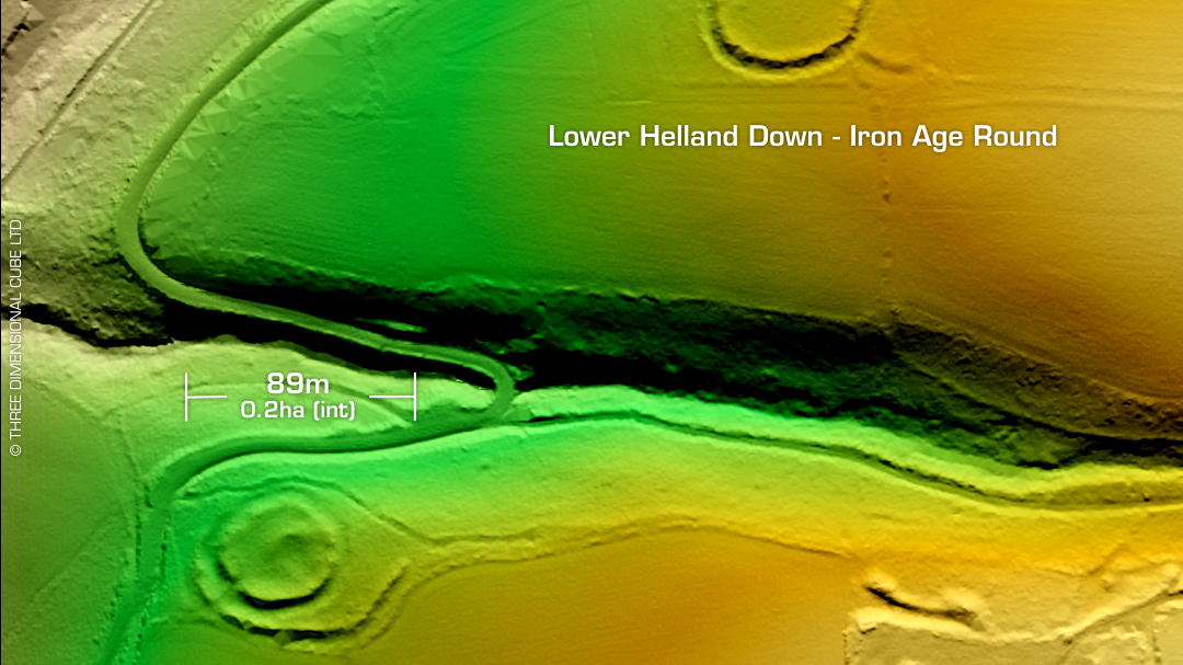
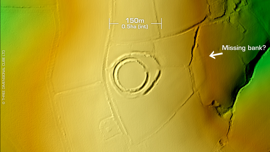
DTM- (Digital Terrain Model, i.e. No buildings or foliage) To the east of Bodmin Airfield and north of Treslea lies the oval, complex multivallate partial contour hillfort, Bury Castle. Site disturbed in antiquity but in generally good condition. Outer embankments visible to the north on LiDAR. On 1st Ed. OS Map of 1882. RCHME survey 1978. No recorded excavations or finds, hence undated. Iron Age tribal association (conjecture based on location): Dumnonii (Scheduled Monument) [Any descriptive text attributed to the Atlas of Hillforts & Historic England websites]