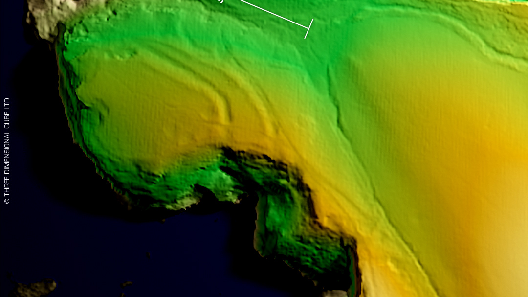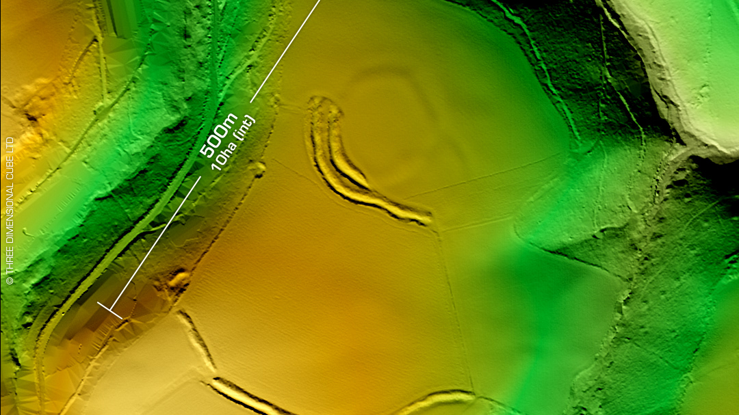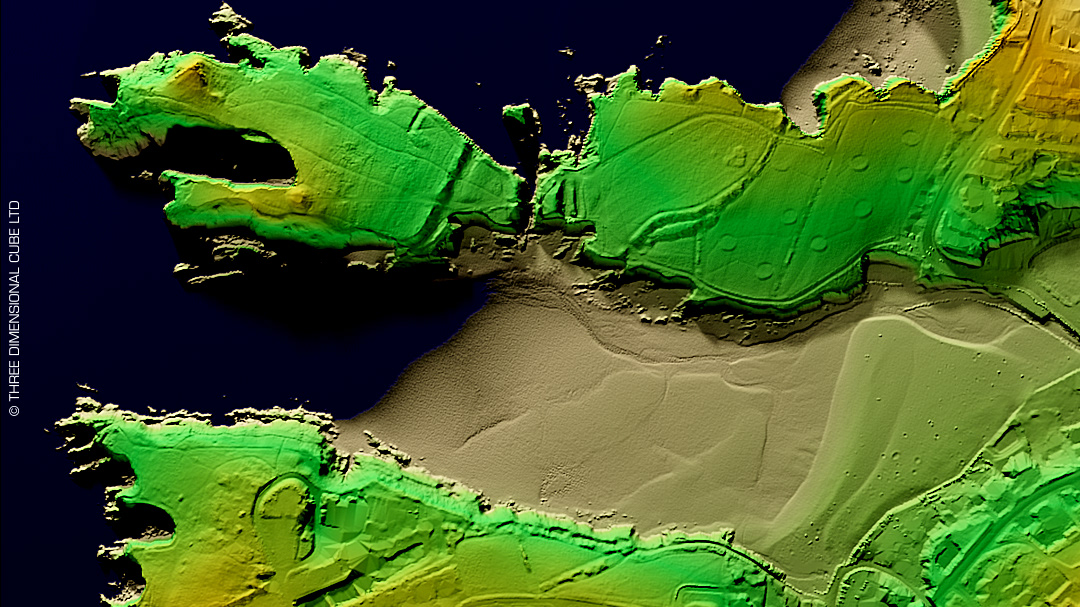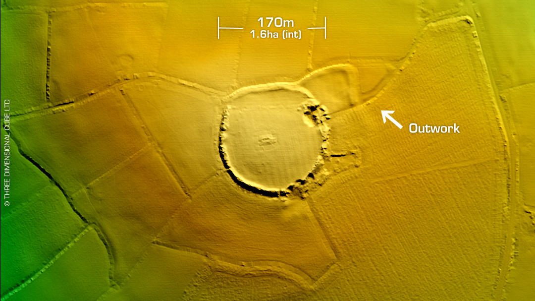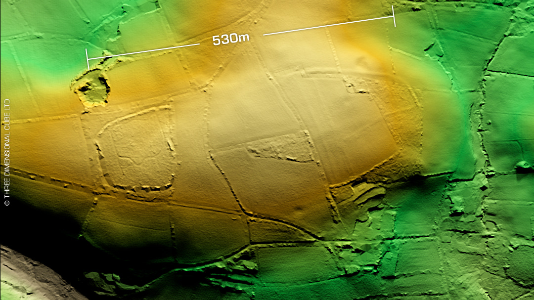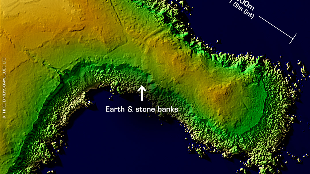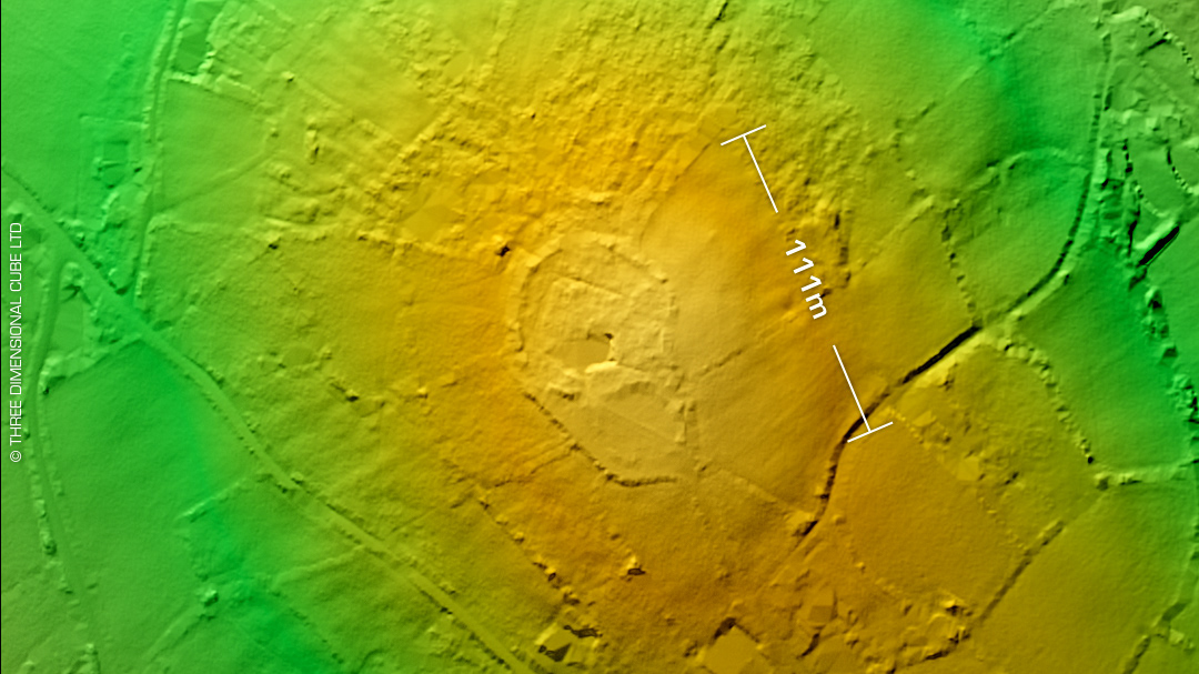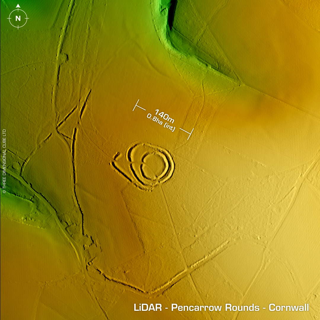
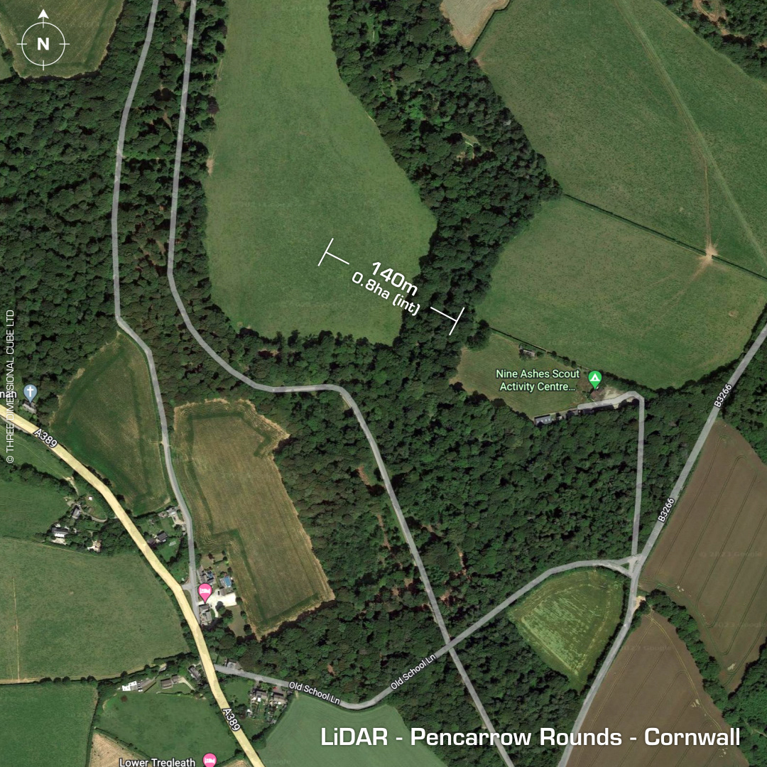
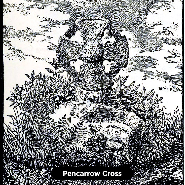
DTM- (Digital Terrain Model, i.e. No buildings or foliage) Just to the northwest of Dunmere Wood, within the grounds of Pencarrow House & Garden lies the small multivallate hillslope hillfort (but maybe vast enclosed area) called Pencarrow Rounds. The visible outworks to the west are the Pencarrow Rings but when you look at the wide view LiDAR it looks as though they make a continuous circuit including Old School Lane below the site then faintly joining around the contour of the hill across the top of the view to form a distorted polygon. This could be significant as the area has been degraded since the medieval period by farming before the house & grounds were built in the 1760's. A very early Christian cross head was found on the estate in 1870 called the Pencarrow Cross Head. 1st map depiction in 1881. Last field investigation in 1972. No recorded excavations or finds, hence undated. Iron Age tribal association (conjecture based on location): Dumnonii (Scheduled Monument) [Any descriptive text attributed to the Atlas of Hillforts & Historic England websites]