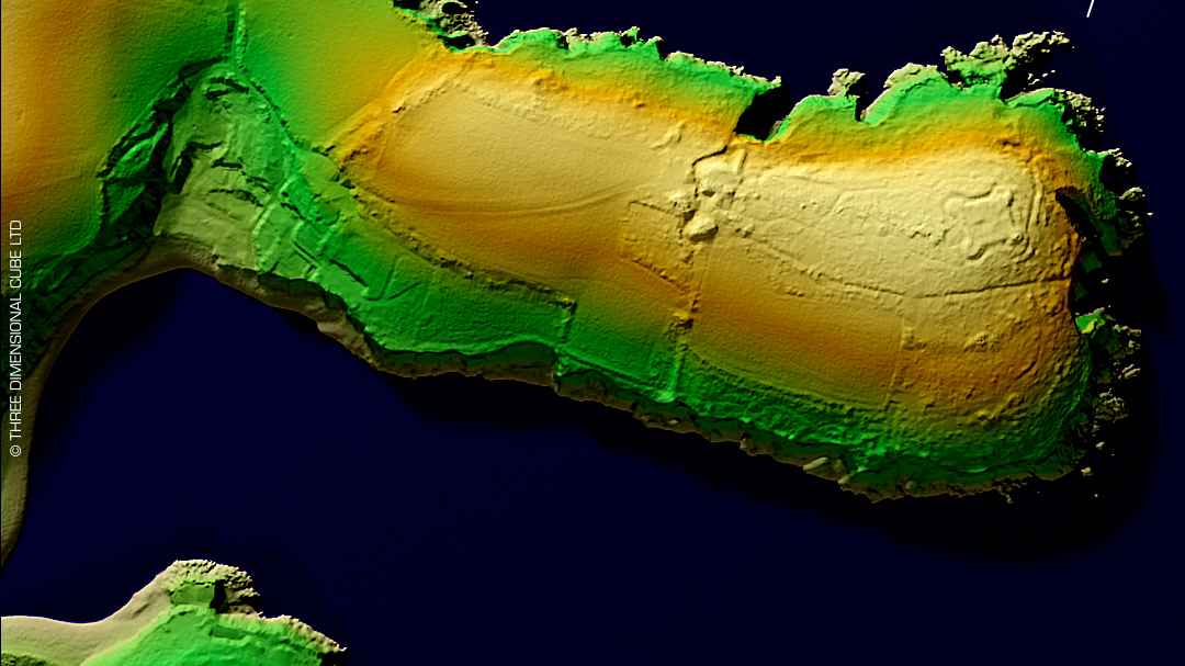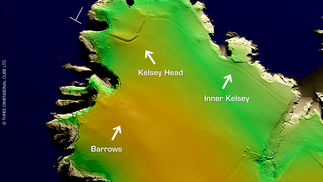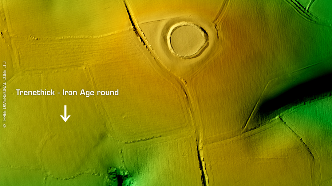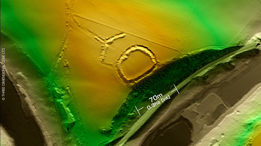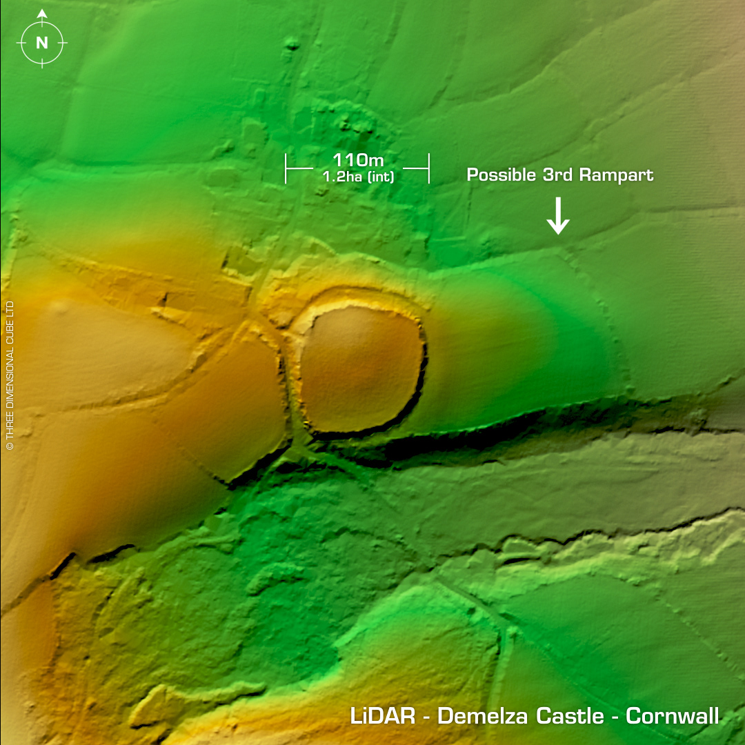
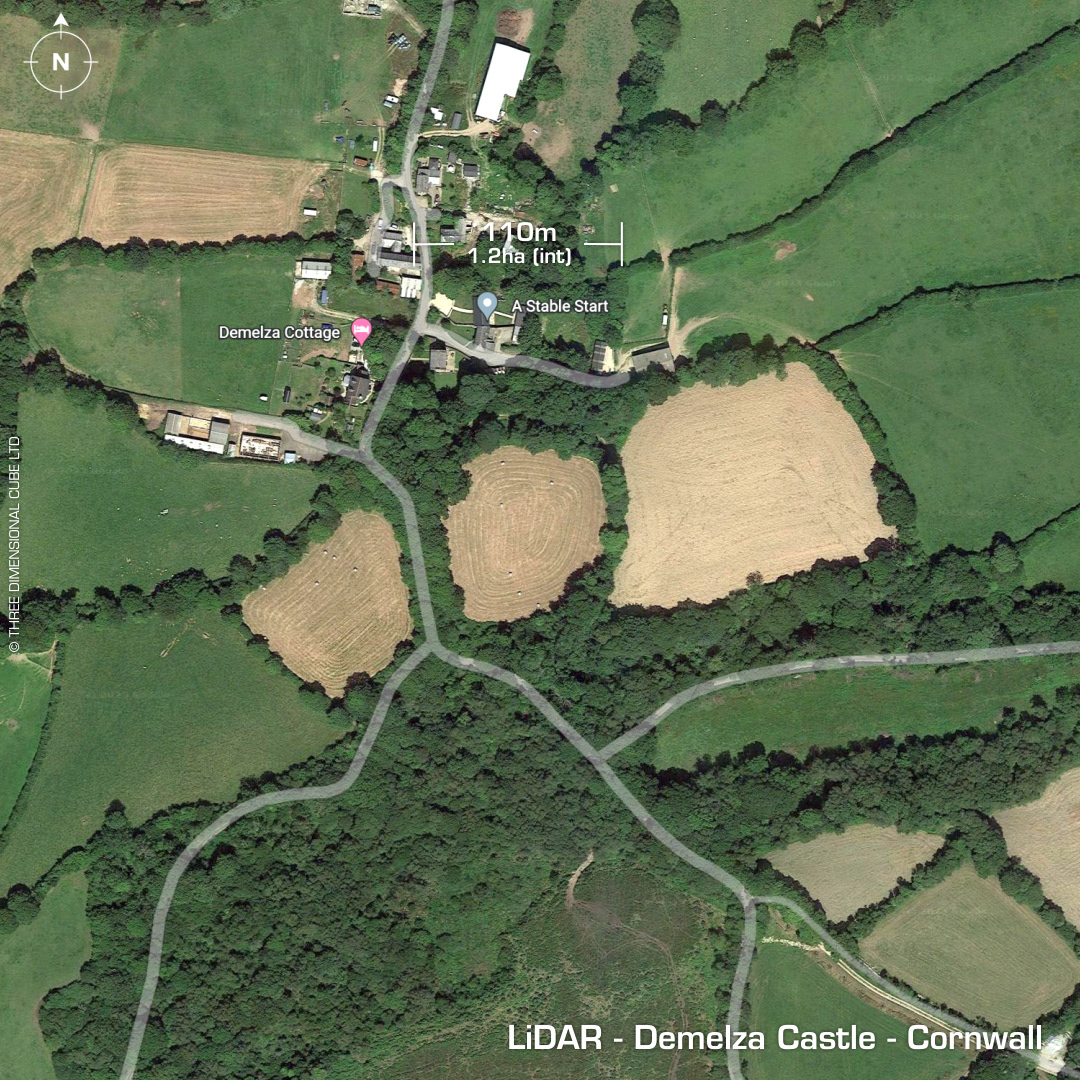
DTM- (Digital Terrain Model, i.e. No buildings or foliage) Two miles to the northeast of Castle An Dinas hillfort, north of the A30 at Demelza lies the (possible) bivallate contour hillfort, Demelza Castle. (Ancient name; Damelsa Castle). Defines by two ramparts with infilled ditches. Possible third rampart to the east (curved raised field boundary in LiDAR). First written reference in 1750 by Hals who described a third rampart. Whole area heavily degraded by farming. Last site visit in 1979. No recorded excavations or finds, hence undated. Iron Age tribal association (conjecture based on location): Dumnonii (Scheduled Monument) [Any descriptive text attributed to the Atlas of Hillforts & Historic England websites]