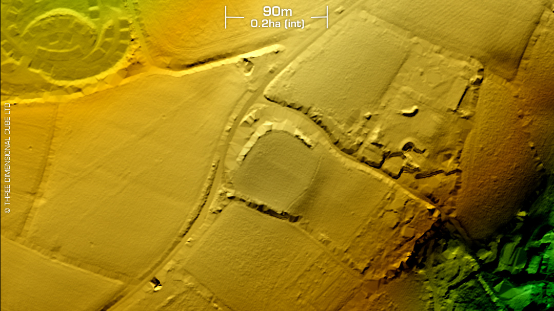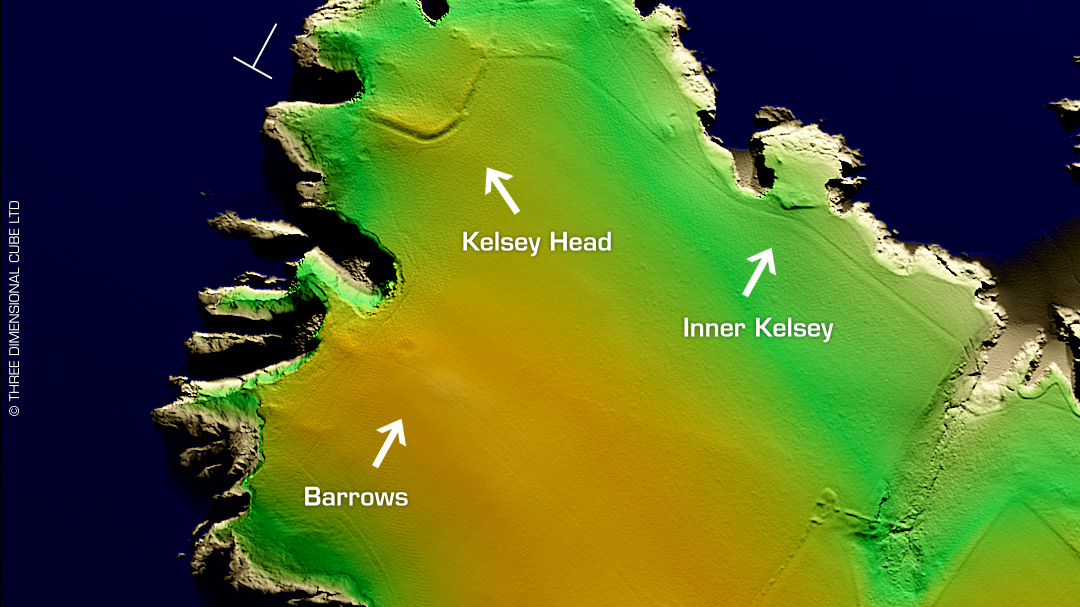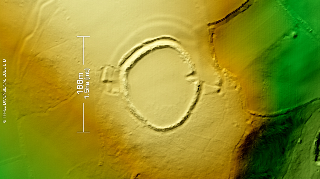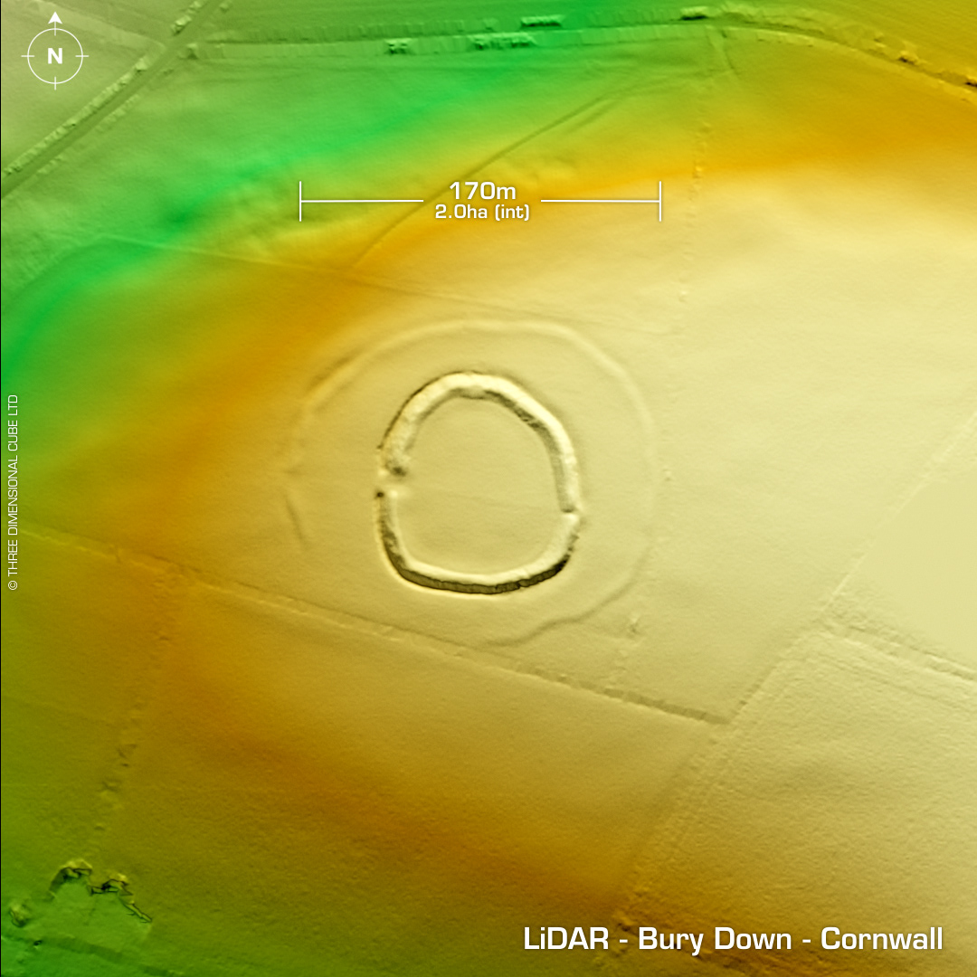
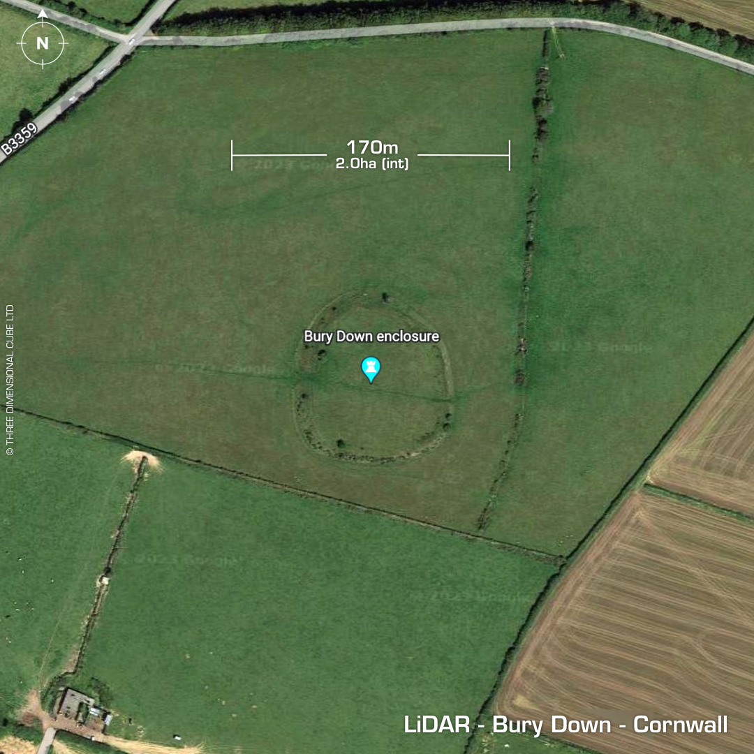
DTM- (Digital Terrain Model, i.e. No buildings or foliage) One point four miles NNE of Lanreath & to the east of the B3359 within fields lies the possible bivallate hillfort, Bury Down. Degraded by ploughing and trackways. Geophys & trial excavation in 1994 found V-shaped ditch profile. No artefacts recovered. Site possibly an early neolithic causewayed enclosure. First written reference in 1758 (W. Borlase). On 1st Ed. OS Map of 1882. No recorded excavations or finds, hence undated. Iron Age tribal association (conjecture based on location): Dumnonii (Scheduled Monument) [Any descriptive text attributed to the Atlas of Hillforts & Historic England websites]