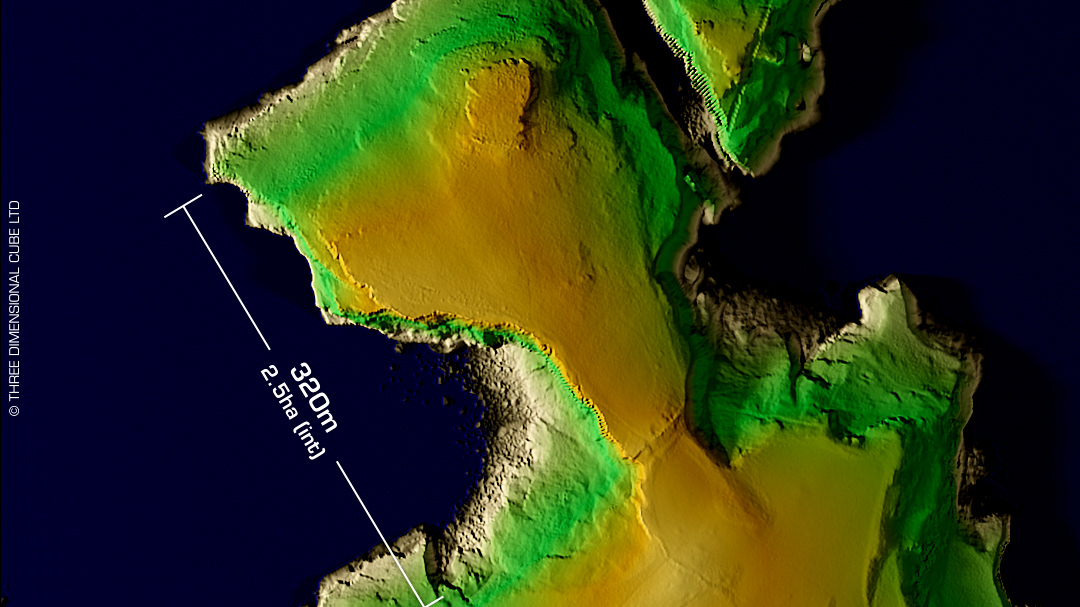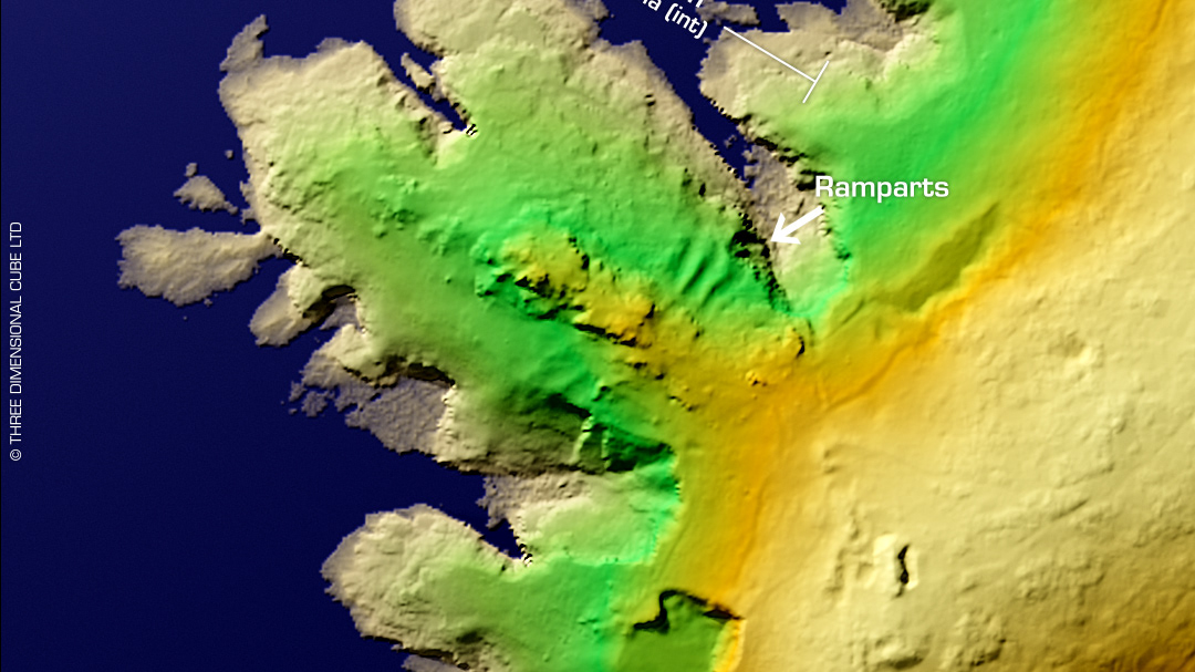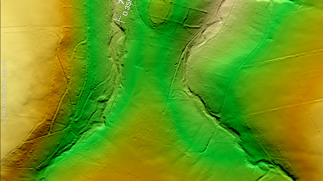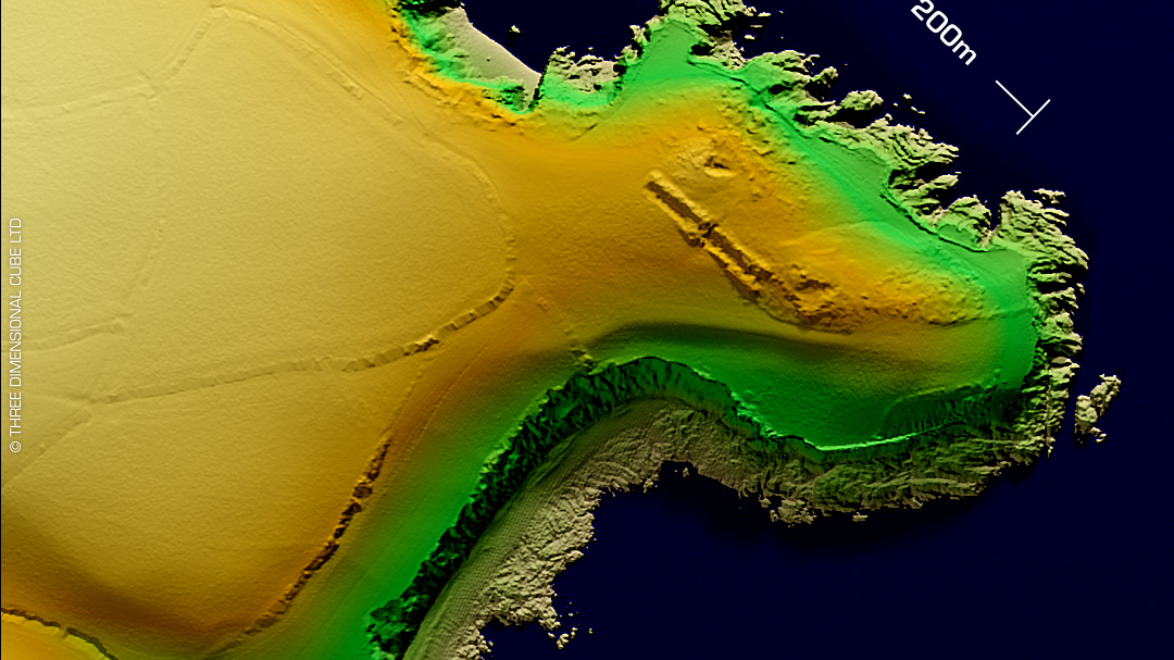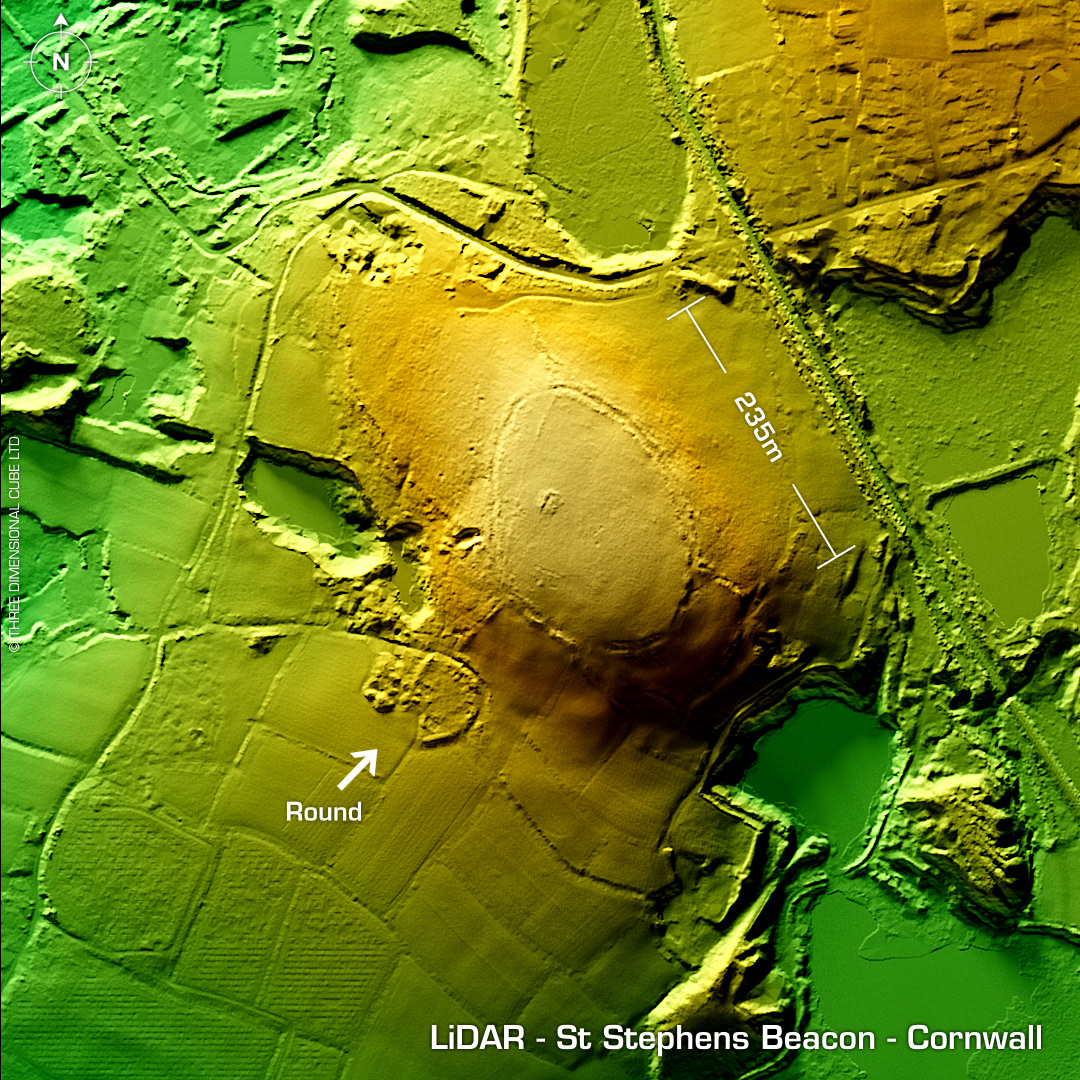
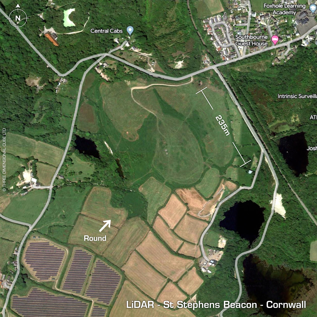
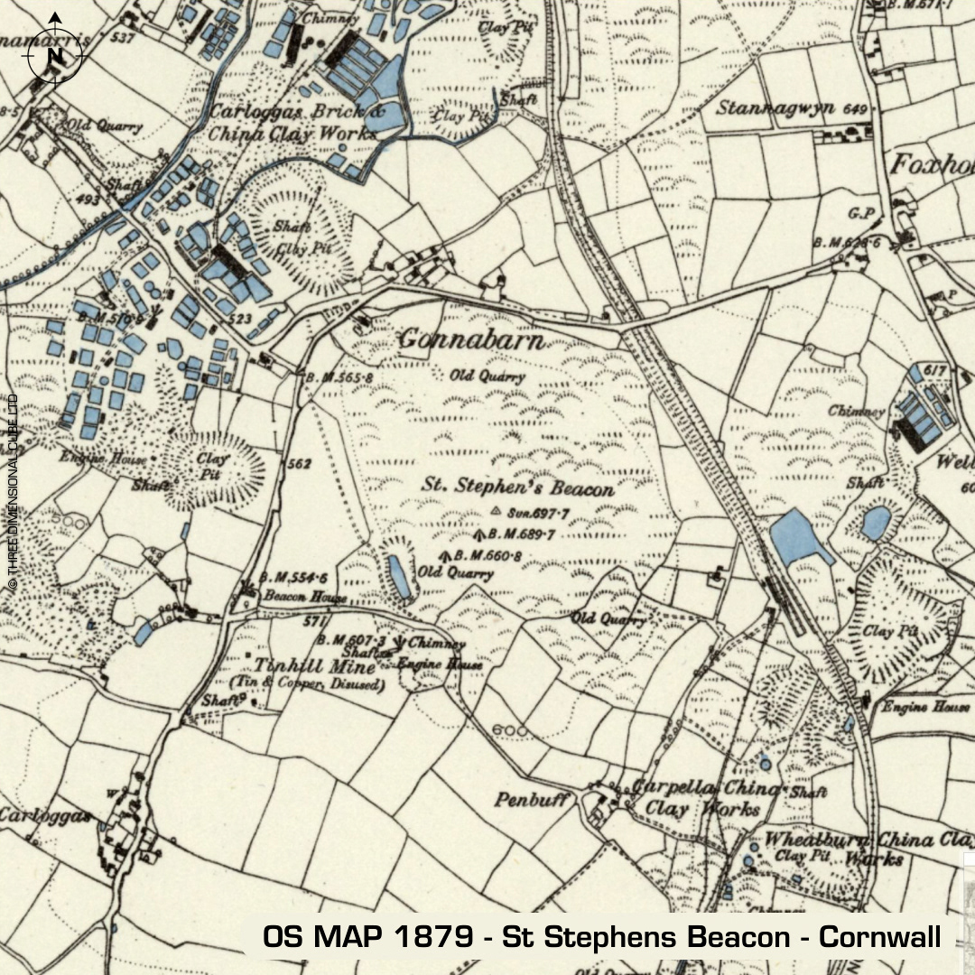
DTM- (Digital Terrain Model, i.e. No buildings or foliage) Overlooking St Stephen from the northeast and Foxhole from the southwest atop St Stephens Beacon lies a little known and complex possible hillfort. Stone robbed in 1853 along with its 20m wide cairn to build an engine house for Tin Hill Mine. 3 quarries along northern edge & general mining site degradation for China Clay works. Suggested as possible Neolithic hilltop enclosure but on the LiDAR it pings-out (technical term) as a hillfort. Recorded Iron Age 'round' just on the southwestern slope. First written record in 1864 but not indicated on 1st Ed OS Map of 1881. Last site investigation in 1971 (OS). No recorded excavations or finds, hence undated. Iron Age tribal association (conjecture based on location): Dumnonii (Scheduled Monument) [Any descriptive text attributed to the Atlas of Hillforts & Historic England websites]