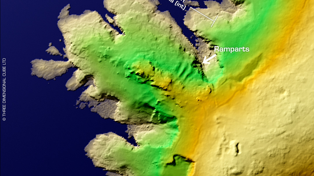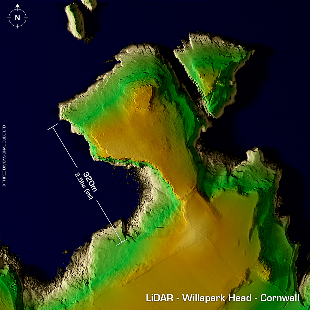
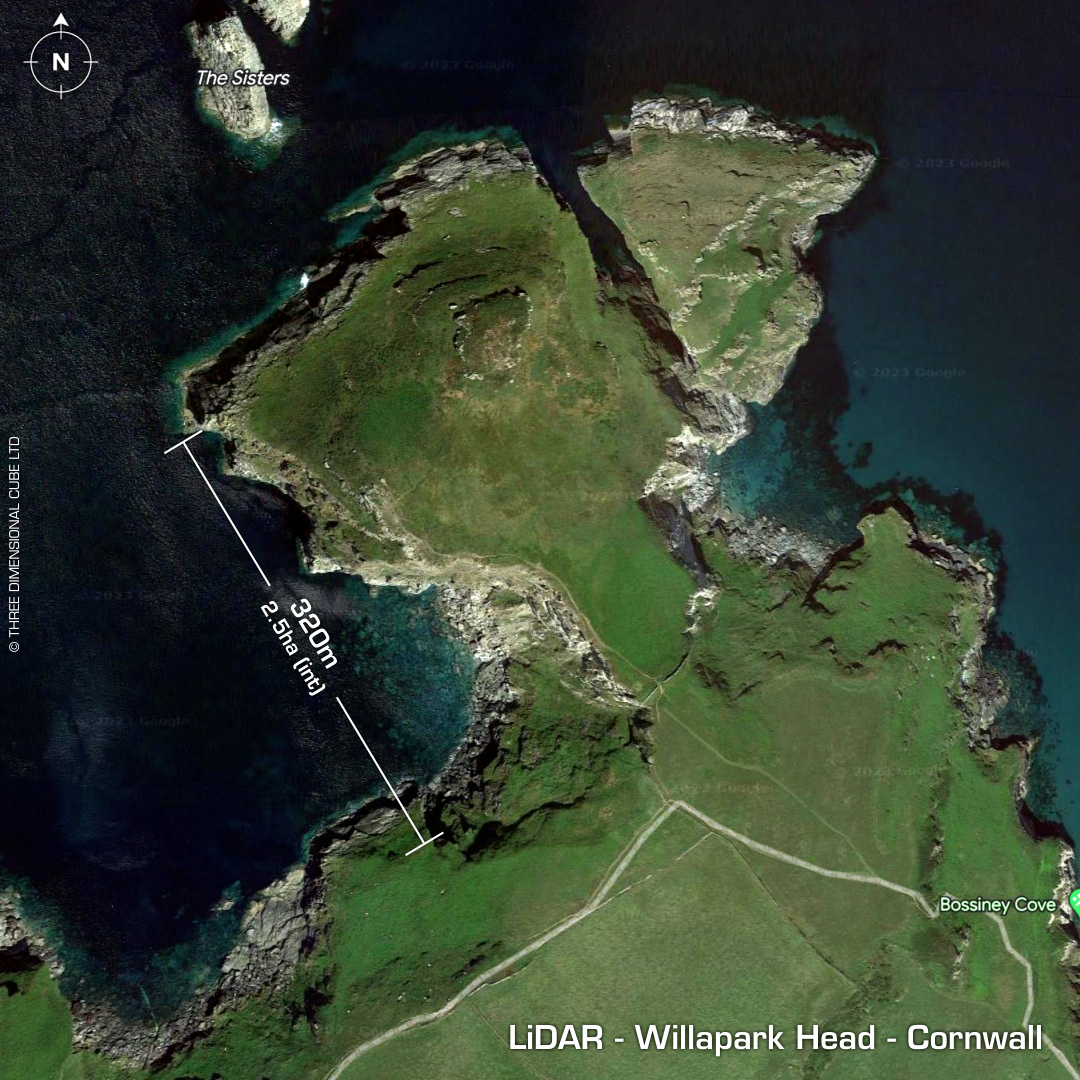

DTM- (Digital Terrain Model, i.e. No buildings or foliage) To the northeast of Tintagel Castle atop a promontory lies the possible fort, Willapark Head. On 1st Ed OS Map as a 'Camp'. Promontory bisected by bank & ditch. 1.7m high drystone wall built on top of bank. Possible hut circle platforms. Much degraded by coastal erosion & surface quarrying in antiquity. Last field investigation in 1976. No recorded excavations or finds, hence undated. Iron Age tribal association (conjecture based on location): Dumnonii (Scheduled Monument) [Any descriptive text attributed to the Atlas of Hillforts & Historic England websites]