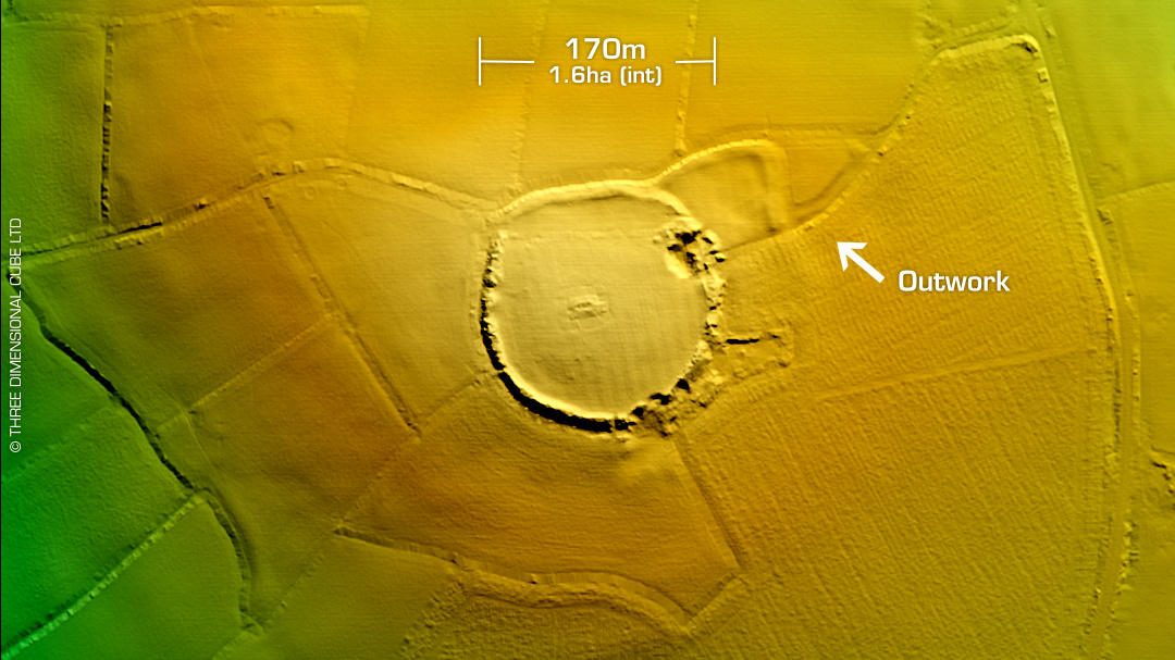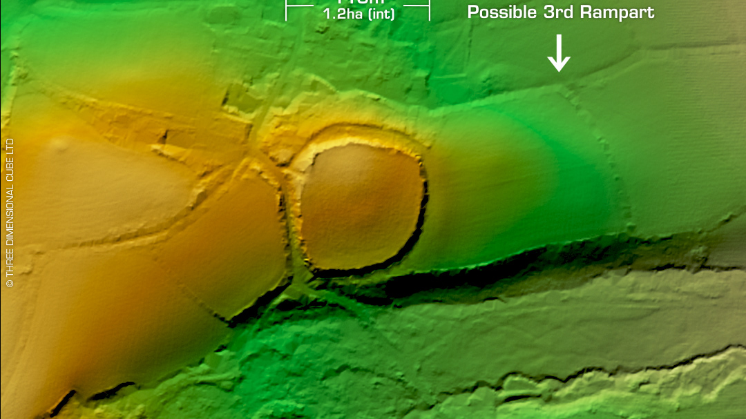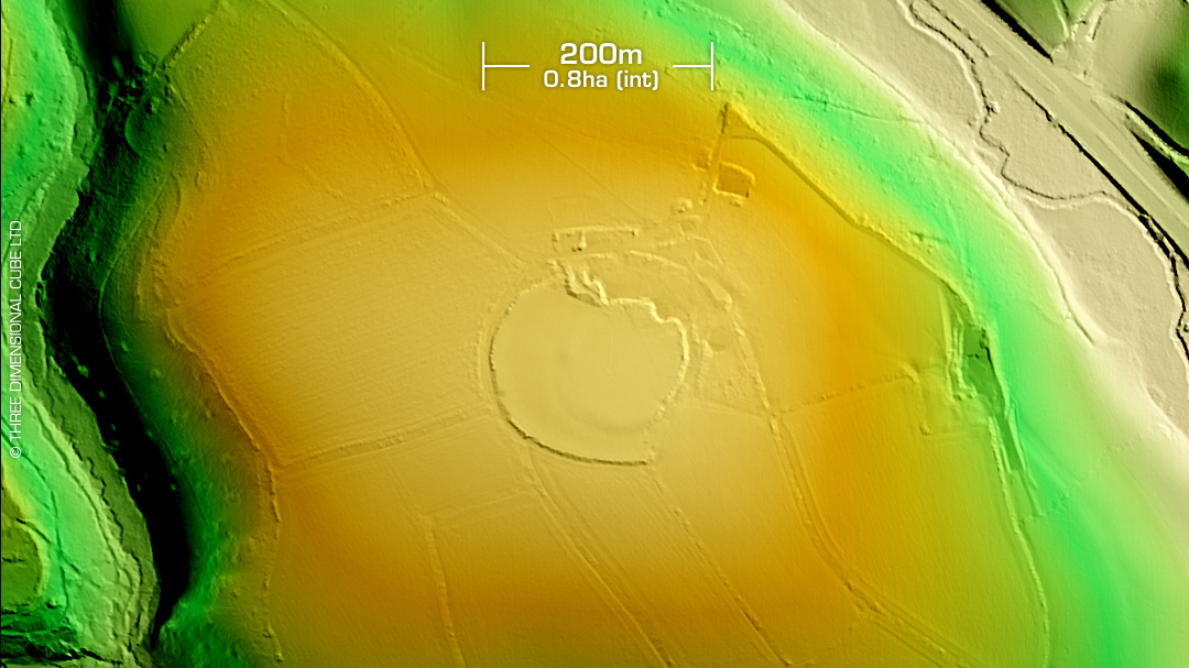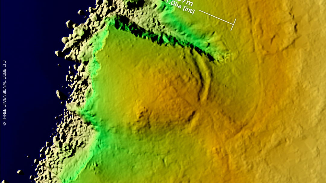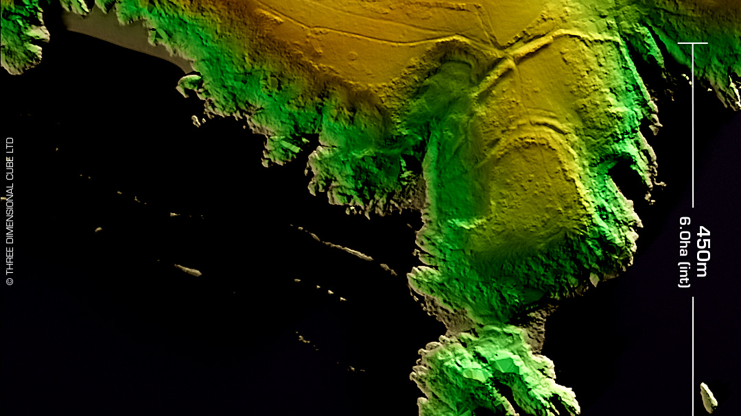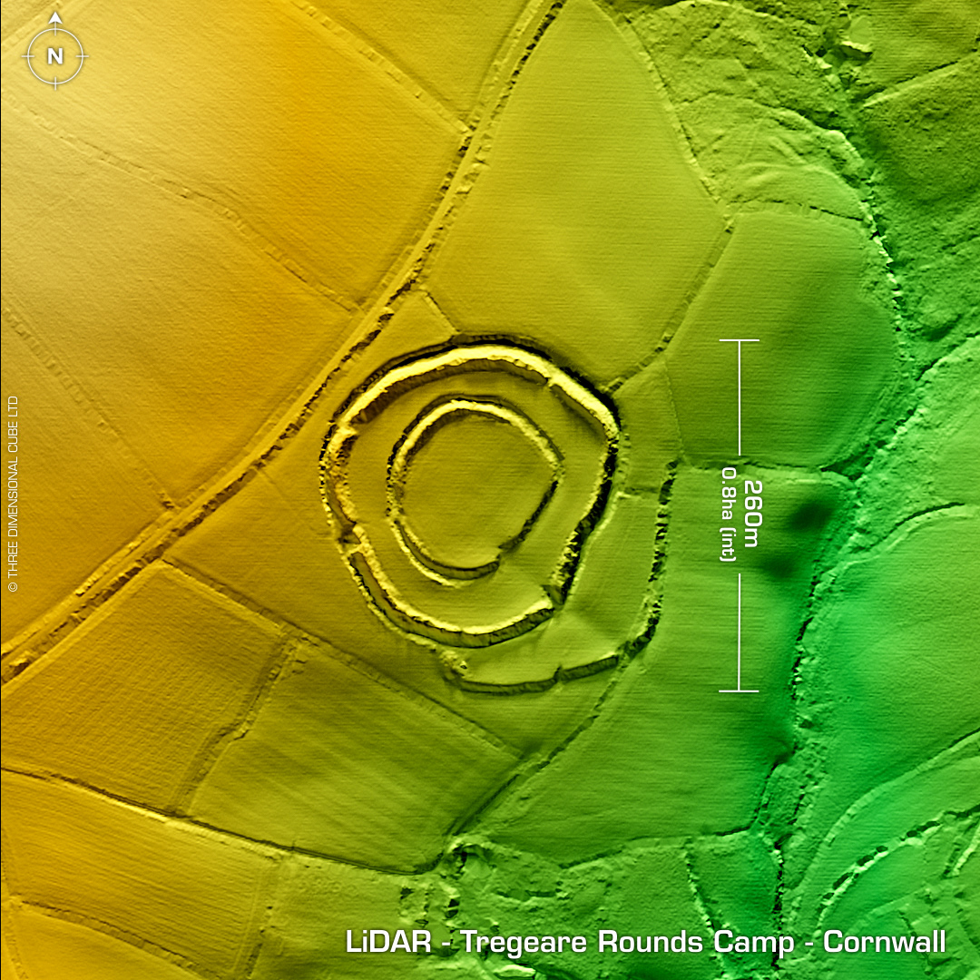
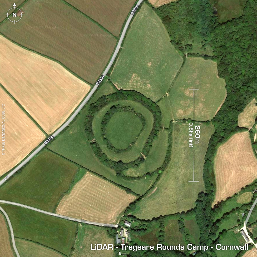
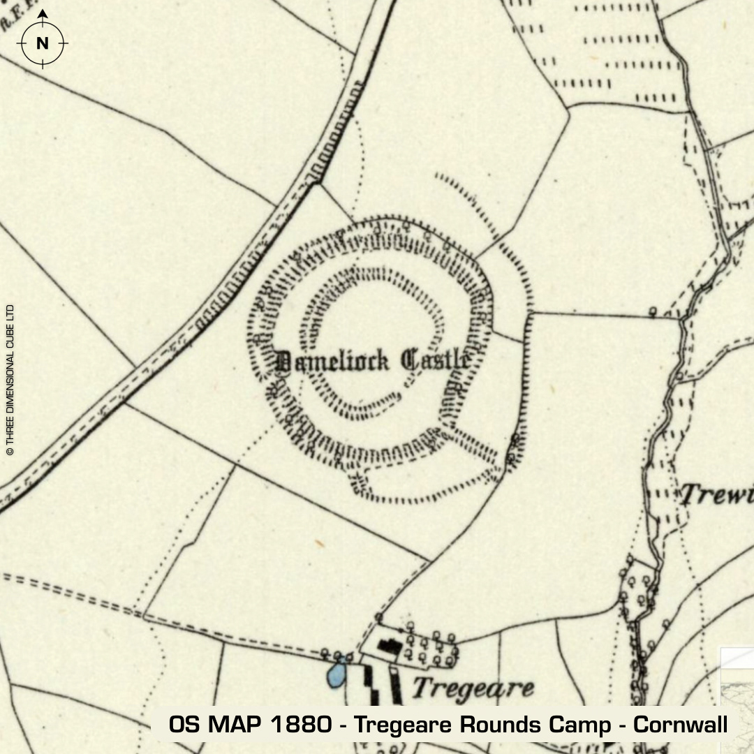
DTM- (Digital Terrain Model, i.e. No buildings or foliage) Three kilometres east of Port Isaac and alongside the B3314 & ringed by trees lies the multiple enclosure hillfort, Tregeare Rounds Camp. Originally called Dameliock Castle on 1st ED OS Map. On the NW side of the site & built into the outer rampart lies a post-medieval 'hull' (underground storage) for potatoes & cheese. Partial excavation in 1902 by Rev S. Baring-Gould with finds including slingstones, perforated stones, spindle whorls and Iron Age pottery. Last site visit in 1978 by the hillfort study group. Iron Age tribal association (conjecture based on location): Dumnonii (Scheduled Monument) [Any descriptive text attributed to the Atlas of Hillforts & Historic England websites]