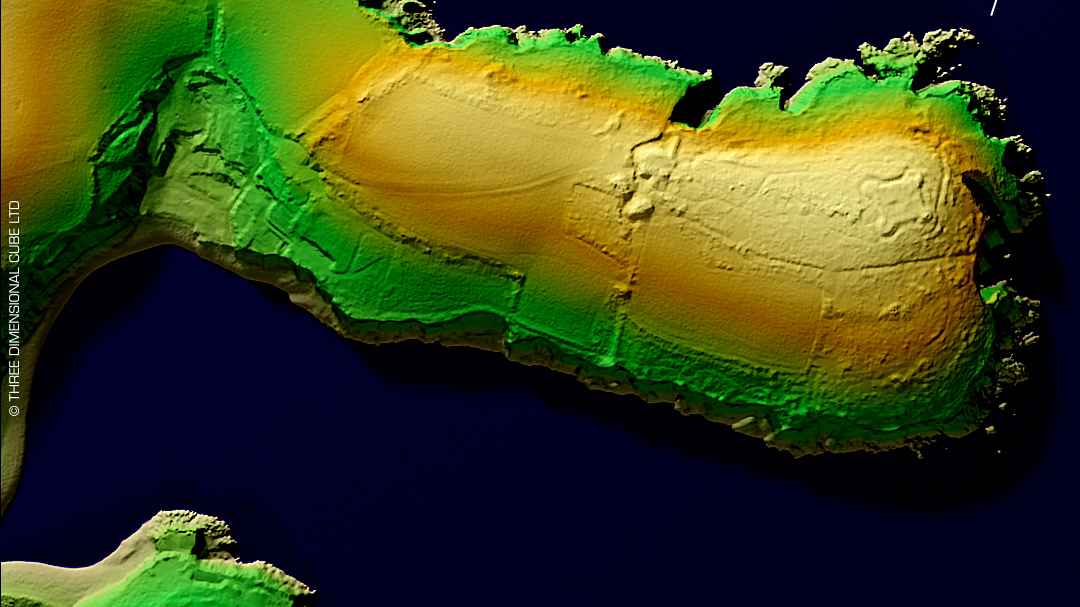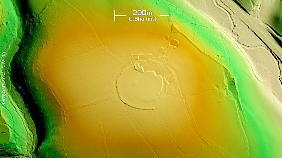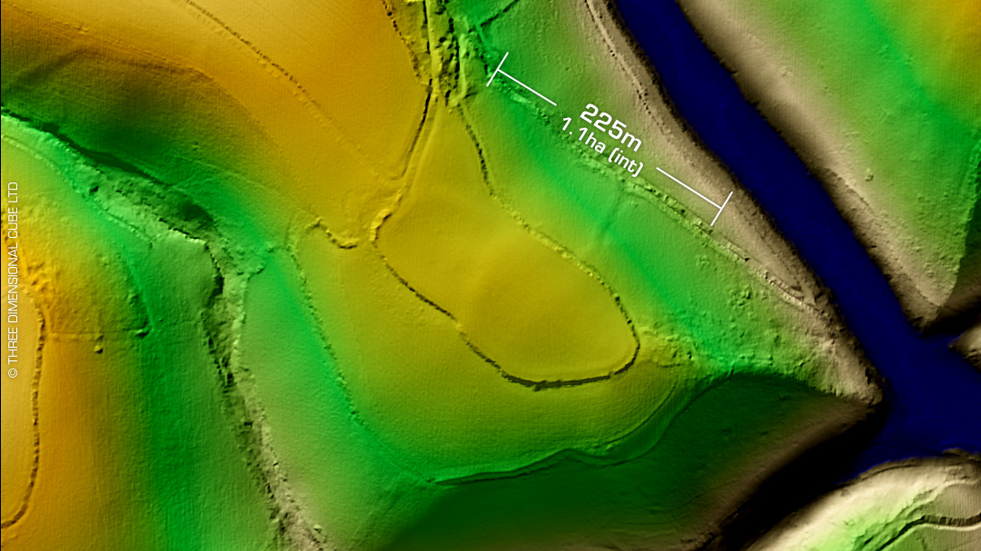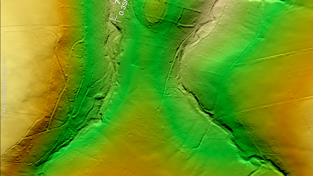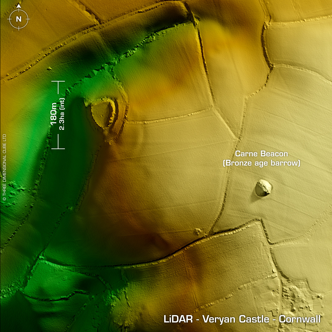
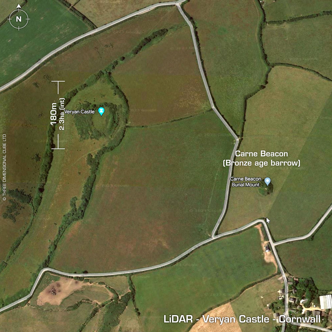
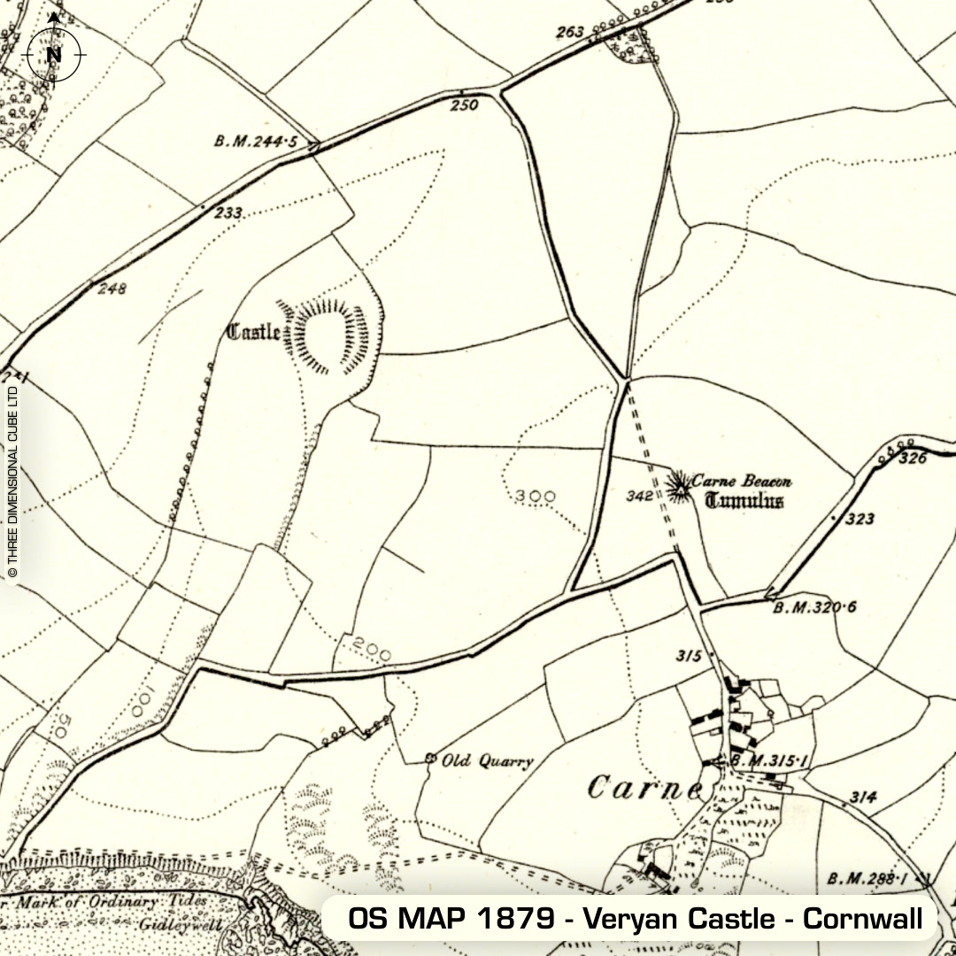
DTM- (Digital Terrain Model, i.e. No buildings or foliage) Just to the southwest of Veryan and overlooking Gerrans Bay lies the multivallate multiple enclosure fort & annexe. Original entrance to the south. SE Annex visible on LiDAR, which was discovered as crop marks by aerial photography. Geophys in 2013 (unpublished). No recorded excavations or finds, hence undated. Iron Age tribal association (conjecture based on location): Dumnonii (Scheduled Monument) [Any descriptive text attributed to the Atlas of Hillforts & Historic England websites]