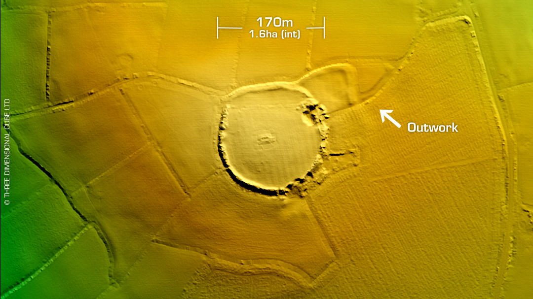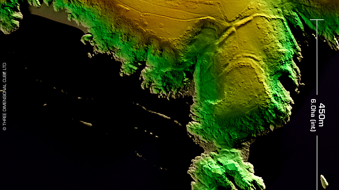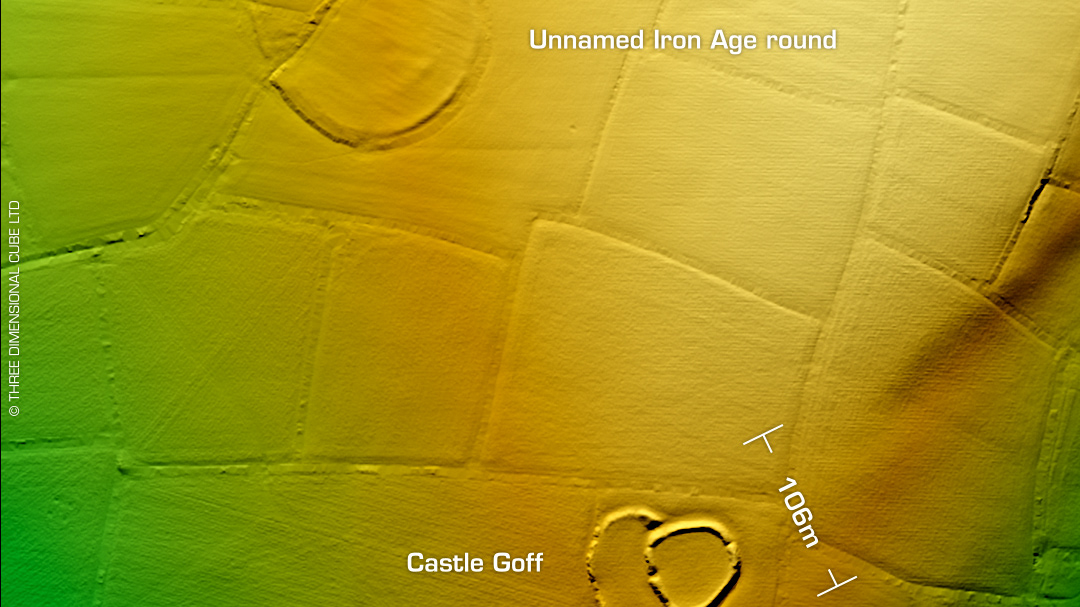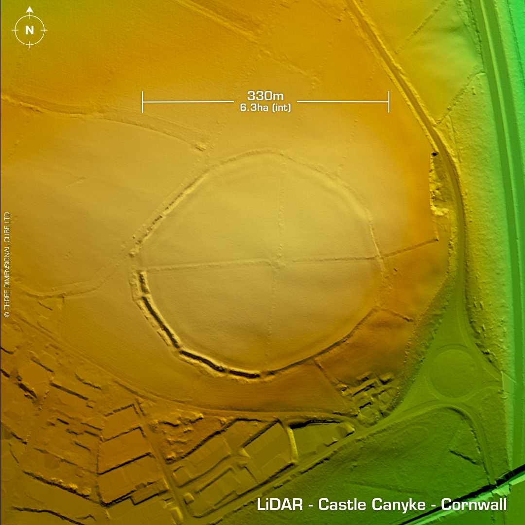
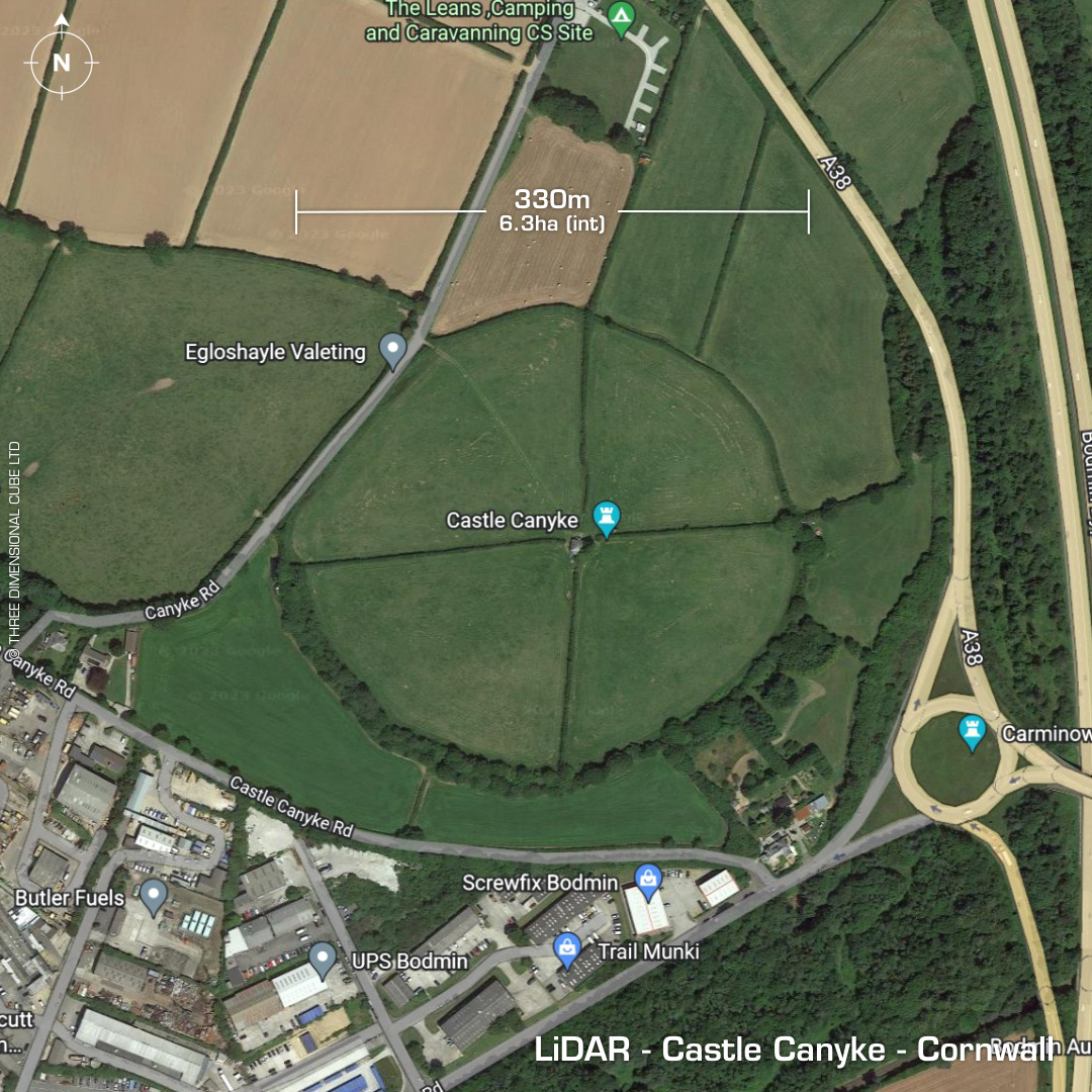
DTM- (Digital Terrain Model, i.e. No buildings or foliage) To the SE of Bodmin town, before you hit the A38 and boundaried & bisected with trees & hedges lies the large multivallate contour hillfort, Castle Canyke. A Celtic cross, the Carminow Waycross lies within the roundabout to the SE of the site. First written record in 1478. First recorded as a hillfort in 1813 when it lay in open moorland. Degraded by farming & field boundaries by 1849. Geophys in 1980's revealed interior settlement features. No recorded excavations or finds, hence undated. Iron Age tribal association (conjecture based on location): Dumnonii (Scheduled Monument) [Any descriptive text attributed to the Atlas of Hillforts & Historic England websites]