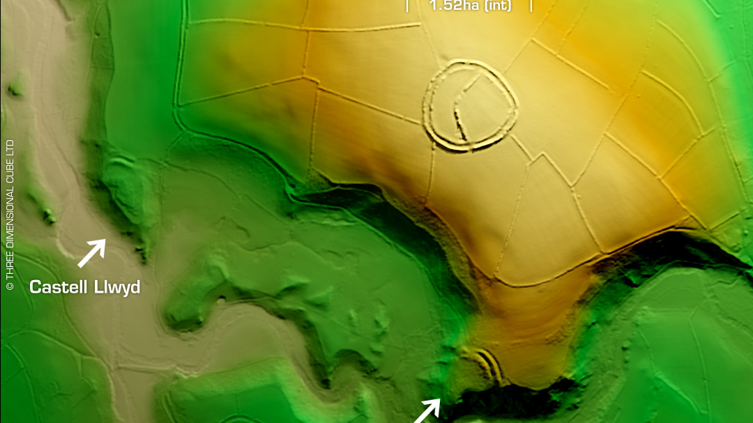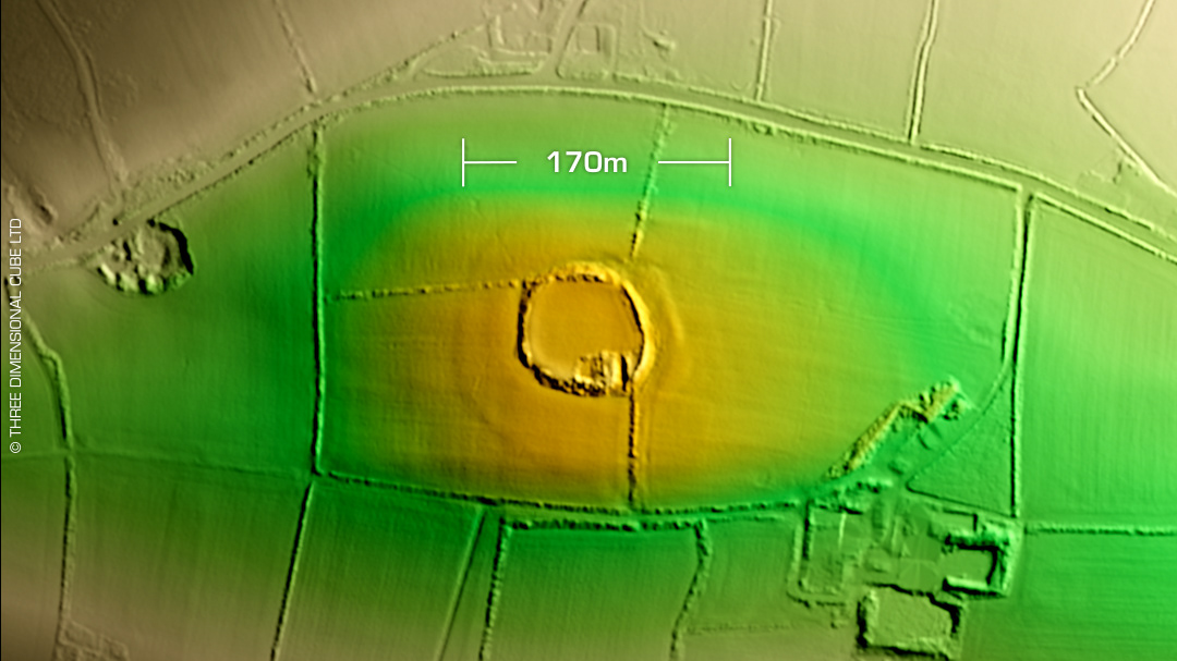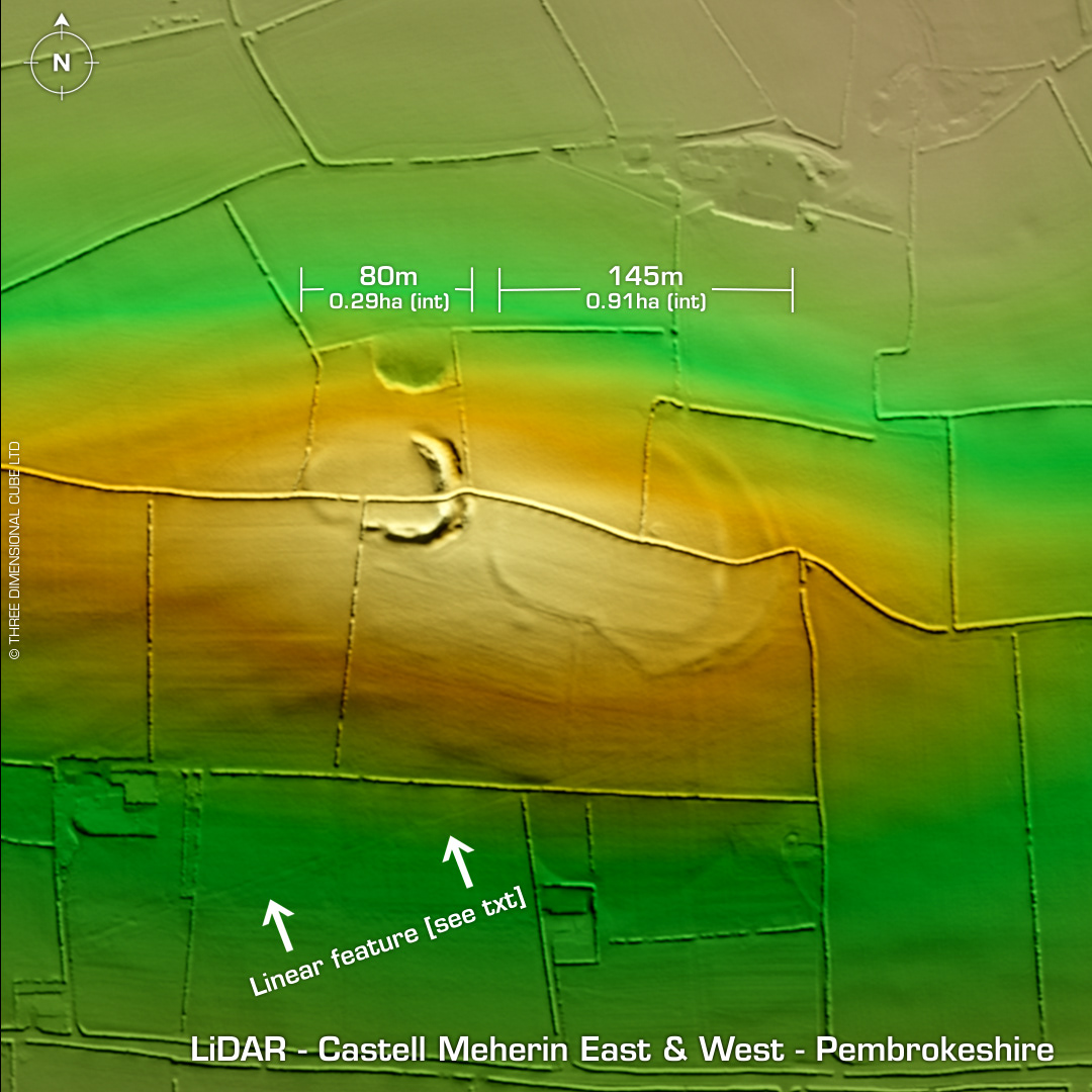
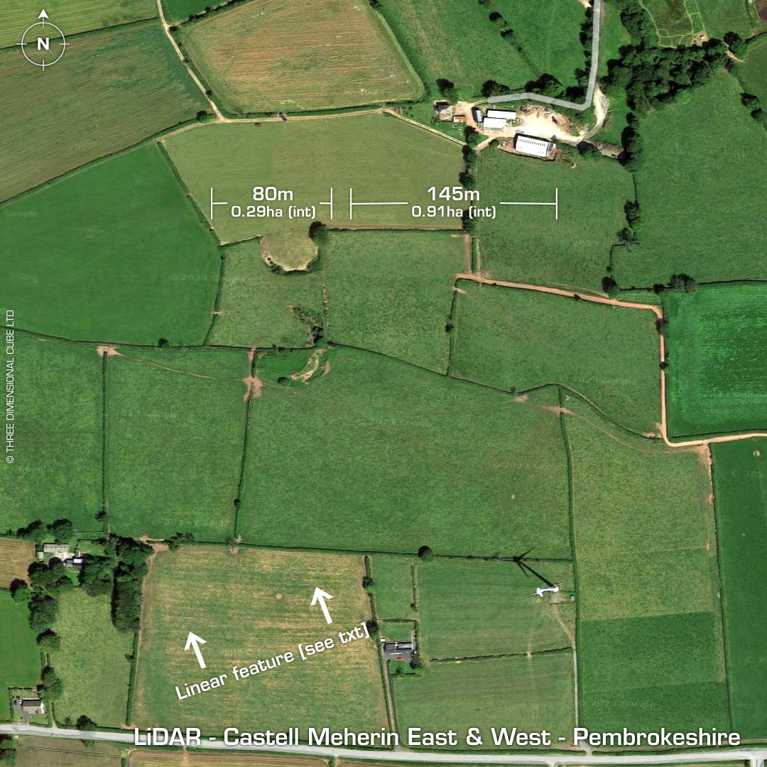
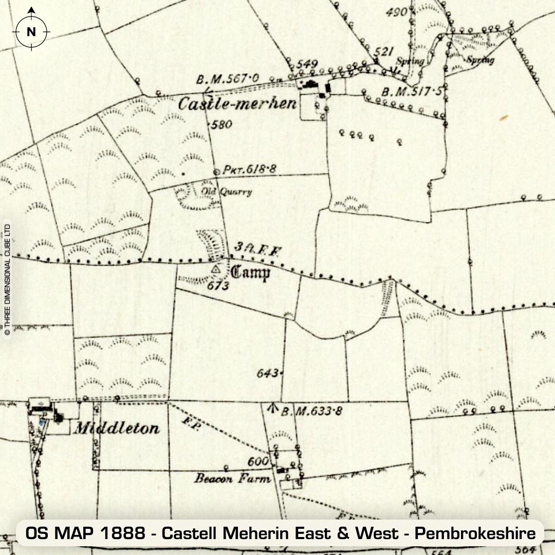
DTM- (Digital Terrain Model, i.e. No buildings or foliage) Lying within fields northeast of the village of Ludchurch, but before the B4314 lie the two hillforts, Castell Meherin East & West. Castell Meherin West: Univallate partial contour hillfort. Simple entrance on east side. Castell Meherin East: Contour hillfort. Heavily degraded by ploughing. Both sites bisected by field boundaries. Relationship between both sites unknown. I found by accident a strong linear feature (indicated) so using QGIS I followed the feature for 10 miles in both directions. Thanks to my mate Dunc who pointed out that when my linear feature crossed a road, on Google Maps street view you can see the gas main posts on either side of the road. So I am the proud discoverer of a gas main! No recorded excavations or finds, hence undated. (Scheduled monument) Iron Age tribal association (conjecture based on location): Demetae Descriptions from hillforts.arch.ox.ac.uk & Dyfed Archaeological Trust HER. Contains public sector information licensed under the Open Government Licence v3.0.