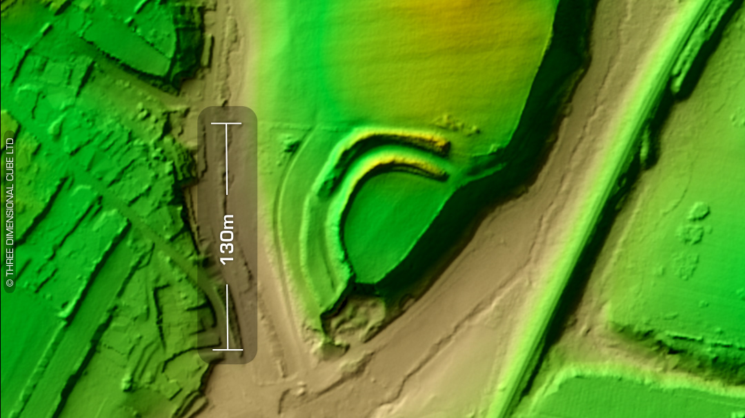
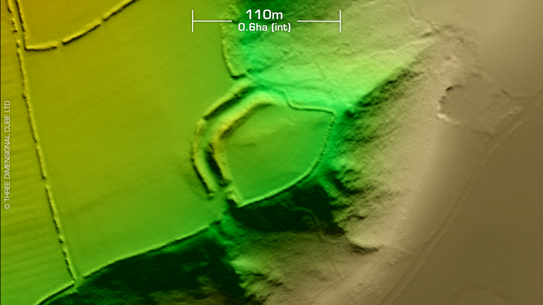
DTM- (Digital Terrain Model, i.e. No buildings or foliage) Overlooking the river Afon Gamman from the north, just to the NE of the village of Nevern lies the univallate inland promontory fort, Castell Trefach. Single 3.3m high rampart with filled-in ditch. Visible on 1st ED OS Map of 1888 but unlisted. No recorded excavations or finds, hence undated. (Scheduled monument) Iron Age tribal association (conjecture based on location): Demetae Descriptions from hillforts.arch.ox.ac.uk & Dyfed Archaeological Trust HER. Contains public sector information licensed under the Open Government Licence v3.0.