![](https://cdn.myportfolio.com/c078a863-8aa5-43c2-a09f-780e93205fb8/f8d0b820-7954-4bc0-b15b-883964bdc928_rw_1200.jpg?h=ee326de064ea4434477277e4aedf509f)
![](https://cdn.myportfolio.com/c078a863-8aa5-43c2-a09f-780e93205fb8/694ffaed-d8b8-42b1-a575-5c8701b2b8a8_rw_1200.jpg?h=897459b088a3d719c4d3c6e0e5881515)
![hazel grove iron age hillfort Pembrokeshire lidar](https://cdn.myportfolio.com/c078a863-8aa5-43c2-a09f-780e93205fb8/b73d100e-e0d0-49b1-a107-9a1f29eeecef_rw_1200.jpg?h=220fa35d4f526a19ace7bafc3464df10)
![](https://cdn.myportfolio.com/c078a863-8aa5-43c2-a09f-780e93205fb8/6cd37578-d2e7-4ffb-9af5-ec9ebcbabf75_rw_1200.jpg?h=078179213d5e167053138791433652fa)
![pant lladron upper furzey iron age hillfort Pembrokeshire lidar](https://cdn.myportfolio.com/c078a863-8aa5-43c2-a09f-780e93205fb8/73fb8b2e-bf32-44e3-a1d4-29efaf6296d1_rw_1200.jpg?h=ed71987a8025e452e6ffe89e2e7c1259)
![](https://cdn.myportfolio.com/c078a863-8aa5-43c2-a09f-780e93205fb8/76bab4fa-8ce0-4cac-ba06-76b69e56e5ce_rw_1200.jpg?h=5f2d60d221590d4879beb03f85b19eb5)
![](https://cdn.myportfolio.com/c078a863-8aa5-43c2-a09f-780e93205fb8/8ff792f3-67d3-42e3-86d6-4f3fdbfc0bde_rw_1200.jpg?h=3cf49595c31e7e838ab54e9f9d743027)
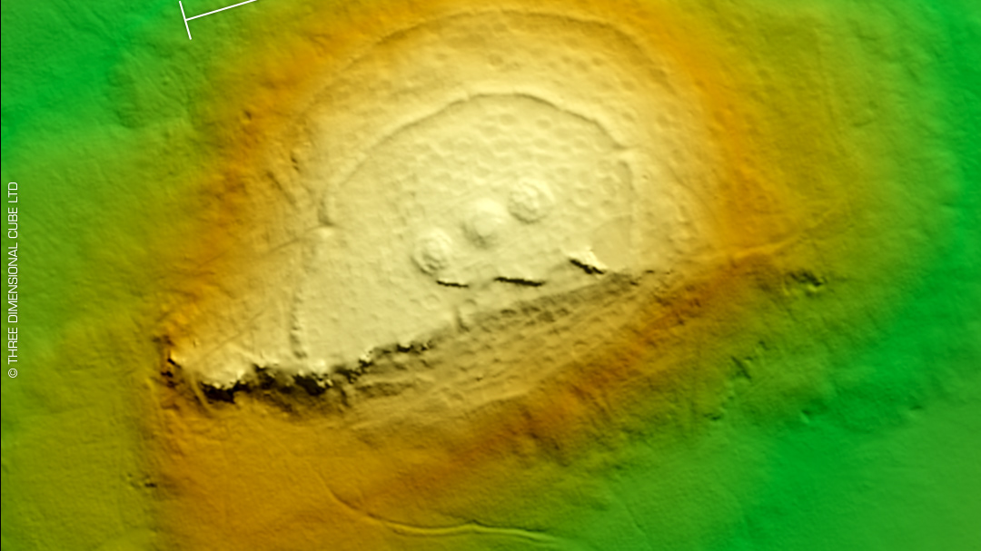
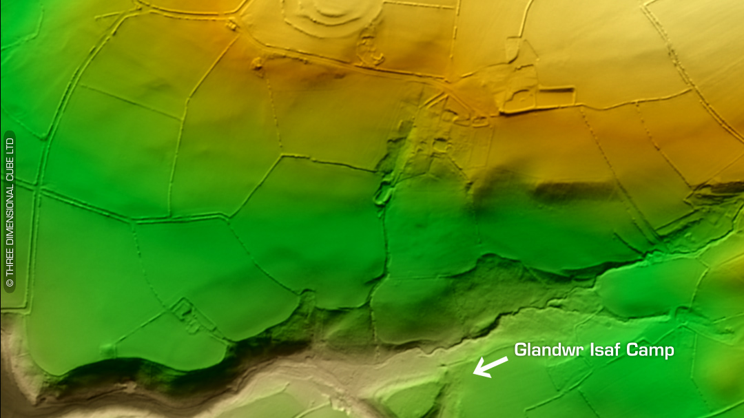
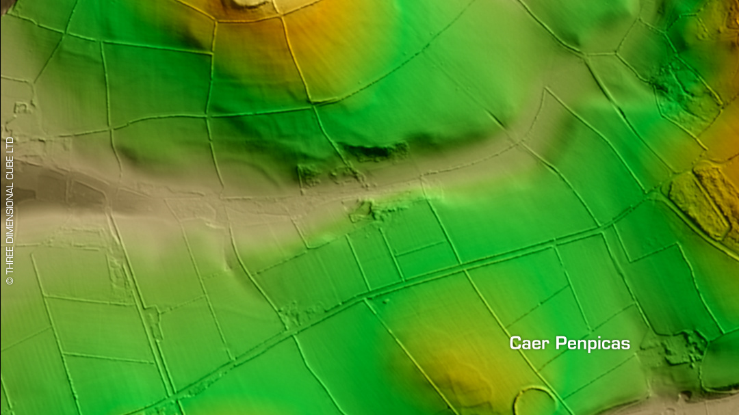
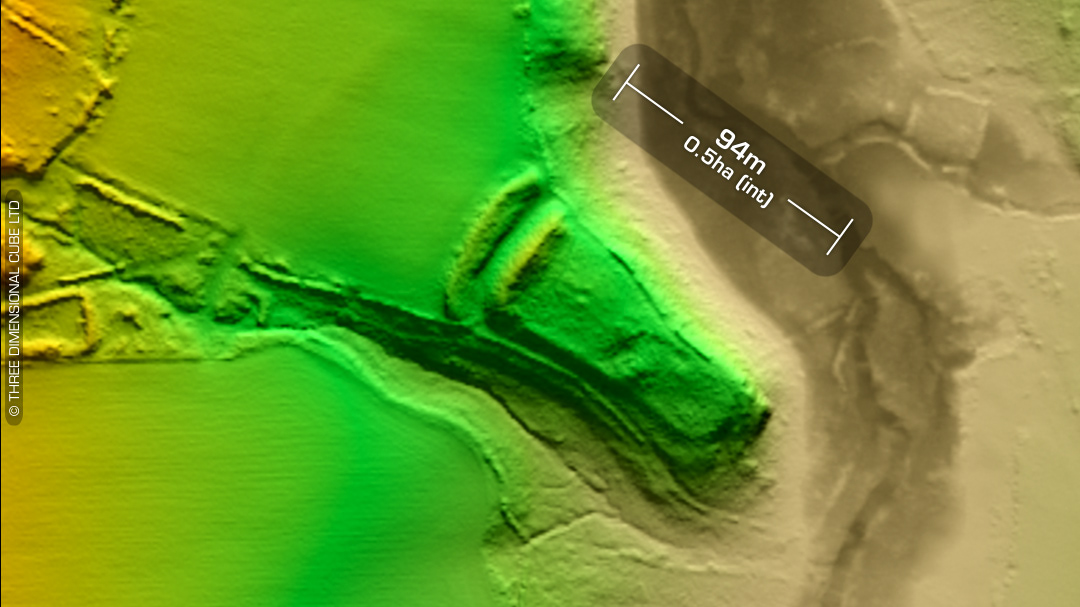
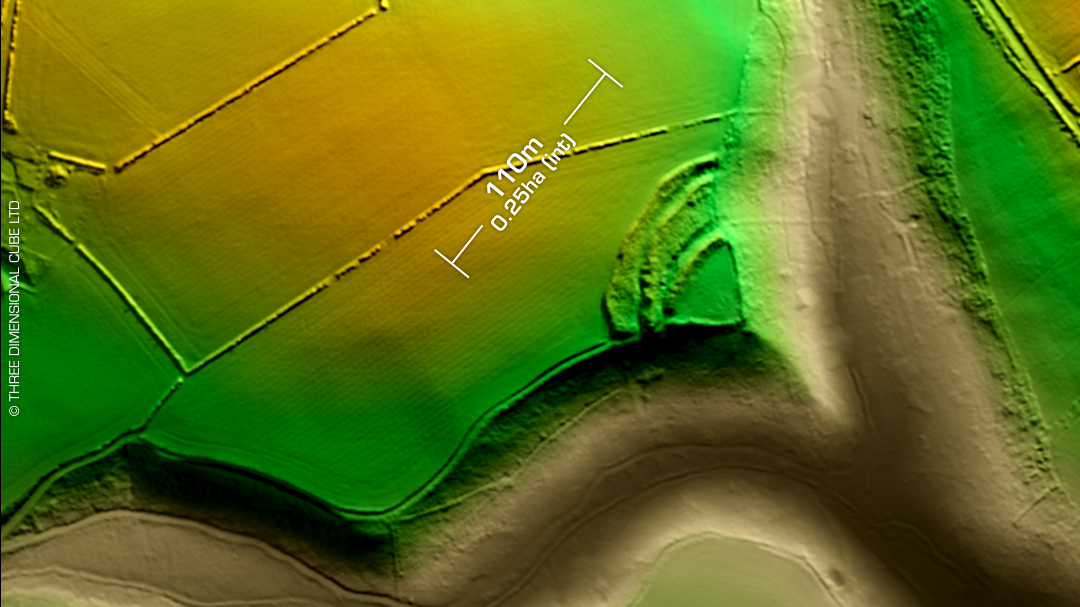
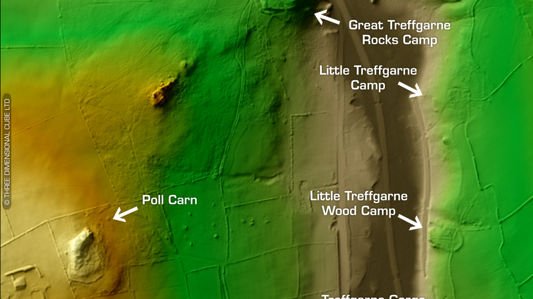
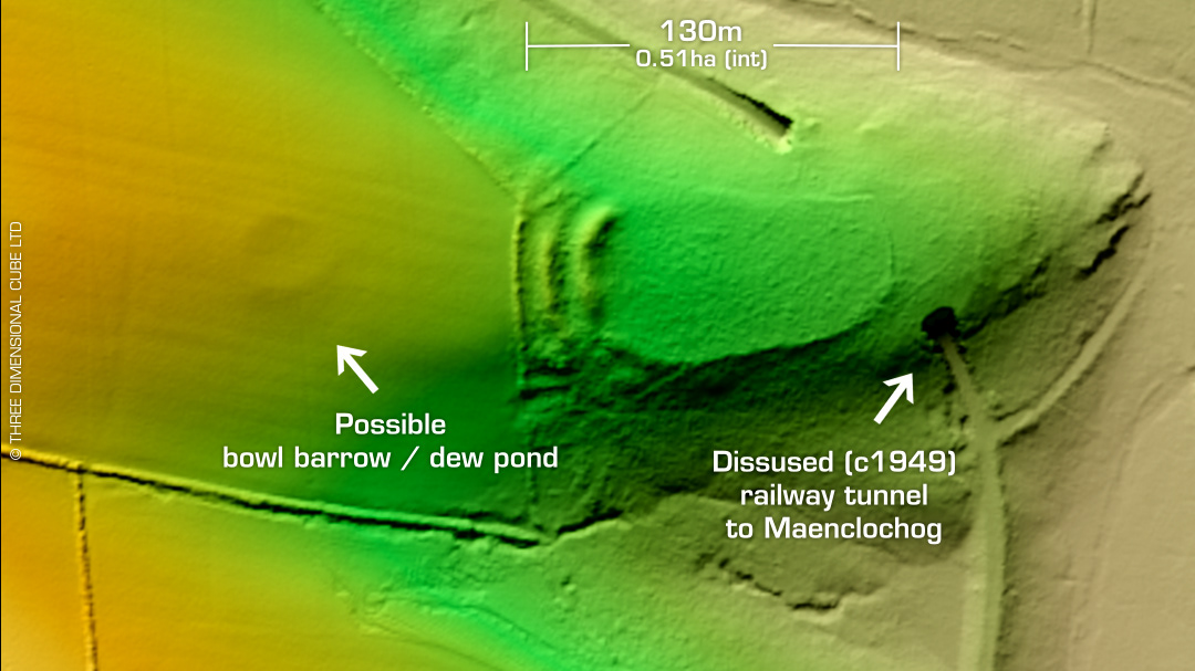
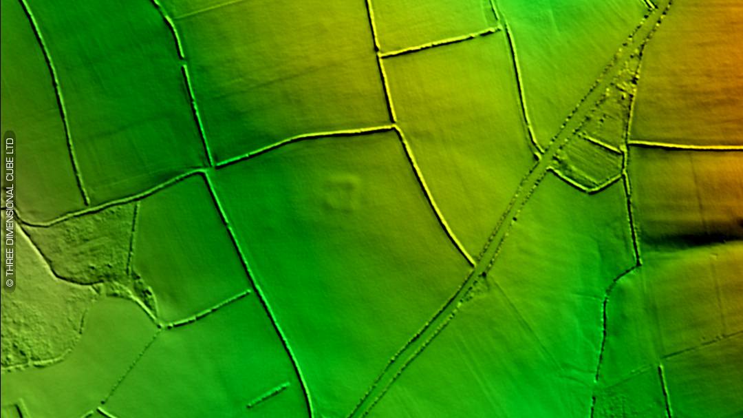
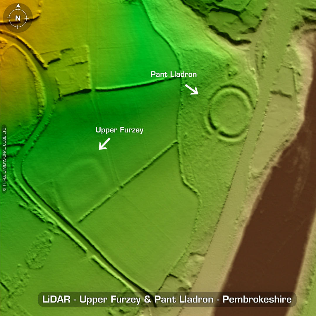
DTM- (Digital Terrain Model, i.e. No buildings or foliage) East of the village Treffgarne & the other side of the A40 and hidden in woodland lie two univallate hillforts, Hazle Grove Camp North & South. The north site has been degraded by the lawn area of Hazel Grove House as well as septic tank & general mutilation of the site. The south site, although more impressive to look at has minimal information apert from the general layout. West of these forts and the other side of the A40 lie the defended enclosure, Pant Lladron. Hidden in woodland. SE corner cut away by the A40. Southwest of Pant Llandron lies the almost ploughed-out univallate earthwork, Upper Furzey. No information apart from general measurements. No recorded finds or excavations, hence undated (All sites). (Scheduled monuments) Iron Age tribal association (conjecture based on location): Demetae Descriptions from hillforts.arch.ox.ac.uk & Dyfed Archaeological Trust HER. 1st ED OS Mapping via National Library of Scotland. Contains public sector information licensed under the Open Government Licence v3.0.