![](https://cdn.myportfolio.com/c078a863-8aa5-43c2-a09f-780e93205fb8/5f7b74d7-d22b-44a0-bab5-600020179f85_rw_1200.jpg?h=ccbd27980f6c2c8ead79317a08cc36b0)
![](https://cdn.myportfolio.com/c078a863-8aa5-43c2-a09f-780e93205fb8/912566cd-0a39-45ed-b166-8f33002356fa_rw_1200.jpg?h=704c9062c045f5fc5a8908c2994a74fd)
![](https://cdn.myportfolio.com/c078a863-8aa5-43c2-a09f-780e93205fb8/9532ad4d-c5bb-4290-8107-e3cd48c7ebae_rw_1200.jpg?h=87b97d4dd8e60b3e9e55763be8cc7f04)
![](https://cdn.myportfolio.com/c078a863-8aa5-43c2-a09f-780e93205fb8/dfd7ba3e-eee6-4414-b2cd-50d9f5df799f_rw_1200.jpg?h=35821c45f420a6178755a060352bb3da)
![](https://cdn.myportfolio.com/c078a863-8aa5-43c2-a09f-780e93205fb8/39626ead-b3c3-44dd-a8c8-2b5350ef8125_rw_1200.jpg?h=d6b805cbaa5848a0c20a77a12588325a)
![](https://cdn.myportfolio.com/c078a863-8aa5-43c2-a09f-780e93205fb8/9d27b3d6-6df2-4477-8ee4-5144e64e6bb0_rw_1200.jpg?h=9b1023592b4b3b5640d492635cecfd37)
![](https://cdn.myportfolio.com/c078a863-8aa5-43c2-a09f-780e93205fb8/9619984d-6dbd-43fb-b8f4-473956dfed49_rw_1200.jpg?h=54b118b82a2f02e6c04cfaaf583843ea)
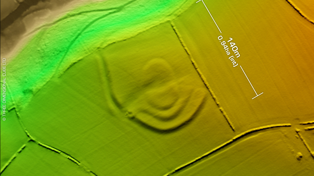
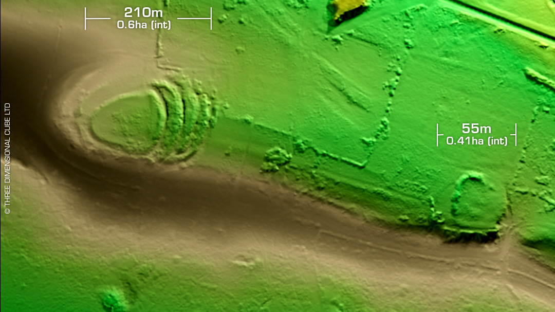
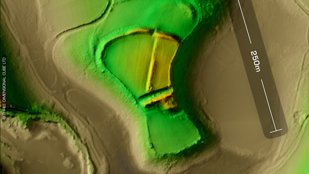
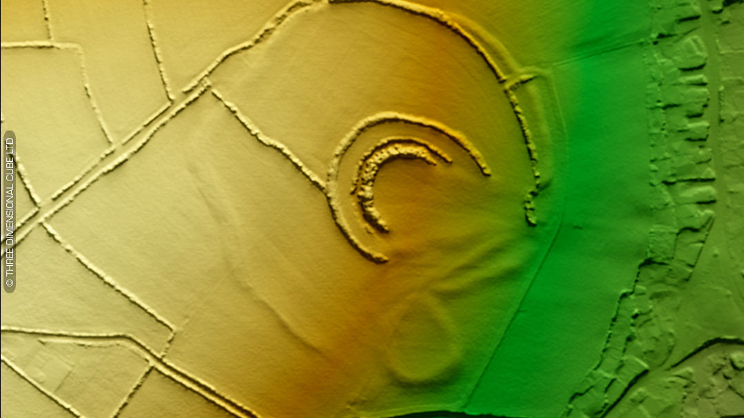
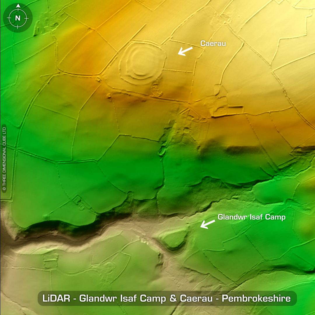
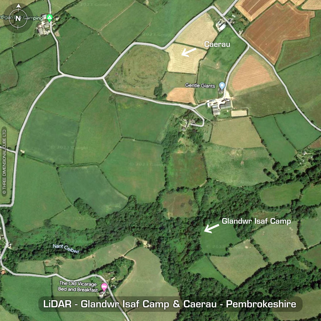
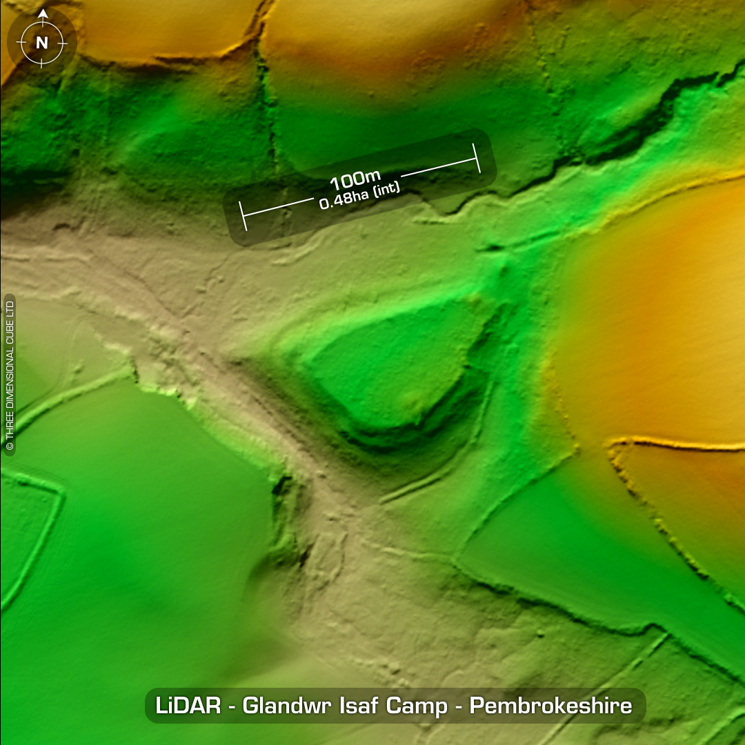
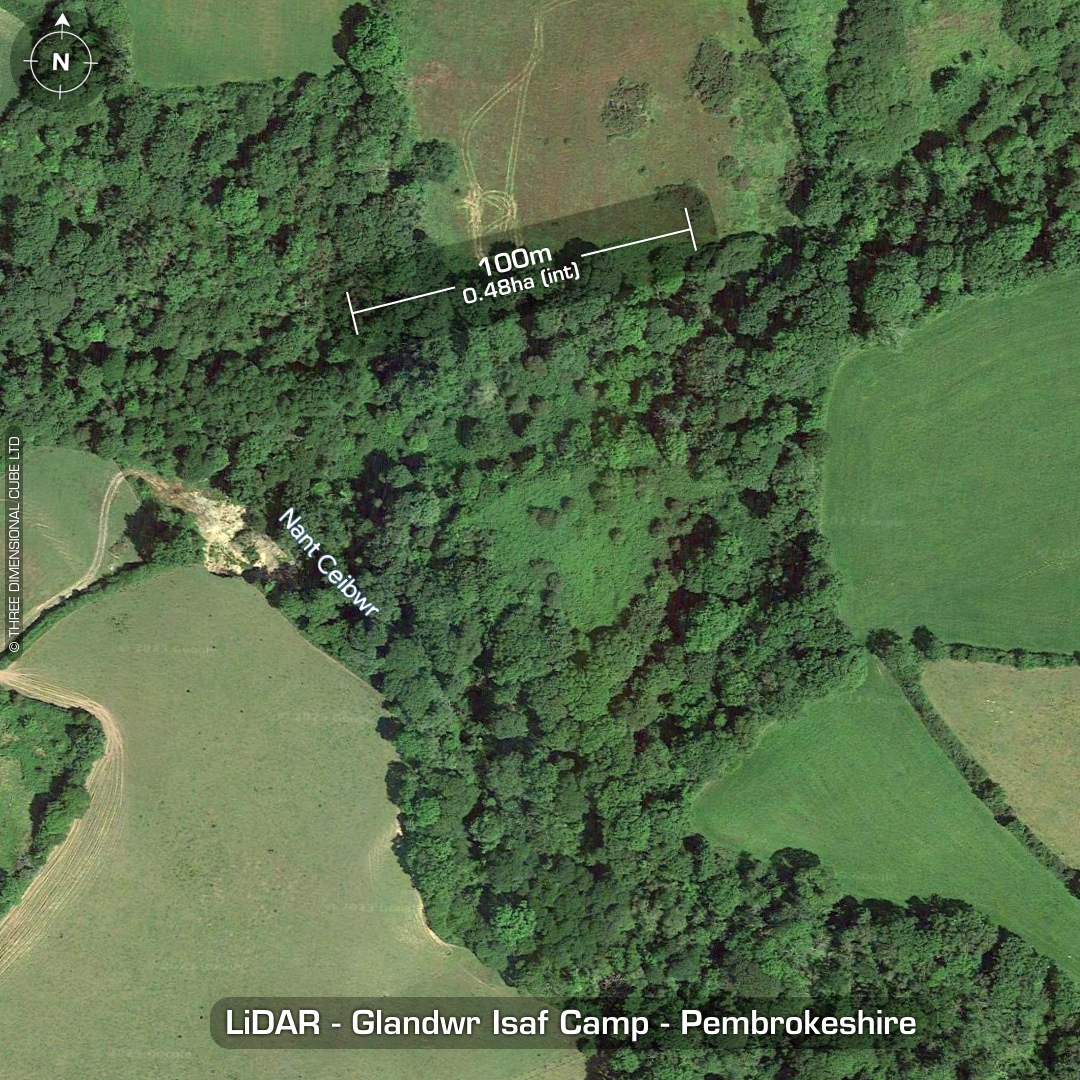
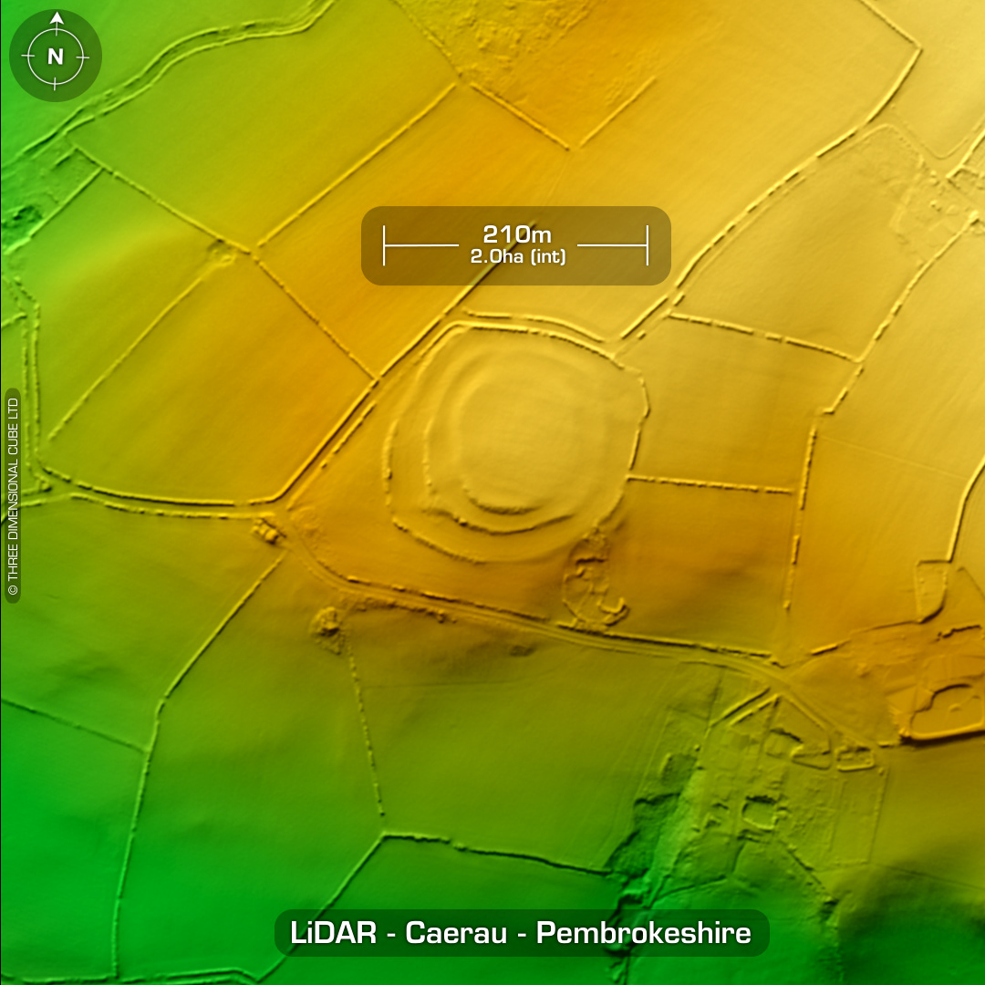
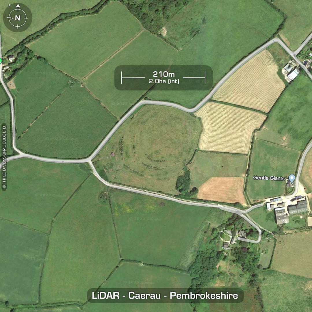
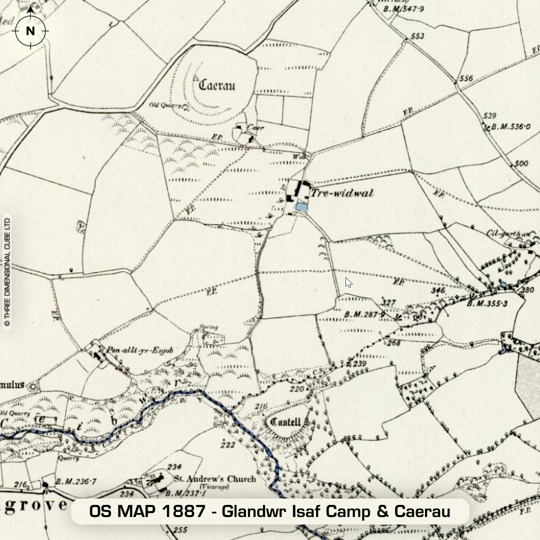
DTM- (Digital Terrain Model, i.e. No buildings or foliage) To the west of the village of Moylgrove & hidden in woodland overlooking the (River) Nant Ceibwr lies the small univallate inland promontory fort, Glandwr Isaf Camp. 'Sub-rectangular mound' or possible bowl barrow in interior (just made out on the LiDAR on the south side. Survey in 1969 Last site visit in 2007. North of this site lies a much larger multivallate defended enclosure, Caerau. This is not listed on the Atlas of Hillforts. Degraded by ploughing. Survey in 1969. Last site visit in 2007. Considering the size of the site I'm surprised by the lack of information. No recorded excavations or finds, hence undated (both sites). (Scheduled monument) Iron Age tribal association (conjecture based on location): Demetae Descriptions from hillforts.arch.ox.ac.uk & Dyfed Archaeological Trust HER. Contains public sector information licensed under the Open Government Licence v3.0.