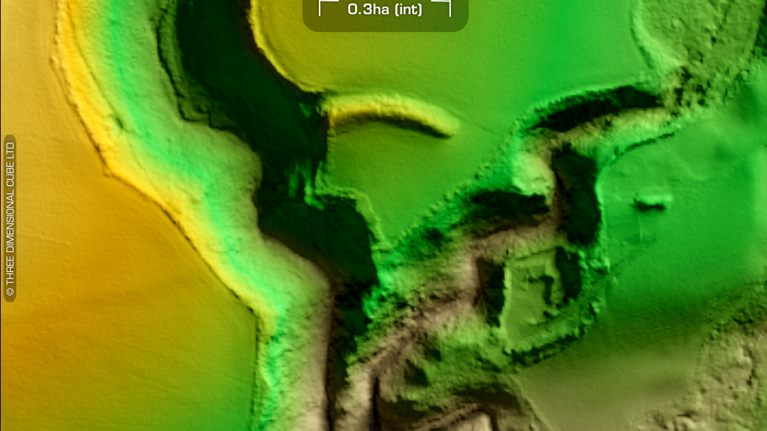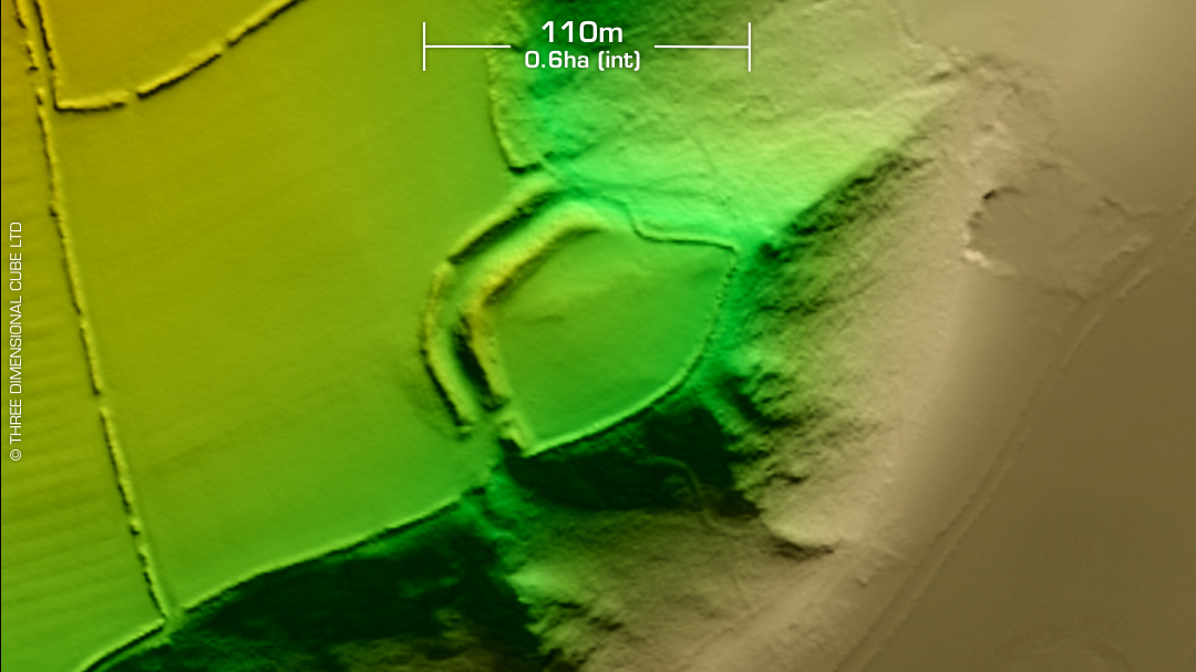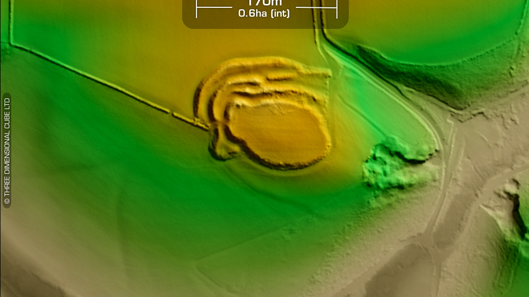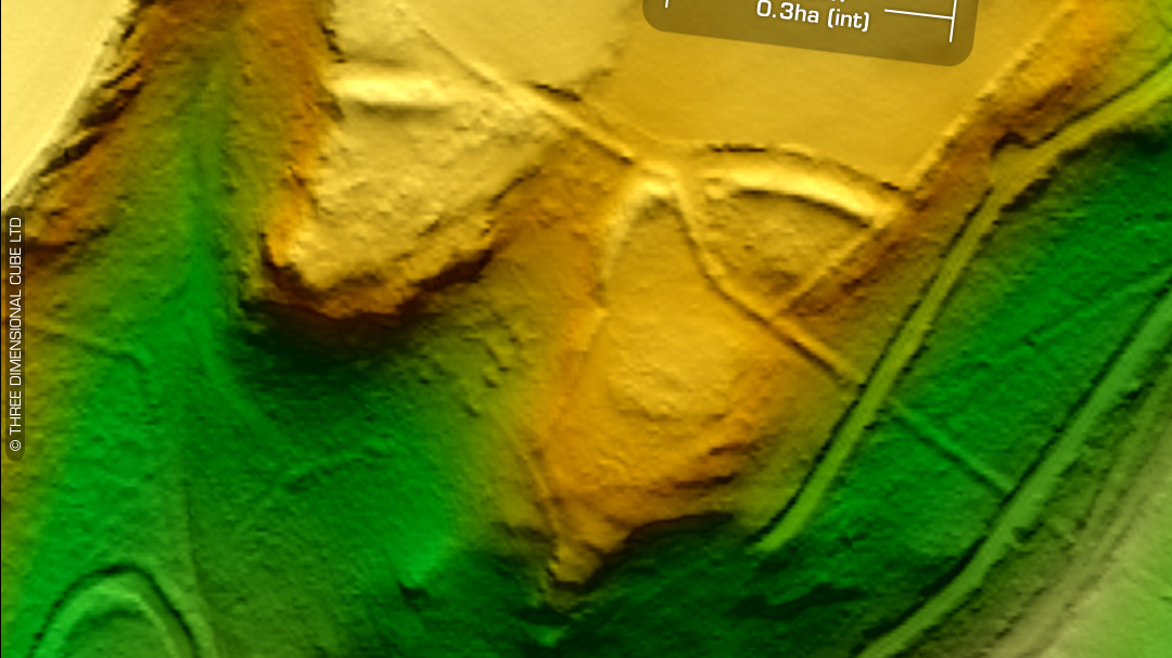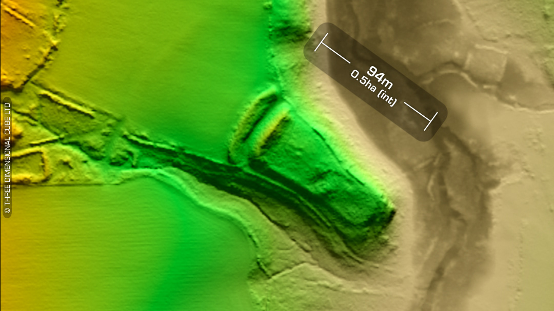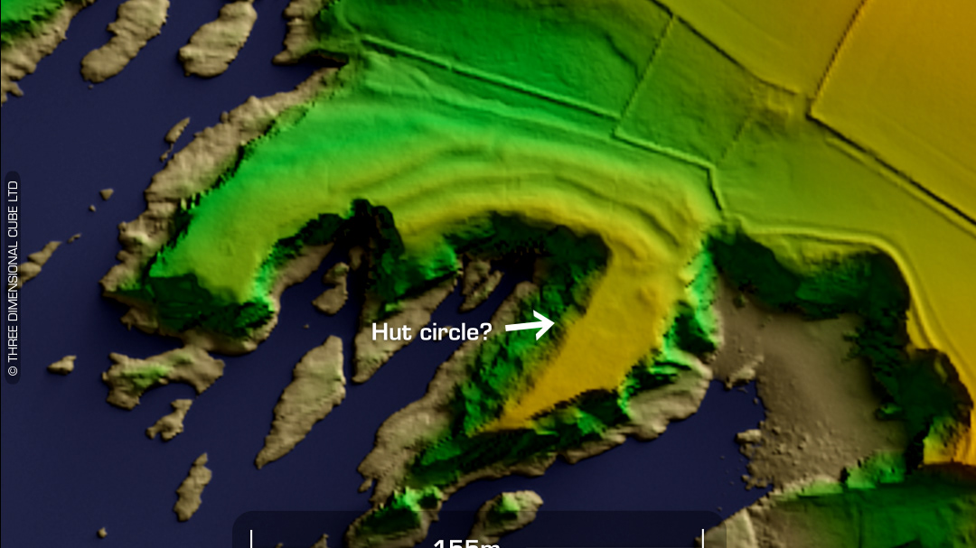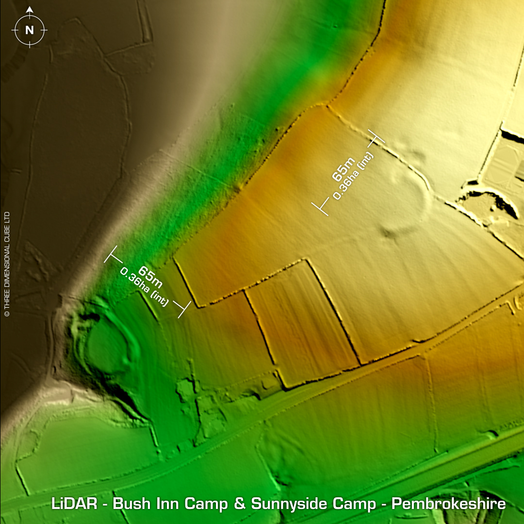

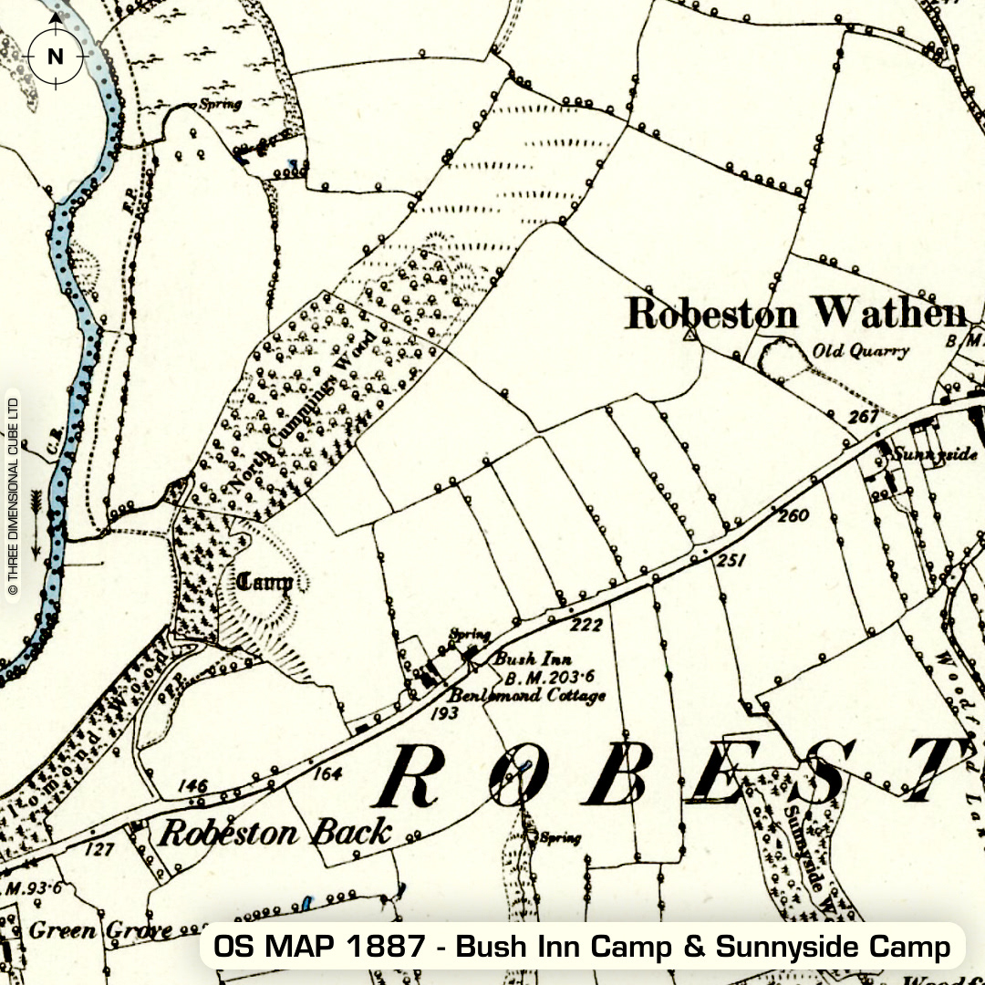
Overlooking the B4314 on the approach to Robeston Wathen from the west lie the inland promontory fort, Bush Inn Camp and just to its NE corner, Sunnyside Camp. The first must have been named after the Bush Inn public house. Last site survey in 2007. No recorded excavations or finds. Sunnyside Camp can be seen as a curved field boundary on the 1st ED OS Map of 1887. Site ploughed down to within an inch of its life. Entire west side destroyed. Stone quarrying to the north side. Last site survey in 2007. No recorded excavations or finds. (Scheduled monuments) Iron Age tribal association (conjecture based on location): Demetae