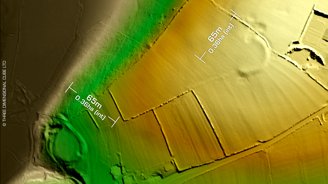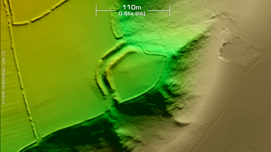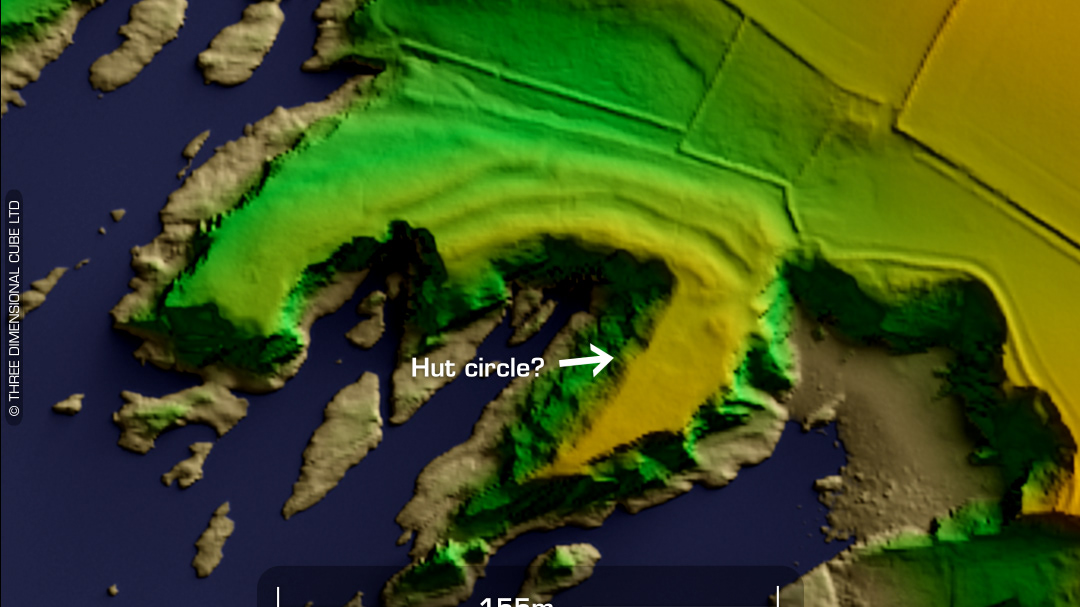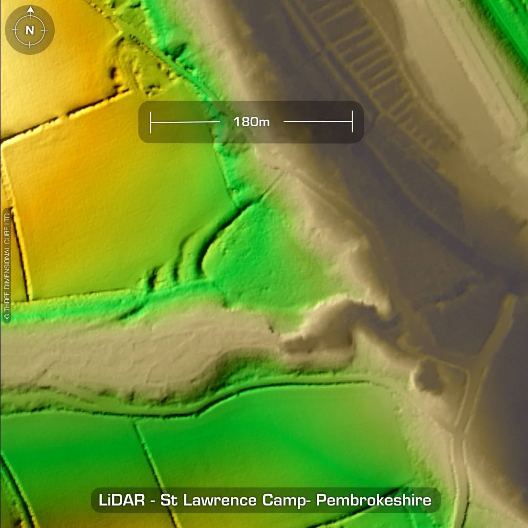
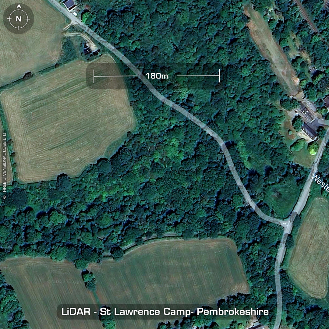
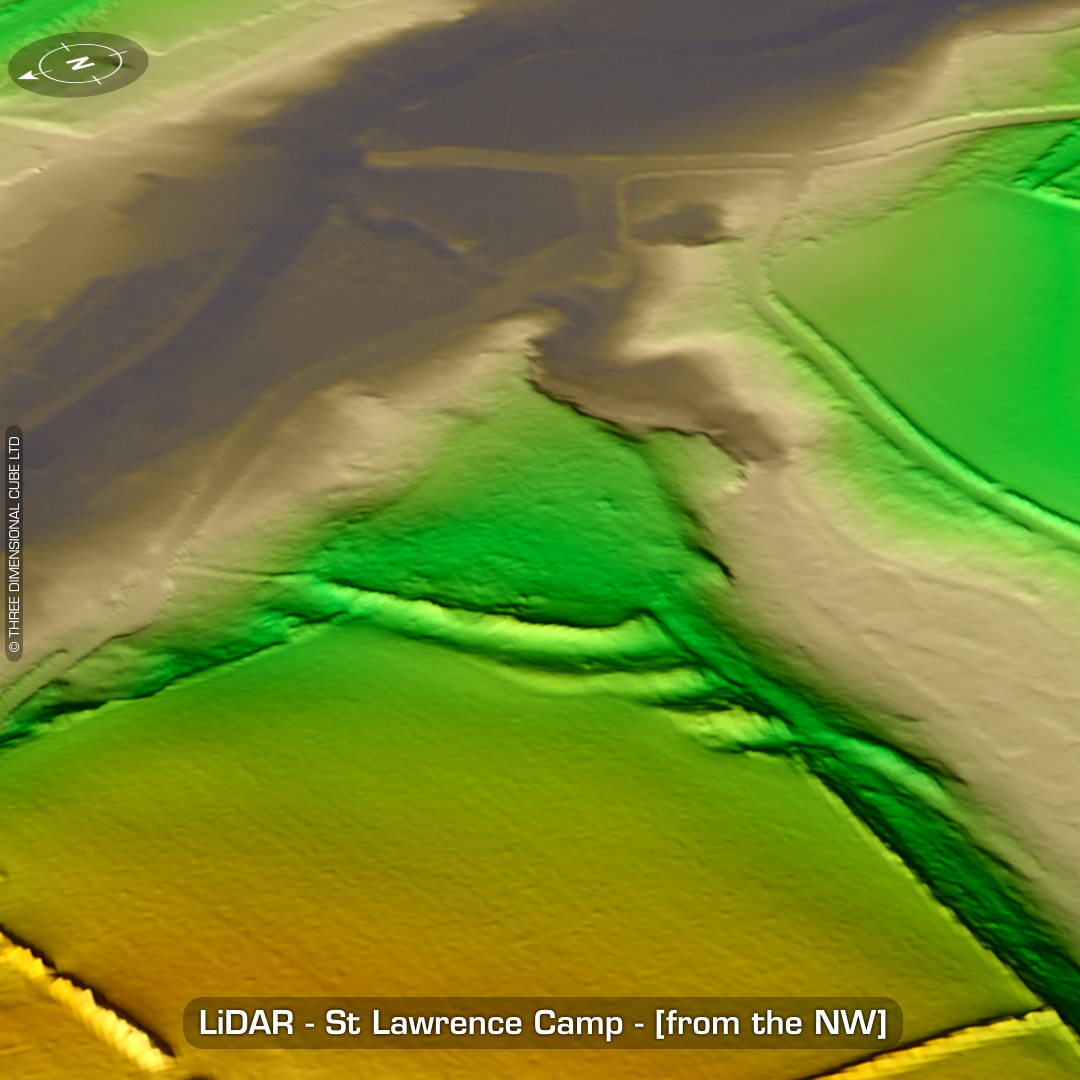
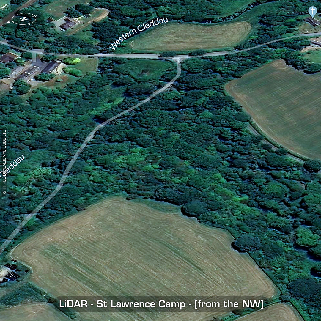
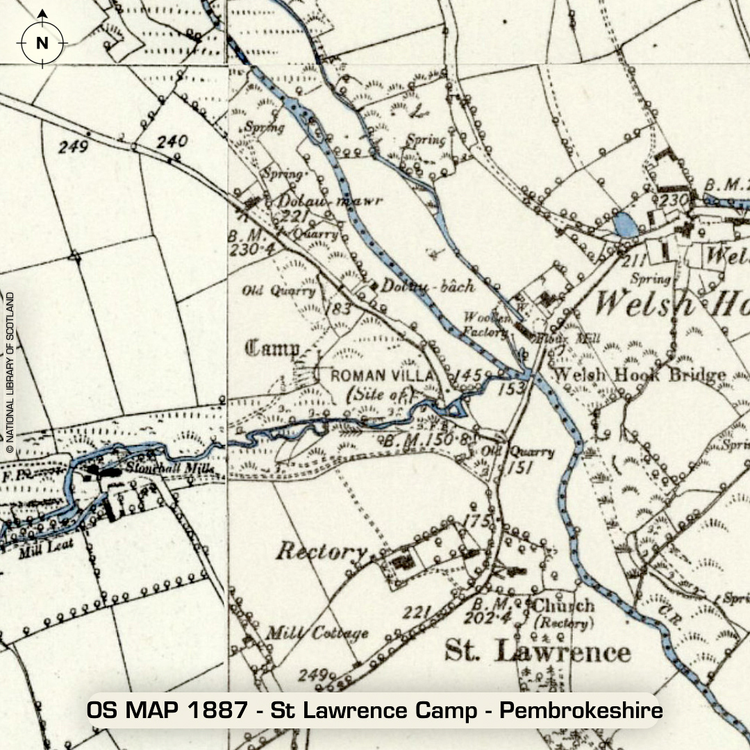
DTM- (Digital Terrain Model, i.e. No buildings or foliage) Two-point five kilometres northwest of the town of Wolf’s Castle and just west of the ‘settlement’ of Welsh Hook lies the inland promontory fort, St Lawrence Camp. Banks degraded by ploughing over the centuries. Listed as the site of a Roman Villa on old OS maps. Excavations in 19th century* found Roman roofing tiles. Details lost. If there was a Roman villa you can bet the local church just south of the site was partially constructed from its masonry in the 12 century when it was built. May be worth a look! No recorded *excavations or finds, hence undated. (Scheduled monuments) Iron Age tribal association (conjecture based on location): Demetae Descriptions from hillforts.arch.ox.ac.uk & Dyfed Archaeological Trust HER. 1st ED OS Mapping via National Library of Scotland. Contains public sector information licensed under the Open Government Licence v3.0.