![syke rath iron age hillfort pembrokeshire lidar](https://cdn.myportfolio.com/c078a863-8aa5-43c2-a09f-780e93205fb8/11730bcb-07ba-4f79-a506-2beb5ab6fc7a_rw_1200.jpg?h=8f9fbac8067268b350881341cd1e4044)
![](https://cdn.myportfolio.com/c078a863-8aa5-43c2-a09f-780e93205fb8/aace7620-b536-4c13-a571-15e0b3c041b3_rw_1200.jpg?h=1a300c7d0865fc8336136cea307c7337)
![](https://cdn.myportfolio.com/c078a863-8aa5-43c2-a09f-780e93205fb8/632e1dd8-55f3-4d4c-89e7-61b30a92fa9b_rw_1200.jpg?h=bc6841a7d2c0e2e0e2ef97b847738620)
![](https://cdn.myportfolio.com/c078a863-8aa5-43c2-a09f-780e93205fb8/22c1c021-1ab3-416f-8d2d-d134ec481666_rw_1200.jpg?h=4c93181d773a3b76d06bff8ed5277cba)
![](https://cdn.myportfolio.com/c078a863-8aa5-43c2-a09f-780e93205fb8/baf4bac1-2fff-4260-8a54-c36050be9e3f_rw_1200.jpg?h=99468a635786347e37237f42d104f6db)
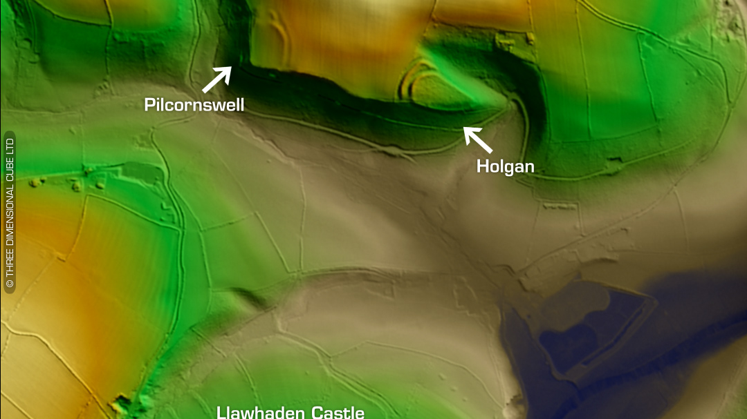
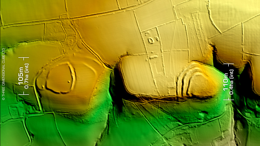
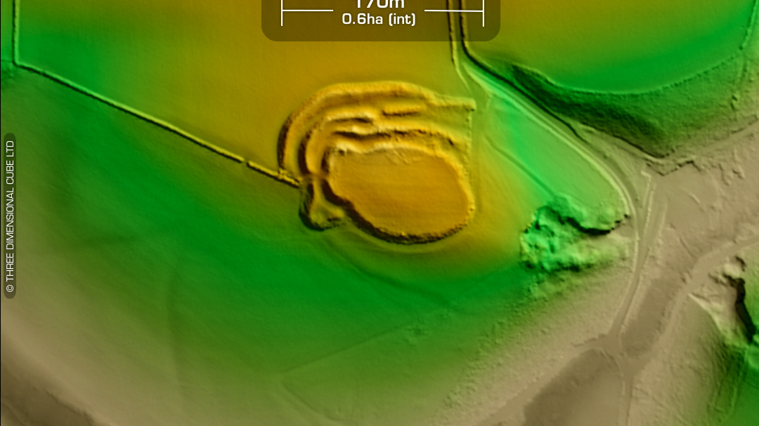
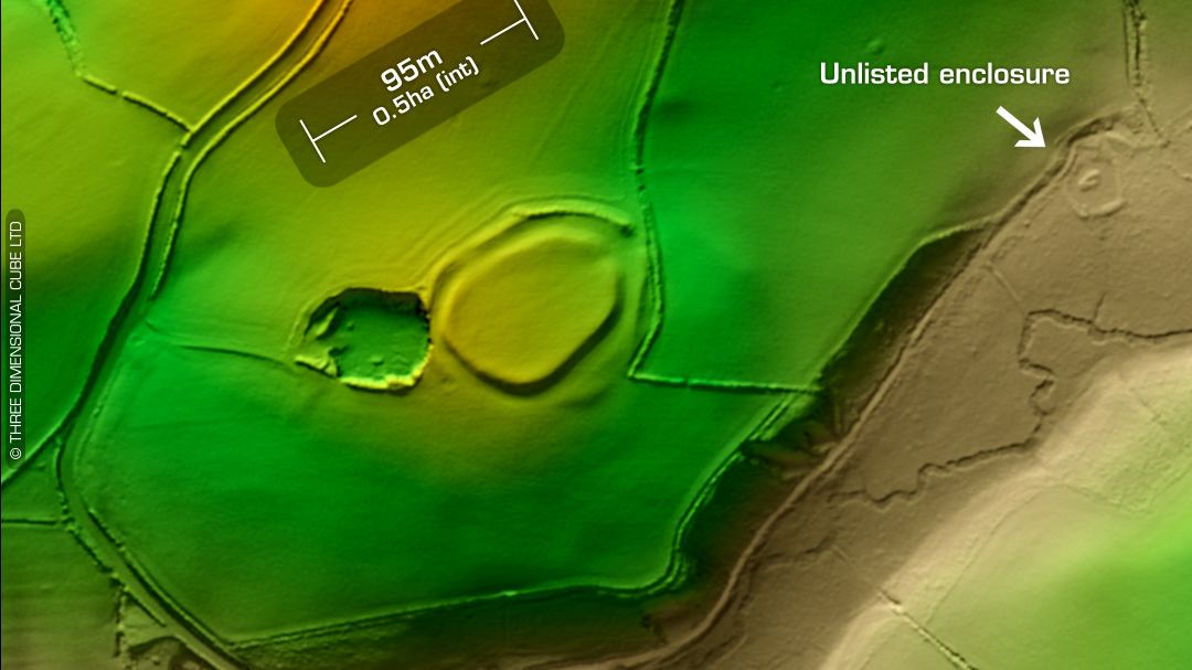
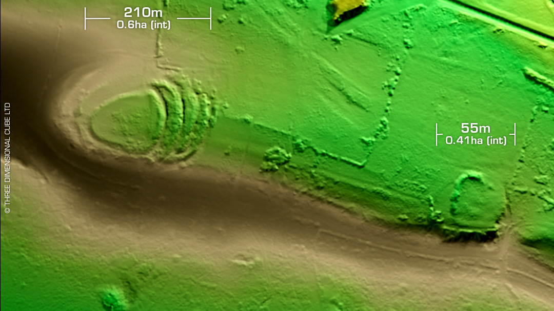
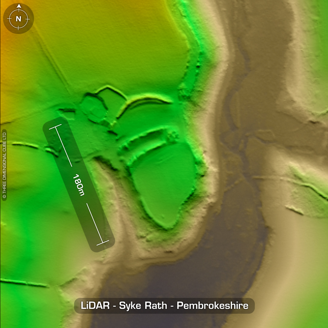
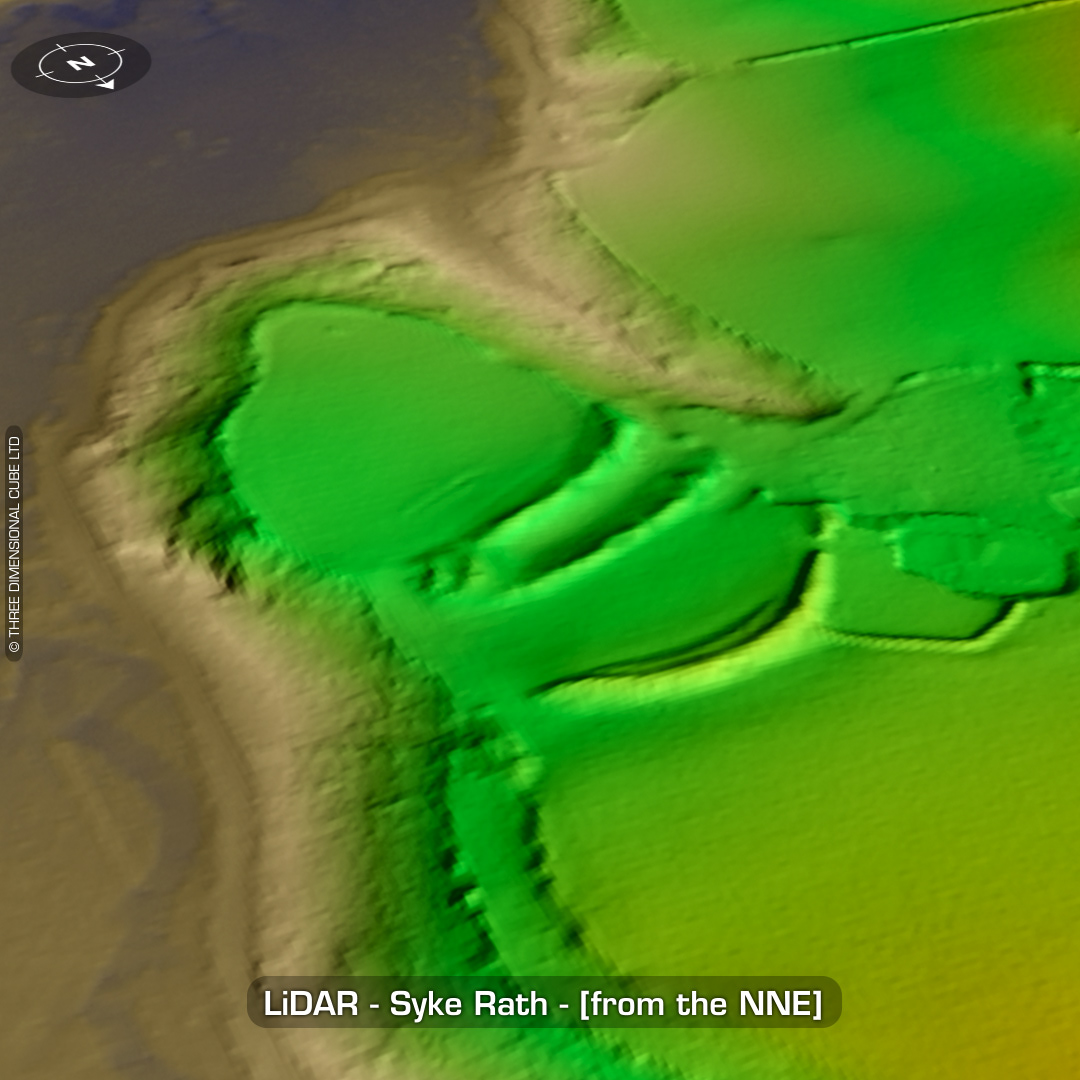
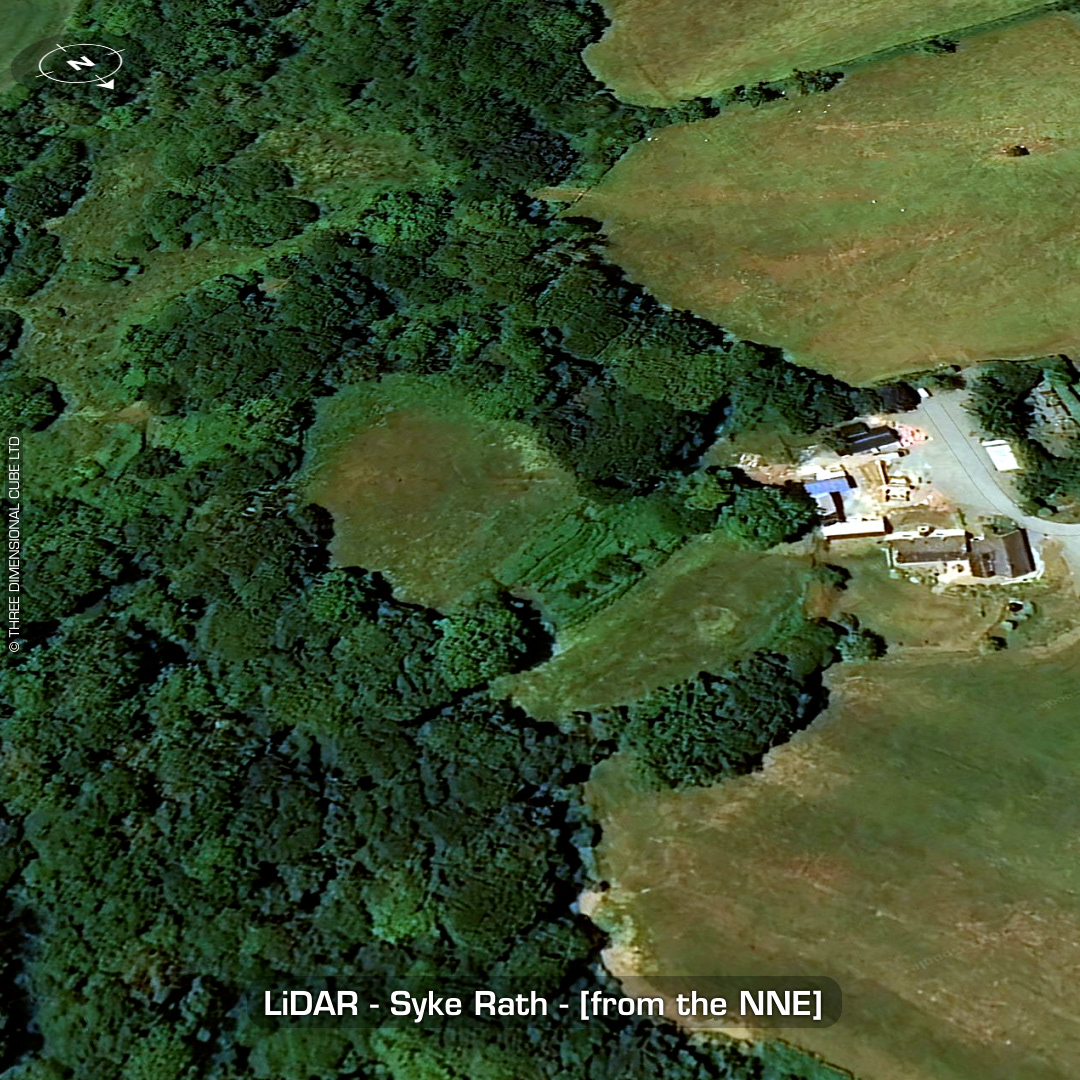
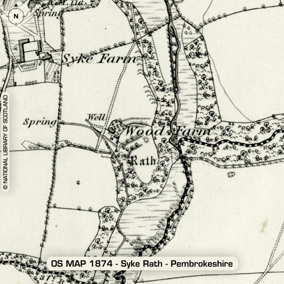
DTM- (Digital Terrain Model, i.e. No buildings or foliage) One kilometre south of the village of Walwyn’s Castle sits the inland promontory fort, Syke Rath. Its boundaries are hidden by trees. Possible annex to the NE. Interesting ‘river crossing’ point picked-up on the LiDAR. Last site report in 2007. No recorded excavations or finds, hence undated. (Scheduled monuments) Iron Age tribal association (conjecture based on location): Demetae Descriptions from hillforts.arch.ox.ac.uk & Dyfed Archaeological Trust HER. 1st ED OS Mapping via National Library of Scotland. Contains public sector information licensed under the Open Government Licence v3.0.