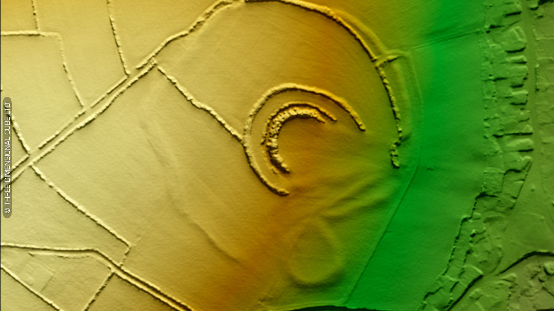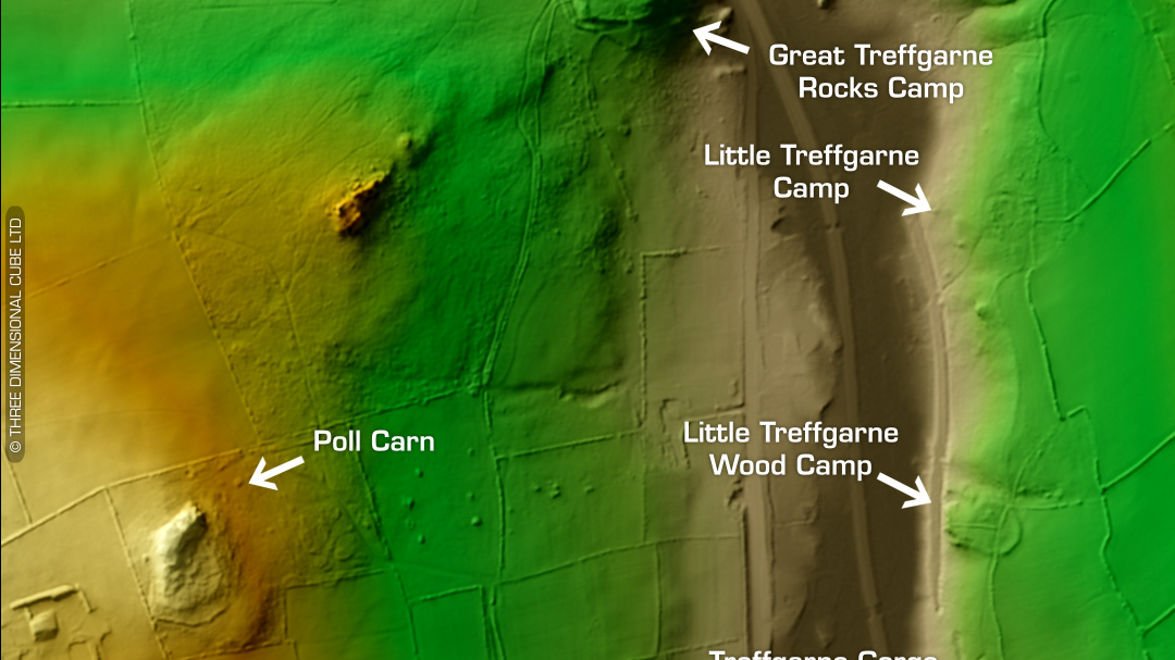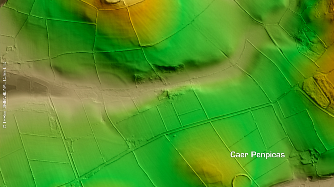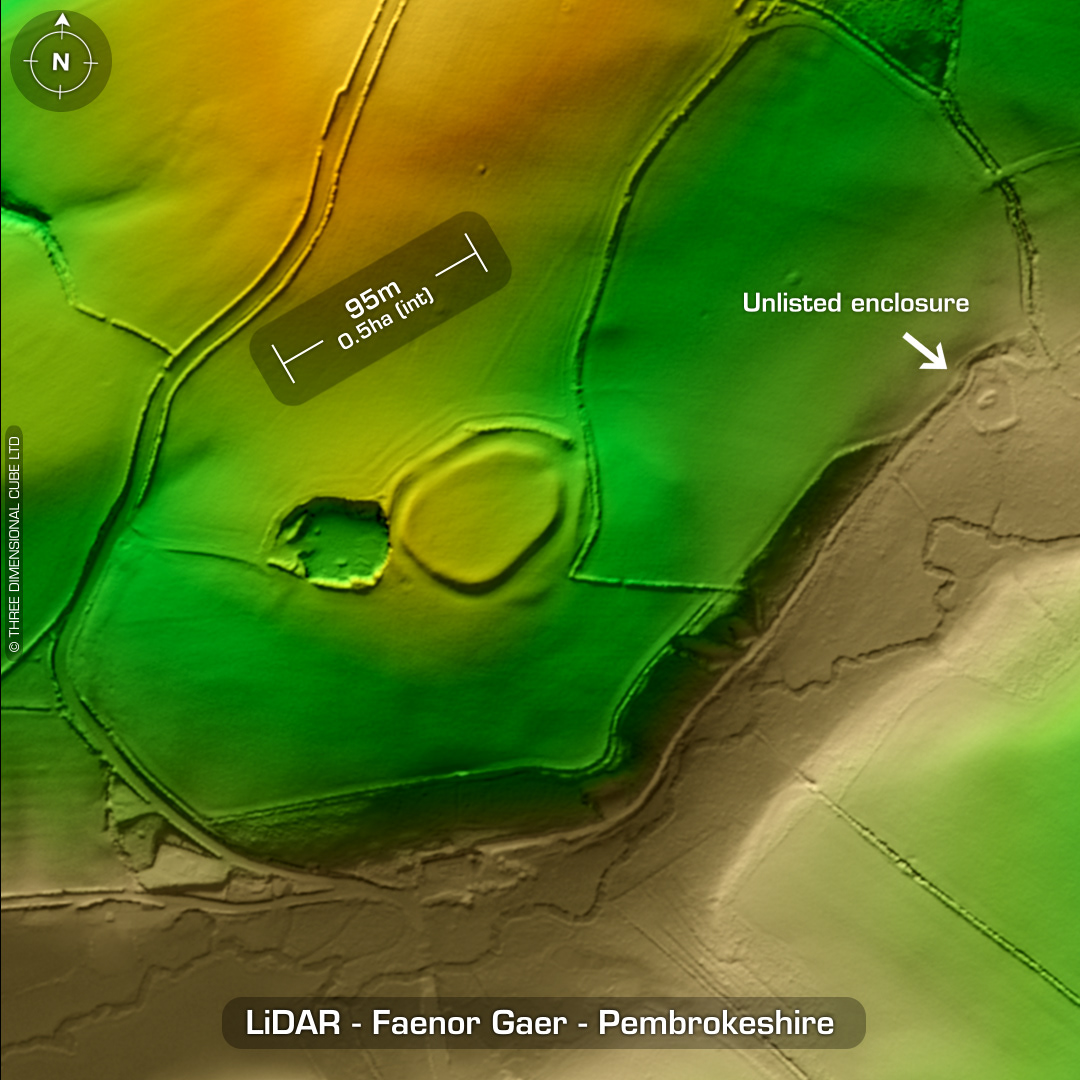
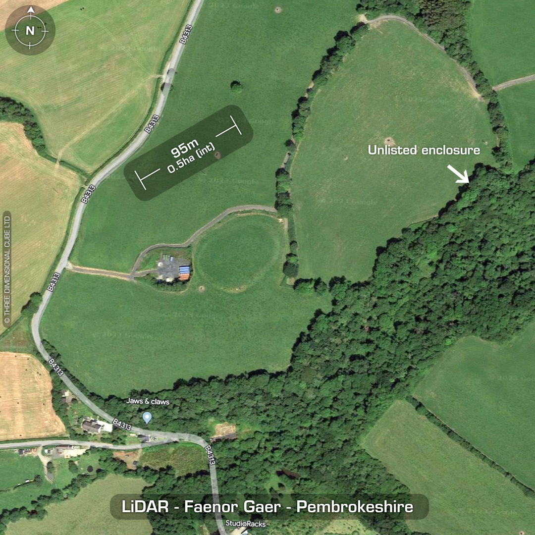

DTM- (Digital Terrain Model, i.e. No buildings or foliage) Just south of the village of Bethesda and east of the B4313 sits the univallate partial contour hillfort, Faenor Gaer. West side degraded by quarry, which now holds shipping containers. Entrance on NE corner. Crossley, D. in 1963 suggests a possible structure west of a south guard chamber. Chance find of burnt earth and daub after ploughing in 1960. Last site visit in 2007. No recorded excavations, hence undated. (Scheduled monument) Iron Age tribal association (conjecture based on location): Demetae Descriptions from hillforts.arch.ox.ac.uk & Dyfed Archaeological Trust HER. Contains public sector information licensed under the Open Government Licence v3.0.