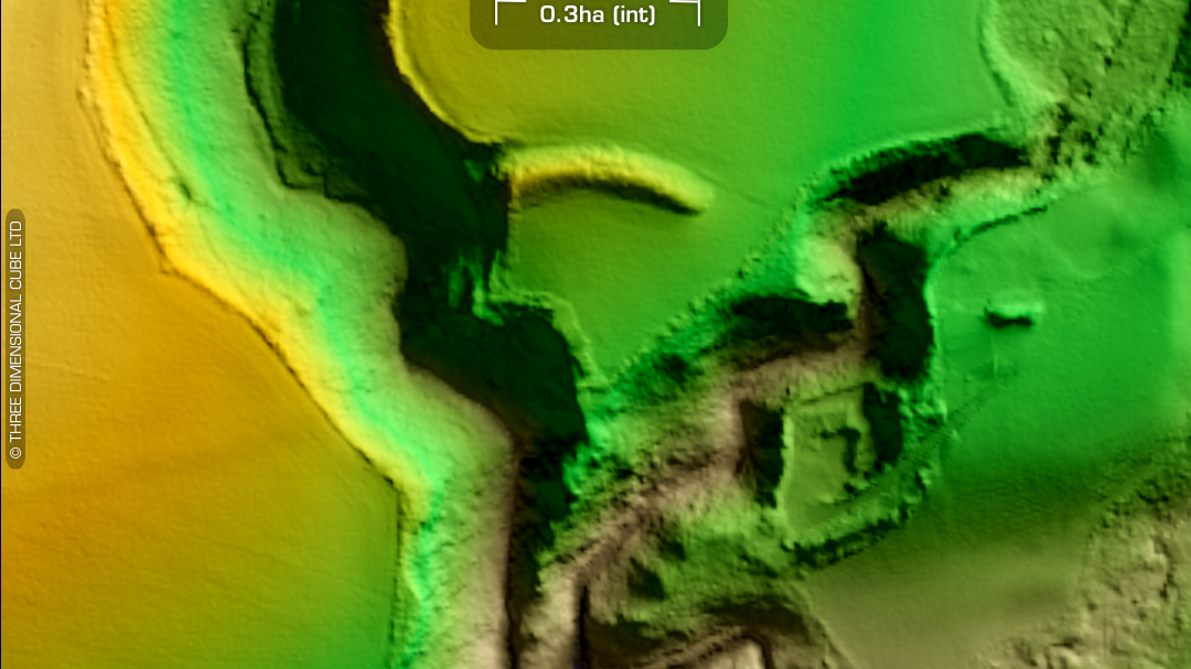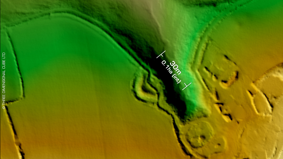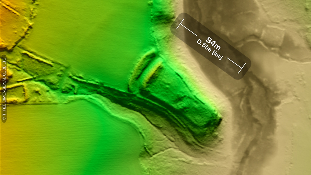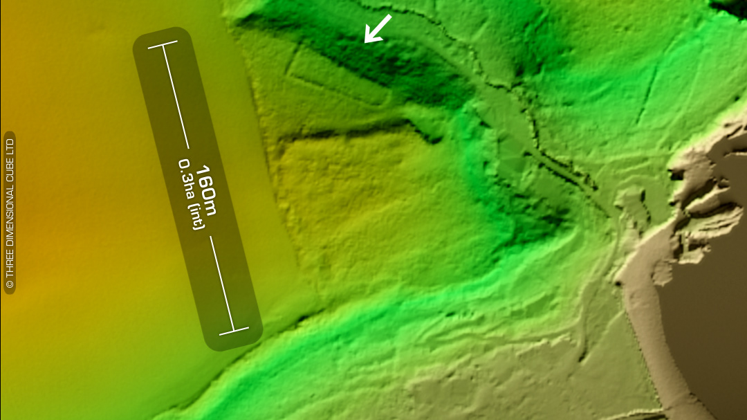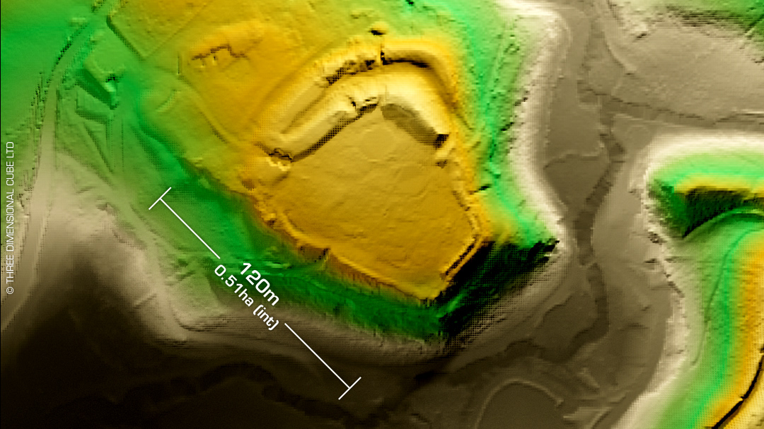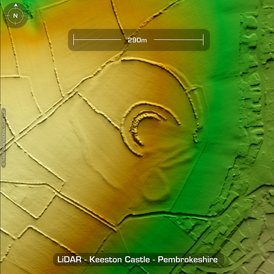

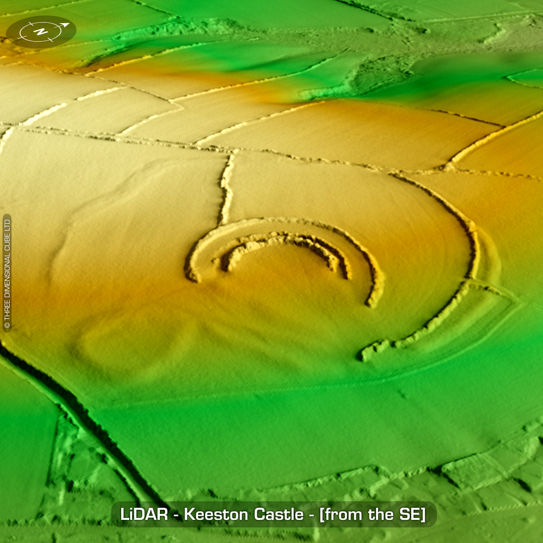
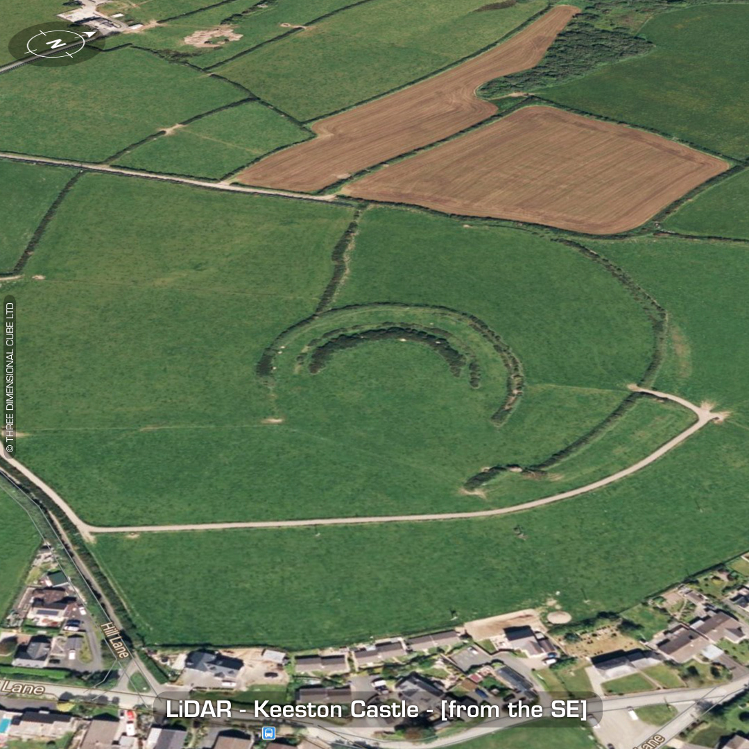
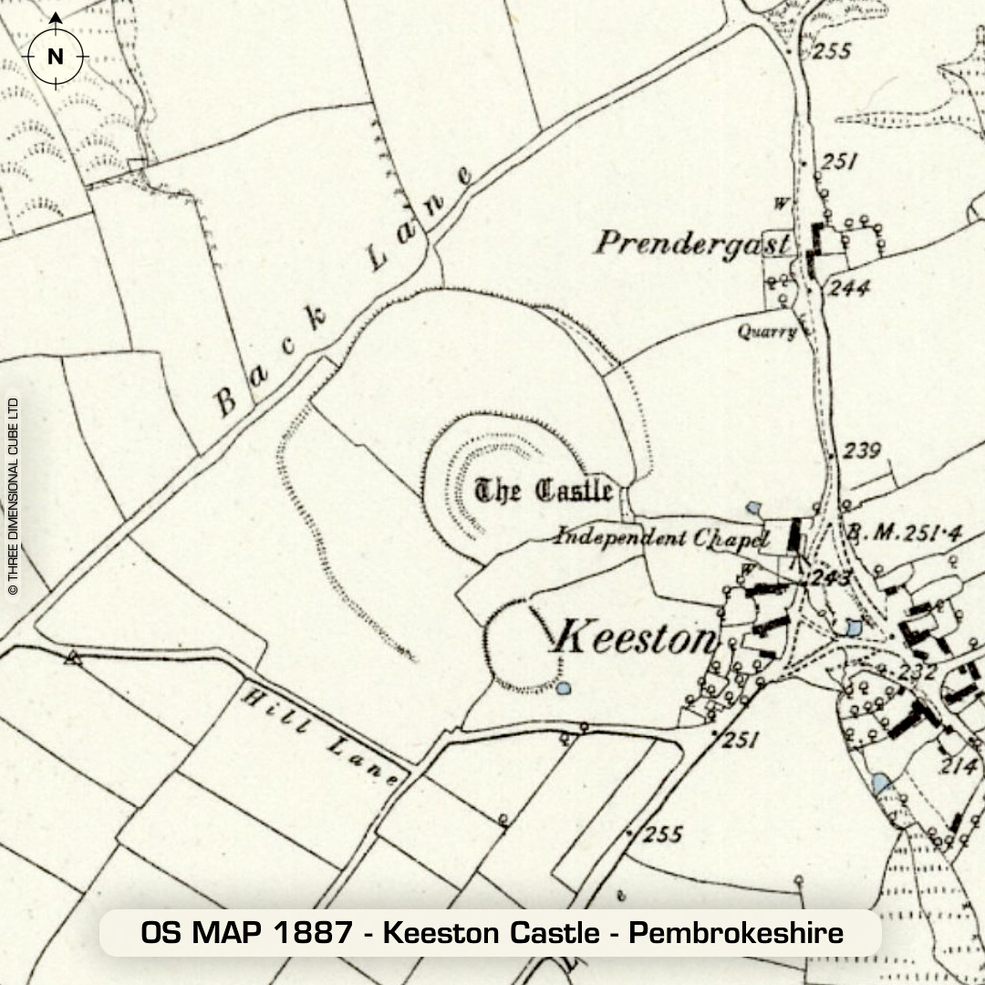
DTM- (Digital Terrain Model, i.e. No buildings or foliage) Just to the west and overlooking the village of Keeston lies the complex bivallate defended enclosure with a concentric annex & extra smaller enclosure on its south side. Ramparts part-destroyed by farming over the centuries. No recorded excavations or finds, hence undated. (Scheduled monument) Iron Age tribal association (conjecture based on location): Demetae Descriptions from hillforts.arch.ox.ac.uk & Dyfed Archaeological Trust HER. 1st ED OS Mapping via National Library of Scotland. Contains public sector information licensed under the Open Government Licence v3.0.