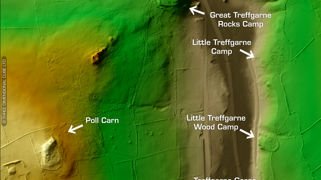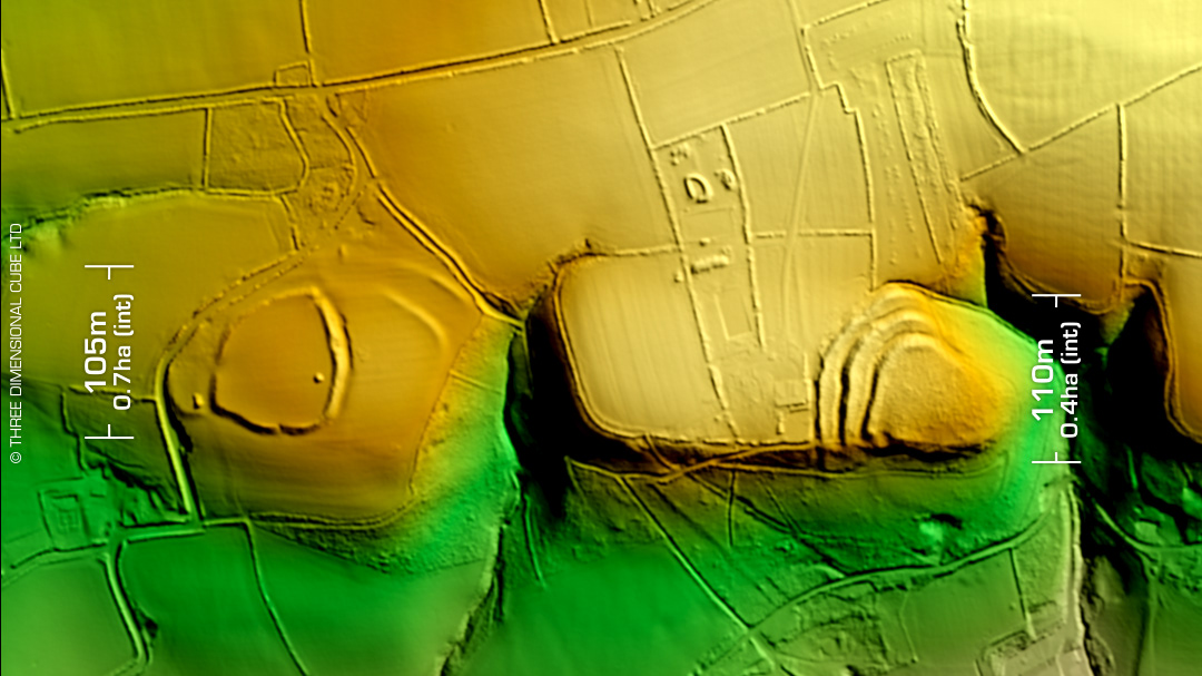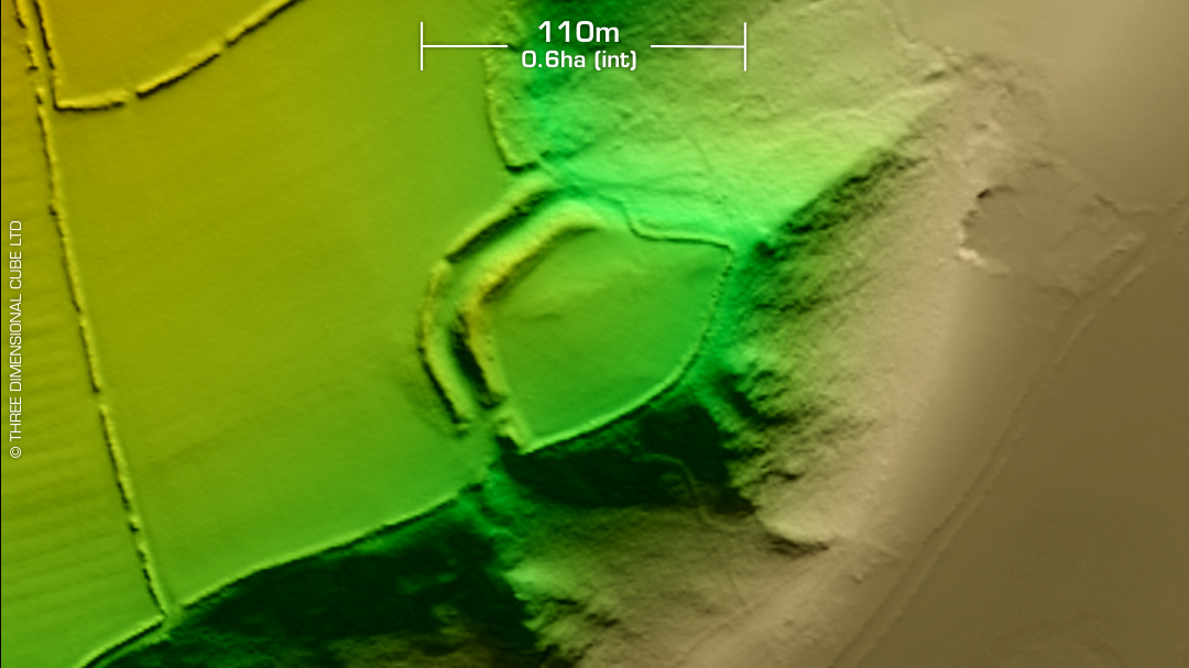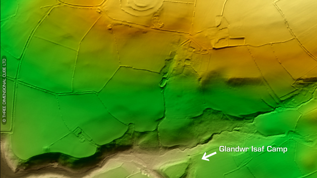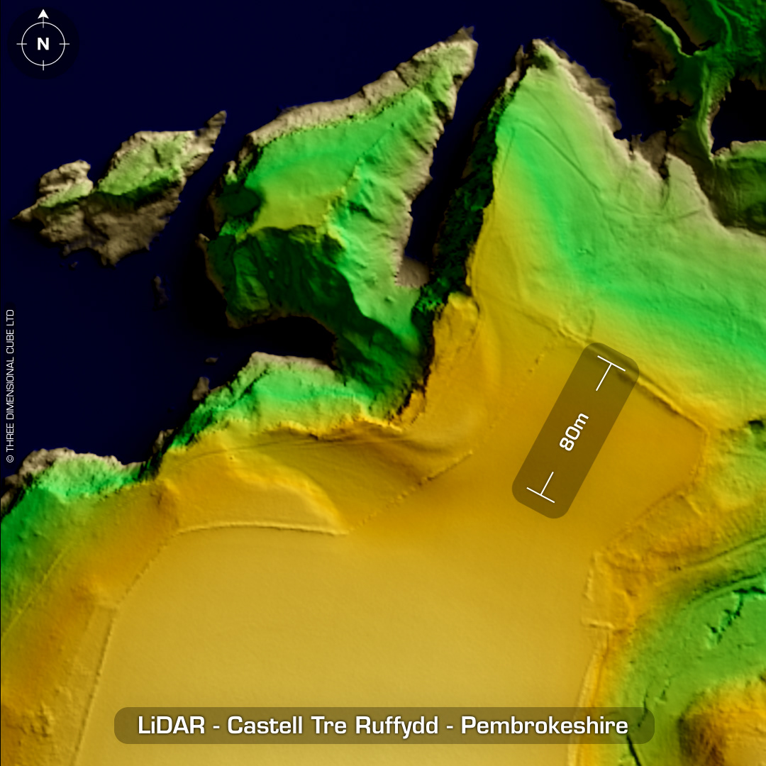

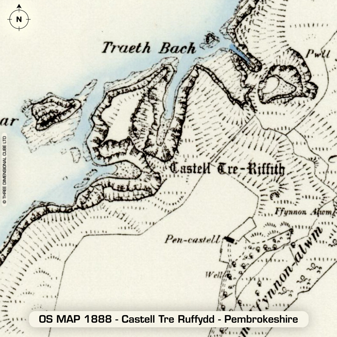
DTM- (Digital Terrain Model, i.e. No buildings or foliage) 1.6km west of the village of Moylgrove lies the severely eroded coastal promontory fort, Castell Tre Ruffydd. (or Treguffith Castle) (This is one of the very few coastal sites visible on Wales HER 1m LiDAR until the maps are updated.) Careg Yspar (Witch's Cauldron) is a collapsed cave leaving a natural arch where the coastal path passes lies directly north of the fort. Possible Roman pot sherd recovered in 1980. Very early description in 1600 by George Owen: 'It appeareth by a wall of stone & a lytell gate as also by the forme and fundacions of some houses or Cottages that it hath bene uses as a place of strength and refuge in tymes past'. The collapse between the isle & mainland only happened just over a hundred years ago as records show people riding between the fort & isle on horseback. The geology of the site has partially enabled its swift erosion; hence it may not exist in 100 year's time. There is a current argument that funds be acquired to excavate the site before its final collapse, but this was proposed in 1996 by G. Williams (UCW Swansea) to no avail. Last site visit in 2007. No recorded excavations or finds, hence undated. (Scheduled monument) Iron Age tribal association (conjecture based on location): Demetae Descriptions from hillforts.arch.ox.ac.uk & Dyfed Archaeological Trust HER. Contains public sector information licensed under the Open Government Licence v3.0.