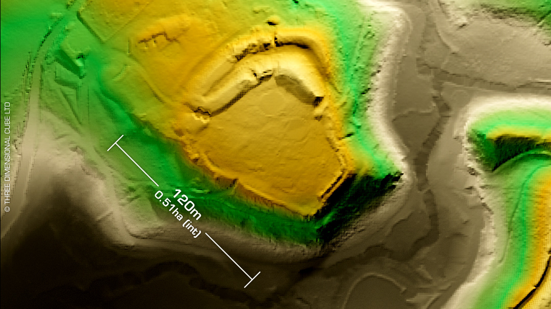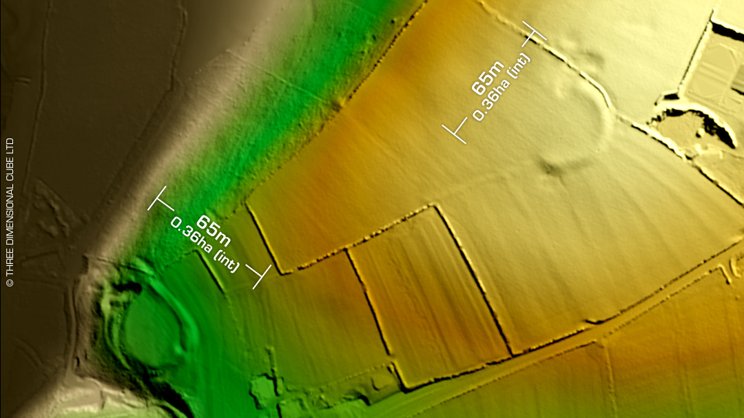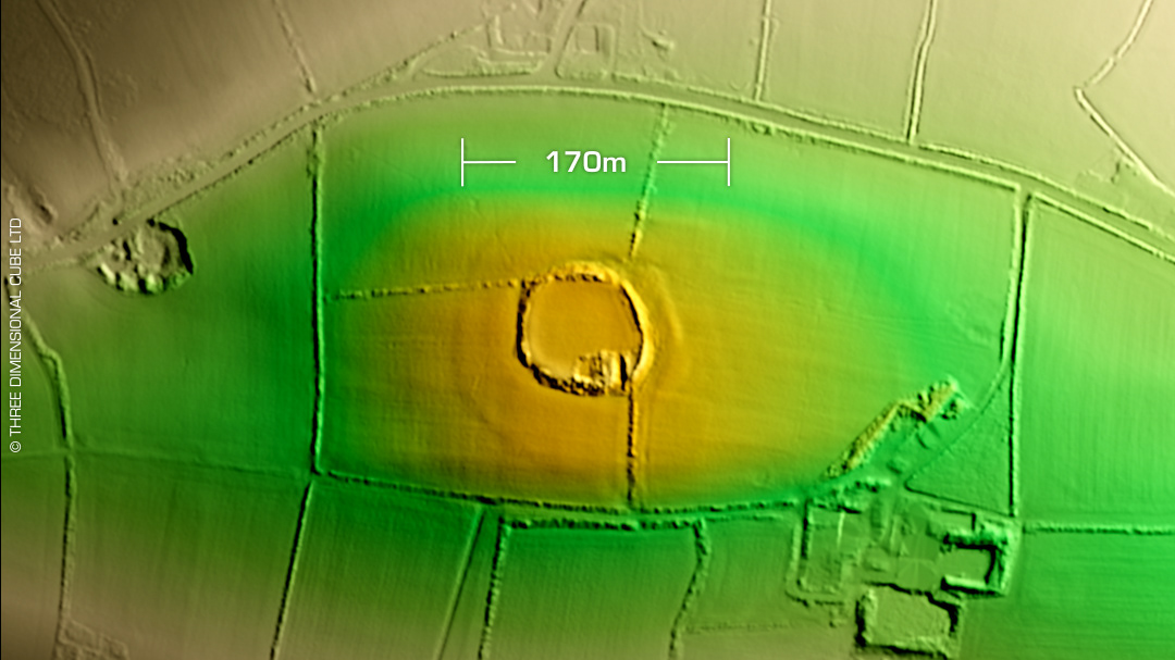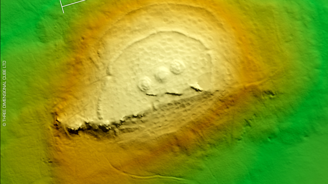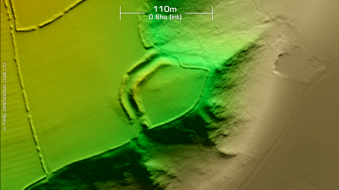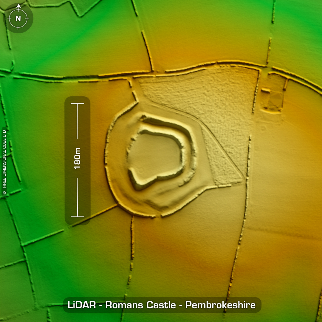

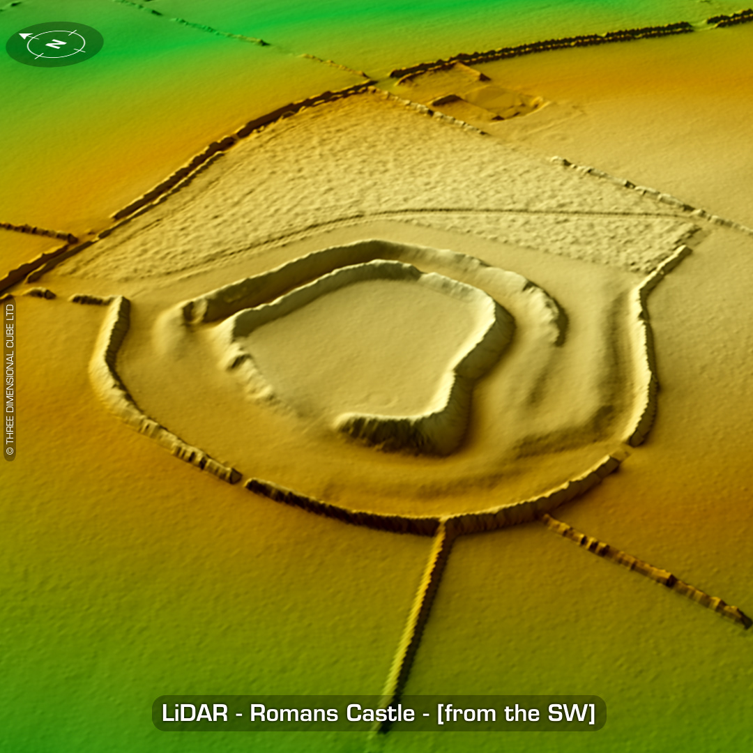
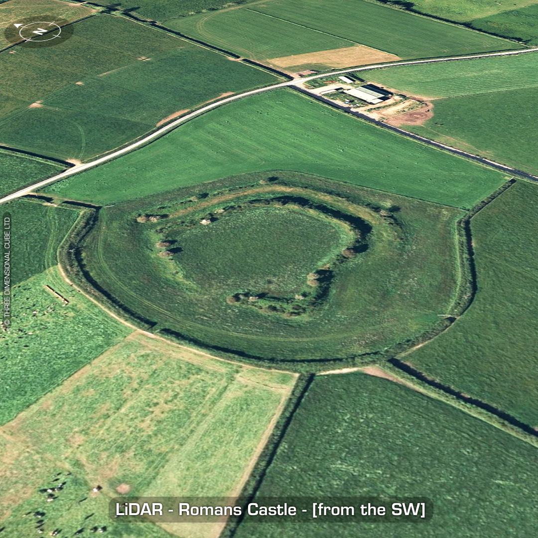

DTM- (Digital Terrain Model, i.e. No buildings or foliage) One kilometre west of the village of Tiers Cross lies the bivallate hillfort, Romans Castle (rath). May have originally been called Ram’s Castle circa 1892AD. Interestingly, on the old OS map, Romans Castle denotes the farm buildings west of the site which are now heavily degraded. Concentric annex. West facing entrance widened for vehicular access. No recorded excavations or finds, hence undated. (Scheduled monument since 2010) Iron Age tribal association (conjecture based on location): Demetae Descriptions from hillforts.arch.ox.ac.uk & Dyfed Archaeological Trust HER. 1st ED OS Mapping via National Library of Scotland. Contains public sector information licensed under the Open Government Licence v3.0.