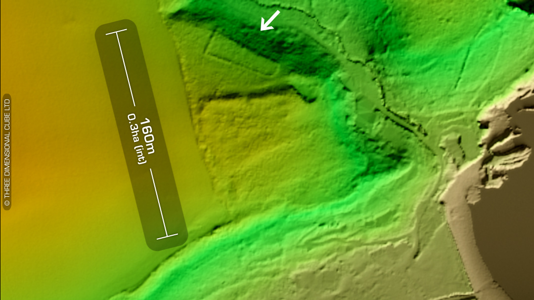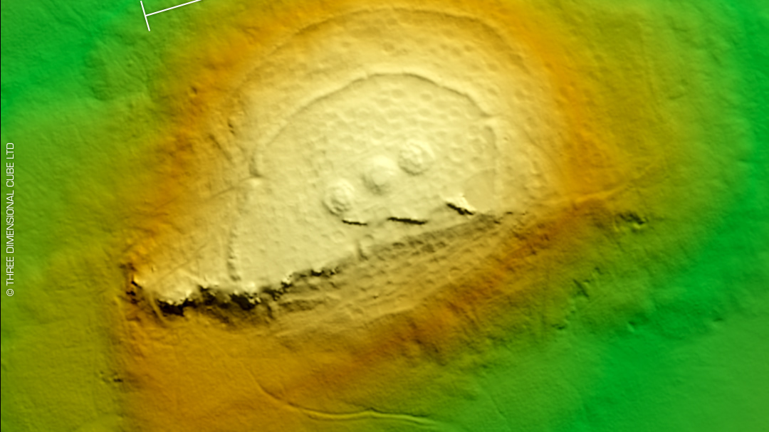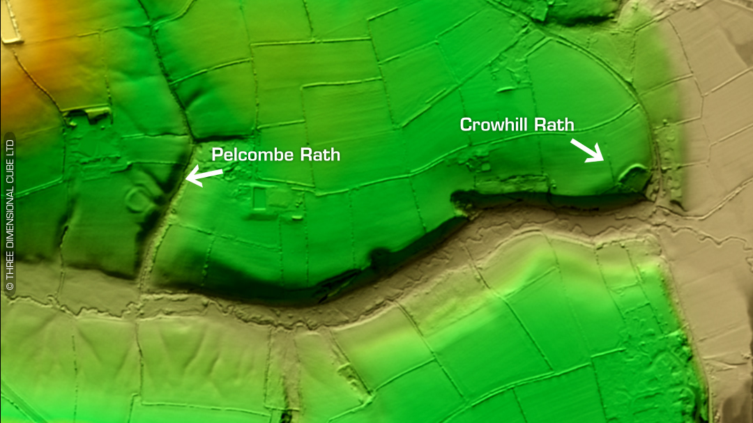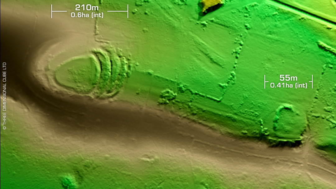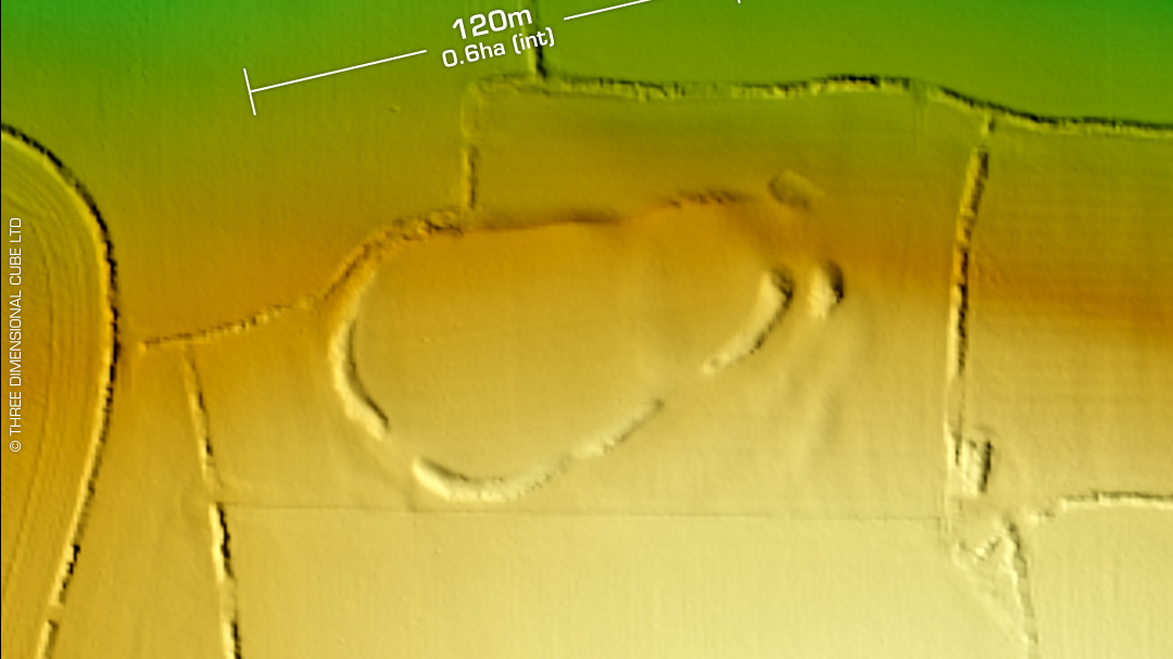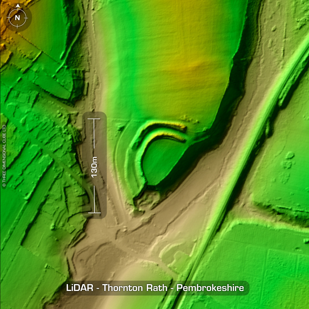
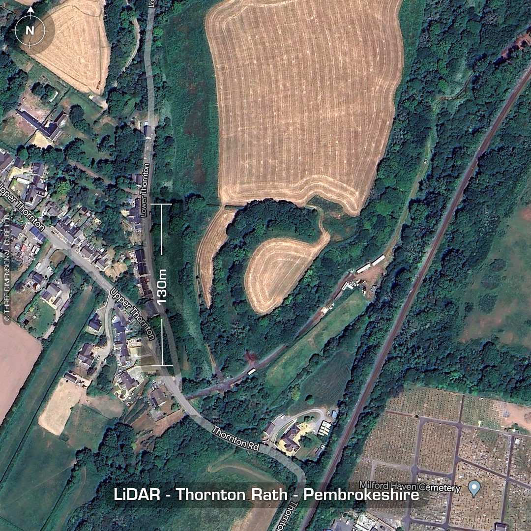
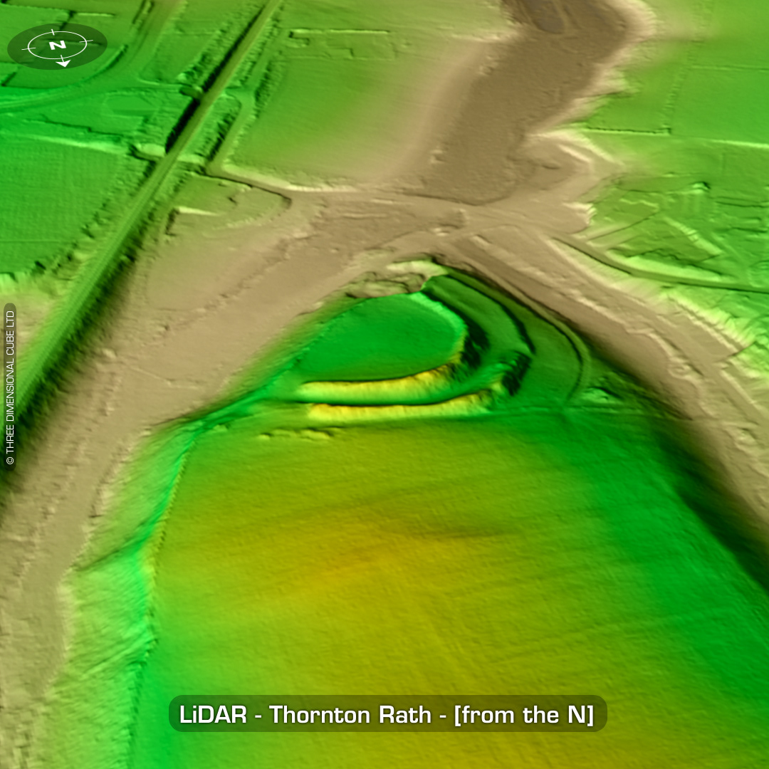

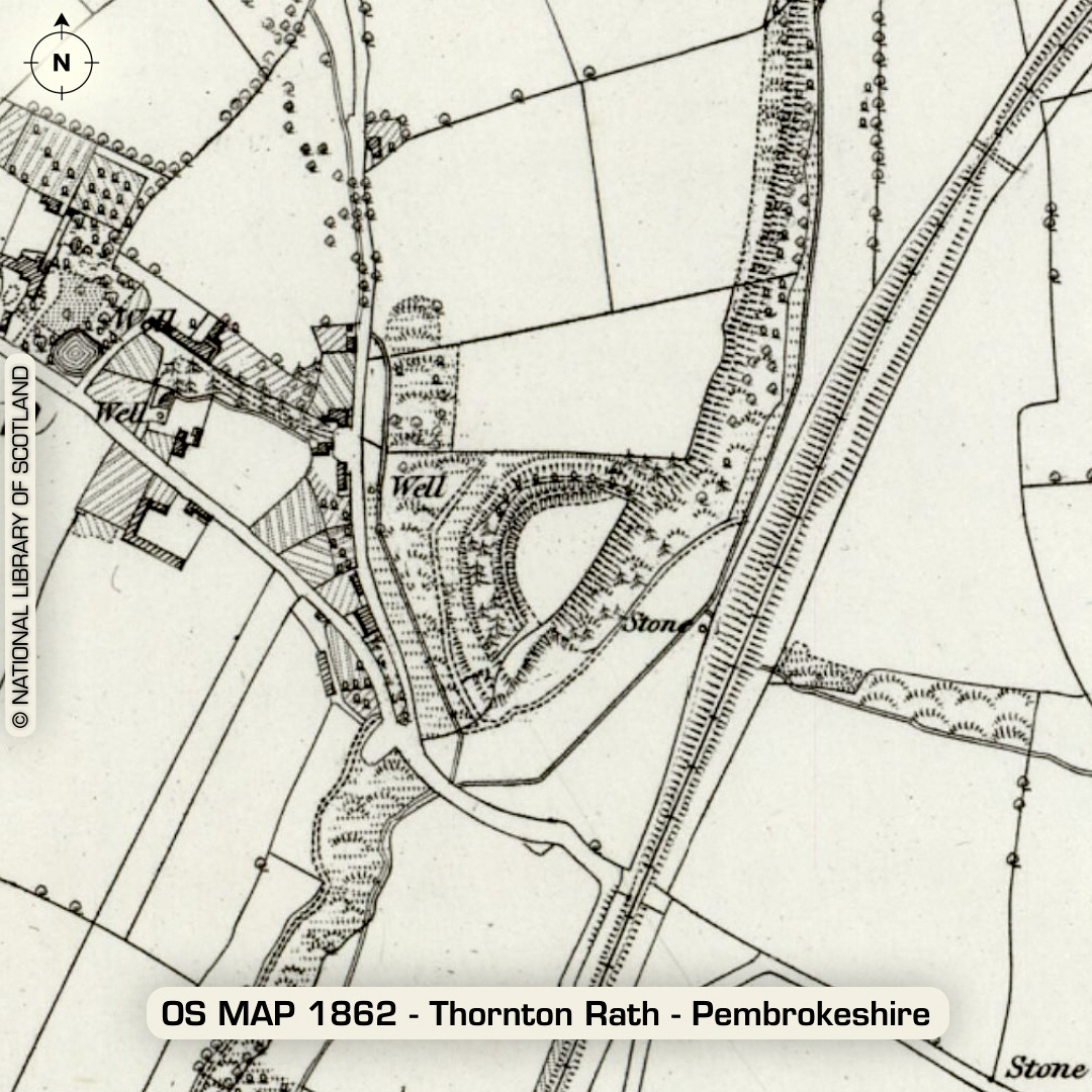
DTM- (Digital Terrain Model, i.e. No buildings or foliage) North of the town of Milford Haven lies the village of Thornton. Overlooking Thornton from the SE lies the bivallate inland promontory fort, Thornton Rath. Rampart damages at NE corner for agricultural access. Interior ploughed-out an in use as farmland whilst defences covered in woodland. As you can see, its not listed as a Rath on the old OS Map. Whether the standing stone marked on the OS map is still extant is unknown. No recorded excavations or finds, hence undated. (Scheduled monument) Iron Age tribal association (conjecture based on location): Demetae Descriptions from hillforts.arch.ox.ac.uk & Dyfed Archaeological Trust HER. 1st ED OS Mapping via National Library of Scotland. Contains public sector information licensed under the Open Government Licence v3.0.