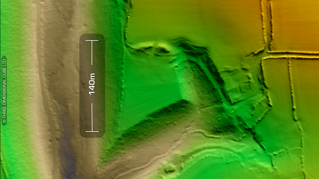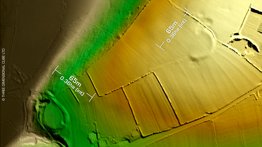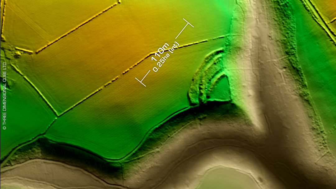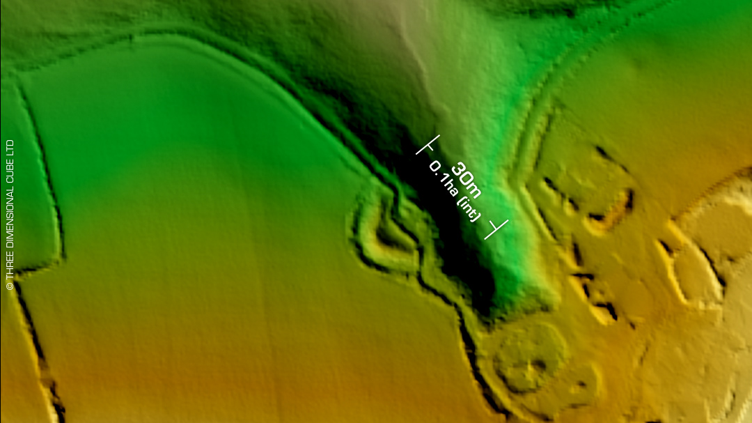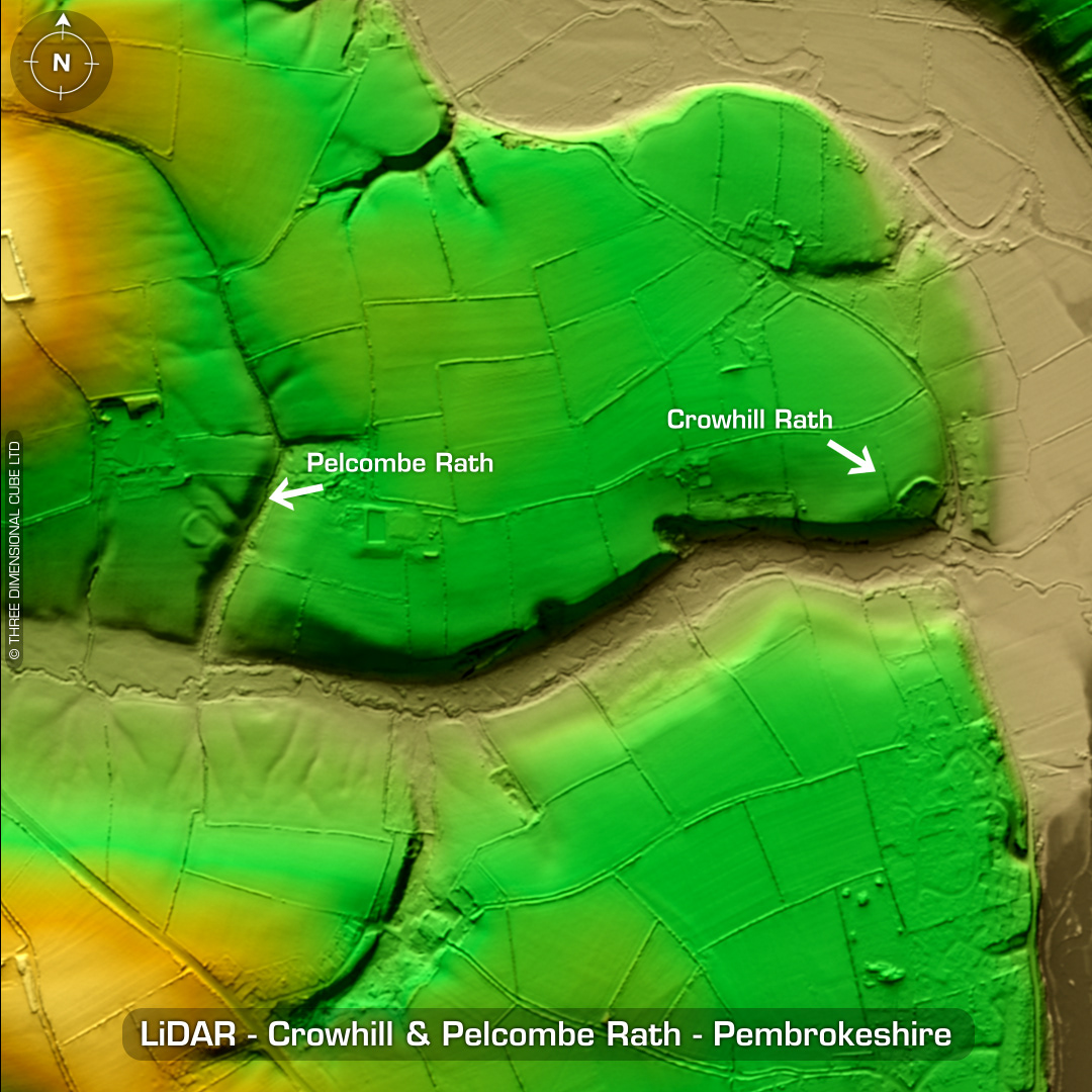
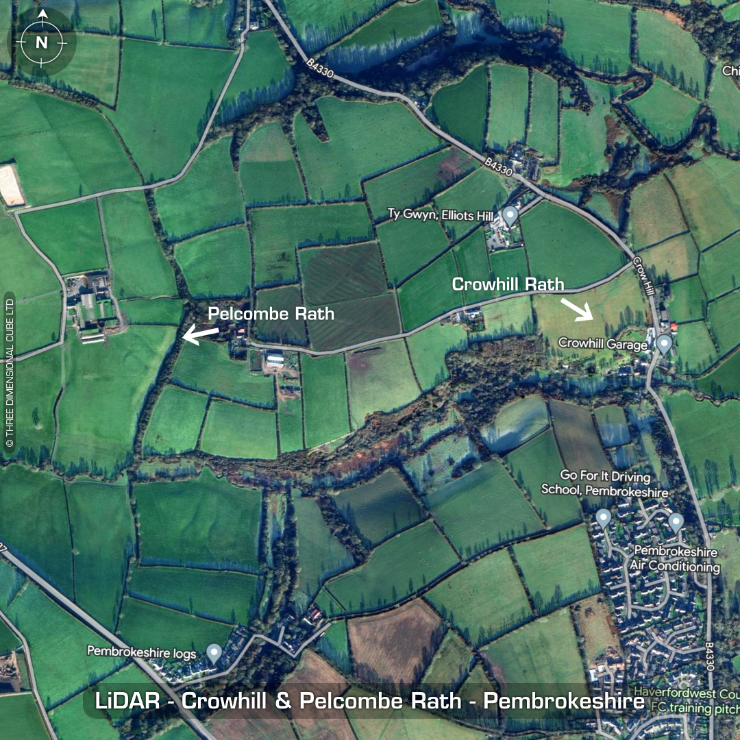
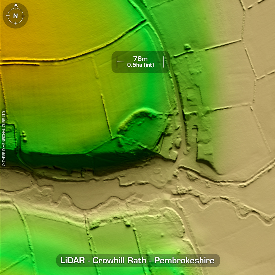
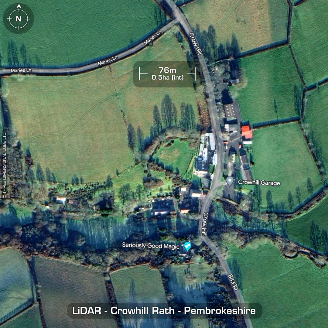
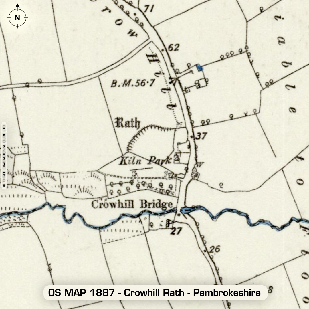
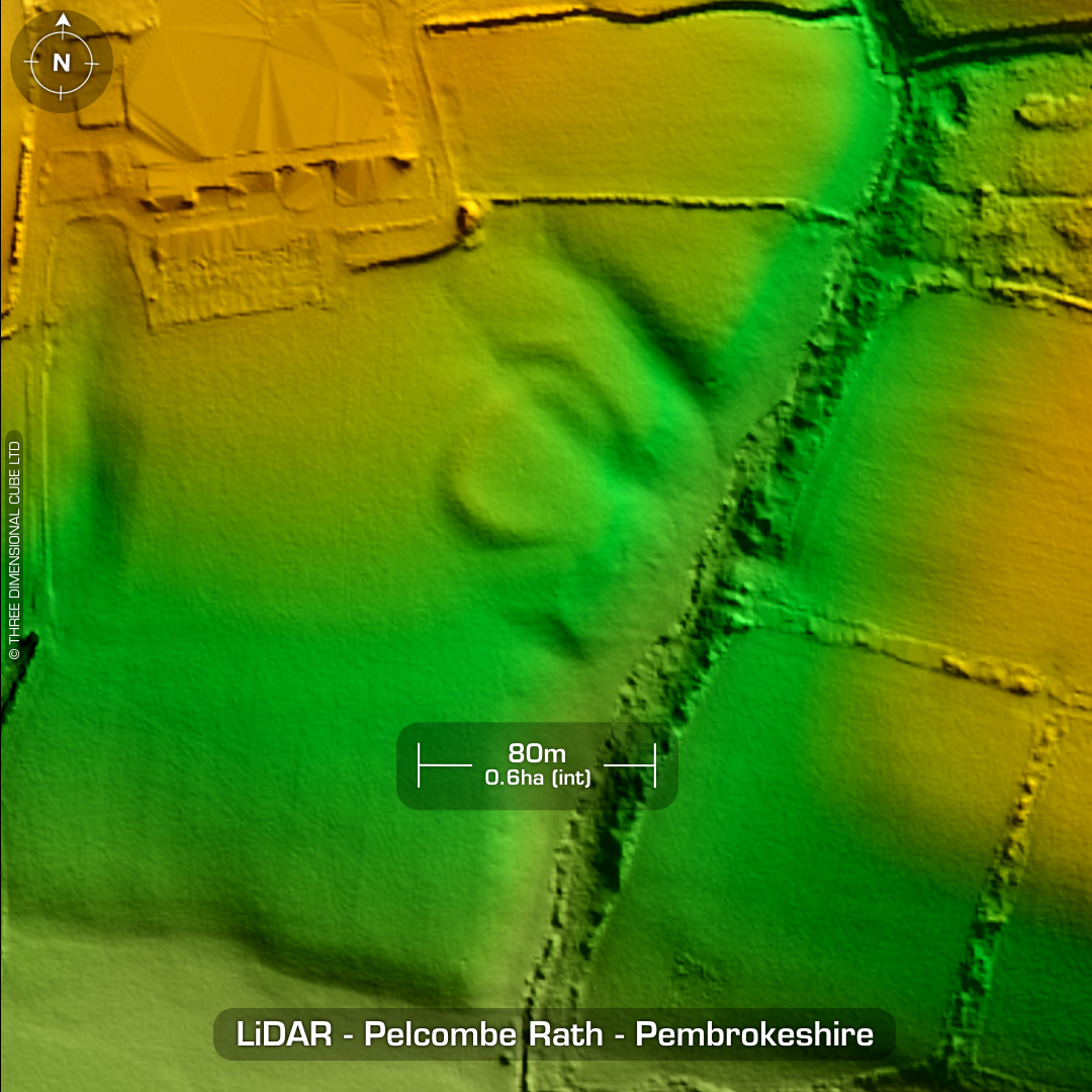
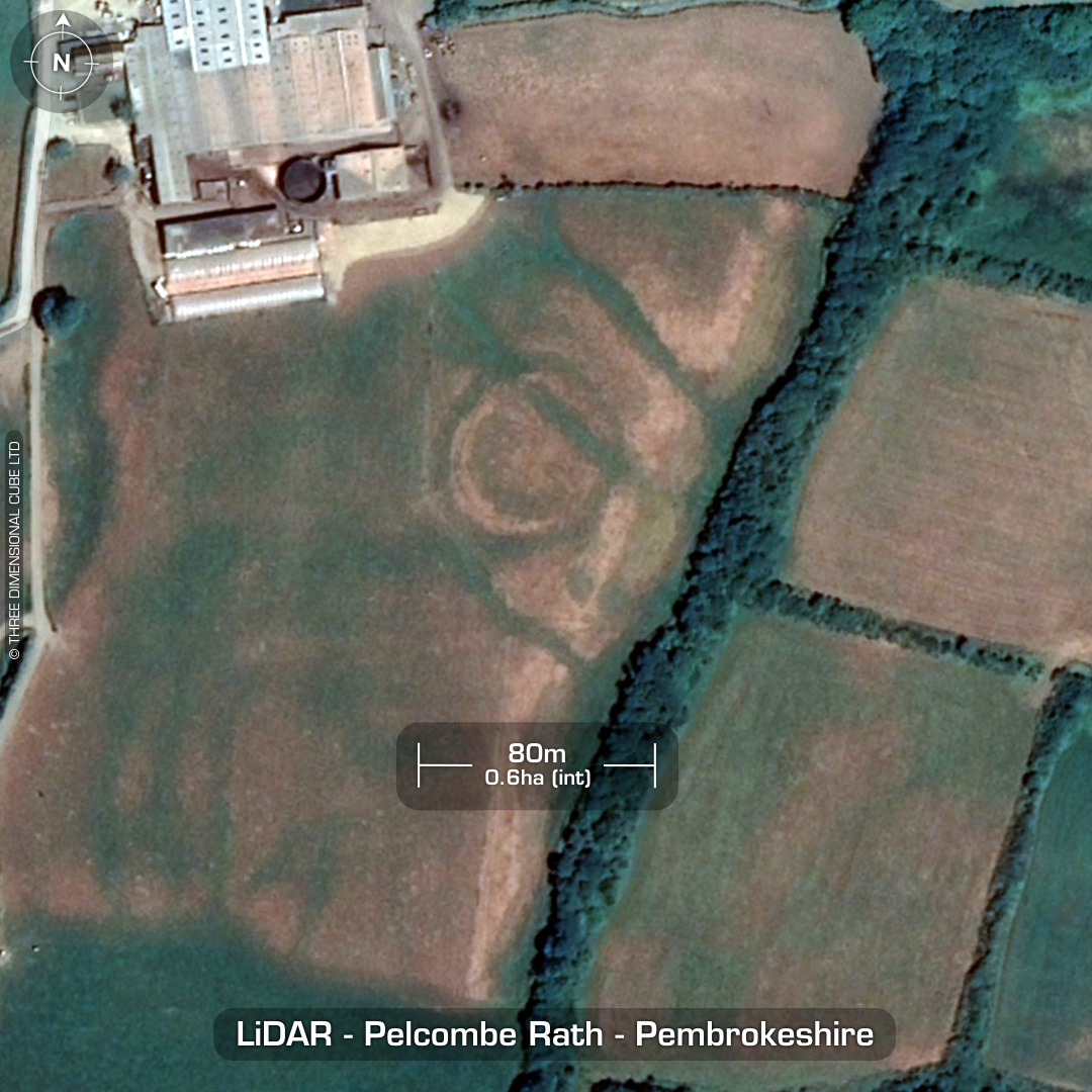
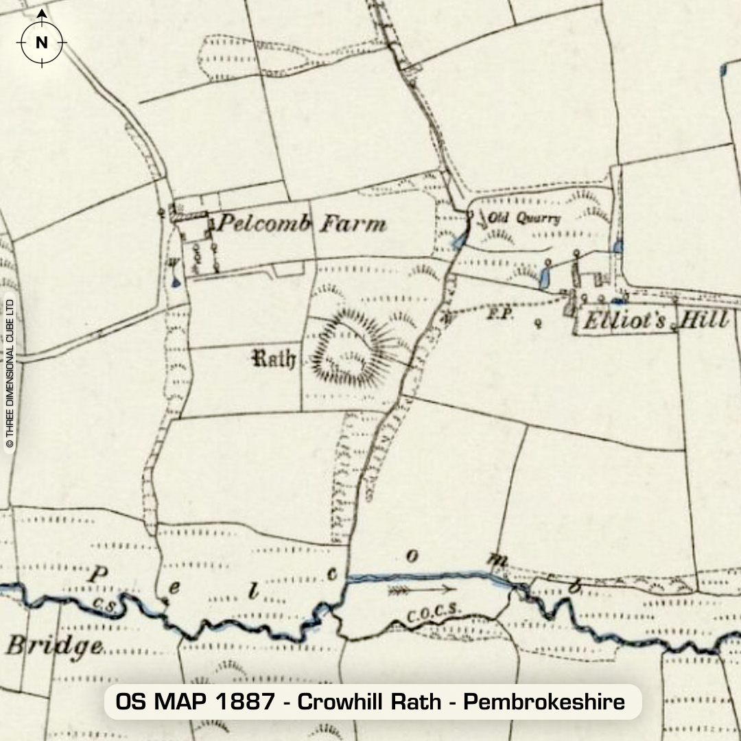
DTM- (Digital Terrain Model, i.e. No buildings or foliage) North of the town, Haverfordwest lie two 'Rath's' (enclosures). The first, overlooking Crow Hill road (B4330) from the west is Crowhill Rath, which is a univallate inland promontory fort whose curved ramparts crops off the promontory. Earliest reference on 1st ED OS Map. Directly west of Crowhill Rath sits Pelcombe Rath, which is not recorded as a hillfort but a univallate defended enclosure, but I included it as it was on the same LiDAR tile as Crowhill Rath. Heavily degraded by ploughing. Site visible as a cropmark in dry conditions. Earliest reference on 1st ED OS Map. No recorded finds or excavations, hence undated. (Scheduled monuments) Iron Age tribal association (conjecture based on location): Demetae Descriptions from hillforts.arch.ox.ac.uk & Dyfed Archaeological Trust HER. Contains public sector information licensed under the Open Government Licence v3.0.