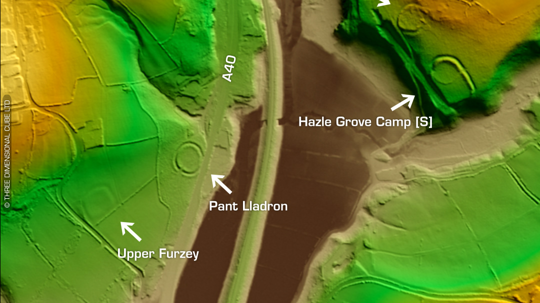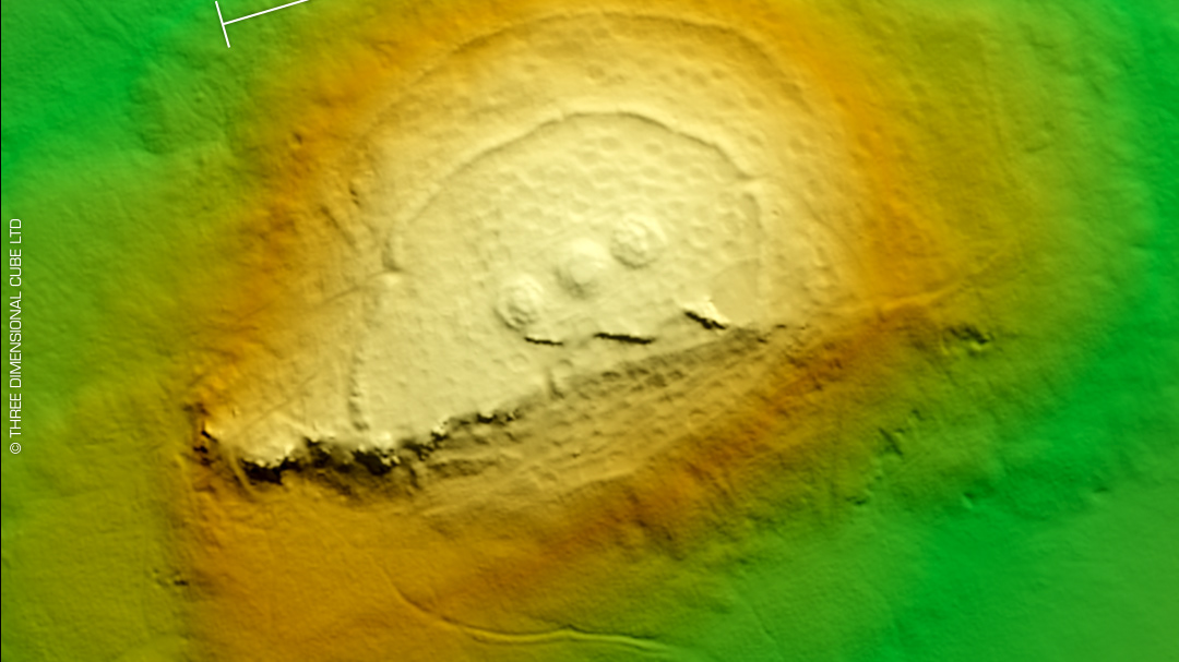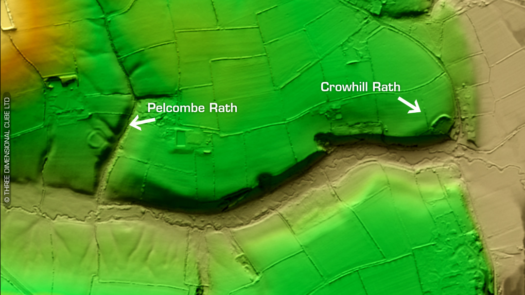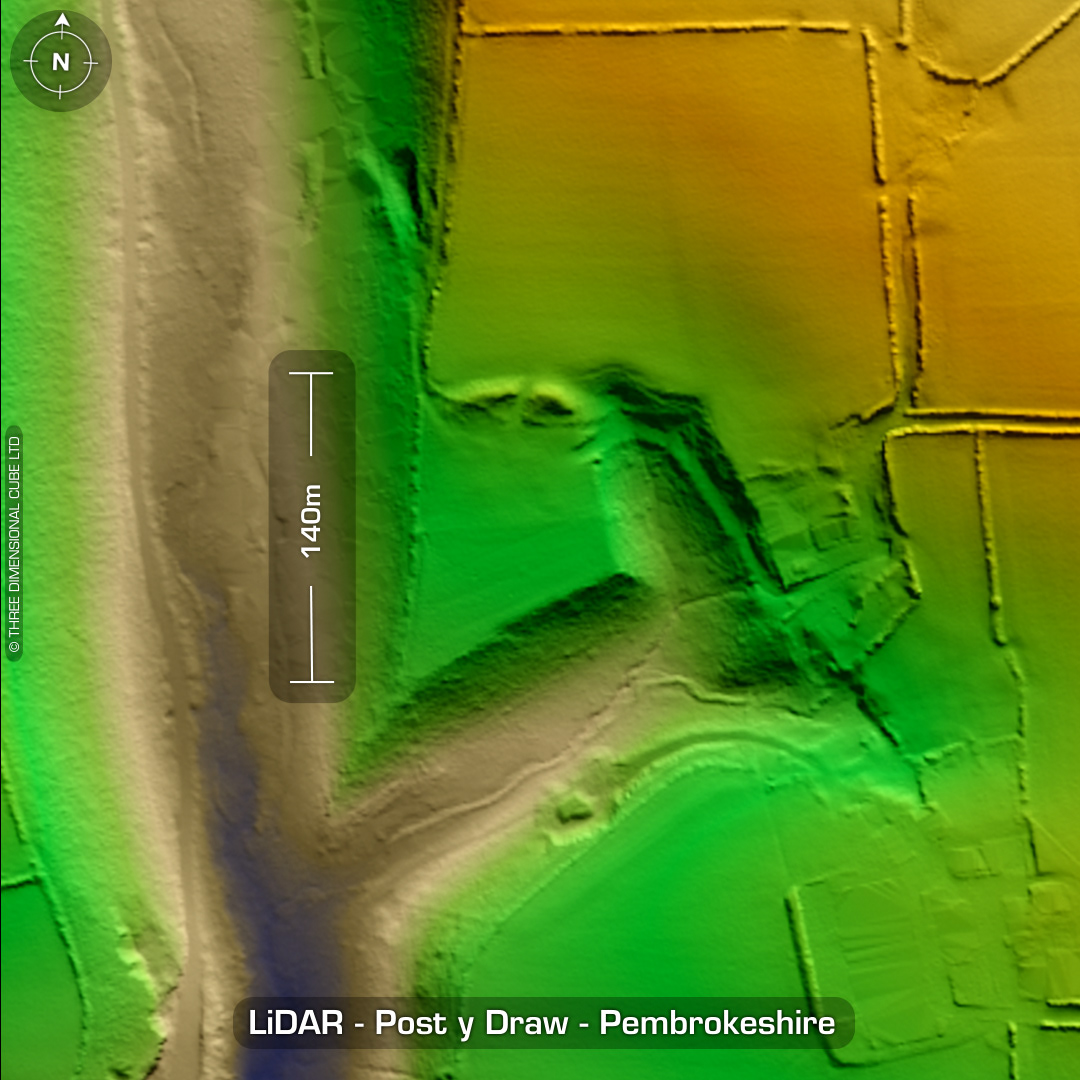
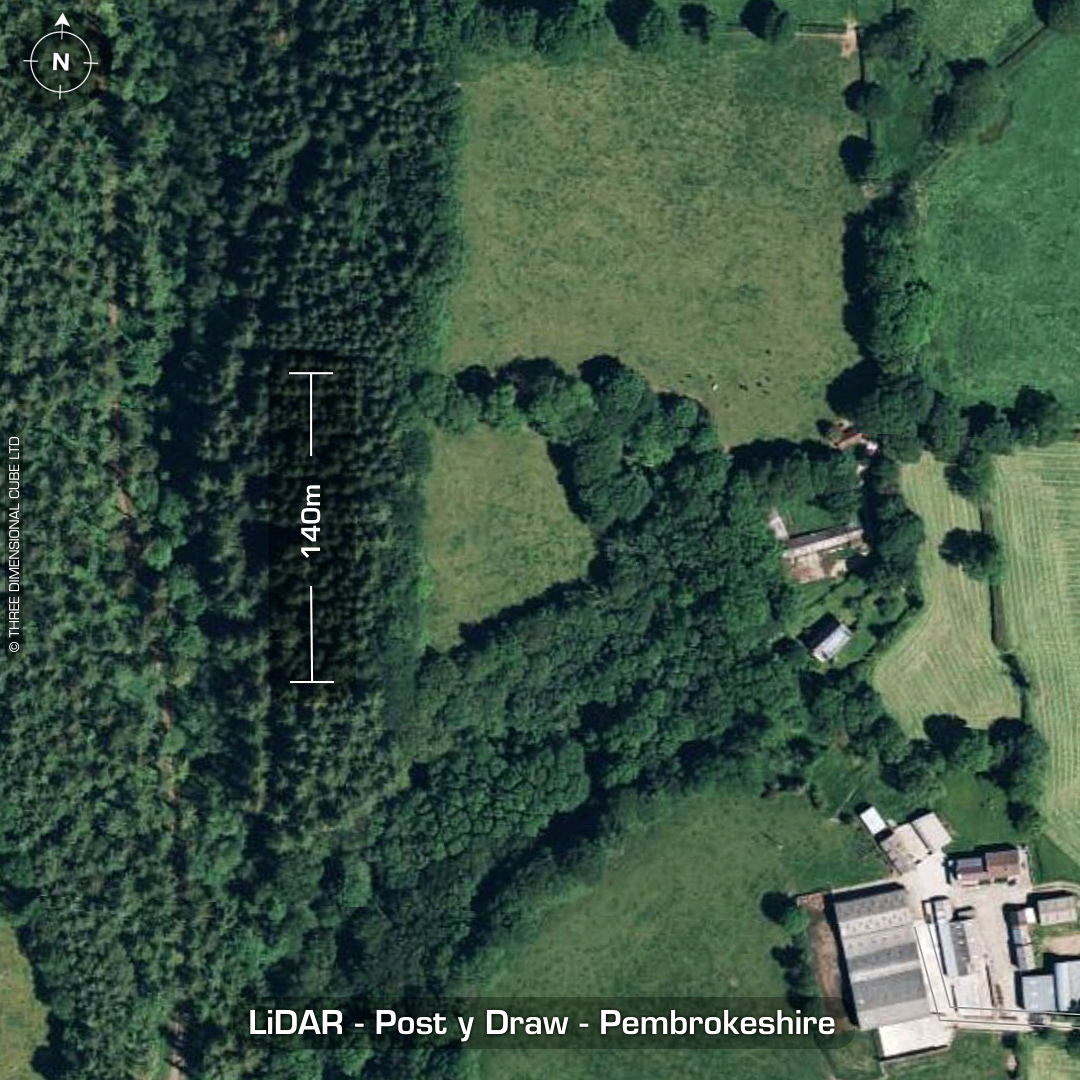
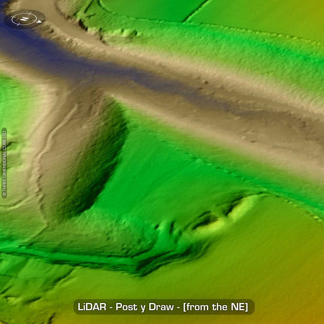
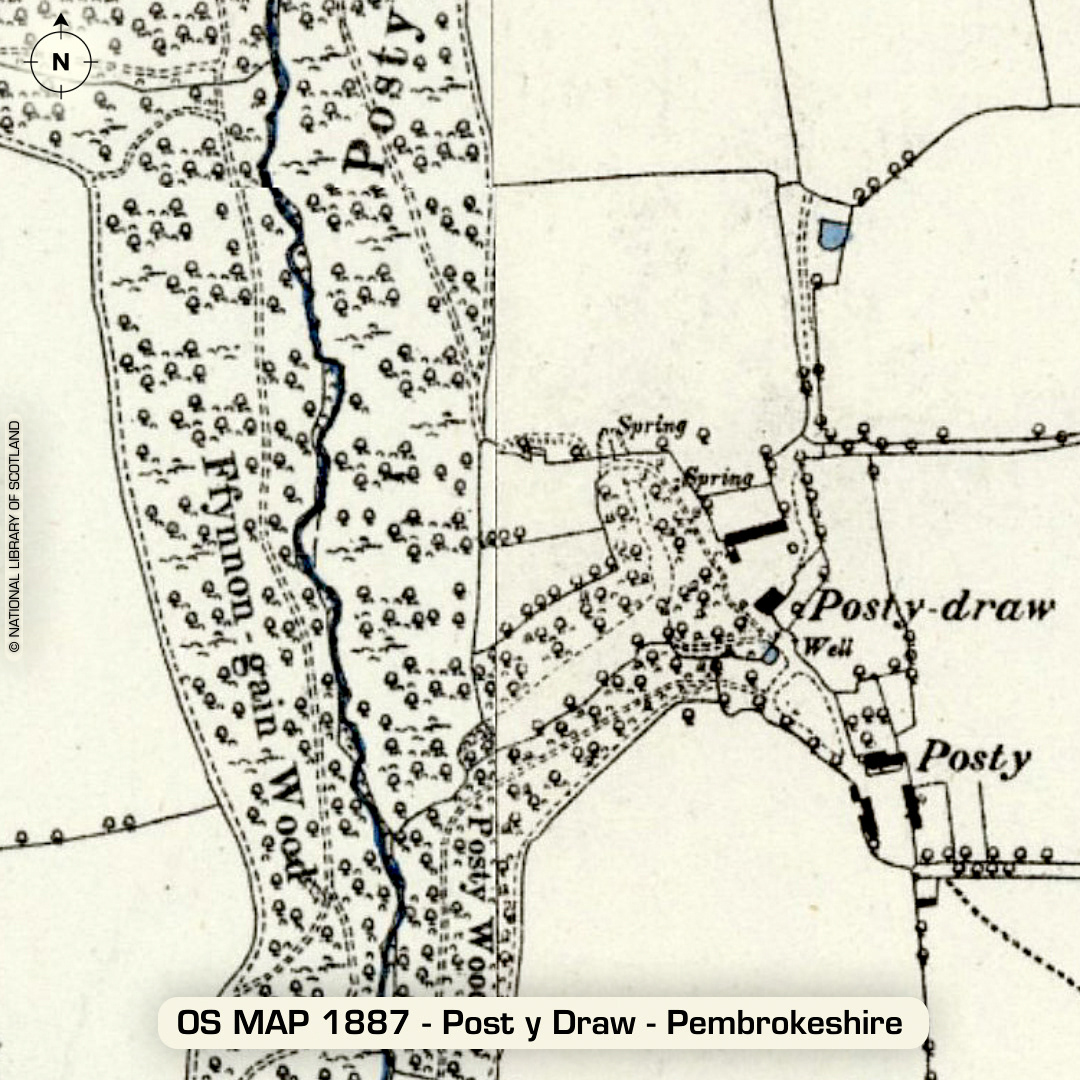
DTM- (Digital Terrain Model, i.e. No buildings or foliage) Eight hundred meters NNW of the village of Pen-ffordd and surrounded by woodland lies the inland promontory fort, Post y Draw (named after the farm & woods). Rampart 65m long. Possible original entrance to the west. The banks centre-cut made circa turn of 20th century for access to the land for farming. Mind you, on its eastern side you can see on the LiDAR the road cut into the side, south of the rampart curving back round to the farm. Earliest record in 1925. (RCAHM) No recorded excavations or finds, hence undated. (Scheduled monument since 2010) Iron Age tribal association (conjecture based on location): Demetae Descriptions from hillforts.arch.ox.ac.uk & Dyfed Archaeological Trust HER. 1st ED OS Mapping via National Library of Scotland. Contains public sector information licensed under the Open Government Licence v3.0.