![Y Gaer Bridell pembrokeshire iron age hillfort lidar](https://cdn.myportfolio.com/c078a863-8aa5-43c2-a09f-780e93205fb8/3bc0a6af-d44e-4c31-a671-6fa8fb5cee4c_rw_1200.jpg?h=b9b8ceb014e3c099f61d38f1e22c0917)
![](https://cdn.myportfolio.com/c078a863-8aa5-43c2-a09f-780e93205fb8/f09defa0-62cd-4e8b-bc5f-0507dce5032e_rw_1200.jpg?h=e3650e26bf6c63af43823f74946881b0)
![](https://cdn.myportfolio.com/c078a863-8aa5-43c2-a09f-780e93205fb8/2c1f2030-00b9-4345-b850-0277d3f638c3_rw_1200.jpg?h=ab1dac9f0a9cedac39166bb5e06ed794)
![](https://cdn.myportfolio.com/c078a863-8aa5-43c2-a09f-780e93205fb8/895d115b-4435-42b8-a26c-291843bf784c_rw_1200.jpg?h=28483637192e14aeda2835c65b286496)
![](https://cdn.myportfolio.com/c078a863-8aa5-43c2-a09f-780e93205fb8/23477fa5-03d8-408a-a8d8-67507d3a7418_rw_1200.jpg?h=0ed120417419f106b5206acb8e97e092)
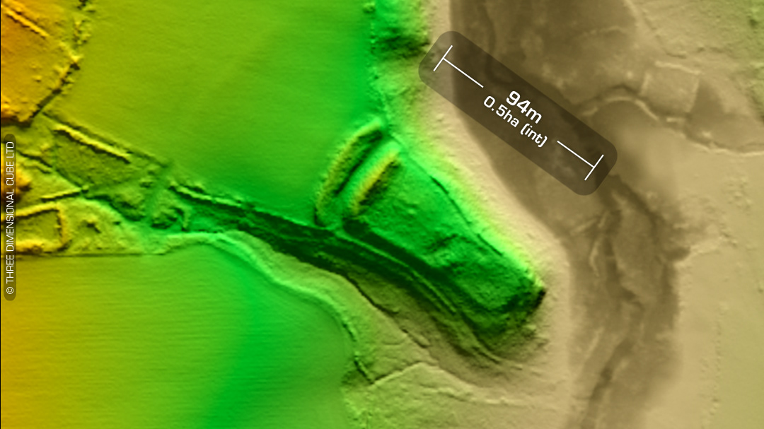
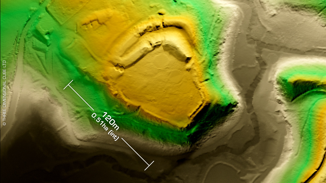
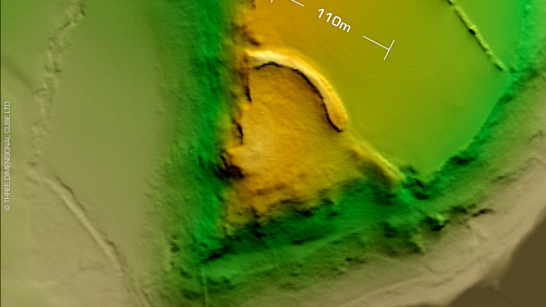
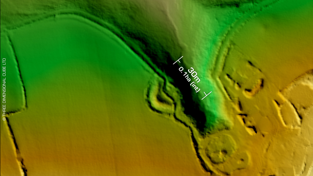
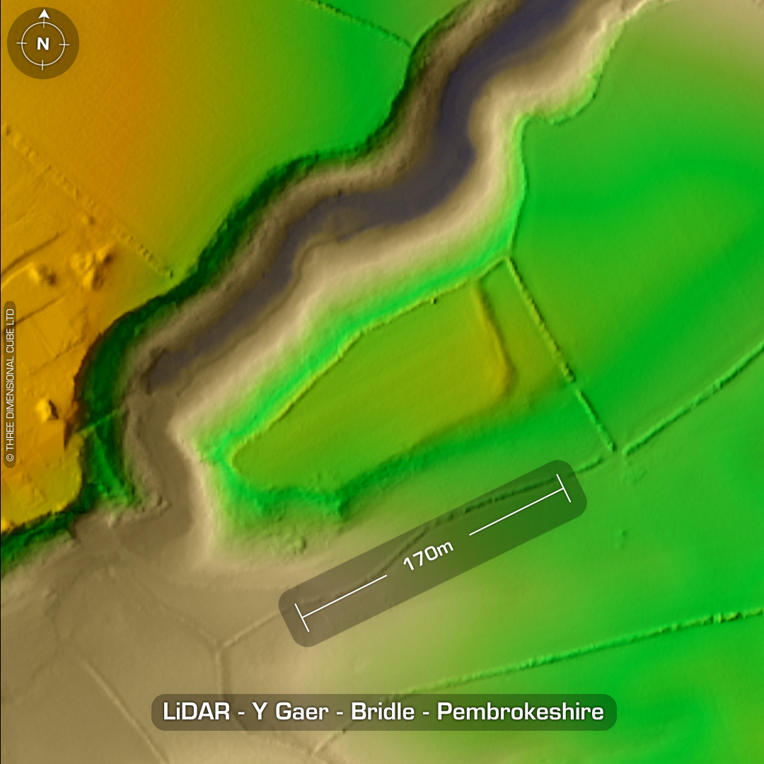
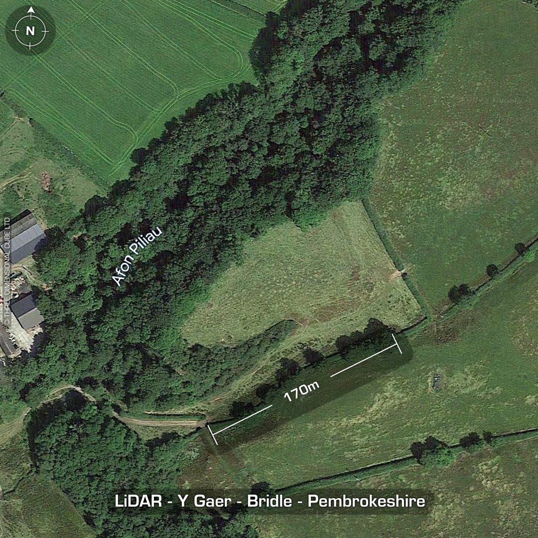
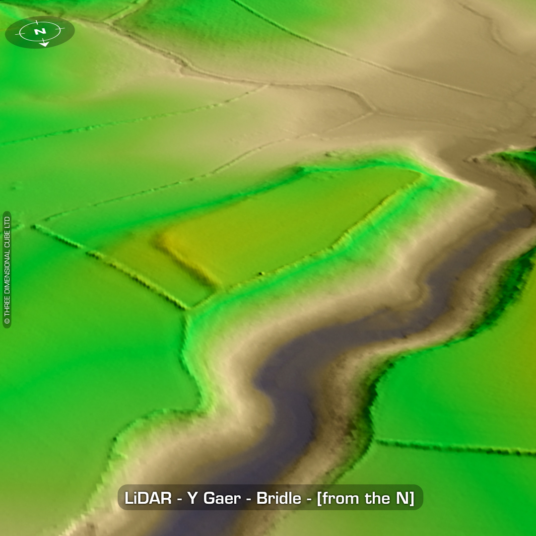
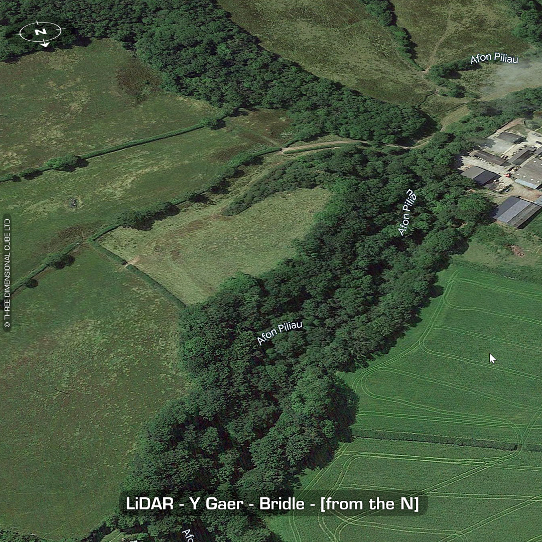
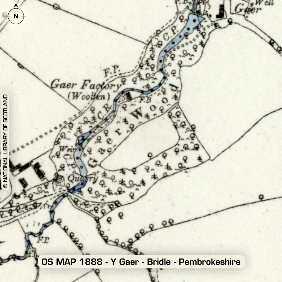
DTM- (Digital Terrain Model, i.e. No buildings or foliage) Just to the southwest of the village of Pen-y-bryn lies the inland promontory fort, Y Gaer. Rampart is now 1.2m high & was 1.7m high in 1974 so it’s been degraded by ploughing in the last few decades. First written record in 1925. As you can see it wasn’t listed on the old OS map. No recorded excavations or finds, hence undated. (Scheduled monument) Iron Age tribal association (conjecture based on location): Demetae Descriptions from hillforts.arch.ox.ac.uk & Dyfed Archaeological Trust HER. 1st ED OS Mapping via National Library of Scotland. Contains public sector information licensed under the Open Government Licence v3.0.