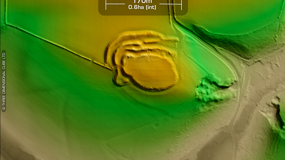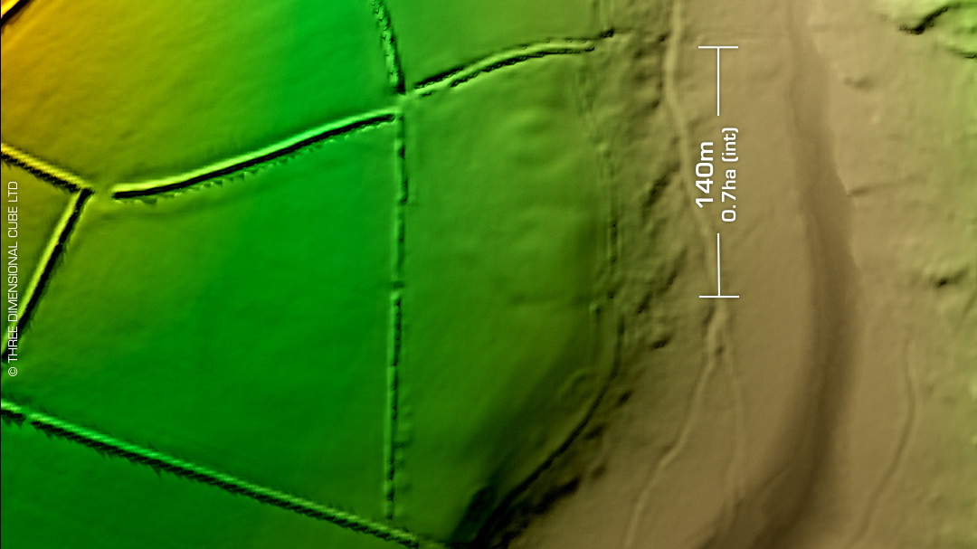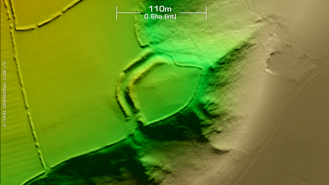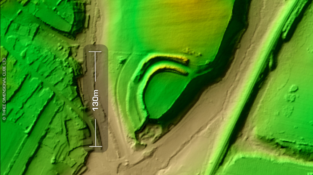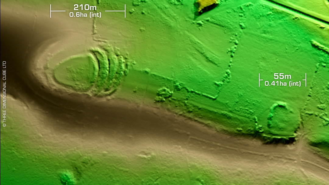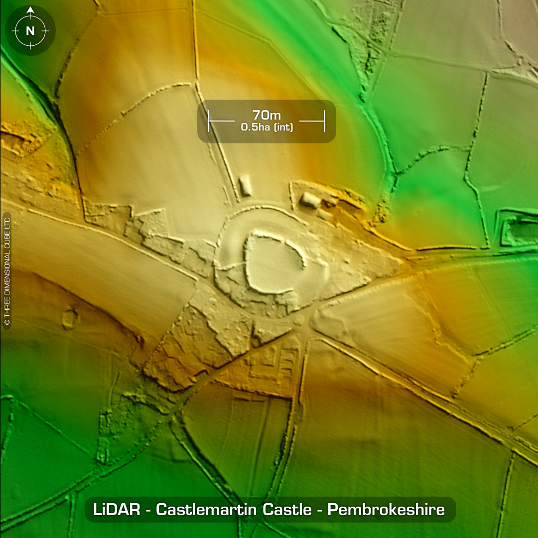
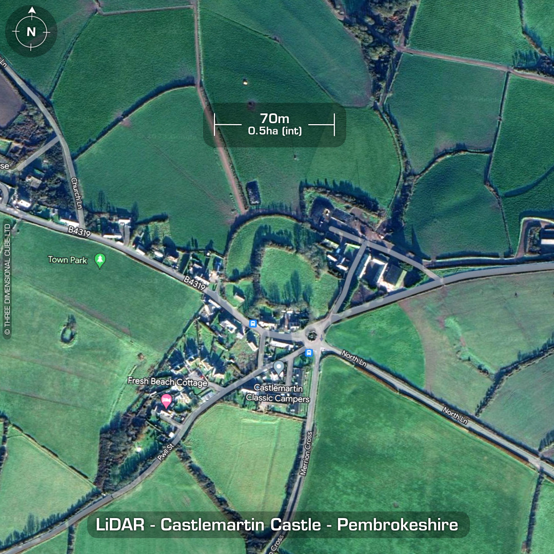
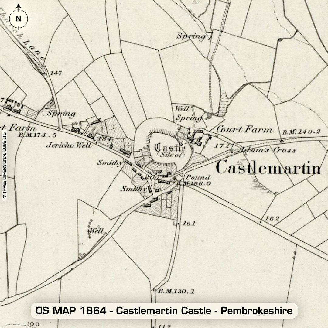
DTM- (Digital Terrain Model, i.e. No buildings or foliage) The village of Castlemartin is bisected by the B4319, which runs below the bivallate contour hillfort of the same name. Earthwork given its name to 'A Hundred' (County division). Who Martin was is unknown, but unlikely to be 'Martin of the Towers' who conquered North Pembrokeshire. Originally thought a medieval site but morphology suggests Iron Age enclosure. Possibly modified by the Normans and fortified with a palisade making it the earliest form of Norman castle in Pembrokeshire. (Not stone & mortar) Heavily degraded by ploughing. Military installation on north edge. No recorded finds or excavations, hence undated. (Scheduled monument) Iron Age tribal association (conjecture based on location): Demetae Descriptions from hillforts.arch.ox.ac.uk & Dyfed Archaeological Trust HER. Contains public sector information licensed under the Open Government Licence v3.0.