![rudbaxton rath iron age hillfort lidar pembrokeshire](https://cdn.myportfolio.com/c078a863-8aa5-43c2-a09f-780e93205fb8/a25efbd7-4cb2-4935-9c41-c3bf9dc62e18_rw_1200.jpg?h=52dc461b17b7863b757c811bb80ef84a)
![](https://cdn.myportfolio.com/c078a863-8aa5-43c2-a09f-780e93205fb8/7dcb6b7c-2deb-4892-8ce8-1c8eadb1e621_rw_1200.jpg?h=b07c3ad5deb90c0813e40226ada170ac)
![](https://cdn.myportfolio.com/c078a863-8aa5-43c2-a09f-780e93205fb8/e063d51c-6a5b-4736-af5a-7552b28424c5_rw_1200.jpg?h=fad3a33af7f72d2215886091df33919e)
![](https://cdn.myportfolio.com/c078a863-8aa5-43c2-a09f-780e93205fb8/55864da5-7272-47c9-8f69-12c1edd4da61_rw_1200.jpg?h=6c306c3cfdd8d15b1bec5d597f510f39)
![](https://cdn.myportfolio.com/c078a863-8aa5-43c2-a09f-780e93205fb8/b0abfac9-1d43-479a-adef-03450796d7f2_rw_1200.jpg?h=917389e37ef3b861db2642b2d81d891b)
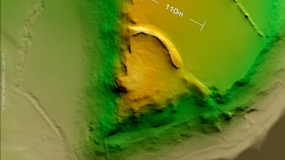
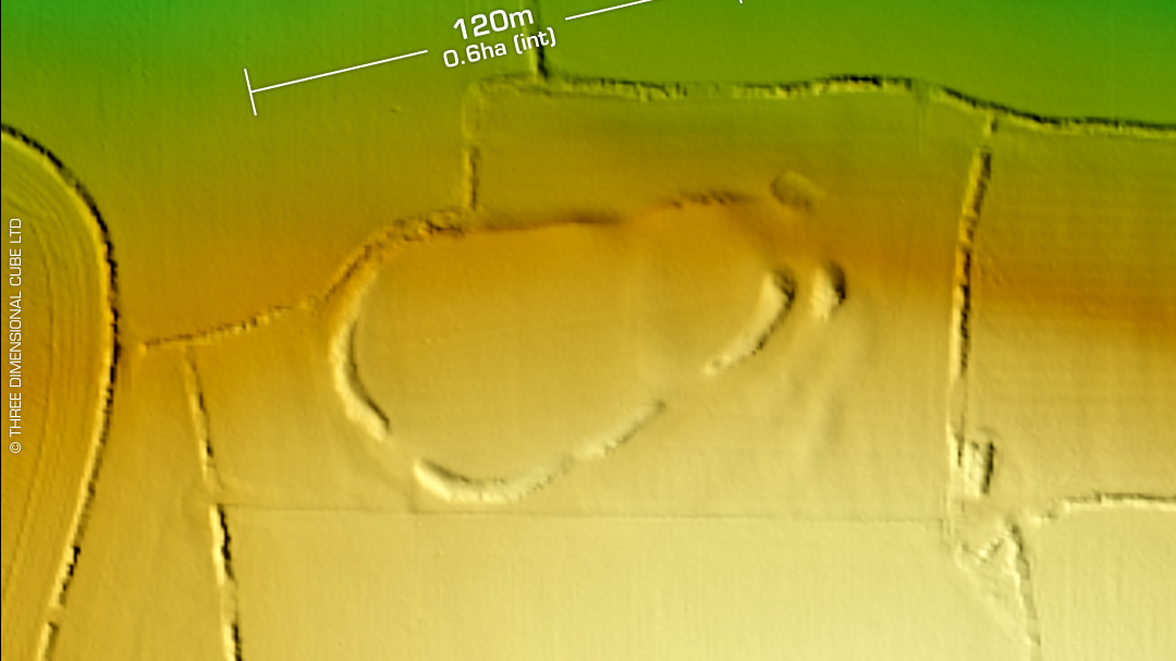
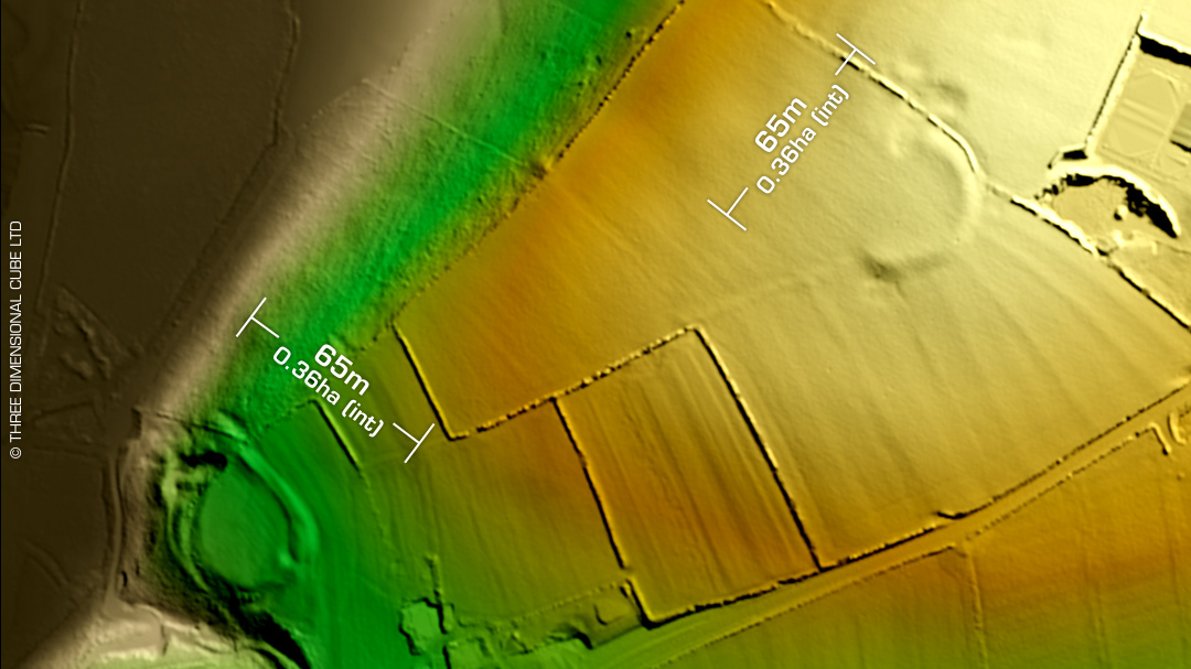
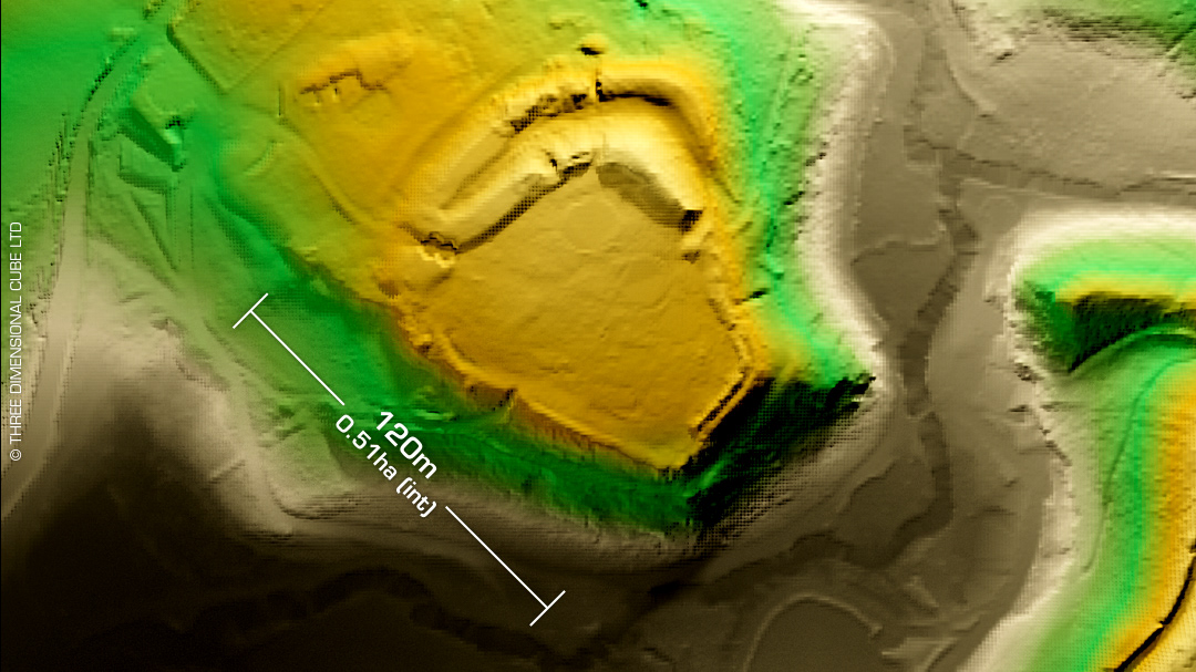
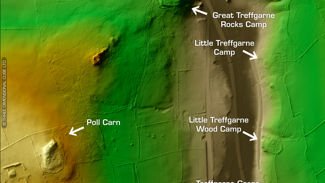
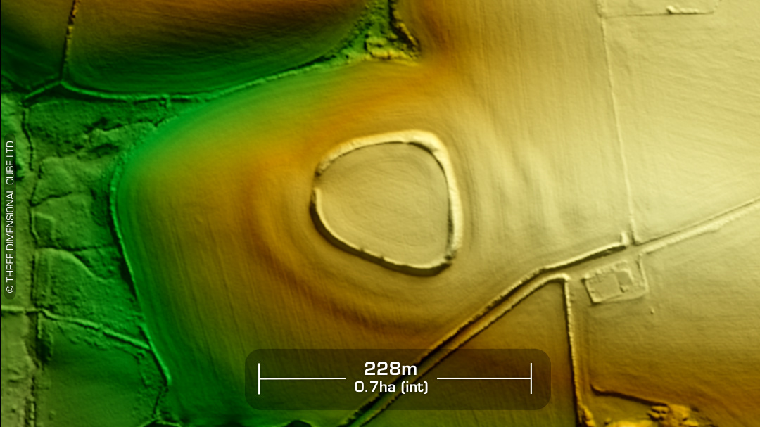
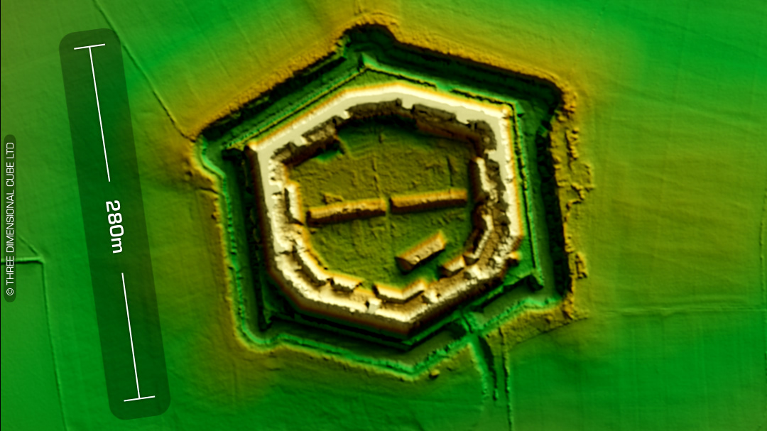
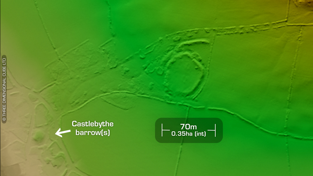
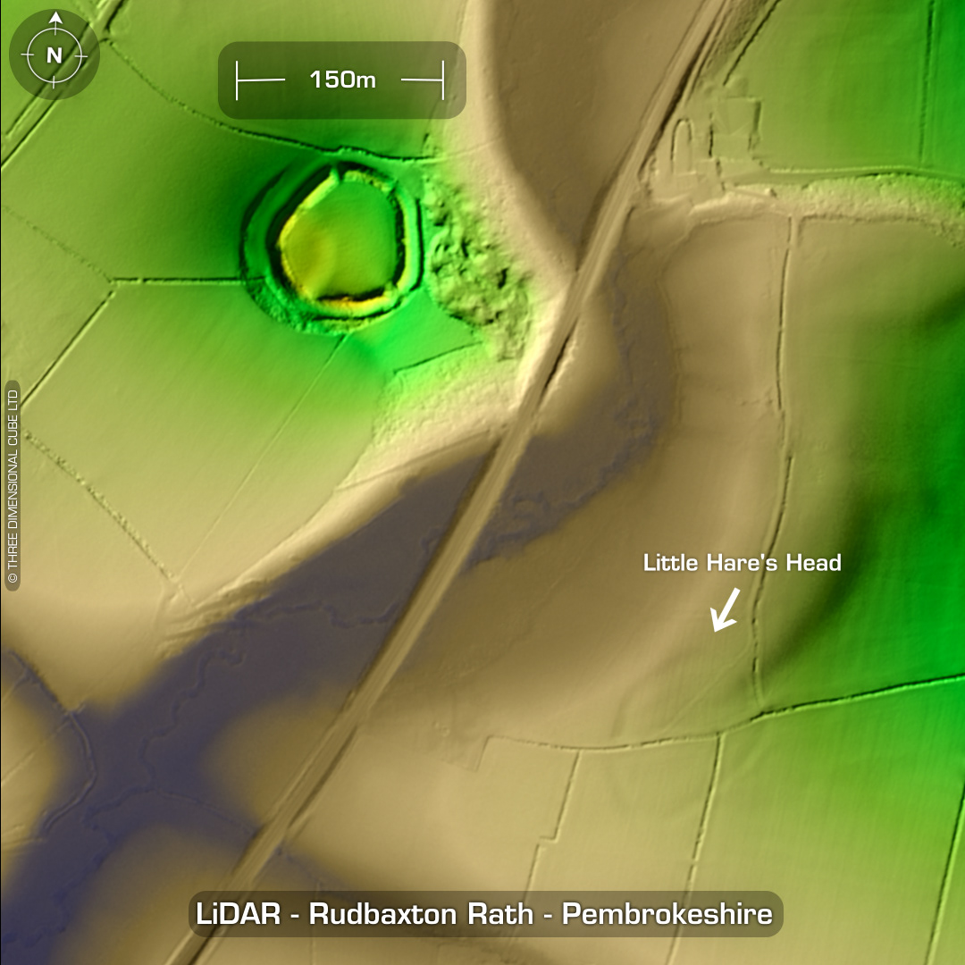
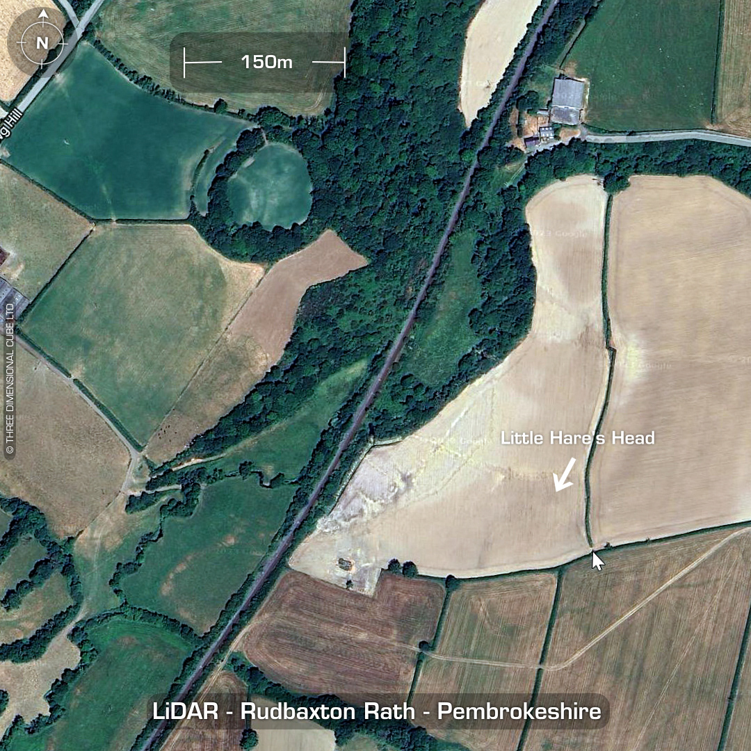
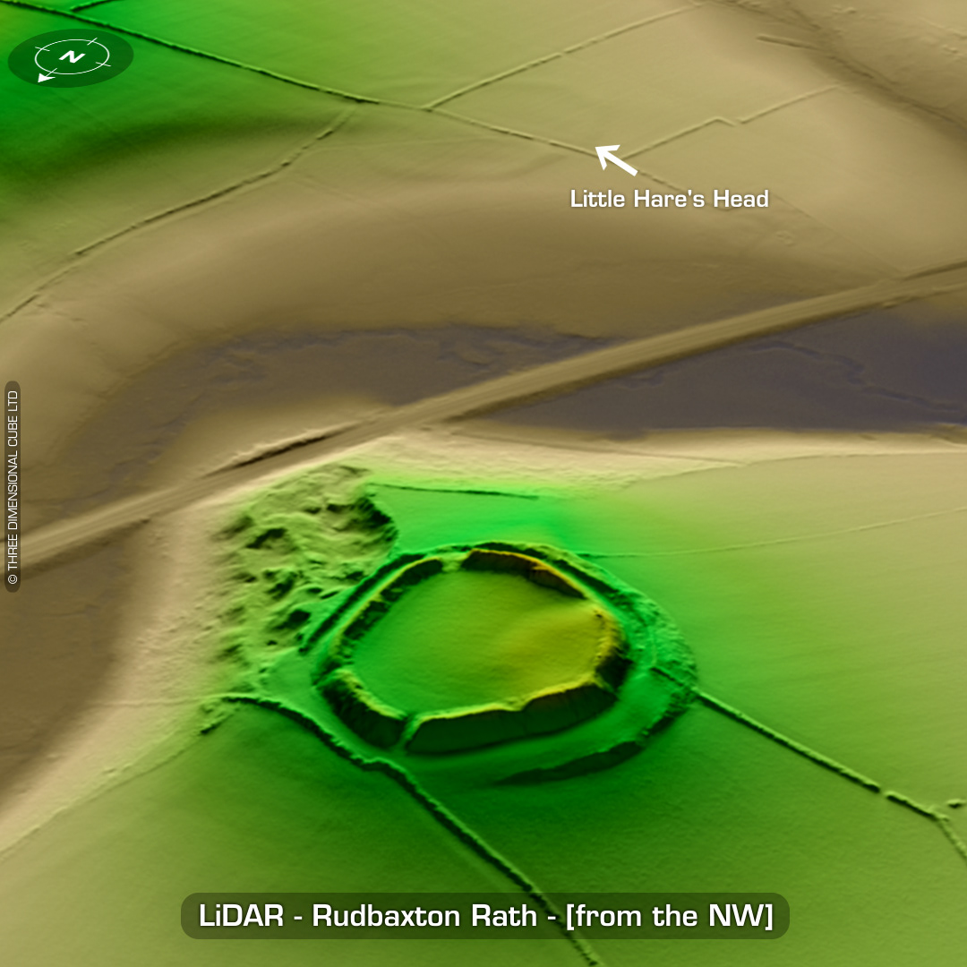
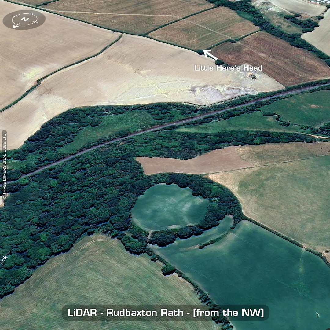
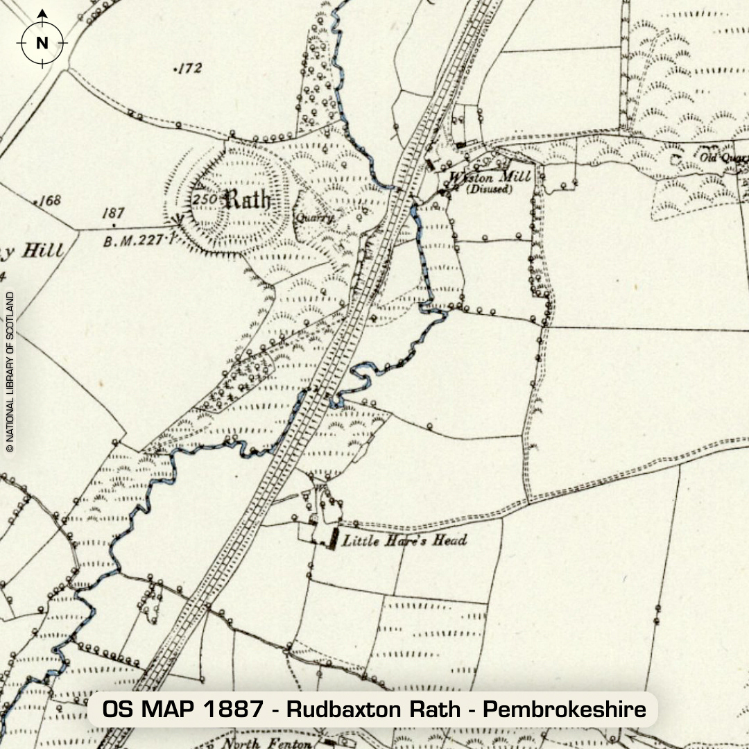
DTM- (Digital Terrain Model, i.e. No buildings or foliage) One point five kilometres northwest of the village of Crundale lies the (initial) hillfort, Rudbaxton Rath then medieval Motte and Bailey, Symon’s Castle. Medieval chapelry called St Leonard’s with cemetery & well. Just to the southeast of the site lies the faint & almost ploughed-out polygonal defended enclosure, Little Hare’s Head (named after the farm next to it). No recorded excavations or finds, hence undated. (Scheduled monuments) Iron Age tribal association (conjecture based on location): Demetae Descriptions from hillforts.arch.ox.ac.uk & Dyfed Archaeological Trust HER. 1st ED OS Mapping via National Library of Scotland. Contains public sector information licensed under the Open Government Licence v3.0.