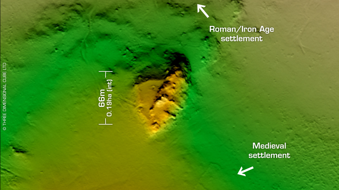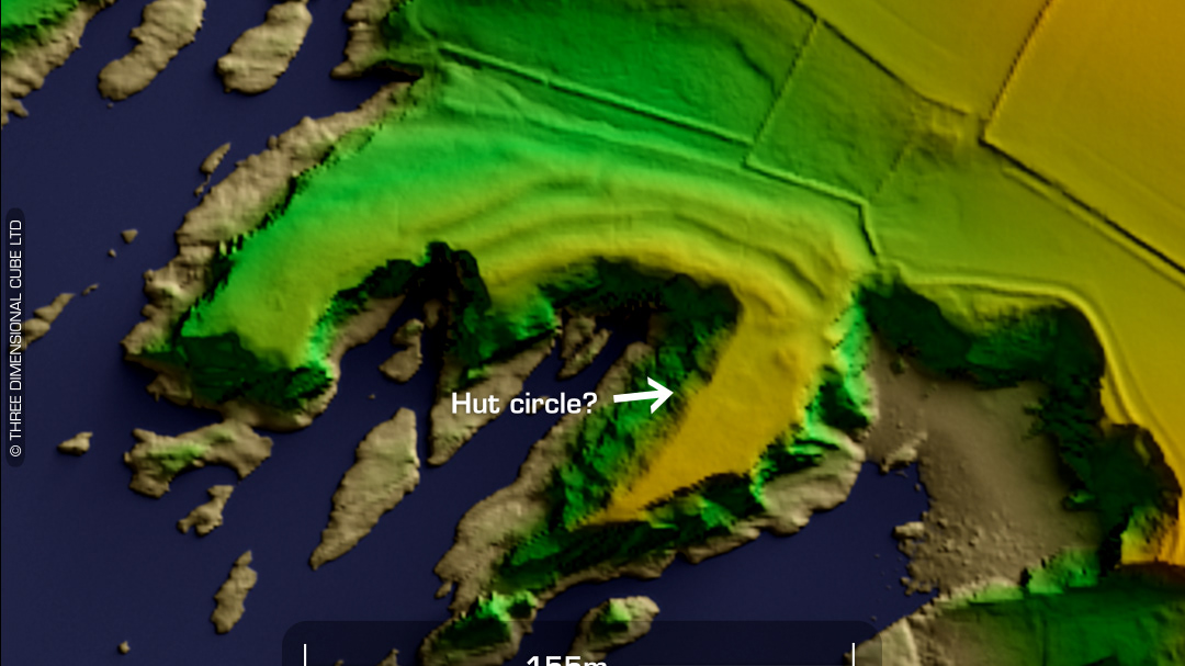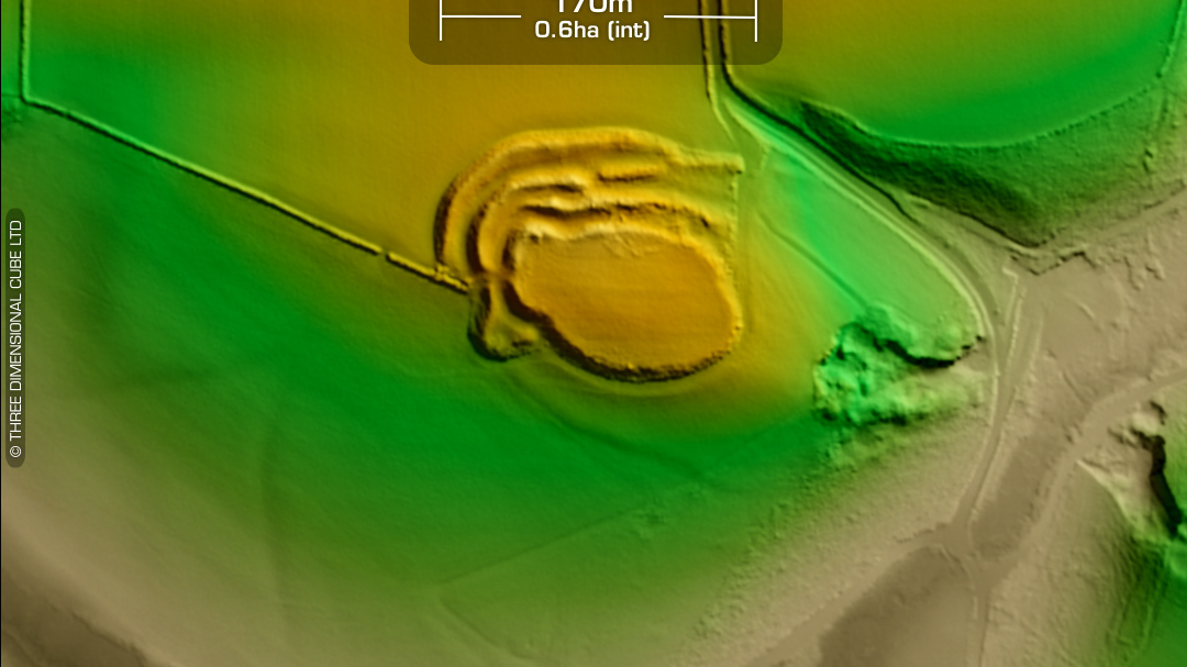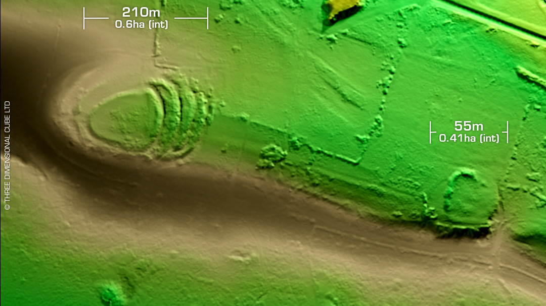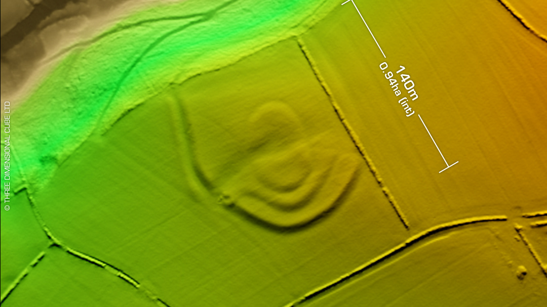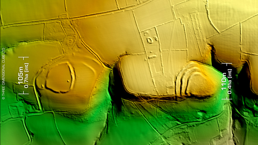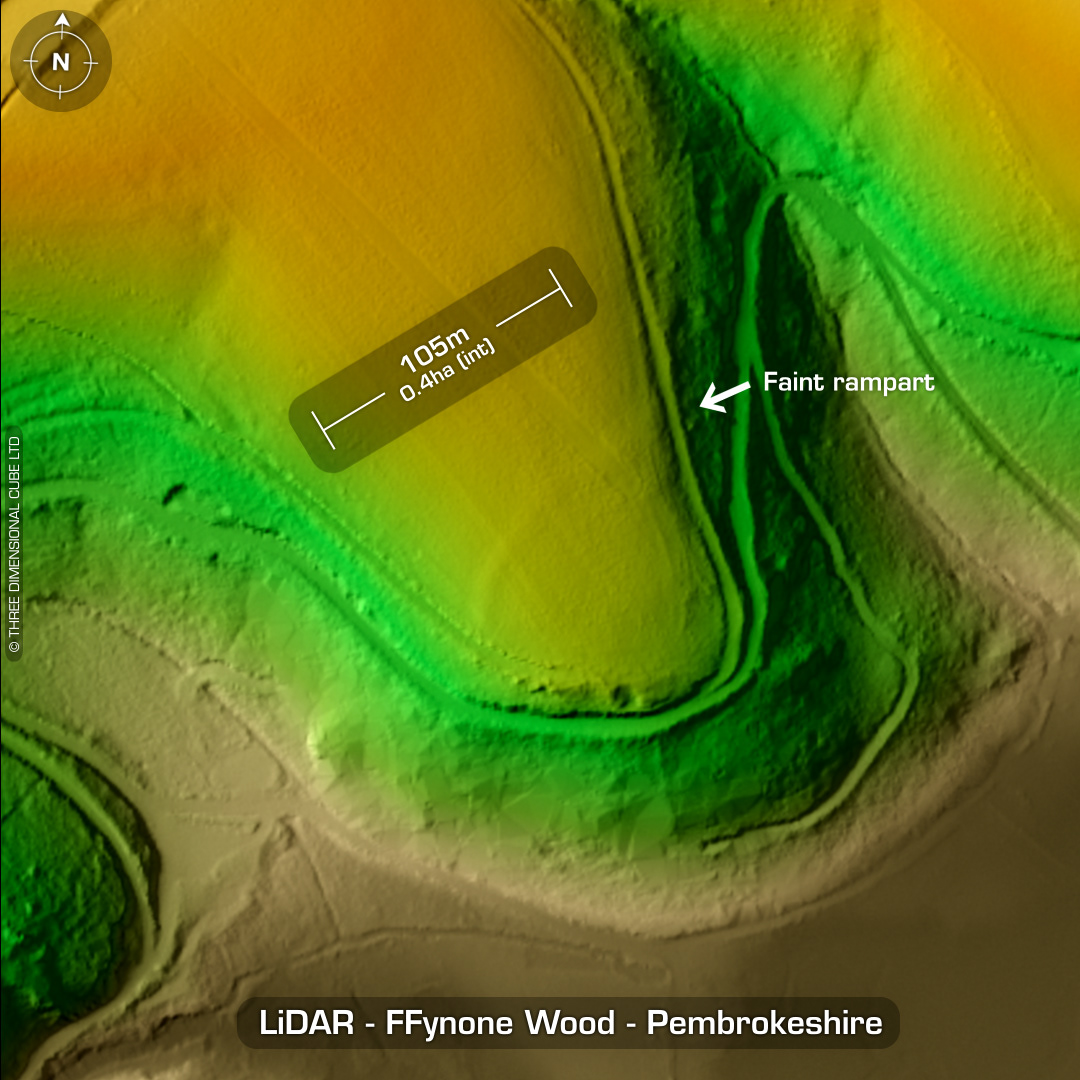
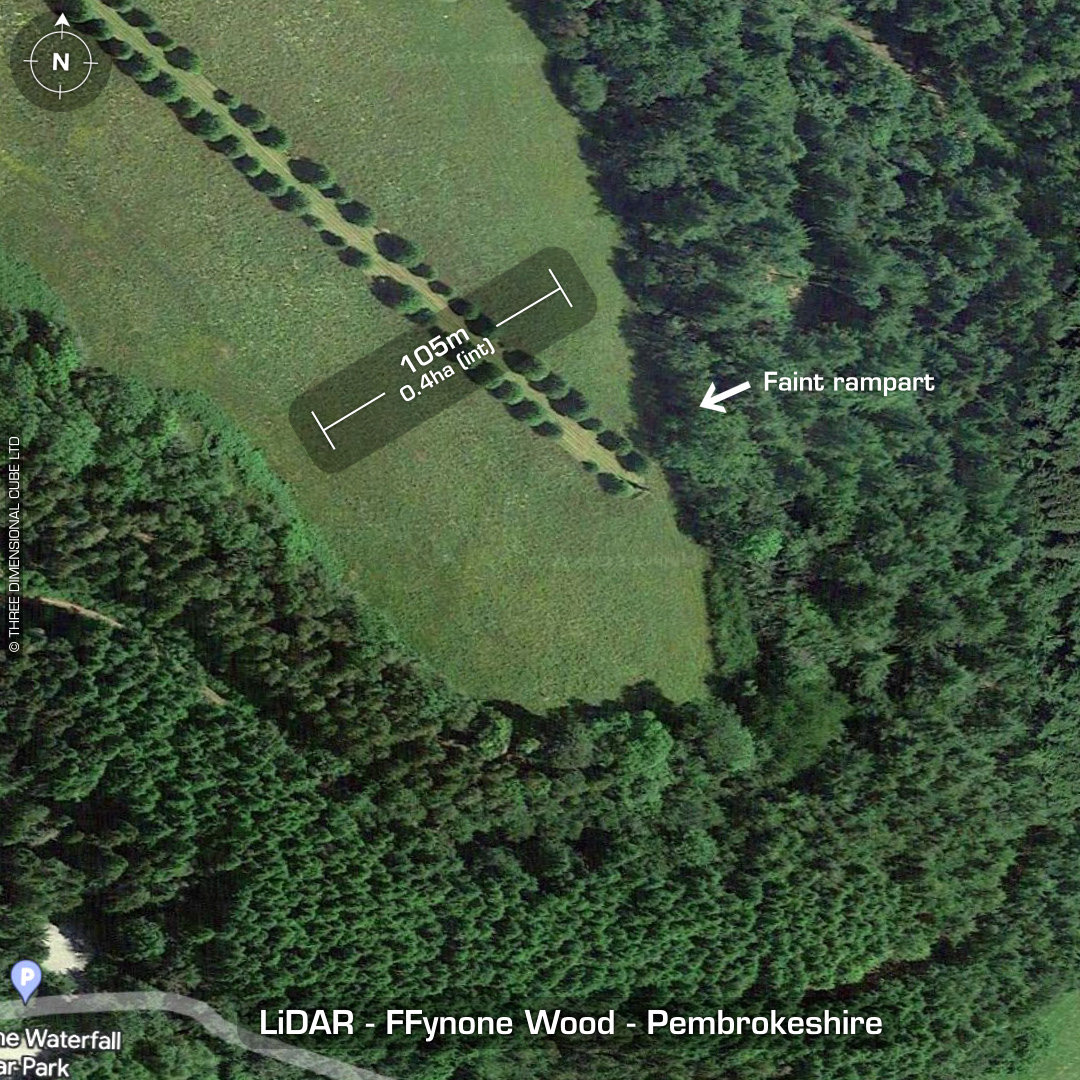

DTM- (Digital Terrain Model, i.e. No buildings or foliage) At the end of a Victorian ornamental path (by Inigo Thomas) running NW to SE at Ffynone Mansion (designed by John Nash) lies the almost destroyed inland promontory fort, Ffynone Wood. Discovered by aerial photography in 1946. Conformed by OS in 1966. Remains of rampart only just visible on LiDAR. Site visit in 2007 failed to locate the bank. I hope this LiDAR helps as I exaggerated the elevation to bring it out a bit better. PS: Whole site (14Ha) sold in 2021 for circa 1.8 million (with free promontory fort!) after sitting in an estate agents window for 11 years at 2.5 million, so the gaff must need a LOT of work . Look it up, the house is ridiculous. You could spend the rest of your life re-pointing the brickwork alone. No recorded excavations or finds, hence undated. (Scheduled monument) Iron Age tribal association (conjecture based on location): Demetae Descriptions from hillforts.arch.ox.ac.uk & Dyfed Archaeological Trust HER. Contains public sector information licensed under the Open Government Licence v3.0.