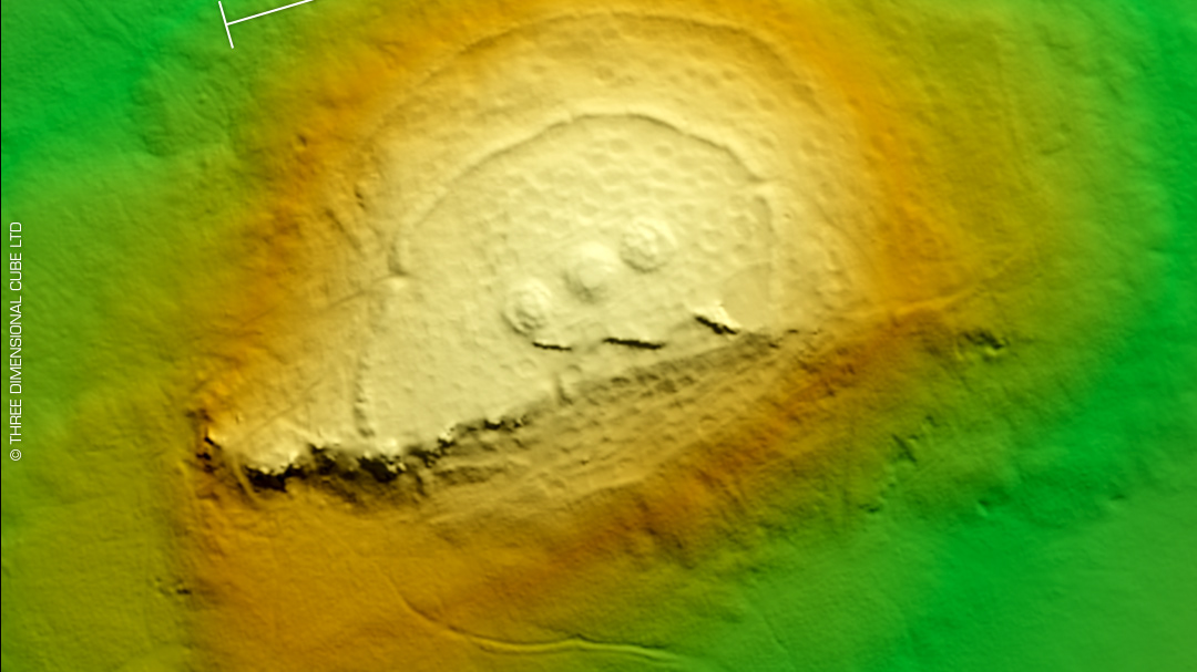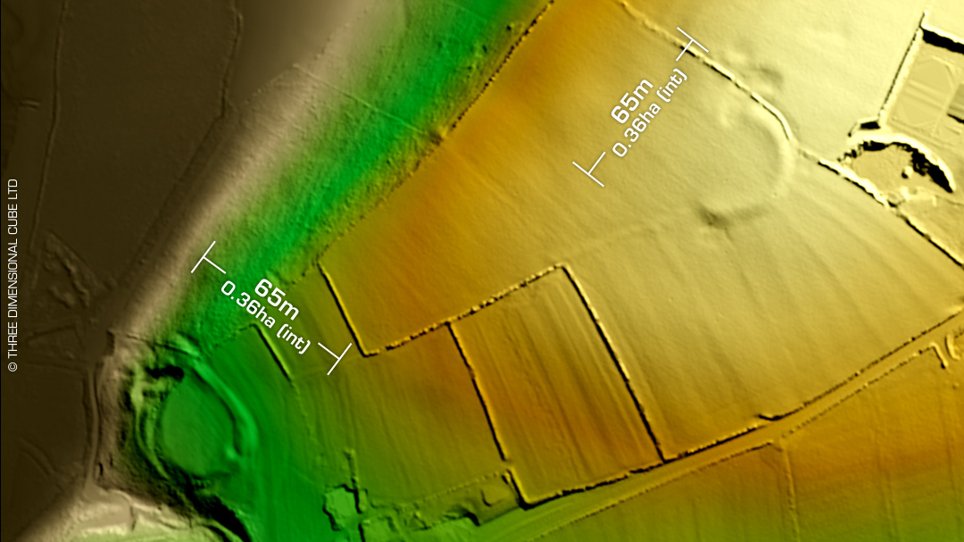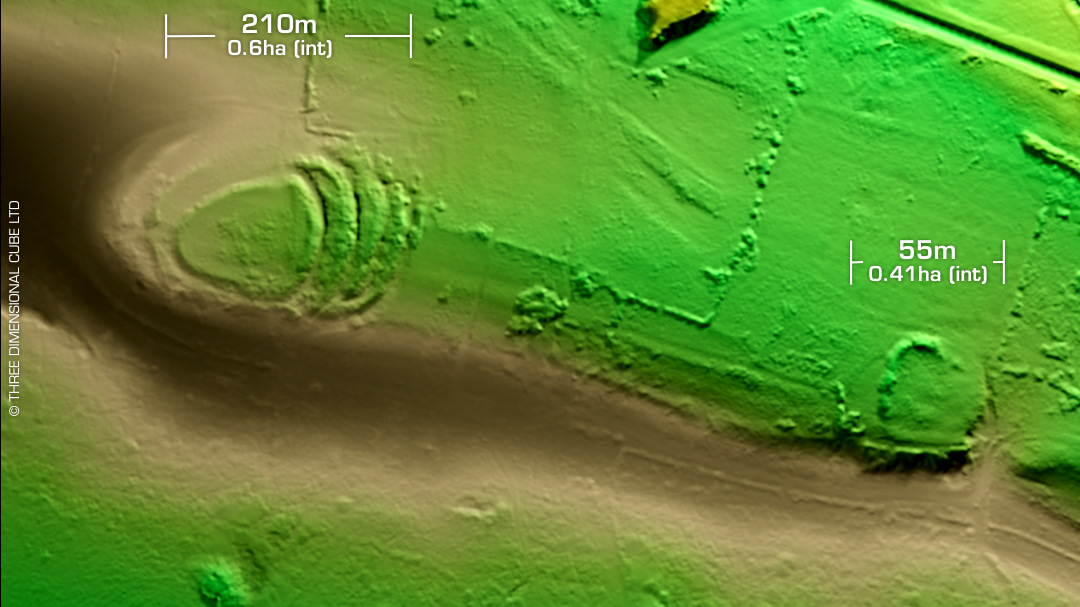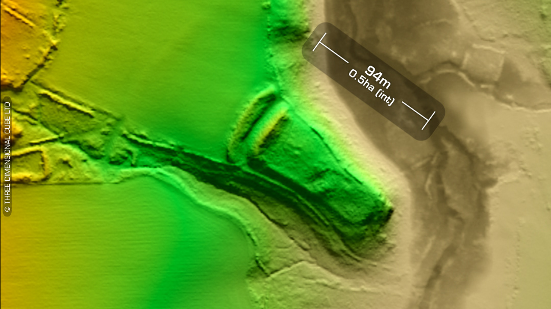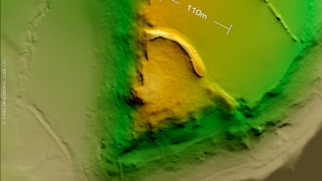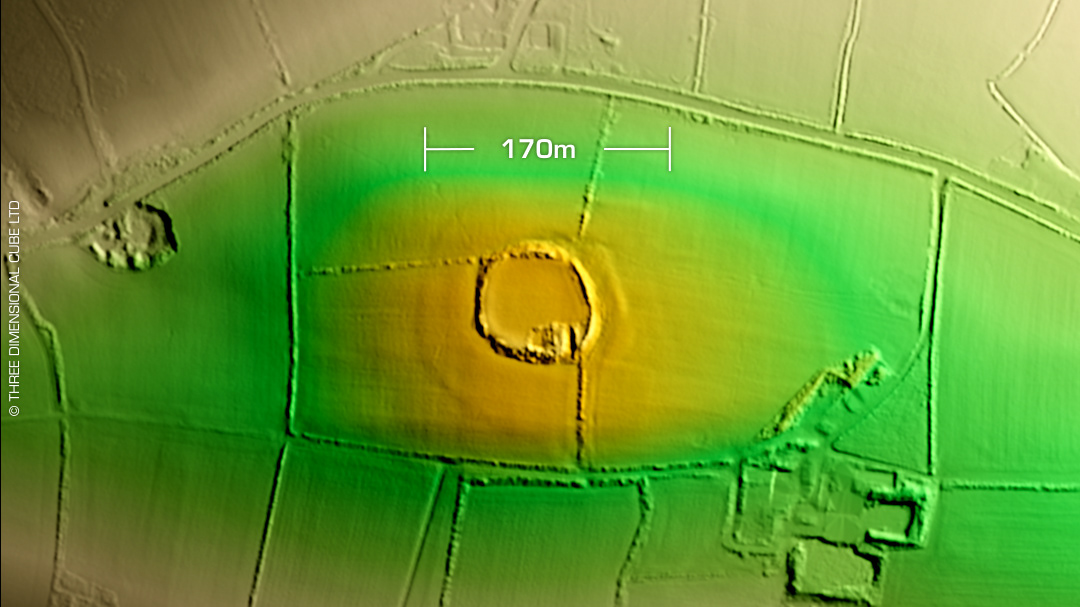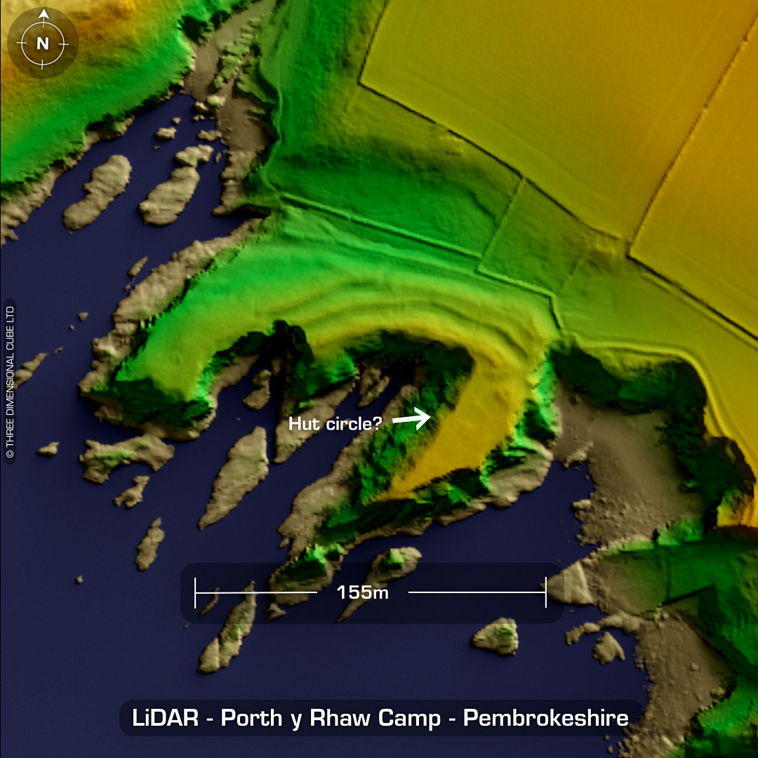
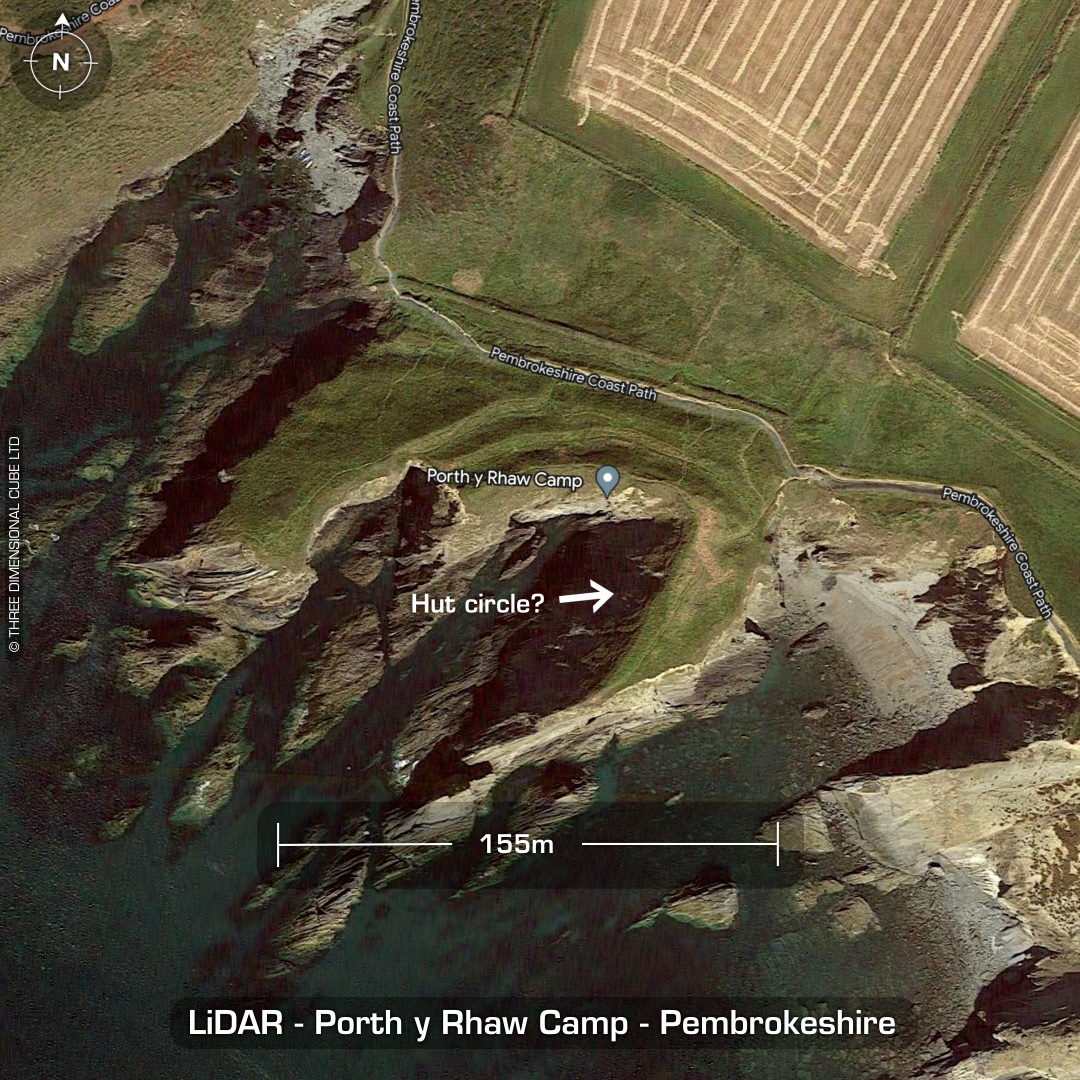
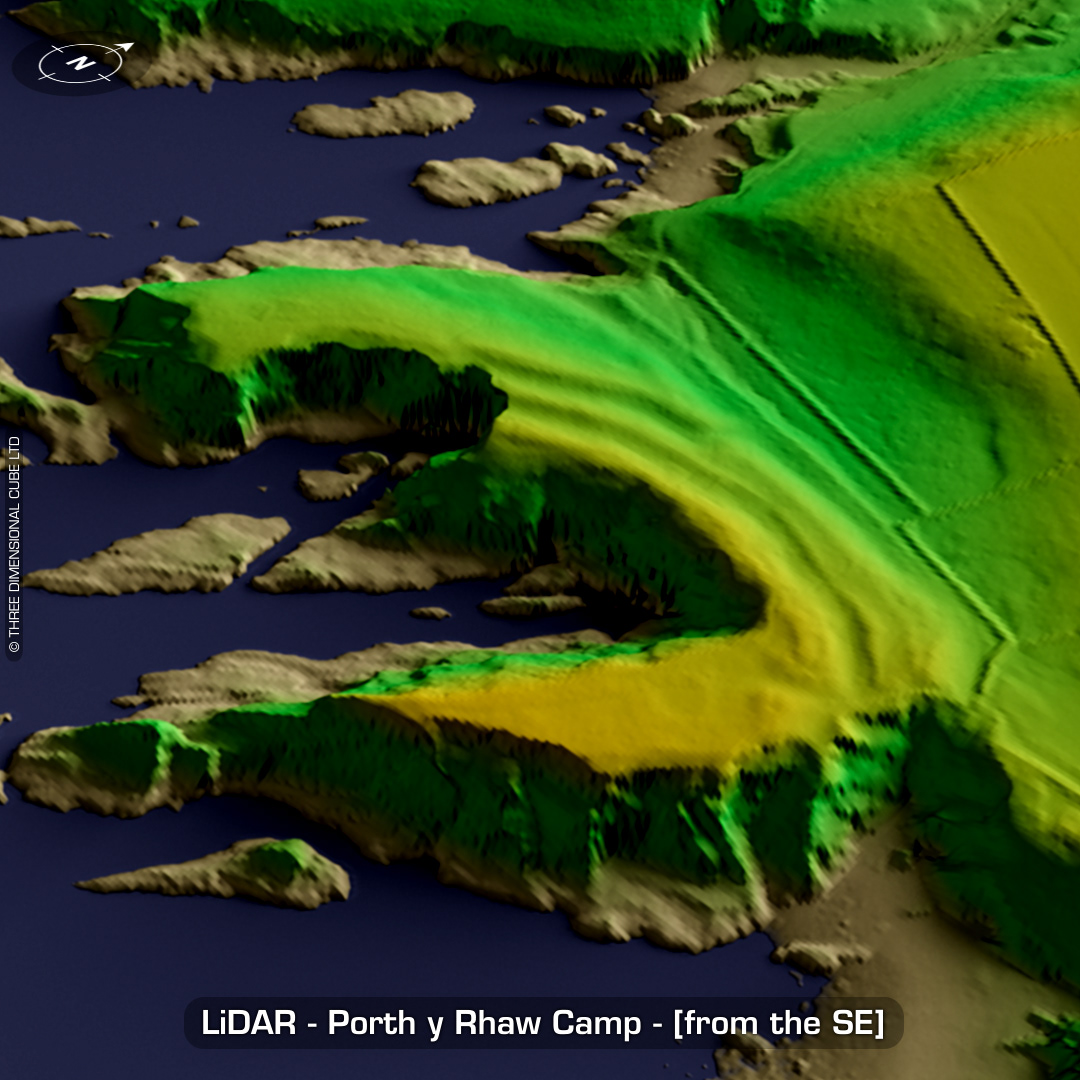
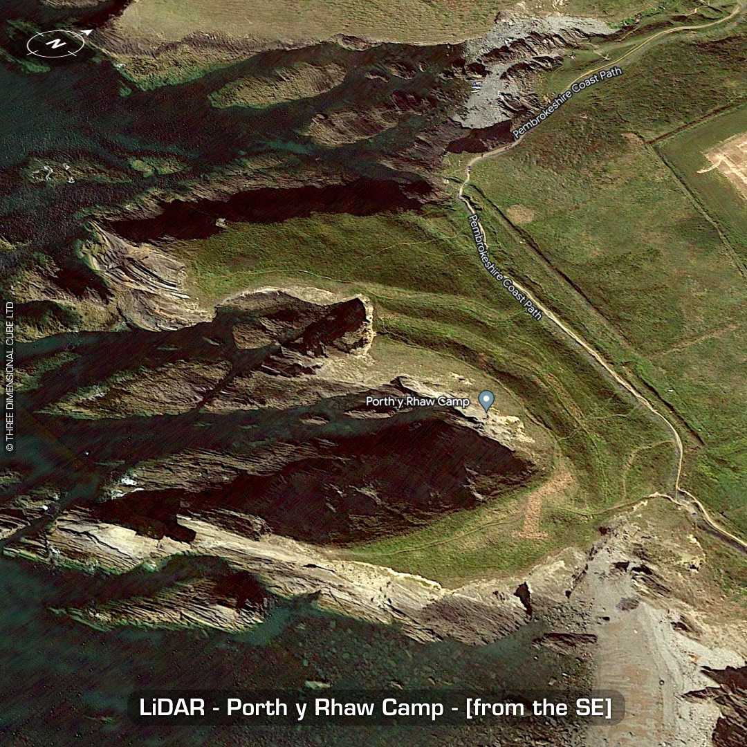
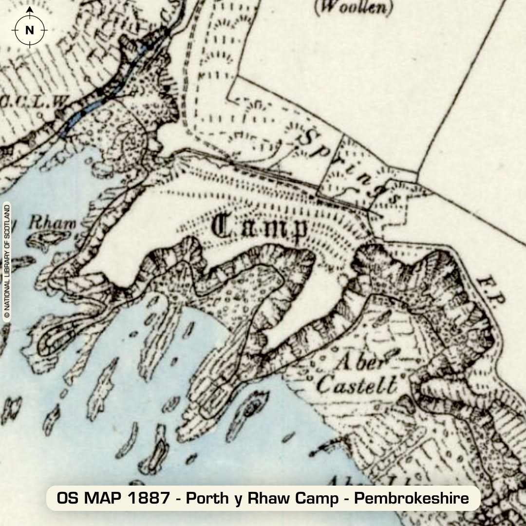
DTM- (Digital Terrain Model, i.e. No buildings or foliage) West of the village of Solva just south of the A487 lies the coastally degraded promontory fort, Porth y Rhaw Camp. Most of the fort has been lost to the sea but its massive twin ramparts remain and on the LiDAR, you can see the remains of one large (16m wide) hut circle on the right main promontory. Excavations between 1995-98 found the remains of 8 roundhouses. C14 dates yield occupation ranges between early to mid iron age, then up to to circa 400AD. (Scheduled monument) Iron Age tribal association (conjecture based on location): Demetae Descriptions from hillforts.arch.ox.ac.uk & Dyfed Archaeological Trust HER. 1st ED OS Mapping via National Library of Scotland. Contains public sector information licensed under the Open Government Licence v3.0.