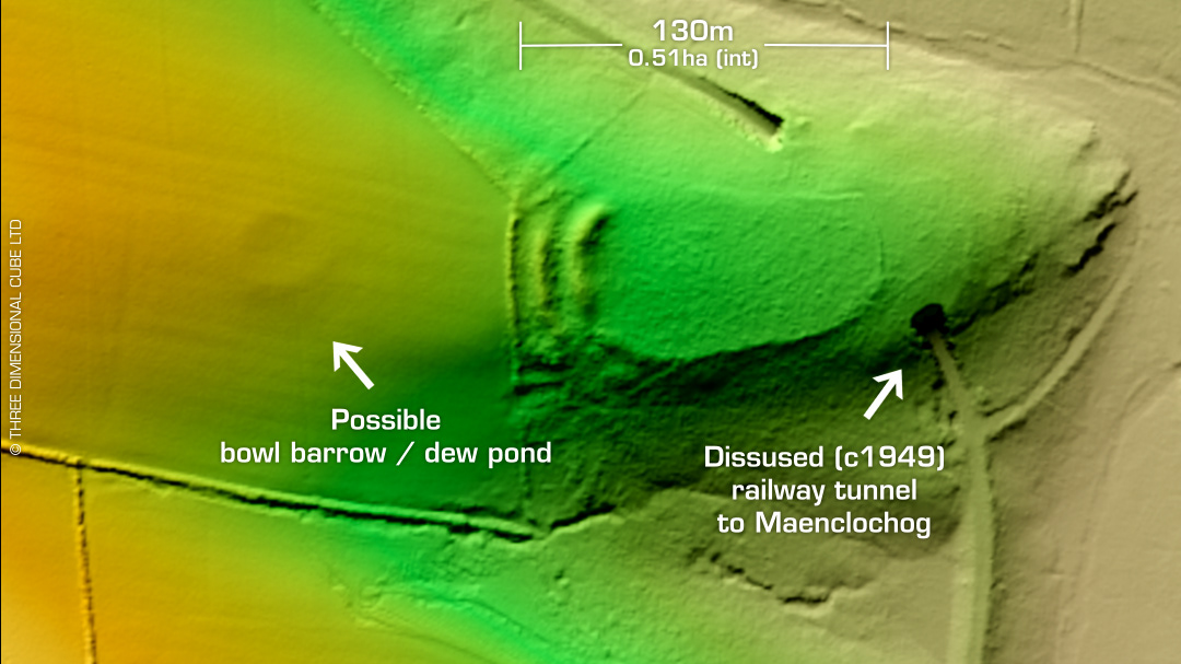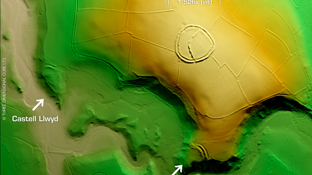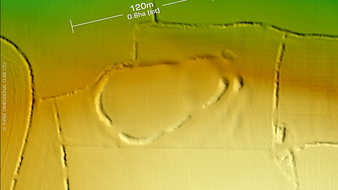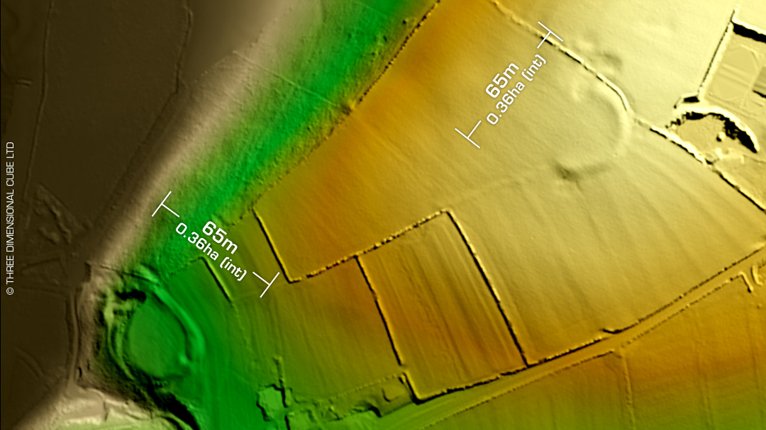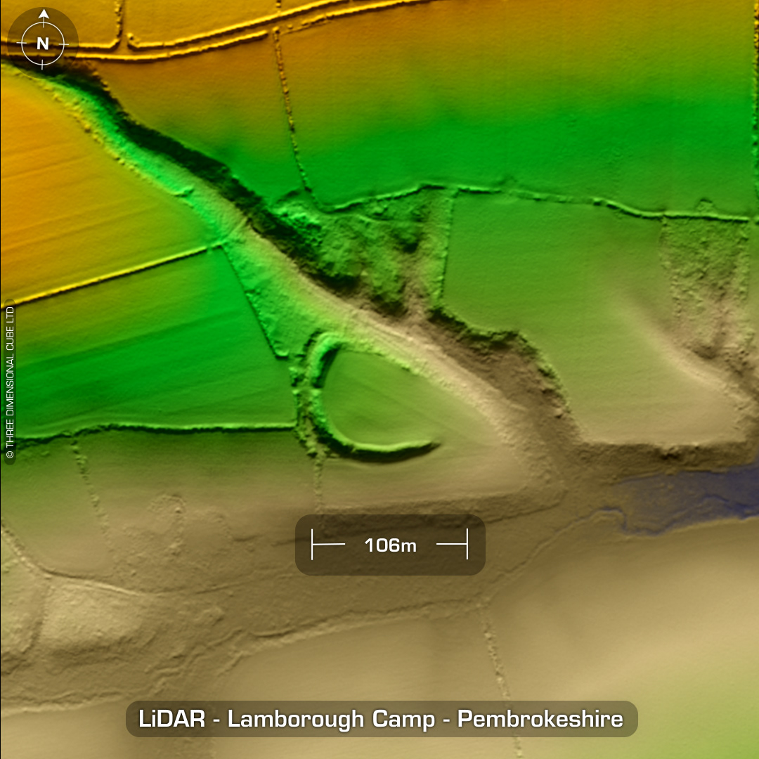
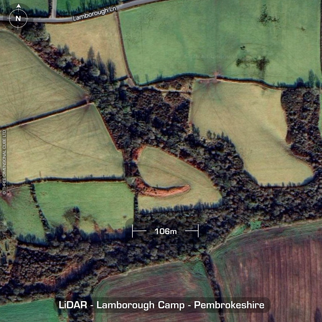
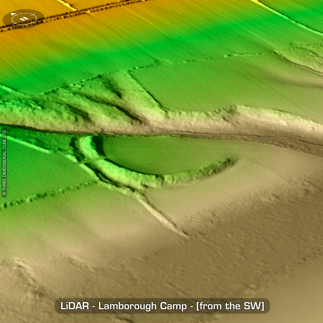
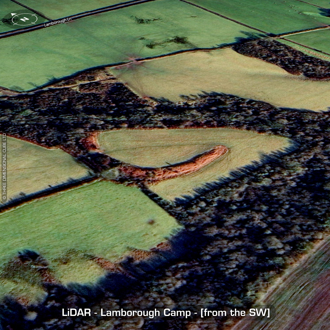
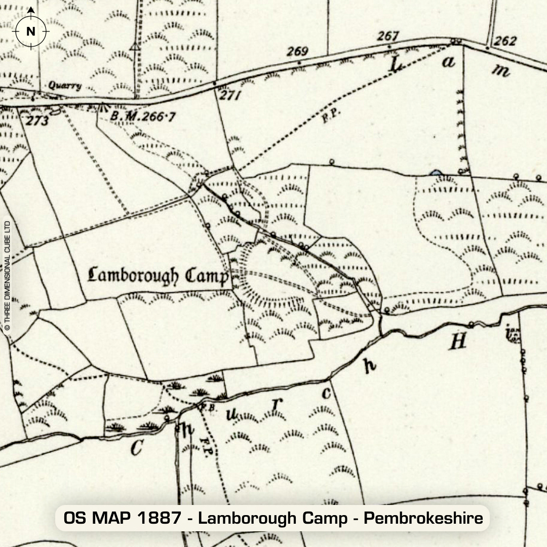
LiDAR – Lamborough Camp - Pembrokeshire DTM- (Digital Terrain Model, i.e. No buildings or foliage) To the right of the road that runs between the villages of Clarbeston Road and Wiston lies the huge rampart of the univallate inland promontory fort, Lamborough Camp. No recorded excavations or finds, hence undated. (Scheduled monument) Iron Age tribal association (conjecture based on location): Demetae Descriptions from hillforts.arch.ox.ac.uk & Dyfed Archaeological Trust HER. 1st ED OS Mapping via National Library of Scotland. Contains public sector information licensed under the Open Government Licence v3.0.