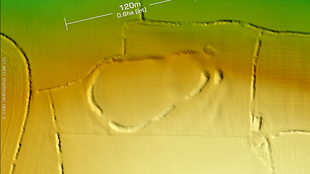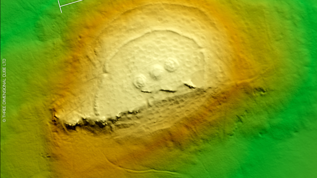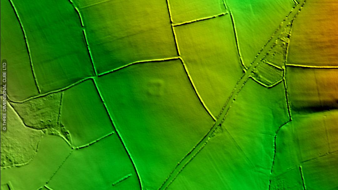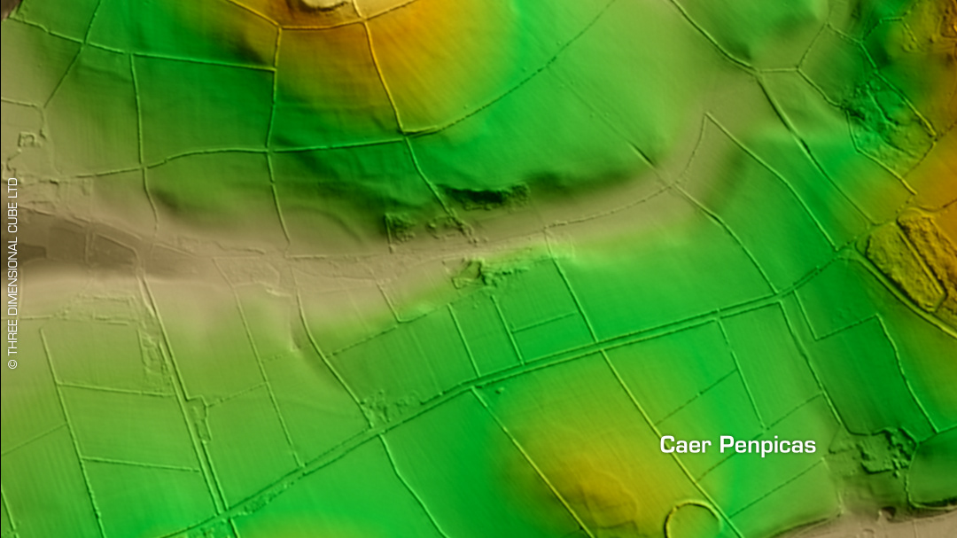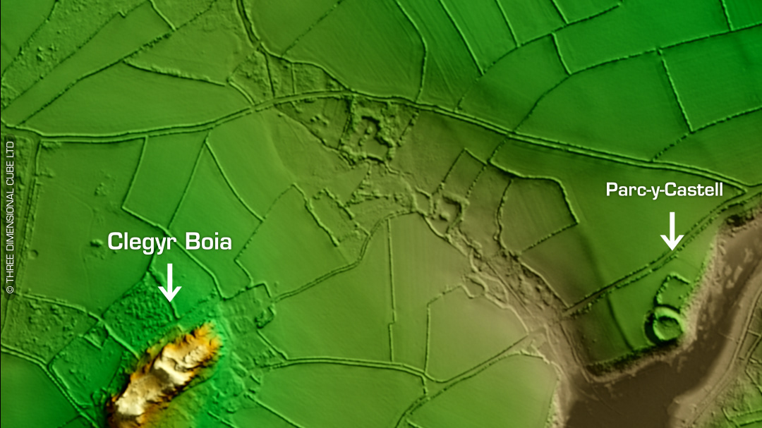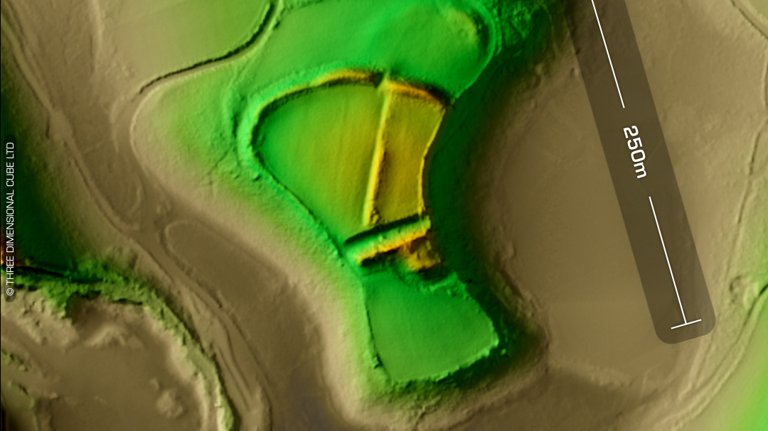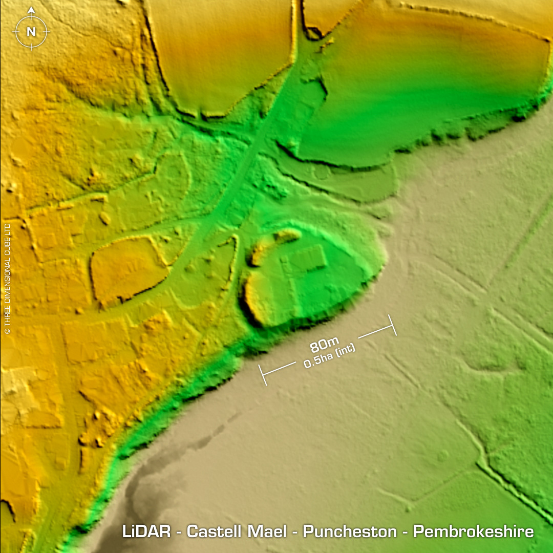
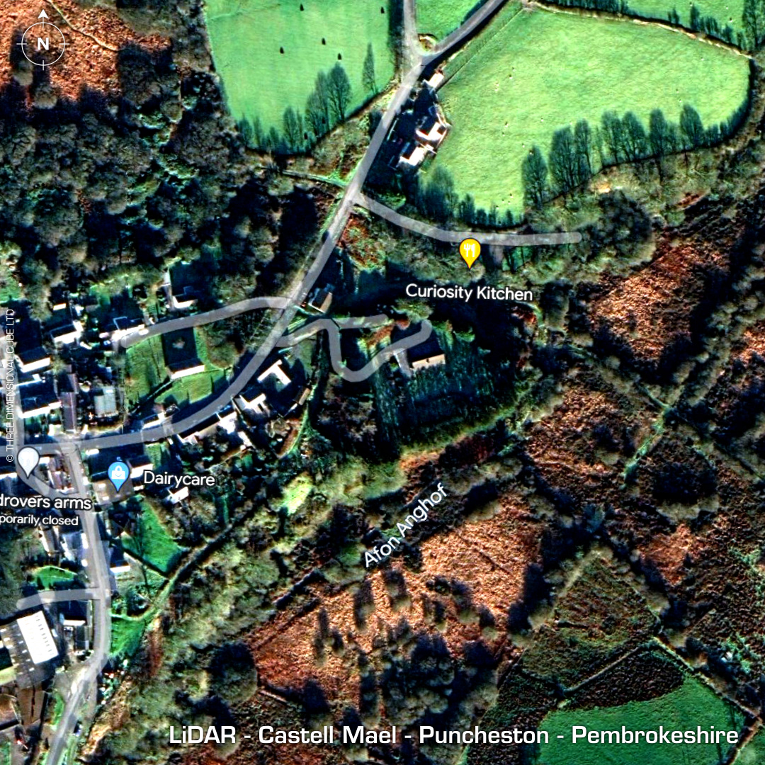
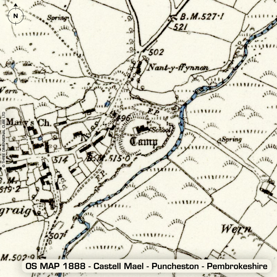
DTM- (Digital Terrain Model, i.e. No buildings or foliage) In the small village of Puncheston lies the possible inland promontory fort, medieval earthwork castle or both, Castell Mael. Sub-circular bank & ditch. 'Mael' means 'King' in old Irish/Welsh (apparently). The Normans built a ringwork castle within what may have been an older structure. S. Lewis in 1833 describes: 'An encampment near the church, fortified with double ramparts.' Minor excavation in 1966 by E. J. Talbot. (Details lost) Site built upon by a school (c1920's), now a dwelling (c1980's). Bank breach on west side hollowed out when school became a house and now used as an entrance. (Wow.) No recorded finds, hence undated. (Scheduled monument) Iron Age tribal association (conjecture based on location): Demetae Descriptions from hillforts.arch.ox.ac.uk & Dyfed Archaeological Trust HER. Contains public sector information licensed under the Open Government Licence v3.0.