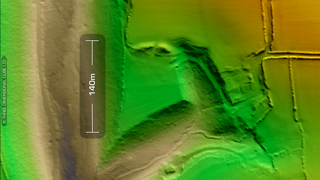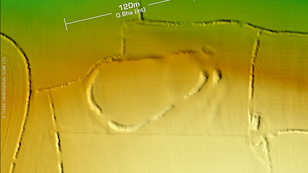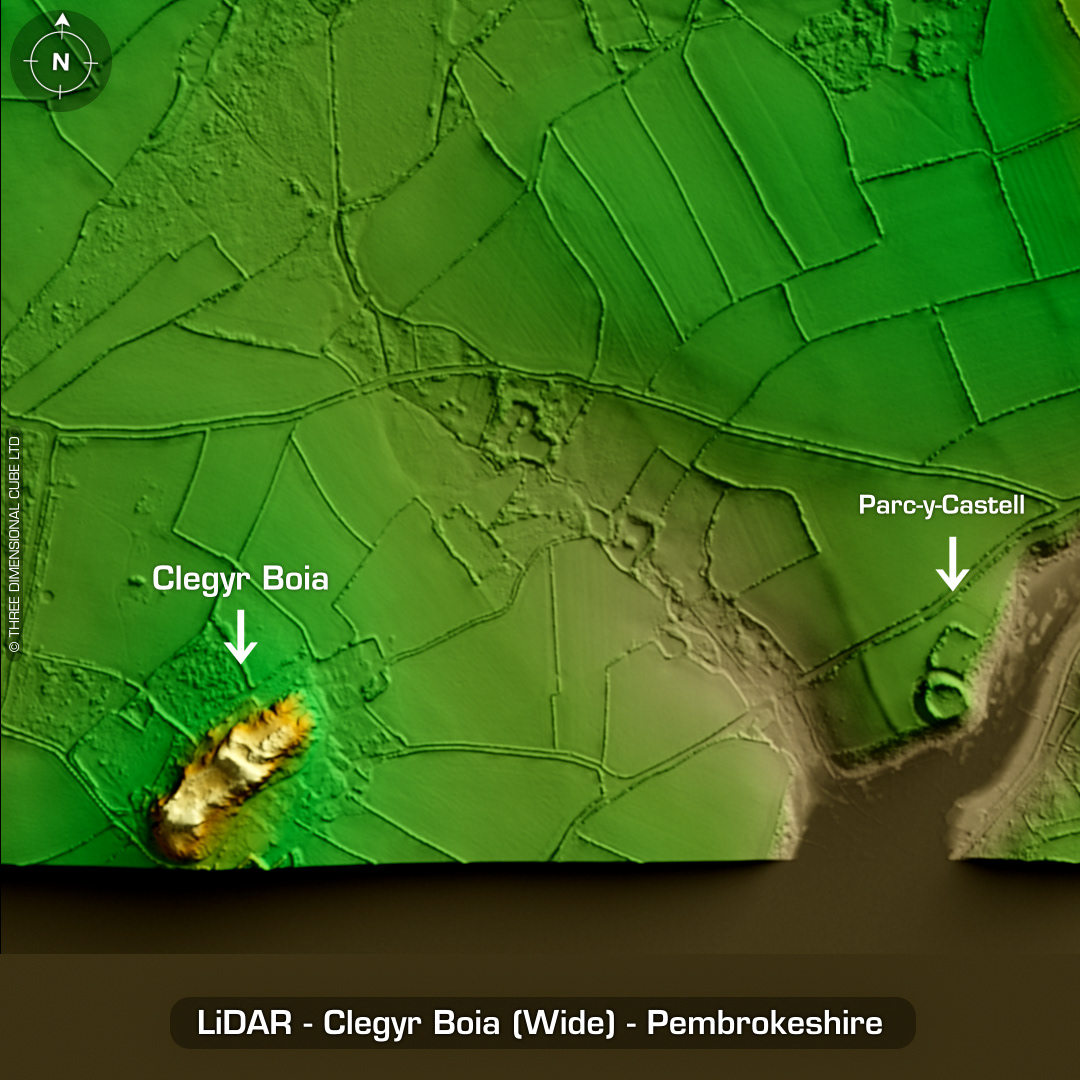
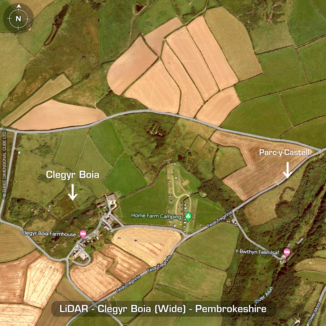
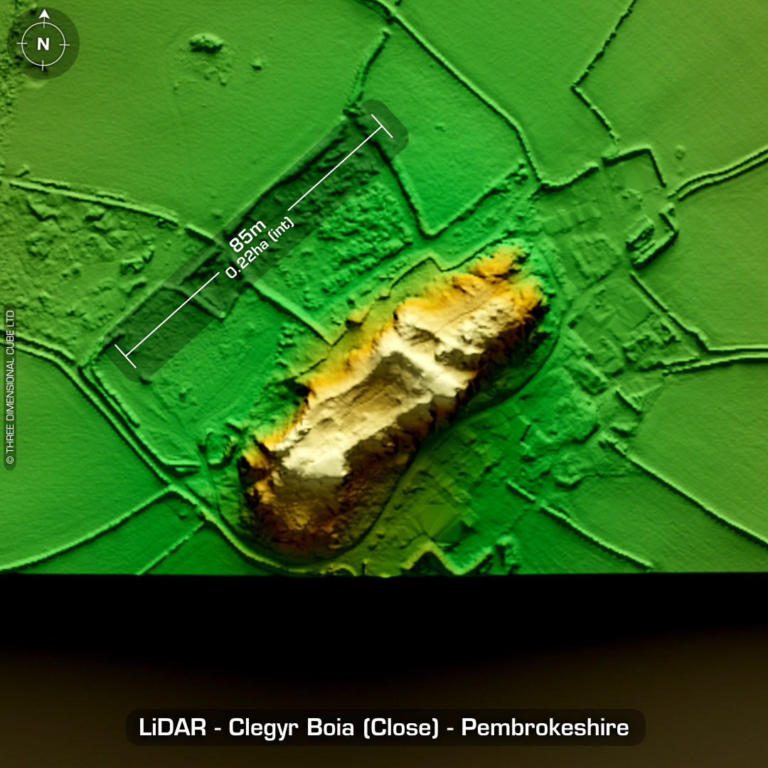
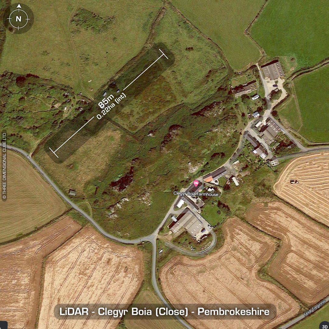
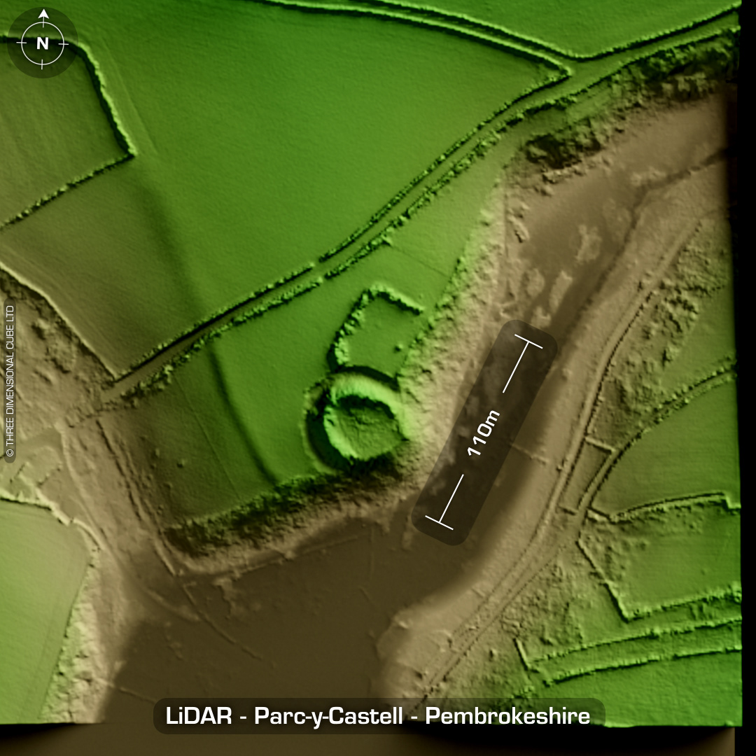

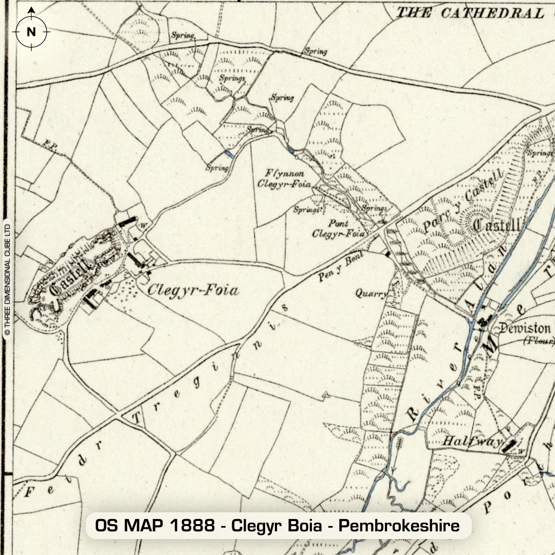
DTM- (Digital Terrain Model, i.e. No buildings or foliage) Just to the west of the town of St Davids & overlooking the Clegyr Boia Farmhouse lies the stone-walled possible partial contour hillfort of the same name. As you can see from the LiDAR, it's the highest peak in the immediate area. The bottom of the LiDAR tile is missing data. Defined by stone rubble & earth riveted (with stone blocks) rampart. Excavated in 1902 by Rev. S. Baring-Gould and Audrey Williams in 1943. Confirmed occupation from Neolithic to Iron Age. Iron age date based on C14 dating (in 1982) of gates to 0AD. Additional C14 dates between 760BC to 400AD. Evidence of round & rectangular huts found with a midden & double timber gates. Finds include Neolithic pottery & polished stone axes & scrapers. The name associates the site as the stronghold of 6th century AD Irish pirate named Boia. Just to the east of Clegyr Boia sits an unnamed motte & bailey. Tradition ascribes the construction of this fort to St David. No recorded excavations or finds to date. (Scheduled monuments) Iron Age tribal association (conjecture based on location): Demetae Descriptions from hillforts.arch.ox.ac.uk & Dyfed Archaeological Trust HER. Contains public sector information licensed under the Open Government Licence v3.0.