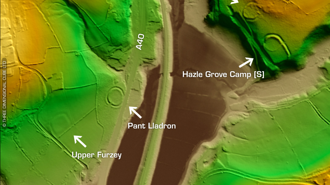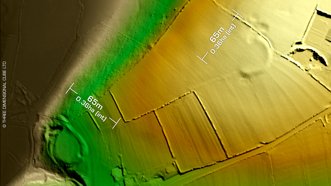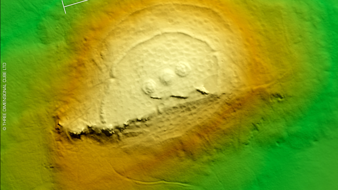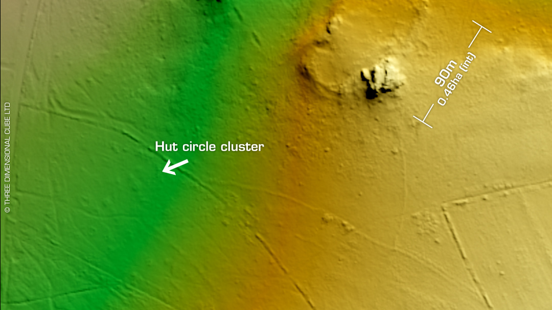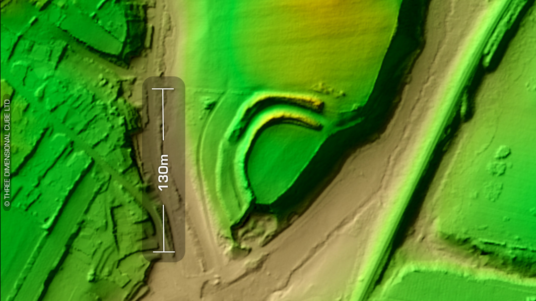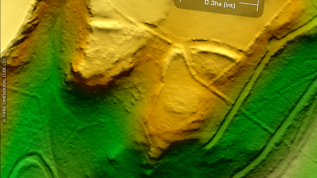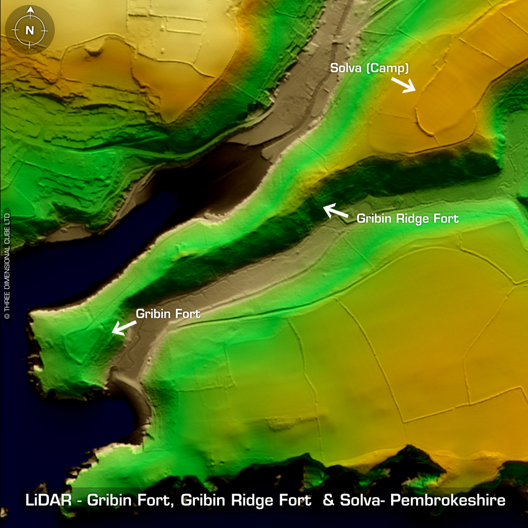
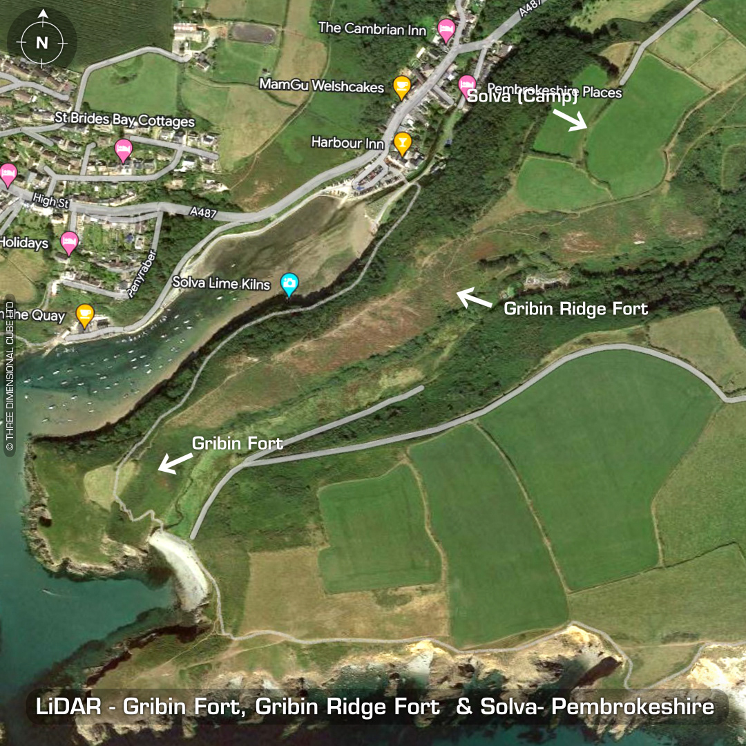
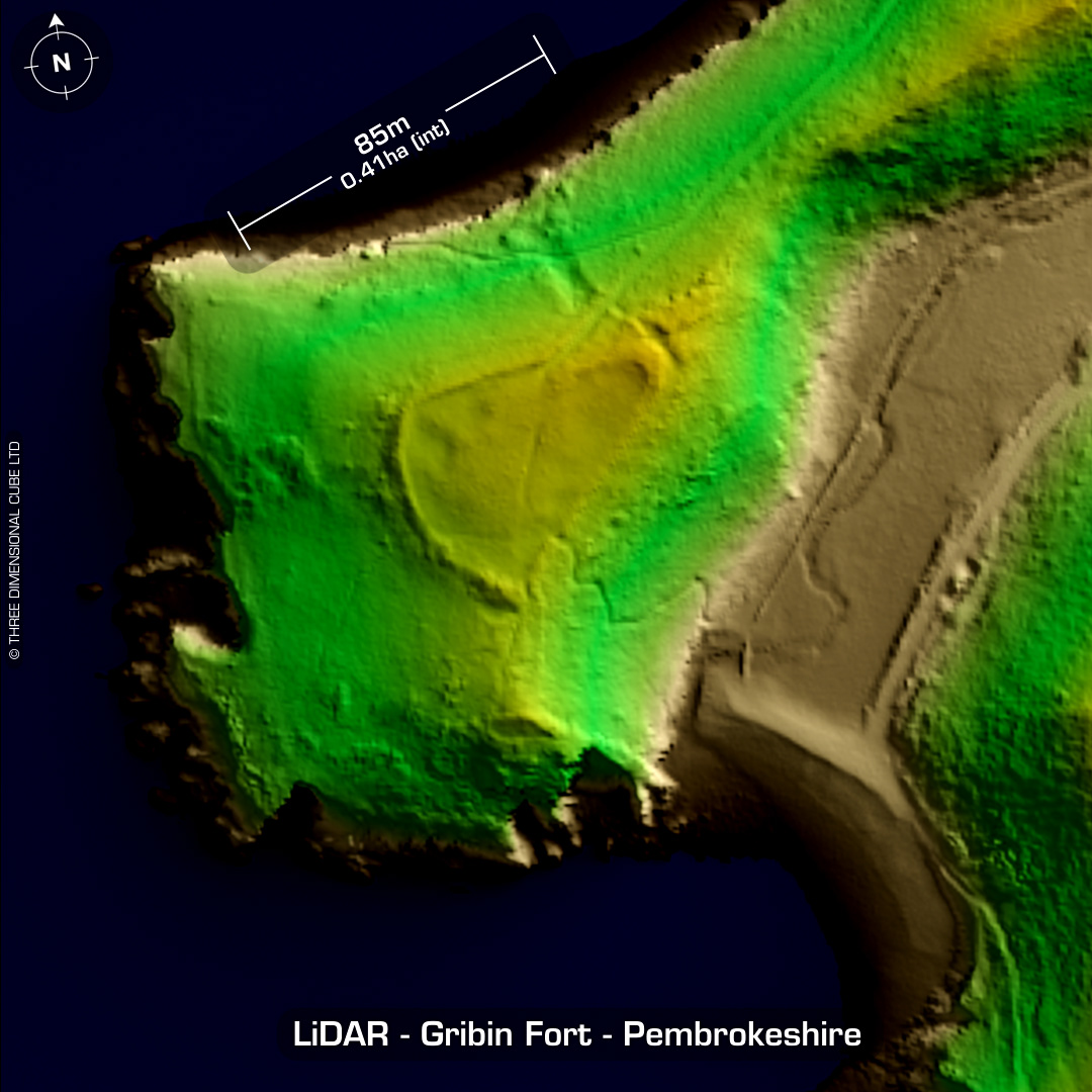
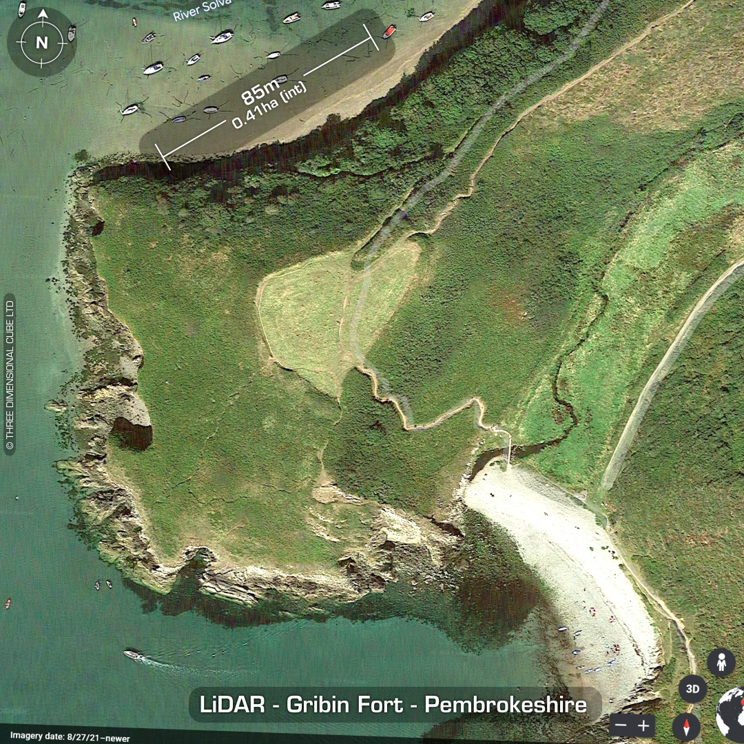
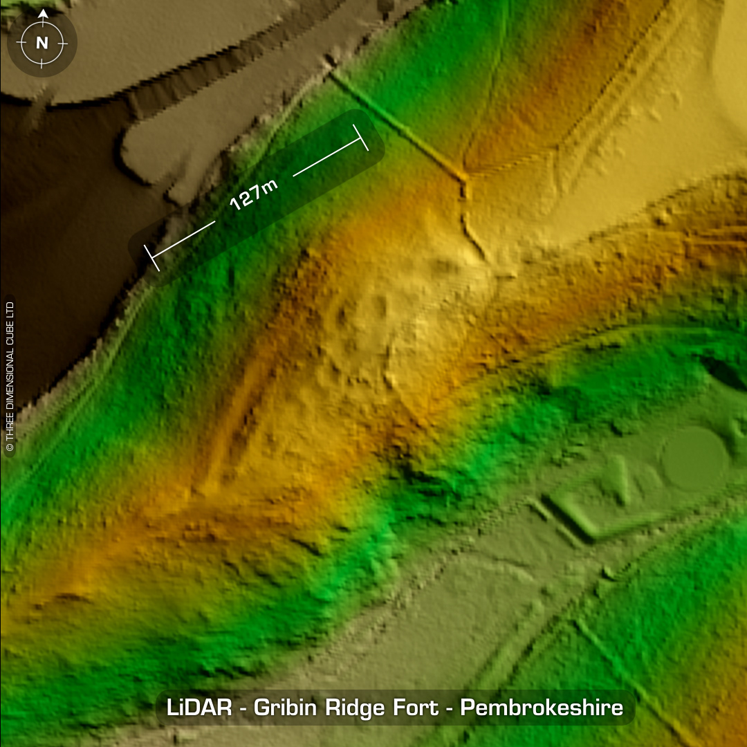
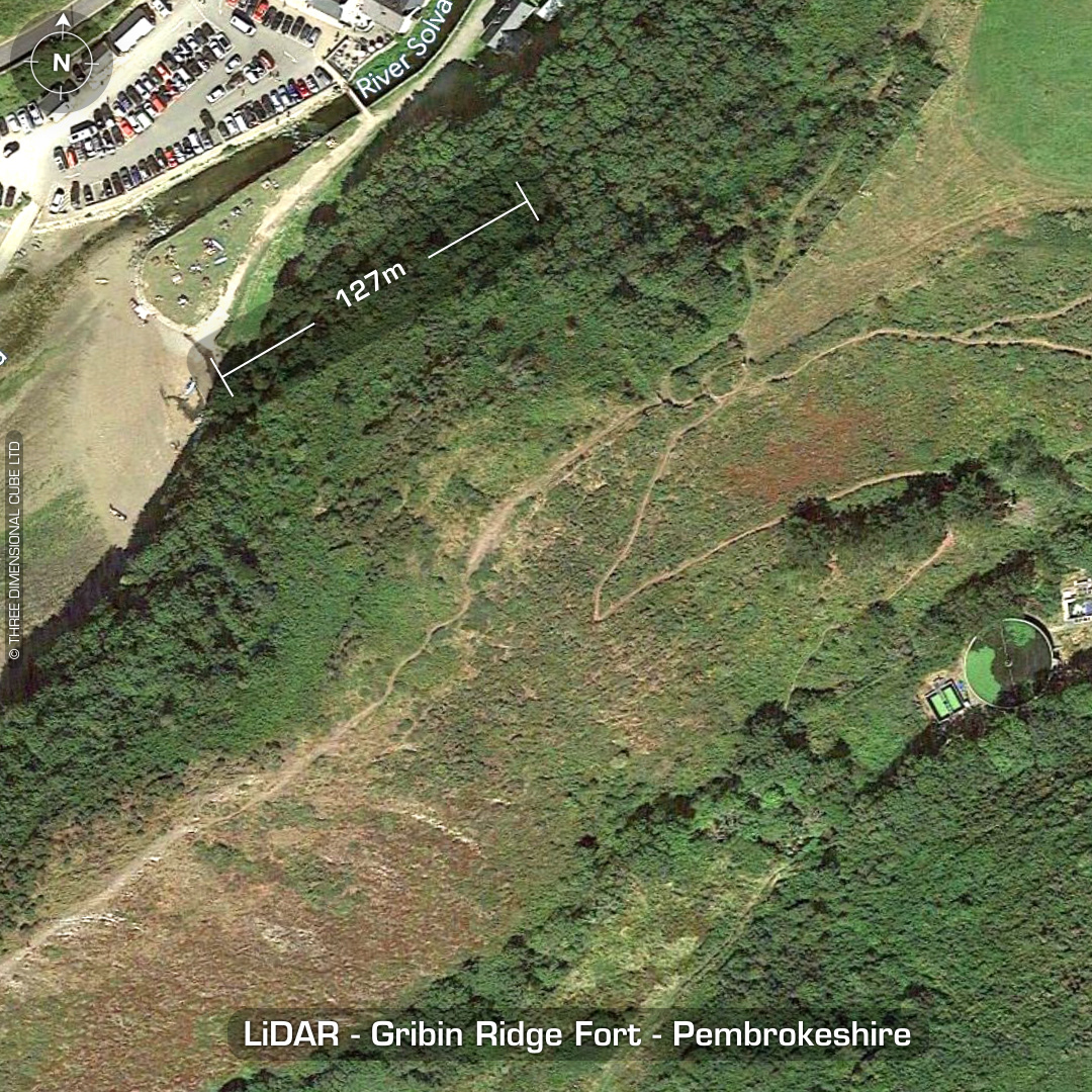
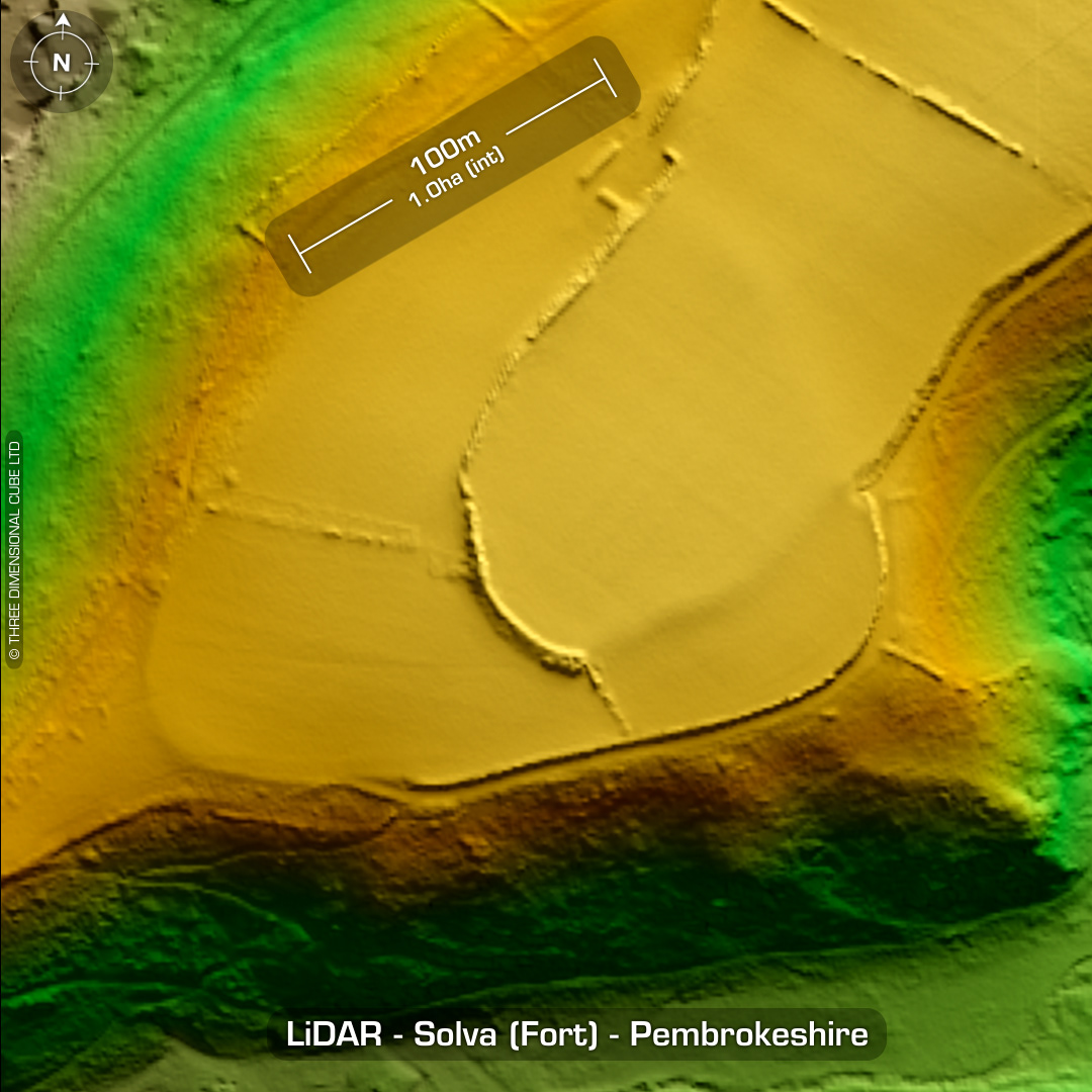
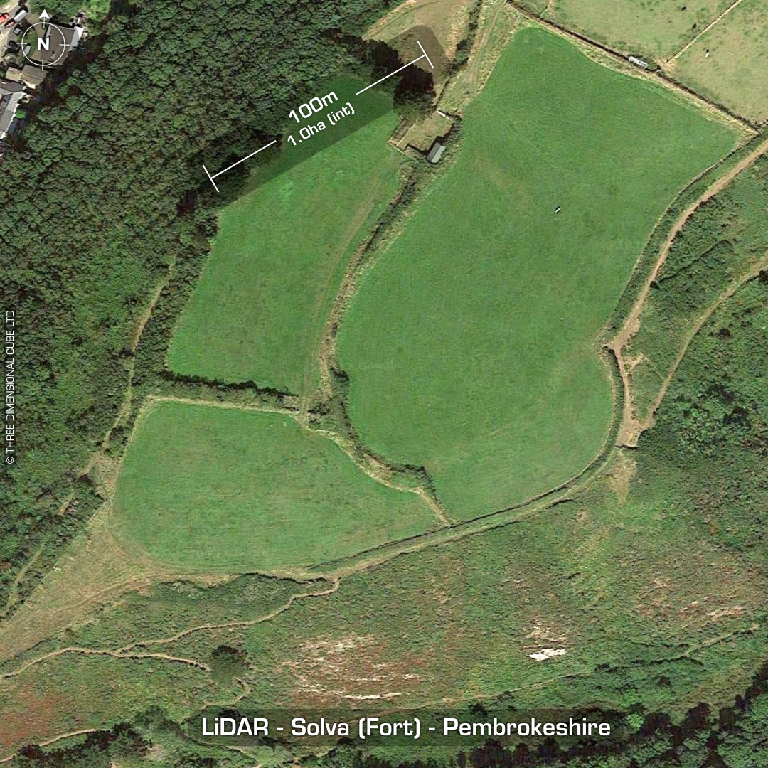
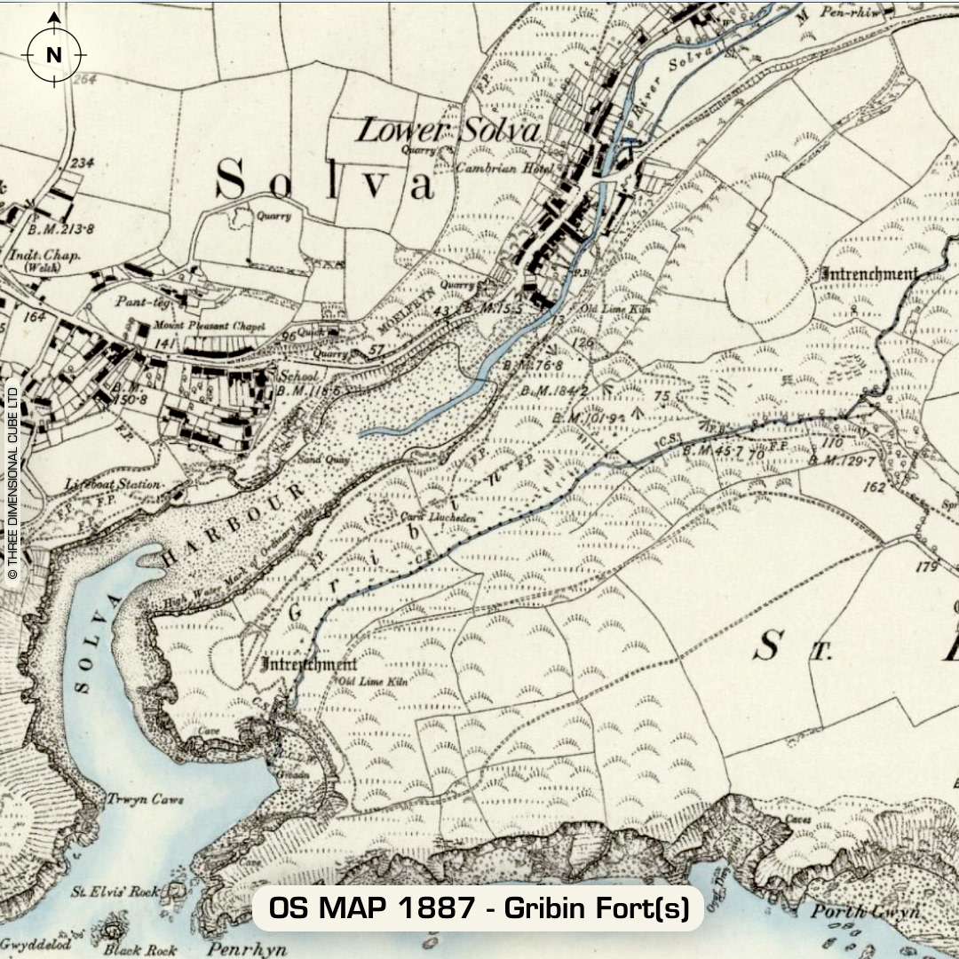
DTM- (Digital Terrain Model, i.e. No buildings or foliage) Overlooking the village of Solva from a promontory to the east lie three forts: Gribin promontory fort, Gribin Ridge fort and Solva (fort). Gribin promontory fort is a coastal contour hillfort in a strategic position overlooking Solva harbour. Defined by a spread stony bank. Circular & rectangular interior hut platforms recorded. Last site visit in 2011. Gribin Ridge Fort lies along the same promontory but northeast of Gribin Fort. Partial contour hillfort. Discovered in 2010! 20 hut platforms recorded. Solva (Fort) lies at the east-end of the promontory and has almost been ploughed-out. Partial contour hillfort with annex to SW. No recorded excavations, hence undated (All sites). (Scheduled monuments) Iron Age tribal association (conjecture based on location): Demetae Descriptions from hillforts.arch.ox.ac.uk & Dyfed Archaeological Trust HER. 1st ED OS Mapping via National Library of Scotland. Contains public sector information licensed under the Open Government Licence v3.0.